2.1Km
2.1Km
Note
 200m
250m
300m
400m
650m
750m
1.6Km
2.2Km
2.4Km
200m
250m
300m
400m
650m
750m
1.6Km
2.2Km
2.4Km
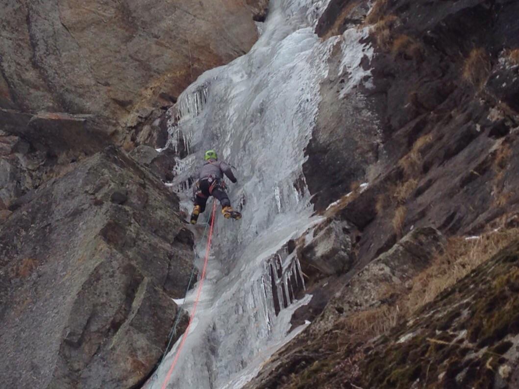
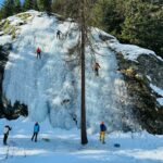
Cascata facile e comoda ma che può essere pericolosa se i pendii sovrastanti sono carichi. Ottima per essere abbinata ad una cascata vicina.
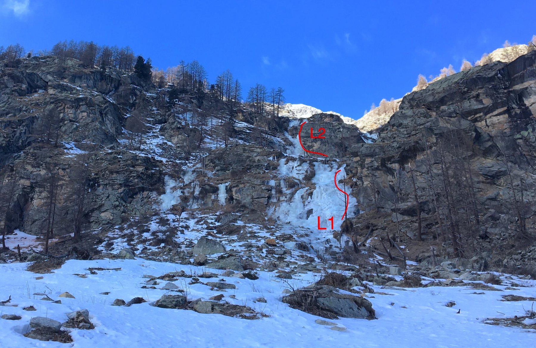
Avvicinamento
Dal park Chabod risalire la strada per circa 50 m dopodiché risalire il breve pendio che conduce alla base dell' evidente colata. 5min
Descrizione
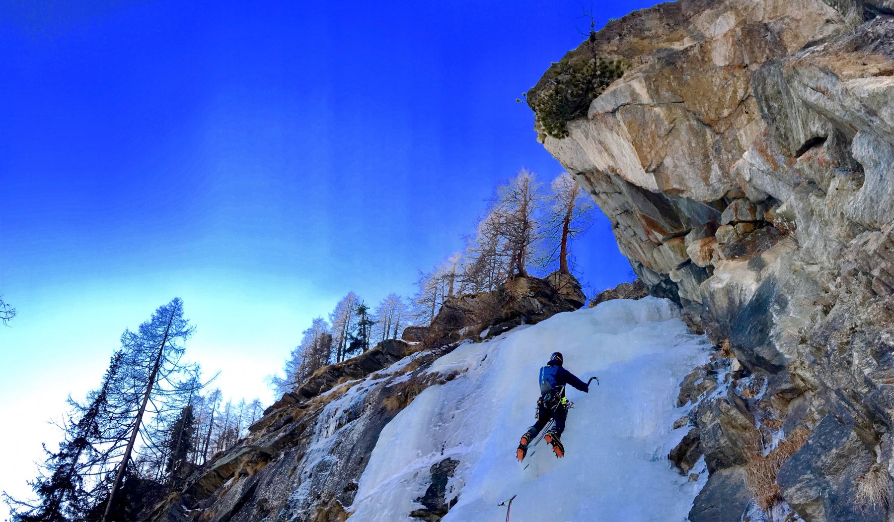
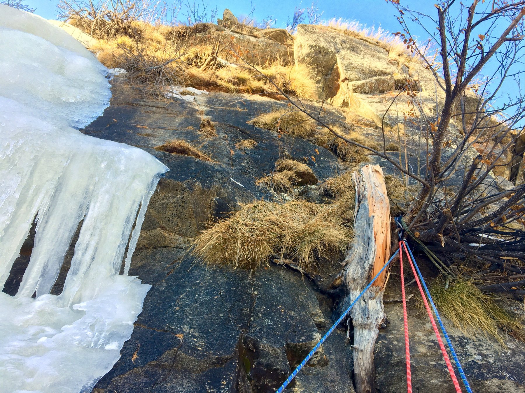
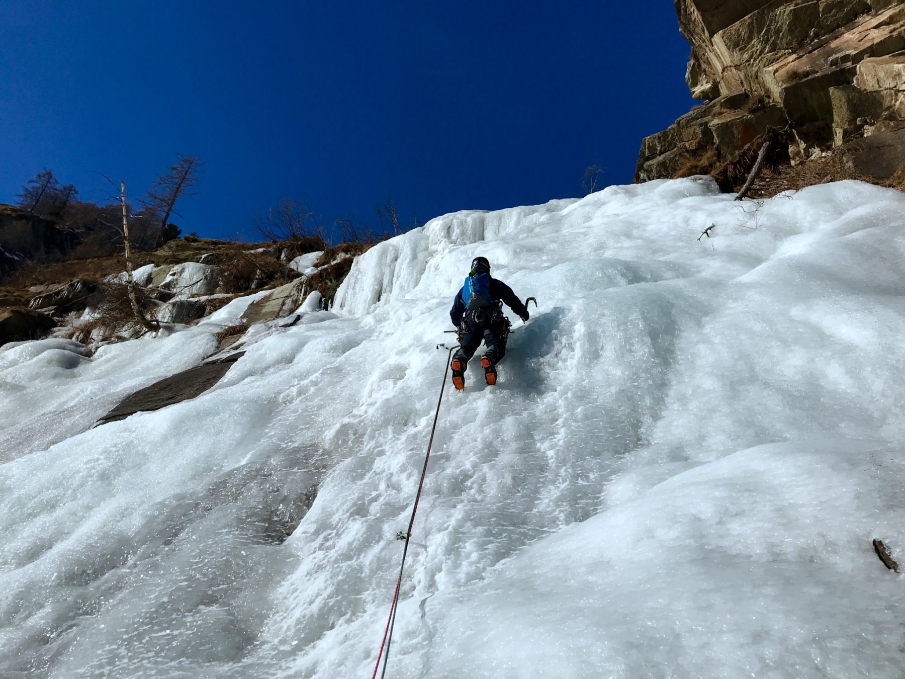
L1 risalire il largo flusso a piacimento fin dove spiana 45m. Sosta a spit sulla destra.
Trasferimento di un centinaio di metri fino sotto ad un salto roccioso alla cui sx ricomincia la colata
L2 bel risaltino che dopo 25 m piega un po verso dx, superare un muretto sugli 80* di ca 10m e raggiungere il pianoro . 60m sosta a spit con anello.
Discesa con 2 comode doppie intervallate dal trasferimento
- Bibliografia:
- Effimeri Barbagli
Nelle vicinanze Mappa
Itinerari
25/01/2015 AO, Valsavarenche 80 m I, 3+ Sud-Est
Valsavarenche – Je Suis Charlie (Cascata)
 200m
200m
31/01/2026 AO, Valsavarenche 80 m II, 4 Sud
Valsavarenche – Antares (Cascata)
 250m
250m
01/03/2024 AO, Valsavarenche 80 m II, 3 Nord
Valsavarenche – Mini Fleuve (Cascata)
 300m
300m
02/02/2023 AO, Valsavarenche 60 m I, 1, M8 Nord-Ovest
Valsavarenche – I gufi sono morti (Dry)
 400m
400m
25/02/2022 AO, Valsavarenche I, 1, M10 Nord
Valsavarenche – Grotta Haston (Falesia Dry)
 650m
650m
21/12/2025 AO, Valsavarenche 200 m II, 2 Ovest
Valsavarenche – Grand Clapey (Cascata di)
 750m
750m
13/02/2022 AO, Valsavarenche 60 m I, 3+, M7 Est
Valsavarenche – Valsabeach (Cascata)
 1.6Km
1.6Km
31/01/2026 AO, Valsavarenche 40 m II, 4 Ovest
Pont Valsavarenche (Cascata di)
 2.2Km
2.2Km
25/02/2026 AO, Valsavarenche 25 m I, 4 Nord
Valsavarenche – Eaux Rousses (Falesia di ghiaccio)
 2.4Km
2.4Km
09/01/2015 AO, Valsavarenche 350 m II, 2 Est
Valsavarenche – Nampio (Cascata del)
2.4Km