250m
250m


Note
 6.1Km
6.1Km
6.1Km
6.1Km
6.1Km
6.1Km
6.2Km
6.2Km
6.2Km
7.6Km
6.1Km
6.1Km
6.1Km
6.1Km
6.1Km
6.1Km
6.2Km
6.2Km
6.2Km
7.6Km
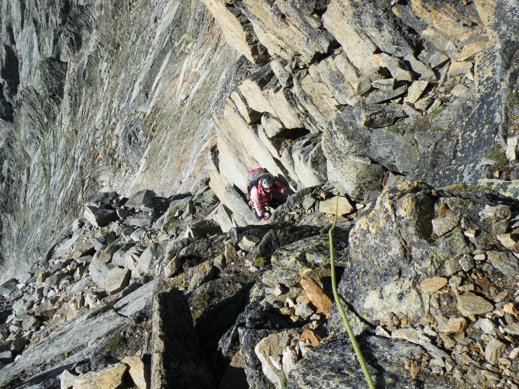
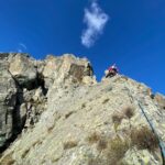
Utile corda (20mt) e ramponi (nel periodo tardo autunno-inverno)
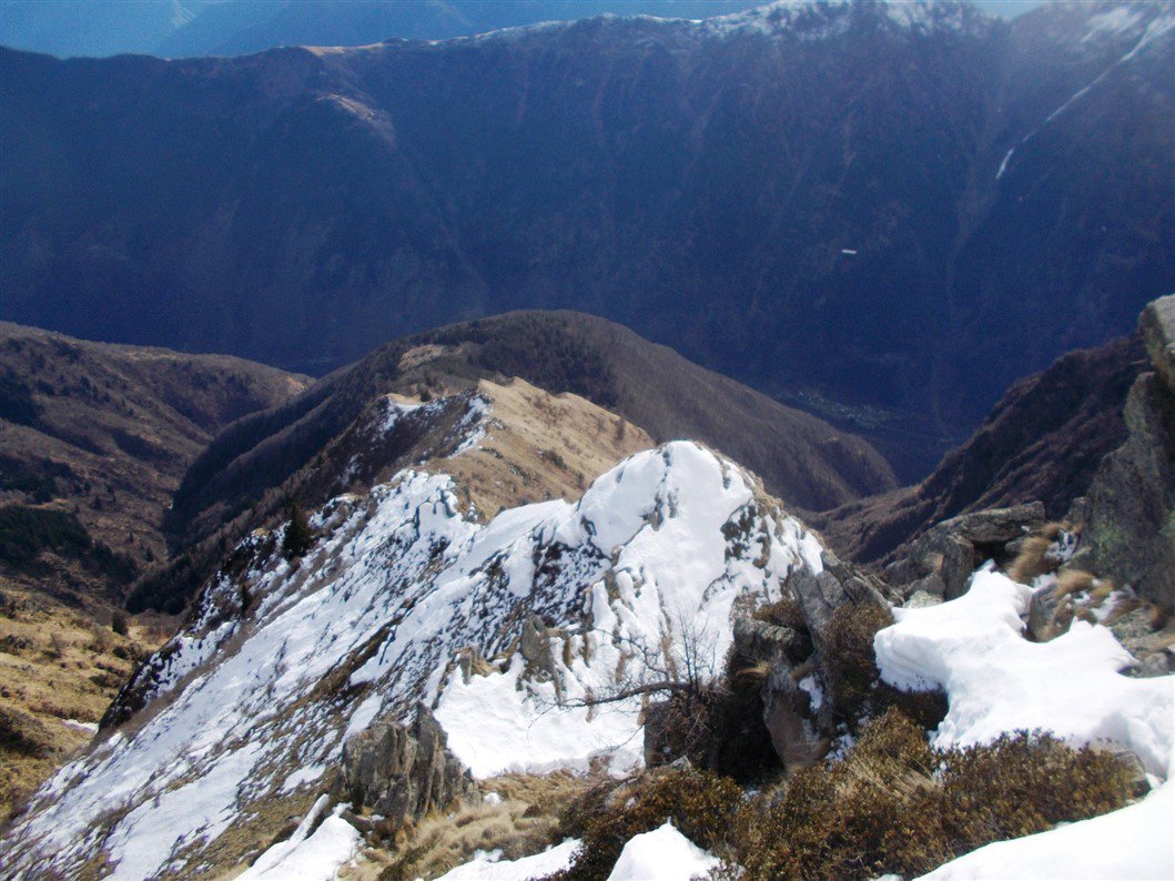
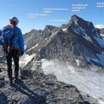
Si tratta di un bel percorso di cresta con qualche facile passo d’arrampicata (Max II), gradato PD sulla guida Cai Andolla-Sempione, esposto in prevalenza a Sud, adatto a coloro che amano muoversi su itinerari panoramici poco o per nulla frequentati... a parte i camosci!
Avvicinamento
Si tratta di un bel percorso di cresta con qualche facile passo d’arrampicata (Max II), gradato PD sulla guida Cai Andolla-Sempione, esposto in prevalenza a Sud, adatto a coloro che amano muoversi su itinerari panoramici poco o per nulla frequentati... a parte i camosci!
Gravellona Toce-Usc. Villadossola-Valle Antrona-San Pietro-Madonna-bivio a dx per Schieranco
Descrizione
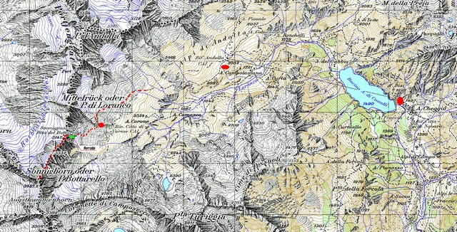
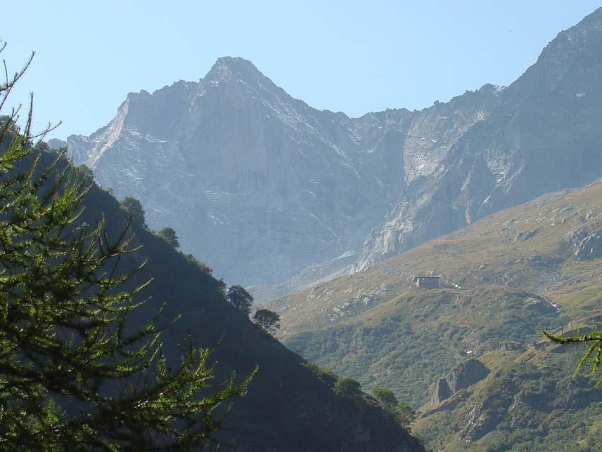
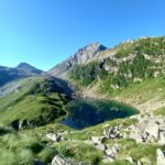
Portarsi alle spalle delle poche case di Schieranco dove, al limite del bosco di castagni, parte il sentiero per l’Alpe Cavallo che si raggiunge senza problemi circa in 1,30h.
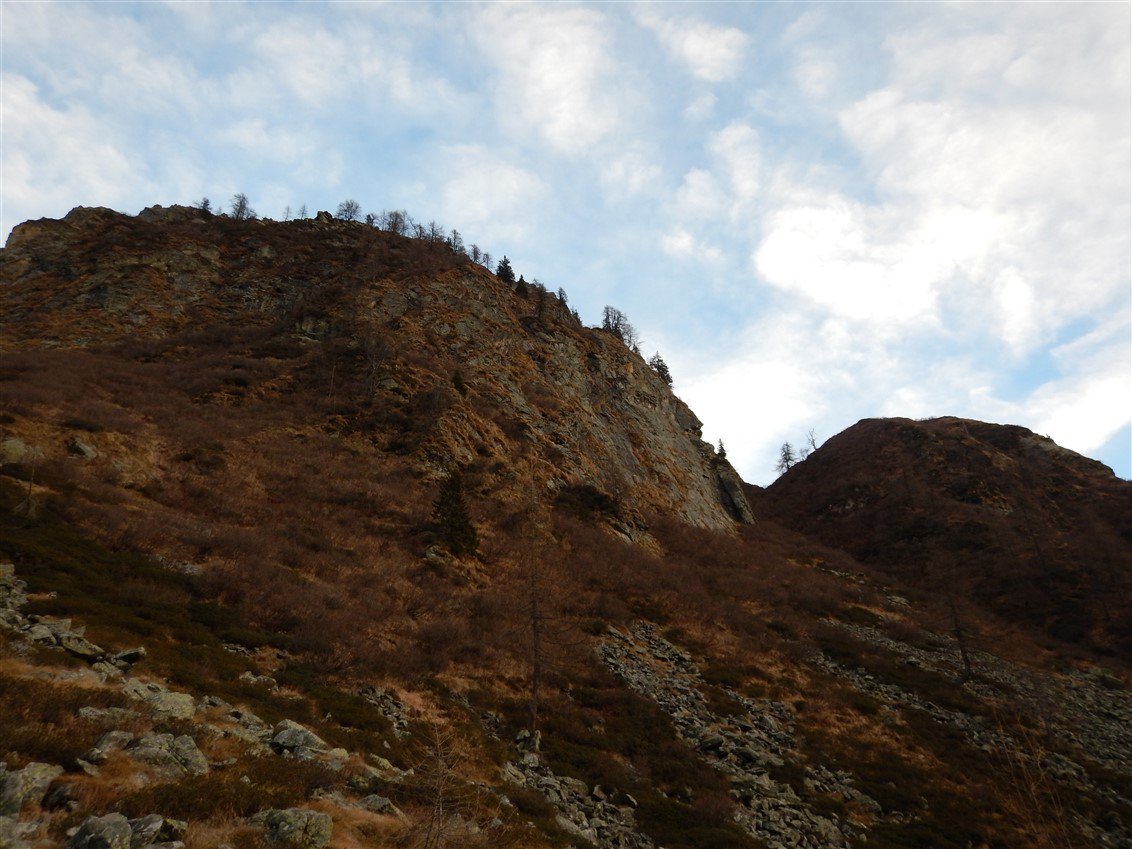
Arrivati all’Alpe Cavallo non resta che proseguire lungo il costone (Costa del Cavallo) che sale verso la cresta spartiacque con la Val Bognanco, traversando inizialmente un fitto bosco di abeti e larici che va pian piano diradandosi fino a scomparire, lasciando spazio a brulli e ripidi pascoli con l’aumento della quota.
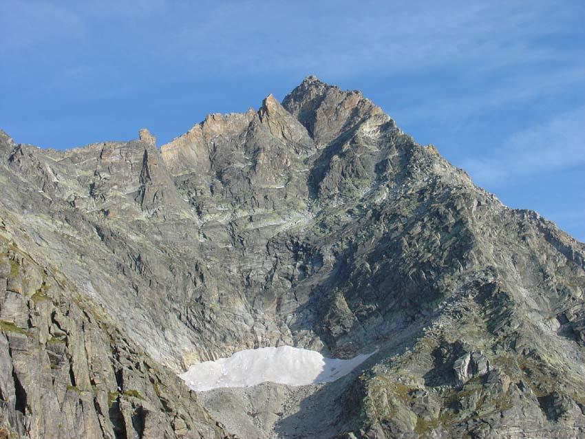
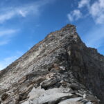
Con un ripido canale erboso si accede alle balze rocciose (II) che proteggono la punta, su molte carte solo quotata, di Pietraforata 2136 m oltre il quale si prosegue seguendo la cresta e aggirando le maggiori difficoltà sul versante del Vallone di Pena.
Il difficile torrione che precede la breve cresta finale del Ciapè può essere aggirato indifferentemente su entrambi i versanti.
Con pochi facili passi dalla cresta spartiacque si raggiunge la panoramica cimetta, protesa verso la Valle Antrona, del Pizzo Ciapè.
Per la discesa si può continuare abbassandosi nella facile conca Ovest verso la Valle Antrona portandosi gradualmente a sx oltre i risalti rocciosi della quota 2239 m per traversare, sfruttando il sentiero segnalato, all’Alpe Cama 1612 m e scendere poi all’Alpe Campo 1227 m dove si ritorna sulla strada proveniente da Antrona.
Tornare a Schieranco da qui è eterno… se non si è organizzato un mezzo per il rientro la cosa più saggia è fare l’autostop…
- Cartografia:
- Kompass 89 Domodossola
- Bibliografia:
- CAI-TCI Andolla-Sempione
Nelle vicinanze Mappa
Itinerari
05/08/2007 VB, Antrona Schieranco D+ 2013 m PD- Nord-Est
Bottarello (Pizzo) cresta Nord-Est dalla Bocchetta del Bottarello (Sonnigpass)
 6.1Km
6.1Km
04/07/2026 VB, Antrona Schieranco D+ 2157 m AD- Sud-Est
Andolla (Pizzo) Cresta Est
 6.1Km
6.1Km
09/09/2007 VB, Antrona Schieranco D+ 1600 m AD+ Sud
Andolla (Pizzo) Cresta SE
 6.1Km
6.1Km
30/07/2023 VB, Bognanco D+ 1889 m PD- Sud-Est
Loranco (Pizzo) o Mittelruck Via Normale dall’Alpe Cheggio
 6.1Km
6.1Km
11/09/2022 VB, Antrona Schieranco D+ 1866 m D Est
Loranco (Pizzo) o Mittelruck Cresta Est o del Lago Maggiore
 6.1Km
6.1Km
24/07/2011 VB, Antrona Schieranco D+ 1311 m AD- Nord-Ovest
Scona d’Batagg Cresta NO + Punta Turiggia e Passo delle Coronette
 6.1Km
6.1Km
30/07/2022 VB, Antrona Schieranco D+ 2300 m F Varie
Stellihorn dal Lago di Antrona, traversata per Pizzo Antigine e Pizzo Cingino
 6.2Km
6.2Km
24/12/2015 VB, Antrona Schieranco D+ 2000 m PD- Varie
Ton (Gemelli Nord e Sud di) e Punta della Forcola dal Lago di Antrona per il dal Passo Forcola
 6.2Km
6.2Km
22/06/2025 VB, Antrona Schieranco D+ 1400 m PD Nord
Ton (Pizzo del) Cresta Est
 6.2Km
6.2Km
17/09/2022 VB, Montescheno D+ 1510 m AD Nord-Ovest
Ciapè (Pizzo) Cresta degli Asini
 7.6Km
7.6Km