 950m
950m
Note
 2.7Km
2.9Km
2.9Km
2.9Km
3.3Km
4Km
4Km
4Km
4.6Km
2.7Km
2.9Km
2.9Km
2.9Km
3.3Km
4Km
4Km
4Km
4.6Km
950m
2.6Km
2.8Km
4.6Km
4.8Km
5.8Km
7Km
7.3Km
9Km
9Km
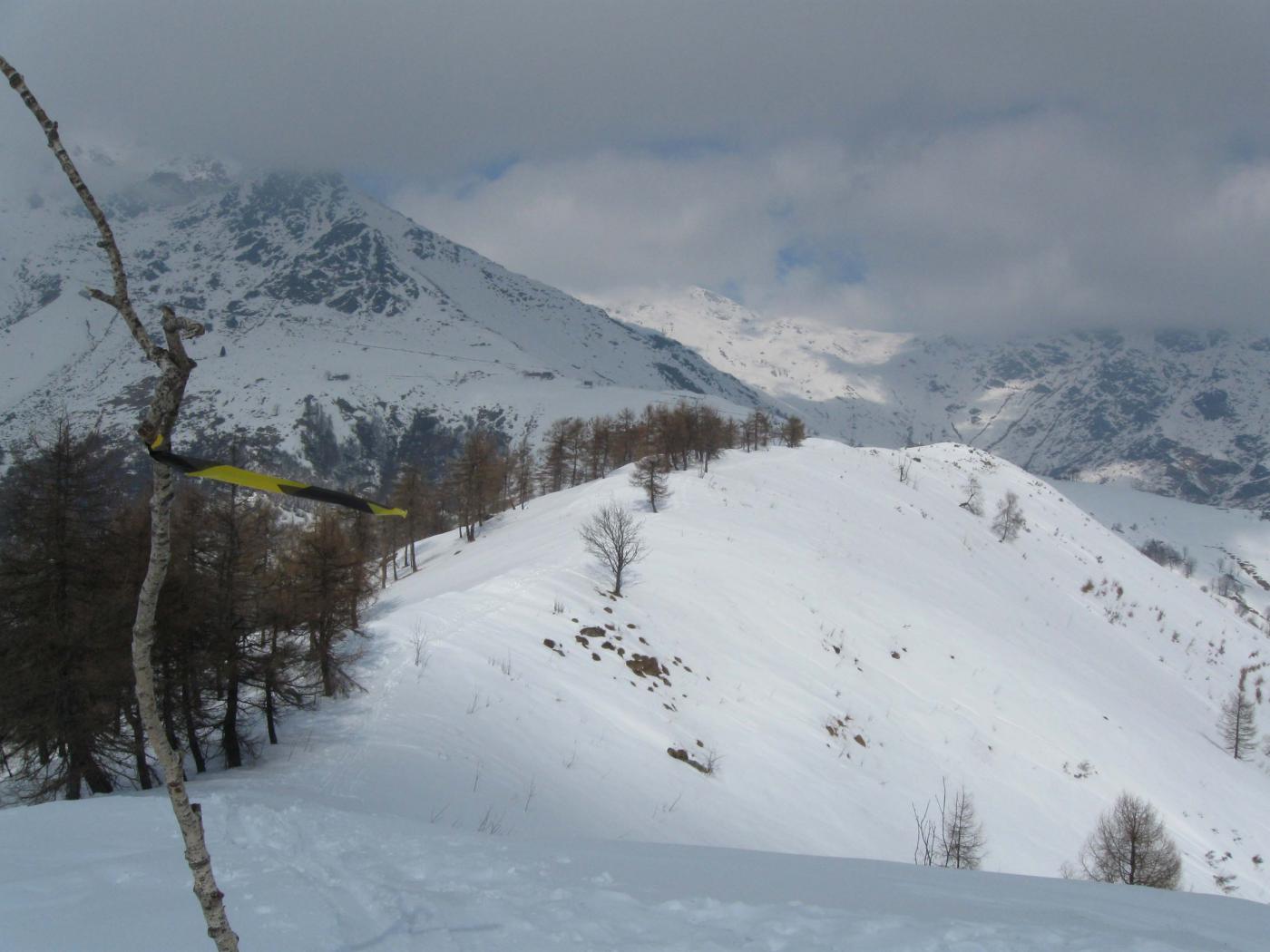
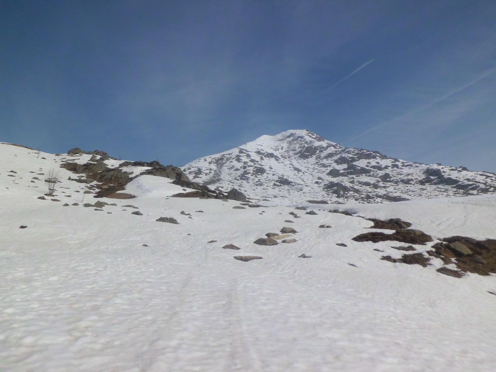
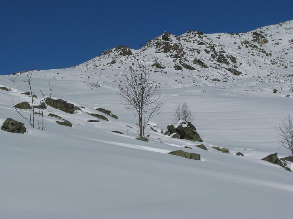
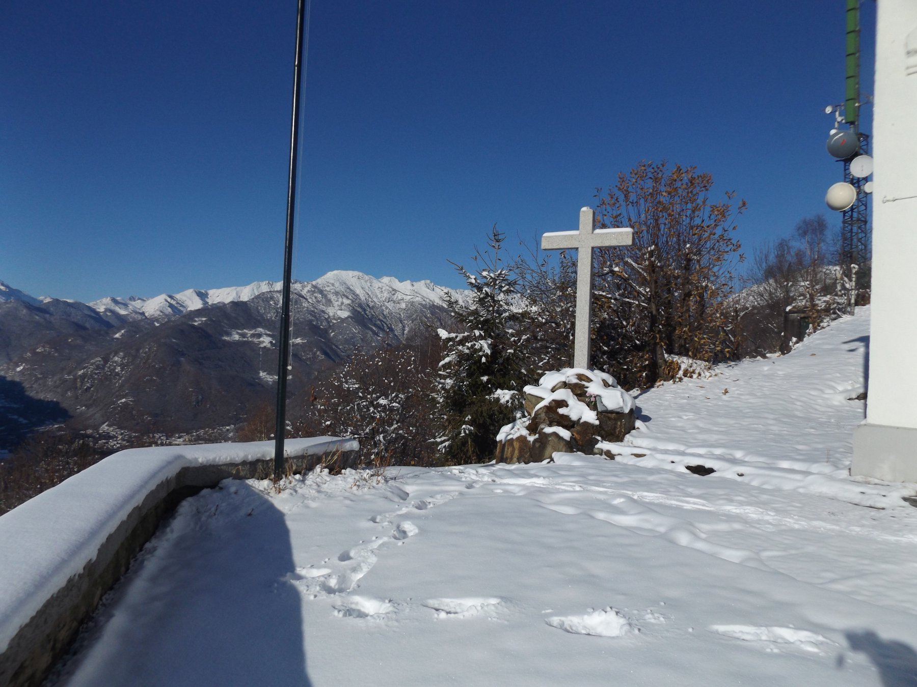
Bella e facile passegiata, indicata quando si ha poco tempo a disposizione, con bei panorami sulla pianura e sulla vicina cima della Quinzeina
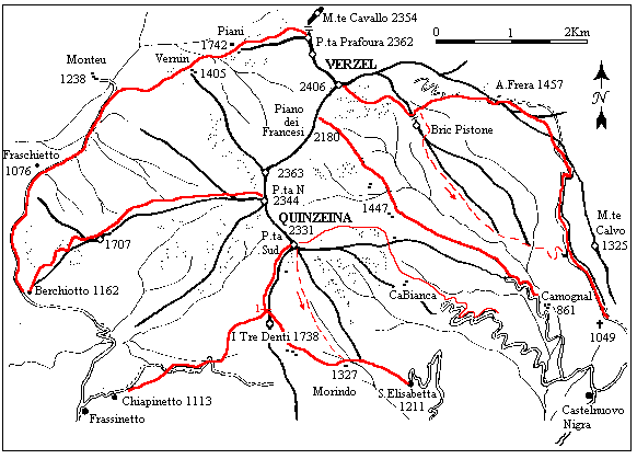
Avvicinamento
Risalire la Valle Sacra sino a Castelnuovo Nigra, poi proseguire seguendo le indicazioni Santa Elisabetta - Si può parcheggiare l'auto nel piazzale della chiesa
Descrizione
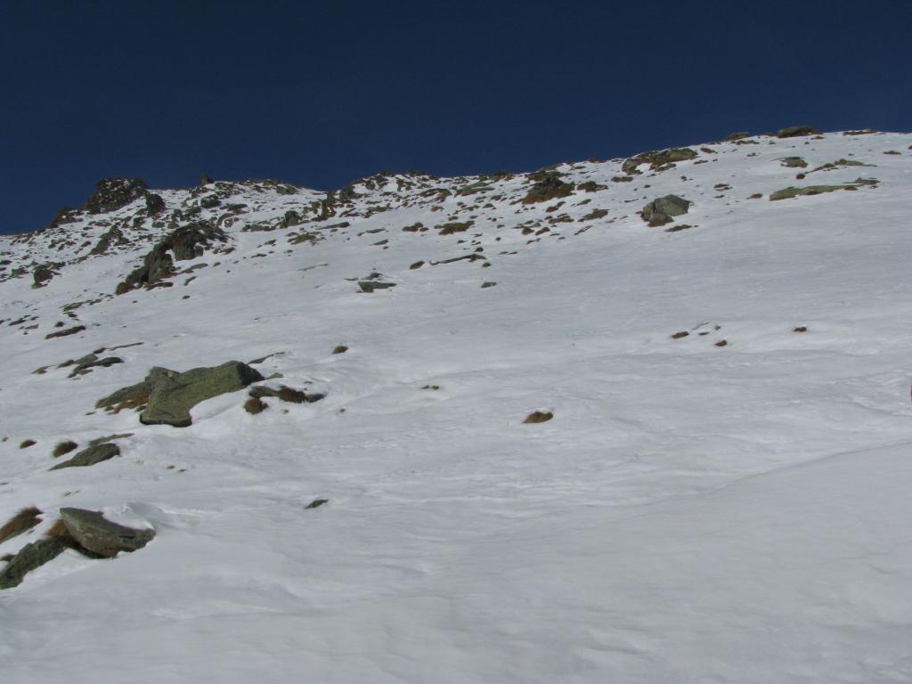
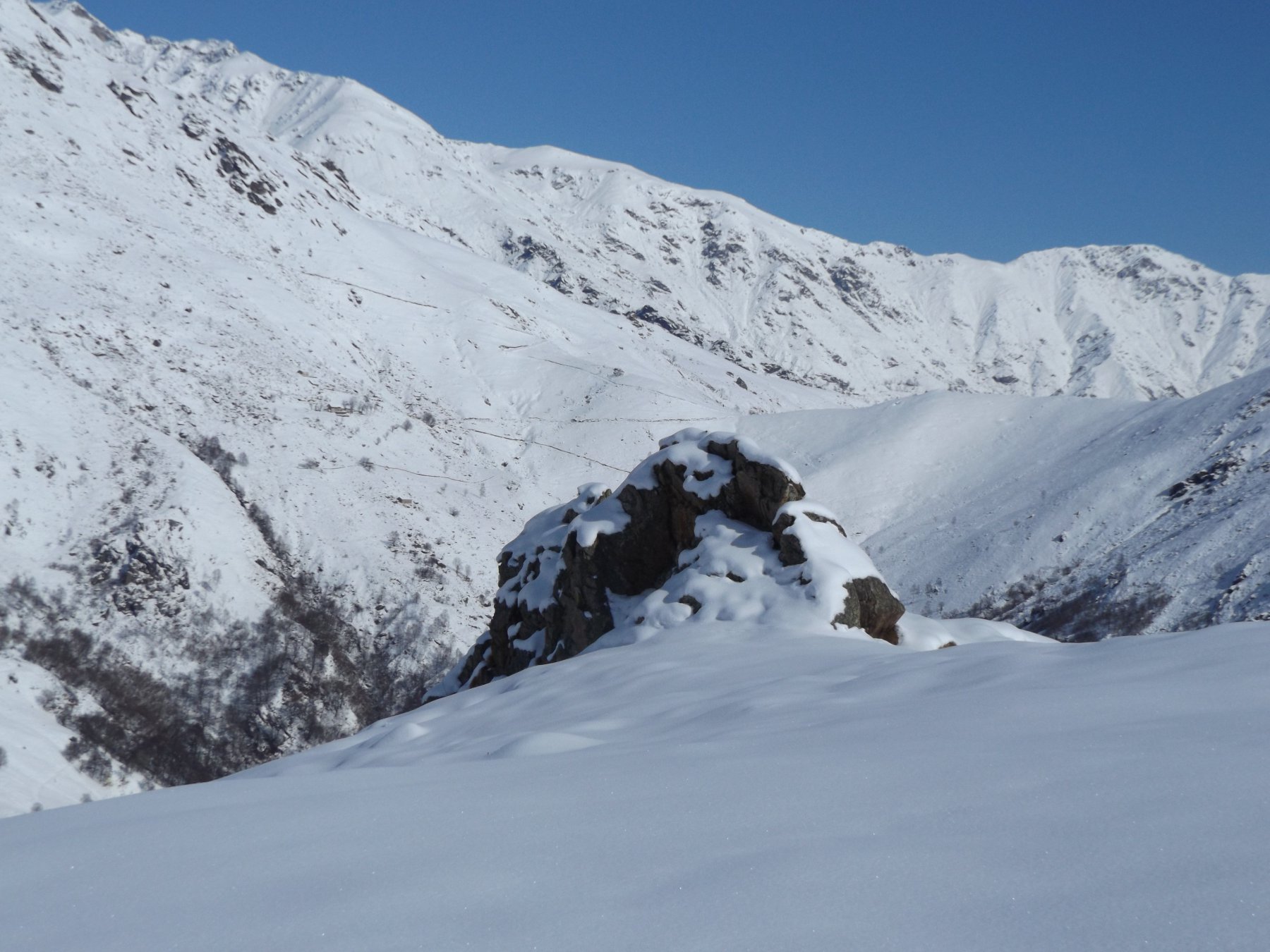
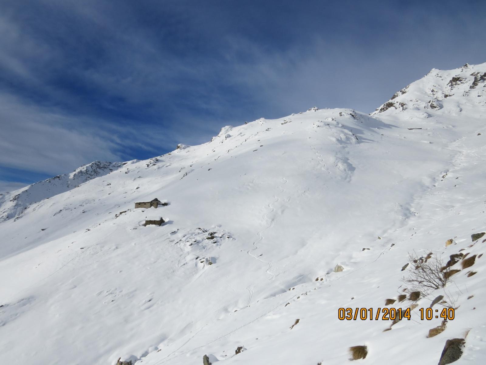
Partire dal piazzale della chiesa seguendo la stradina innevata che costeggia un gruppo di case sino ad uscire su spazi aperti, di qui in avanti si può proseguire lungo la poderale e/o risalire per prati, sino a confluire nuovamente sulla poderale, arrivati ad una grossa antenna (ripetitori) seguire la poderale verso sinistra (a destra si va verso il vallone di Valossera), la poderale effettua un lungo diagonale, passa vicino a degli alpeggi e risale sui prati superiori dove c’è un’area picnic con vicino un agriturismo (El Sernis), di qui in breve si risale il dosso nevoso e si arriva al Pian del Lupo, seguire la poderale verso sinistra che con un lungo traverso in salita, porta nel versante di Frassinetto al di sopra di Pian Confier – Di qui la visuale si apre sulle cime della Valle Orco – Di qui si volendo si può scendere per la poderale verso Frassinetto
Nelle vicinanze Mappa
Itinerari
17/11/2019 TO, Castelnuovo Nigra D+ 534 m MR Sud
Calvo (Monte) da Castelnuovo Nigra
 2.7Km
2.7Km
04/01/2020 TO, Colleretto Castelnuovo D+ 1031 m BR Sud
Quinzeina o Quinseina (Punta Sud) da Santa Elisabetta
 2.9Km
2.9Km
29/12/2019 TO, Colleretto Castelnuovo D+ 1133 m BRA, F+ Sud-Est
Quinzeina o Quinseina (Punta Nord e Sud) da Santa Elisabetta
 2.9Km
2.9Km
14/04/2013 TO, Colleretto Castelnuovo D+ 571 m MR Sud-Est
Tre Denti (I) o Denti della Quinzeina da Santa Elisabetta
 2.9Km
2.9Km
11/01/2014 TO, Colleretto Castelnuovo D+ 340 m MR Sud-Est
Penne Mozze (Cippo) da Santa Elisabetta per il Vallone di Valossera
2.9Km
18/02/2012 TO, Castelnuovo Nigra D+ 1121 m MR Sud-Est
Pistone (Bric) o La Viltà dal Ponte Romano per il Sentiero del Basilisco
 3.3Km
3.3Km
04/03/2018 TO, Castelnuovo Nigra D+ 500 m MR Sud-Est
Aglietto (Punta di Costa) dalla Cappella Visitazione
 4Km
4Km
15/02/2015 TO, Castelnuovo Nigra D+ 300 m MR Nord
Nere (Pian delle) dalla Cappella della Visitazione
 4Km
4Km
24/11/2018 TO, Castelnuovo Nigra D+ 846 m MR Sud-Ovest
Frera o Paradiso (Punta) dalla Cappella della Visitazione
 4Km
4Km
03/12/2017 TO, Cuorgnè D+ 590 m MR Sud-Ovest
Belice (Cappella del) da Salto, anello
 4.6Km
4.6Km
Servizi
950m
2.6Km
Società filia Ristorante
Castellamonte
2.8Km
S.Elisabetta Ristorante
Colleretto Castelnuovo
4.6Km
Da Jacopo Ristorante
Cuorgnè
4.8Km
Palasot Ristorante
Castelnuovo Nigra
5.8Km
La soce Ristorante
Cuorgnè
7Km
La Maddalena B&B
Cuorgnè
7.3Km
Delle Alpi Ristorante
Pont Canavese
9Km
Bergagna Rifugio
Pont Canavese
9Km
