1.9Km
1.9Km


Note
Storico
 200m
300m
350m
800m
800m
900m
1.8Km
2.4Km
2.5Km
2.6Km
200m
300m
350m
800m
800m
900m
1.8Km
2.4Km
2.5Km
2.6Km
1.9Km
2.4Km
2.9Km
4Km
5Km
5.2Km
5.2Km
5.5Km
6.8Km
7.5Km
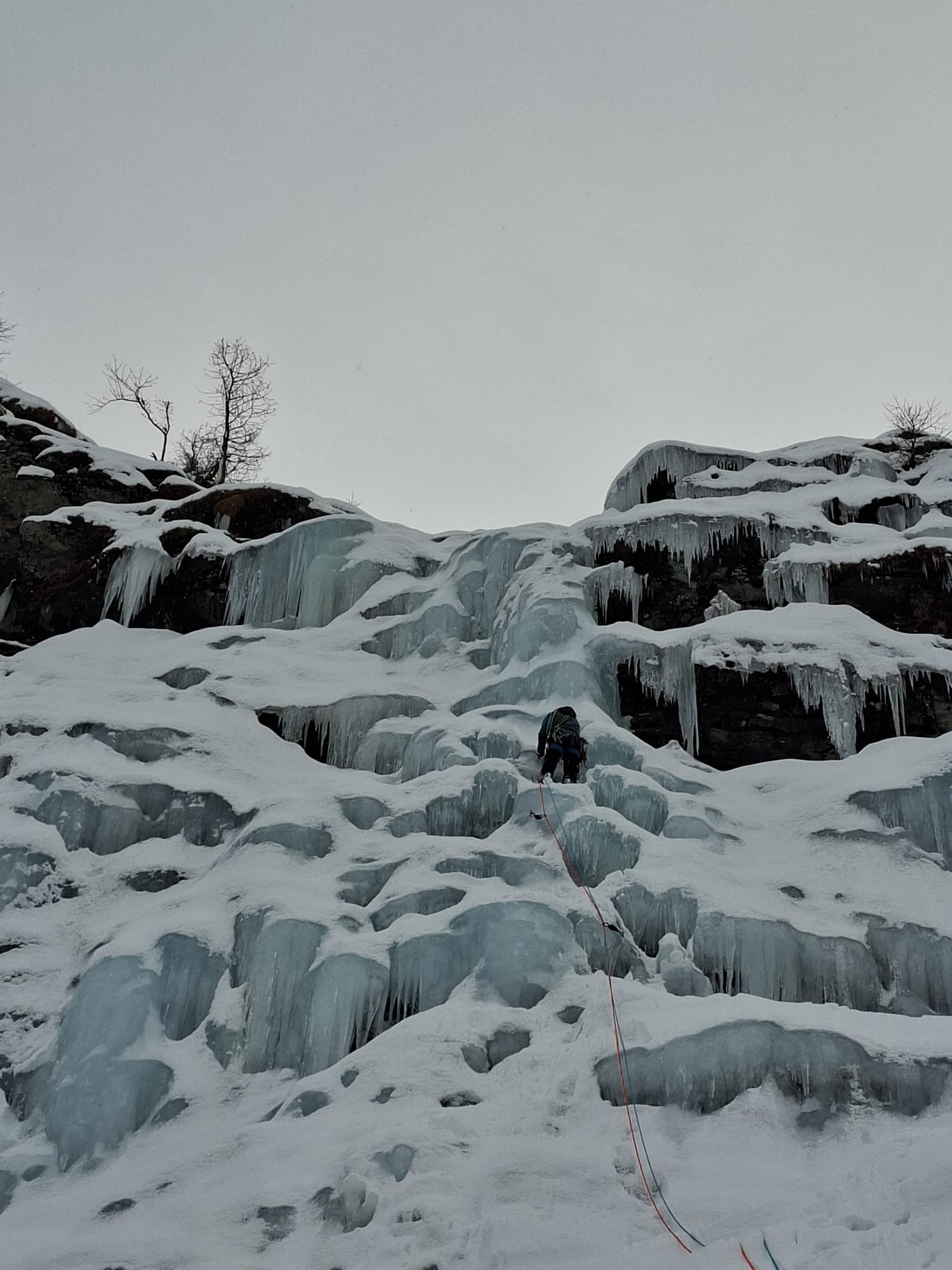
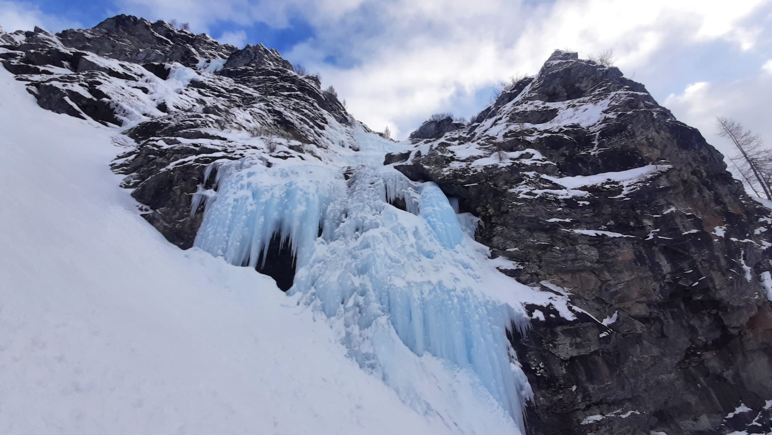
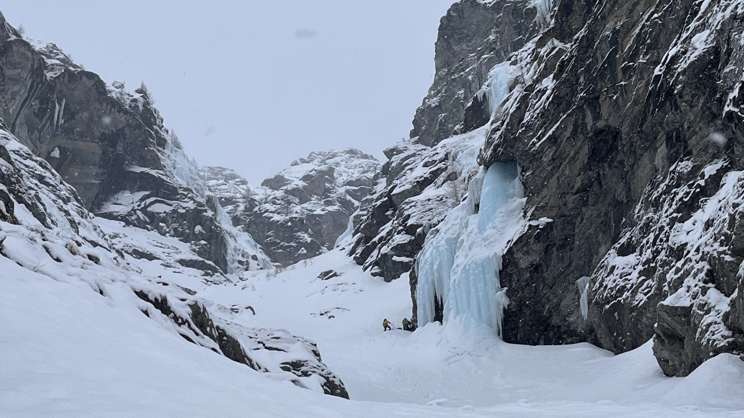
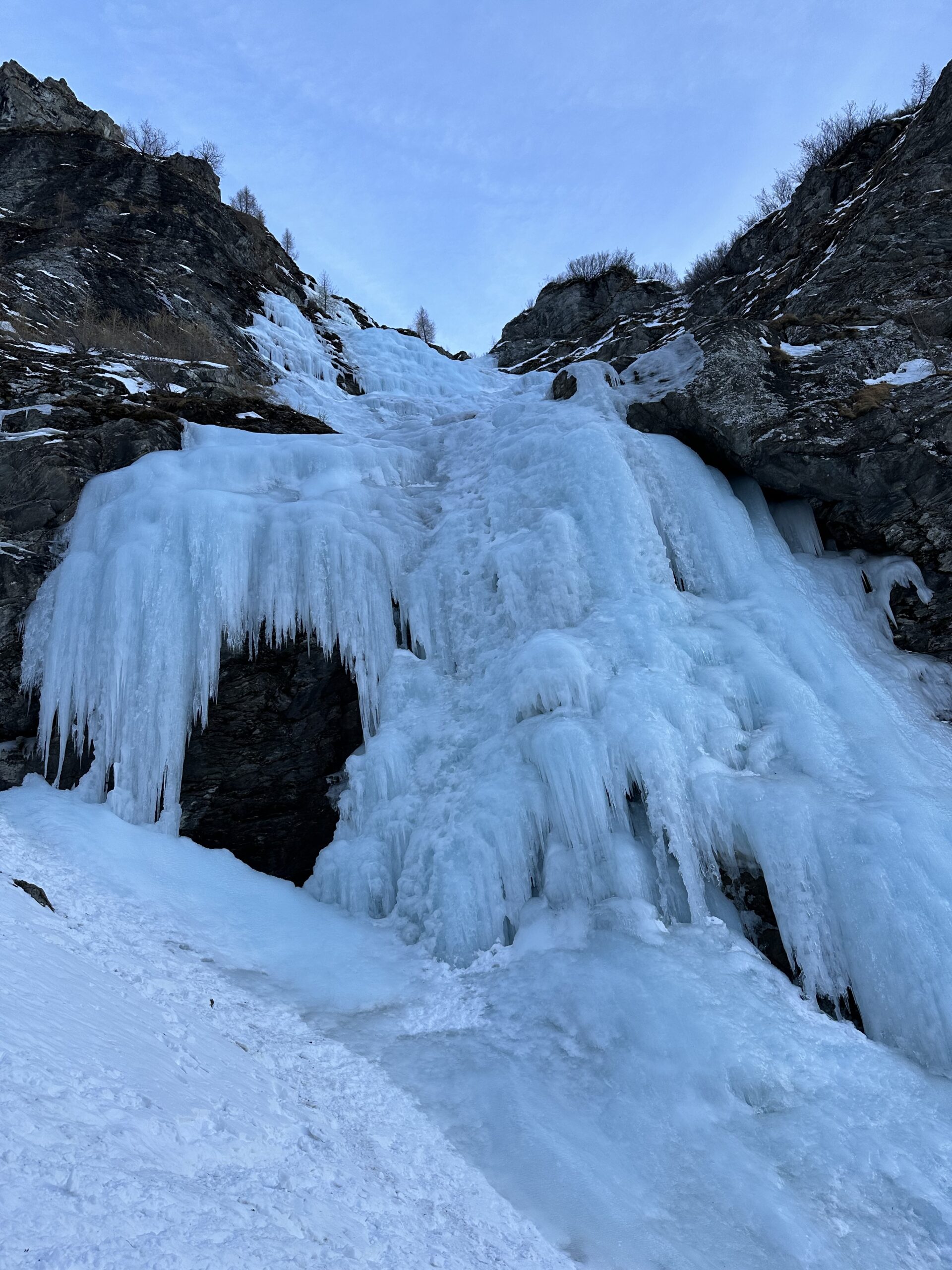
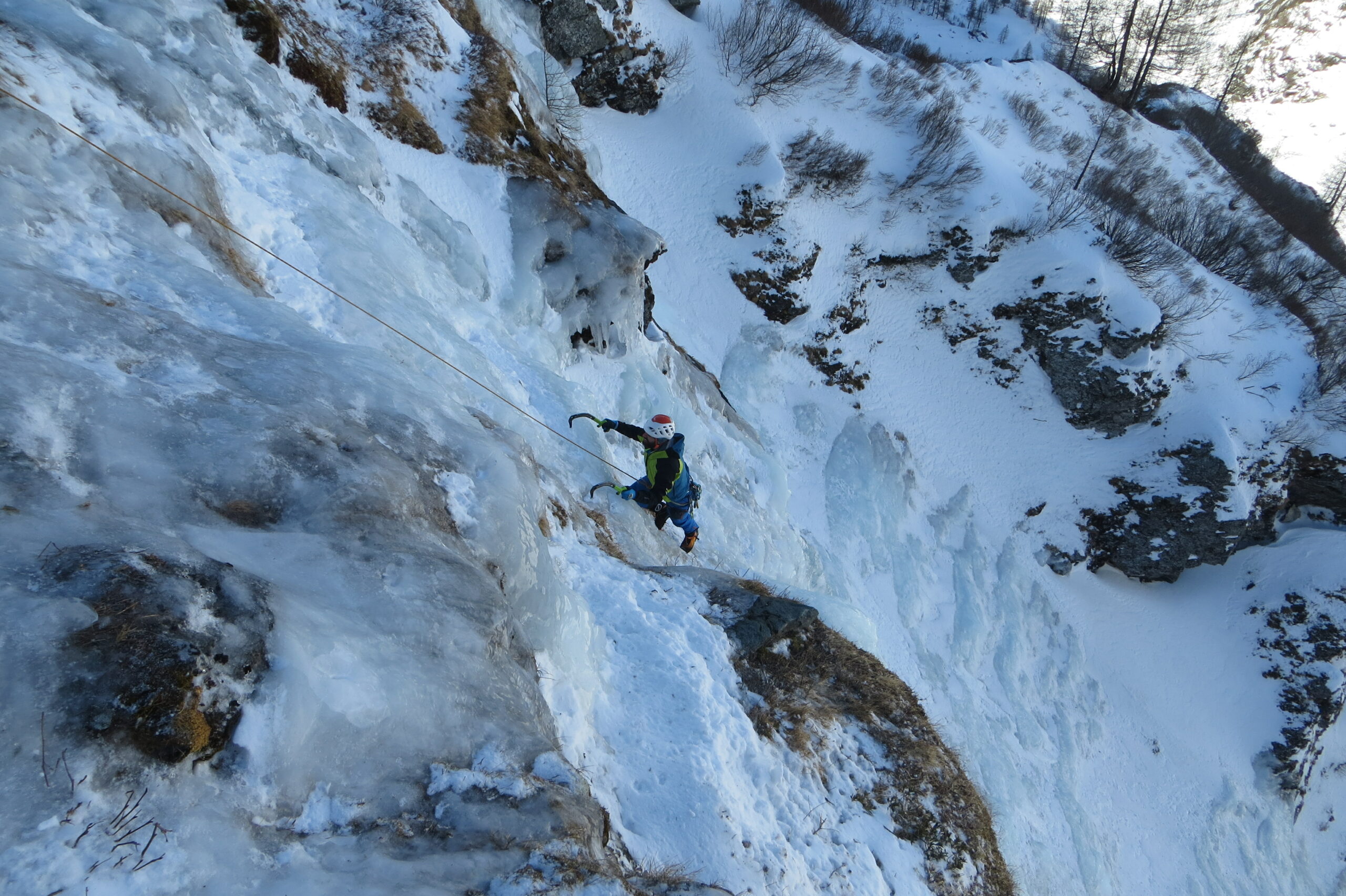
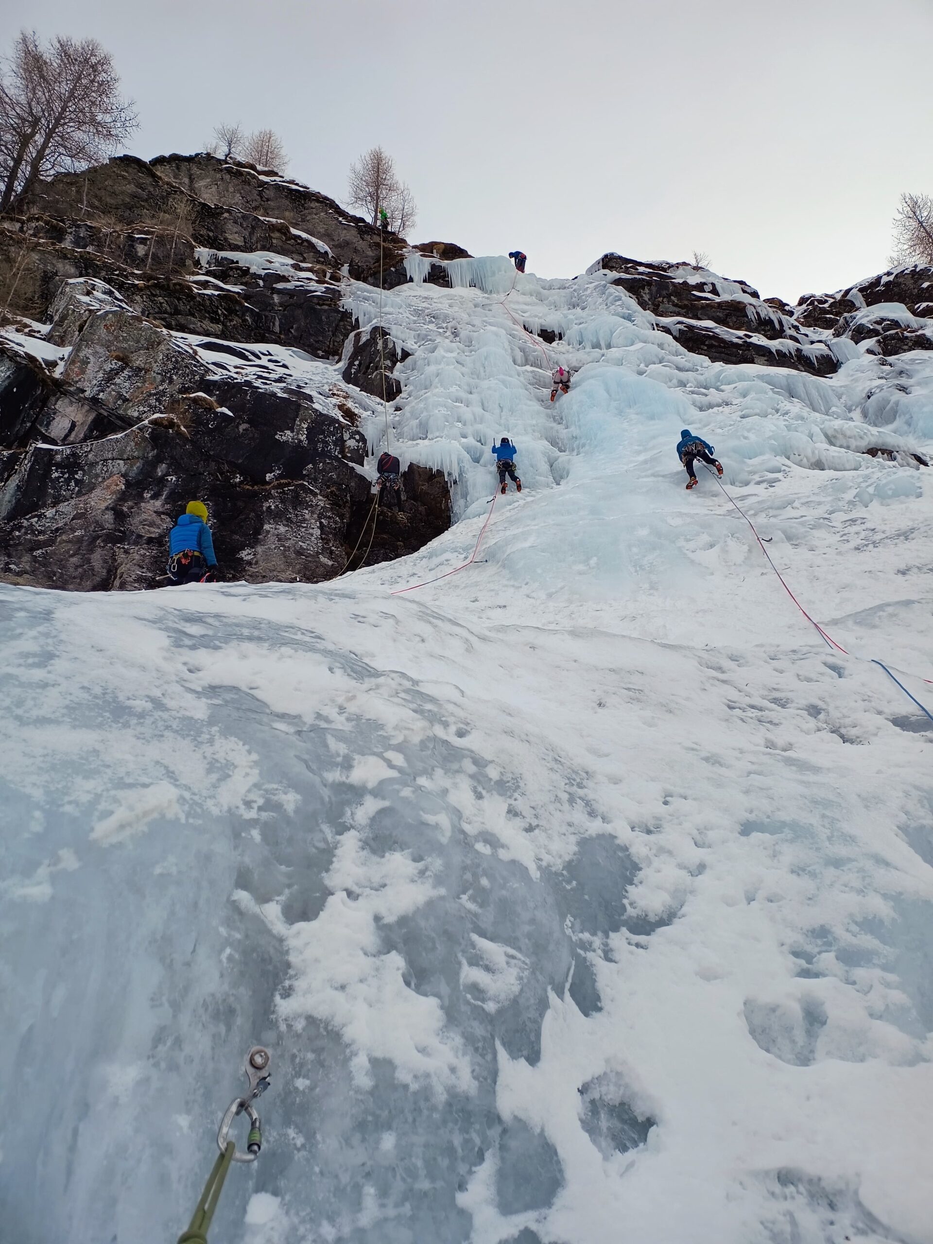
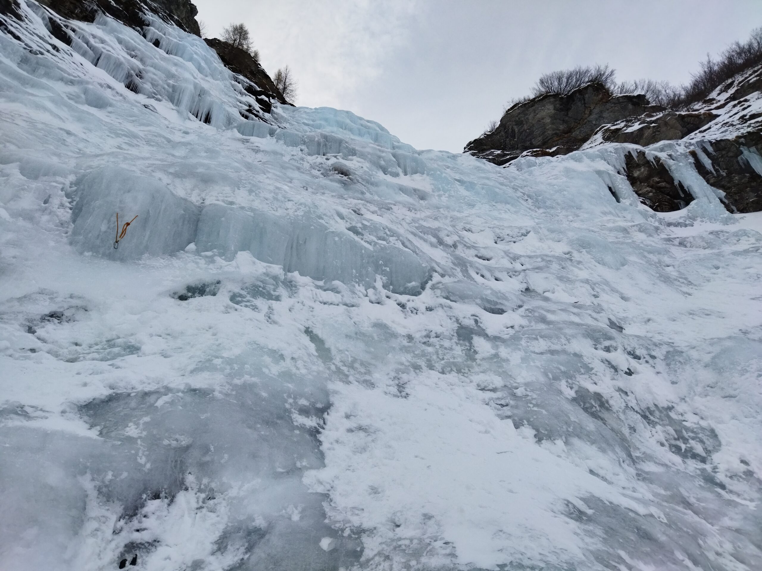
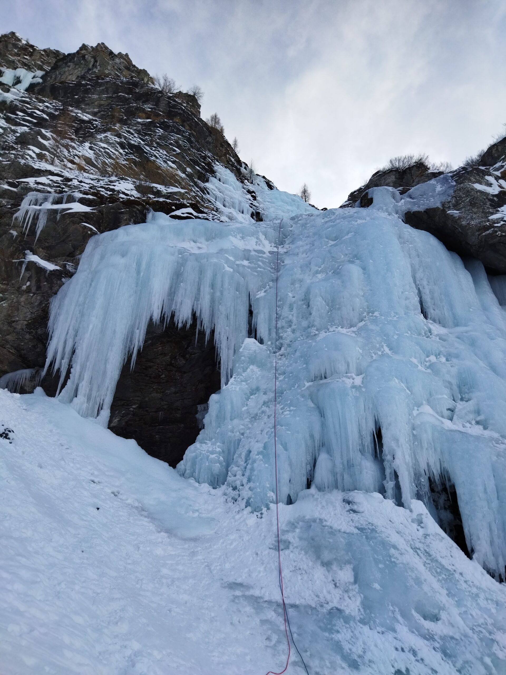
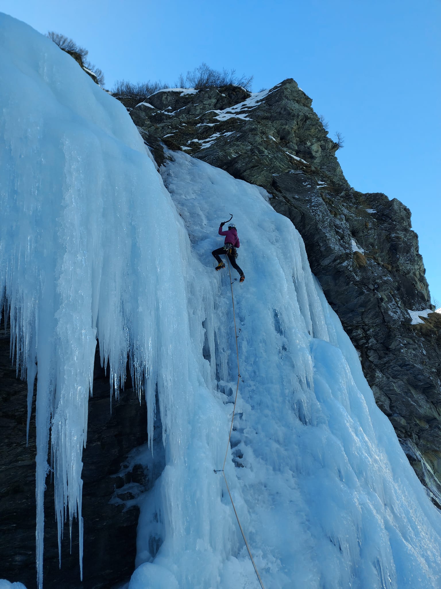
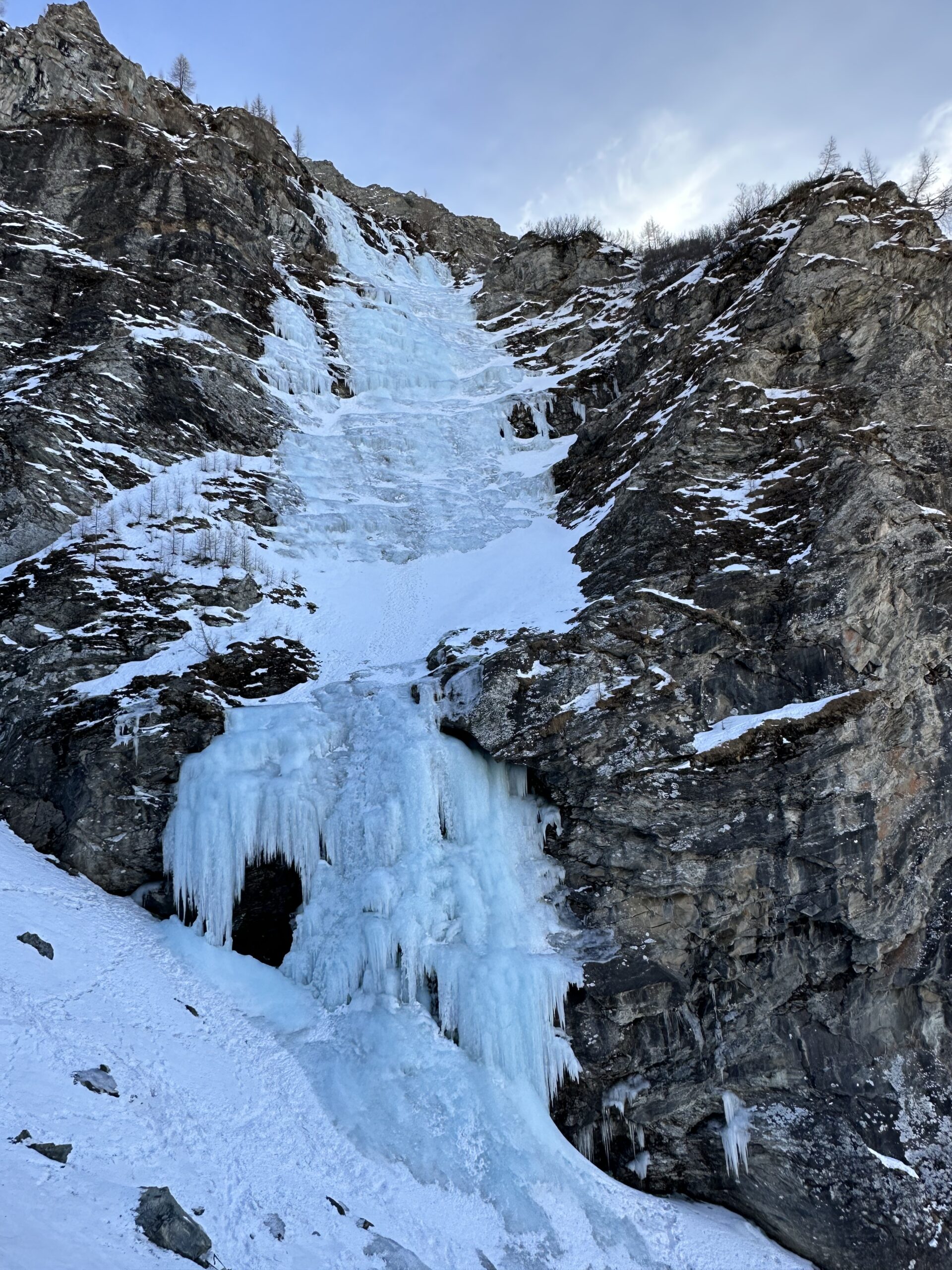
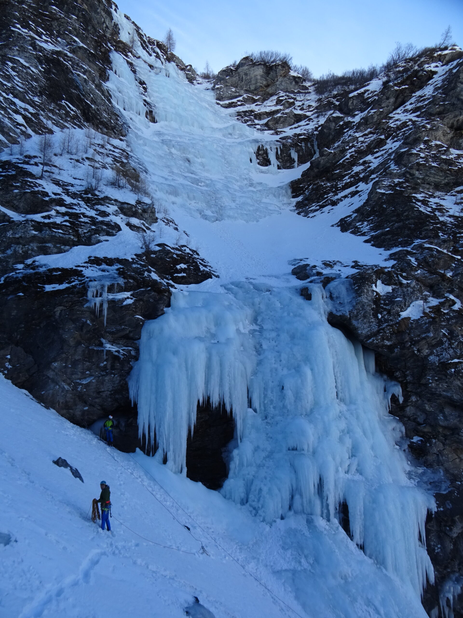
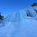
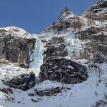
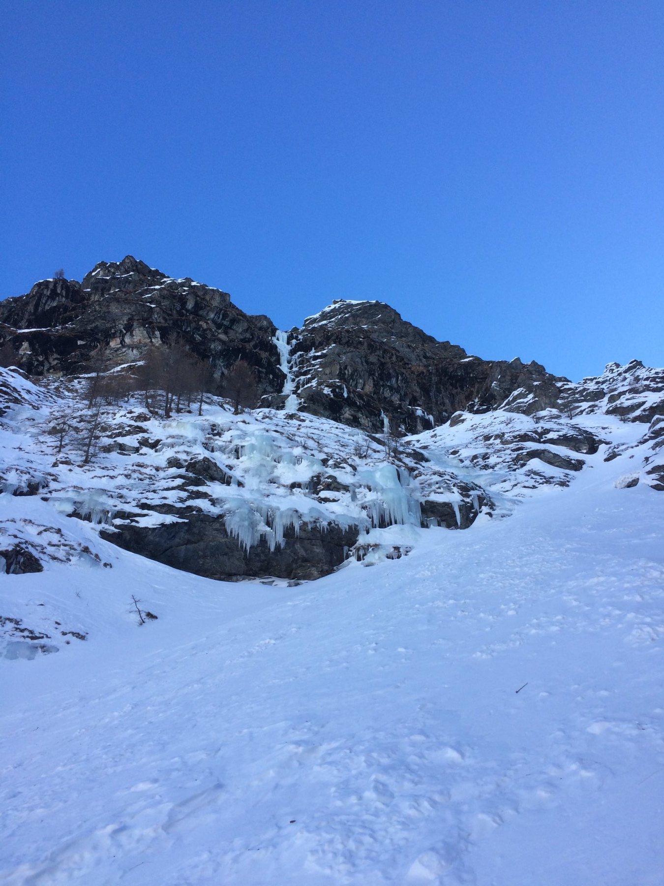
Enorme cascata che data la sua esposizione e la quota è in condizioni fino a stagione inoltrata.
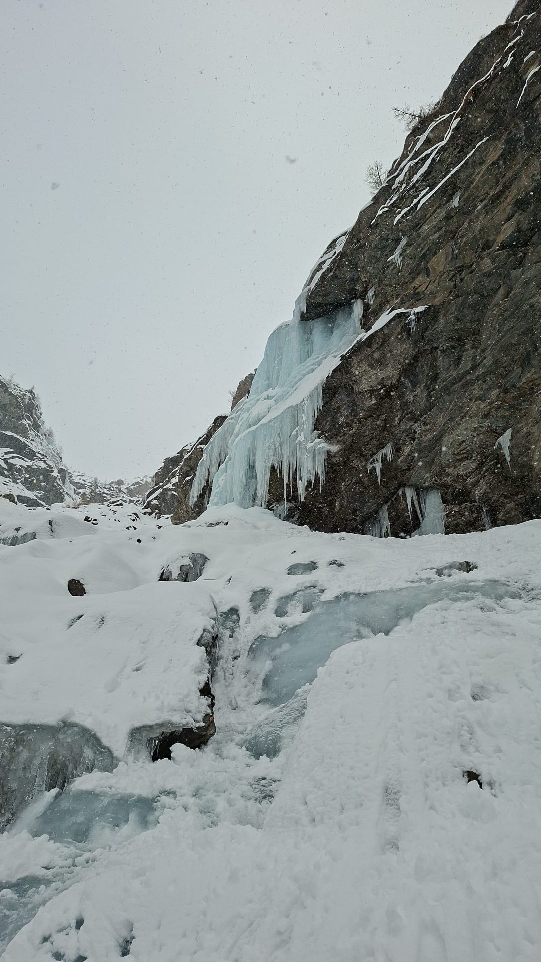
Avvicinamento
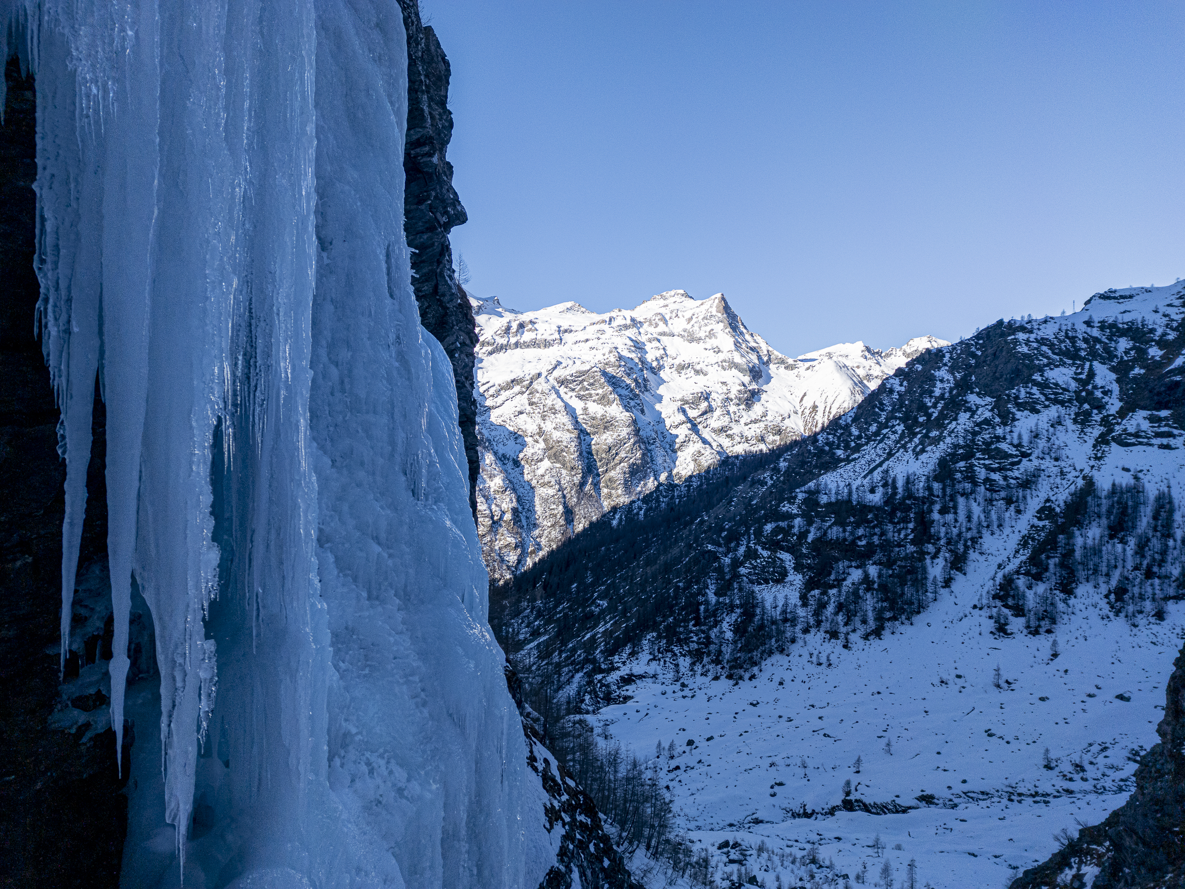
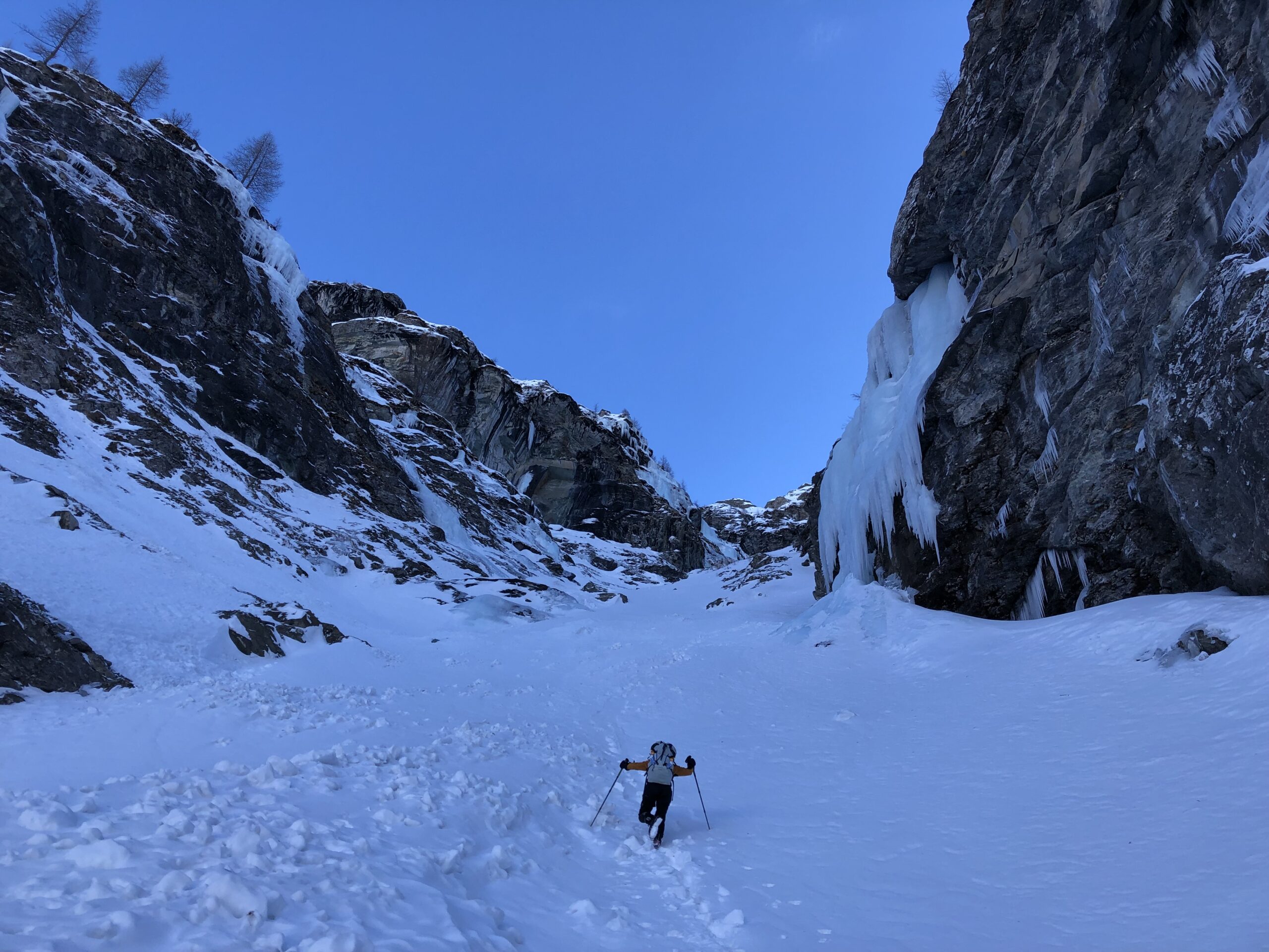
Da Gressoney la trinitè seguire il sentiero che sale nel vallone di Netscho partendo da poco prima del B&B oppure quello che parte dalla centralina (piccolo park). Se si parte dalla centralina si raggiunge una pista che con lieve discesa poi passa nei pressi di un ponte dove si innesta con l'altro accesso. Proseguire ancora brevemente nel vallone sulla pista, attraversare il torrente quindi imboccare l'evidente canalone. La colata è la prima sulla dx che si vede solo una volta superata la conoide.
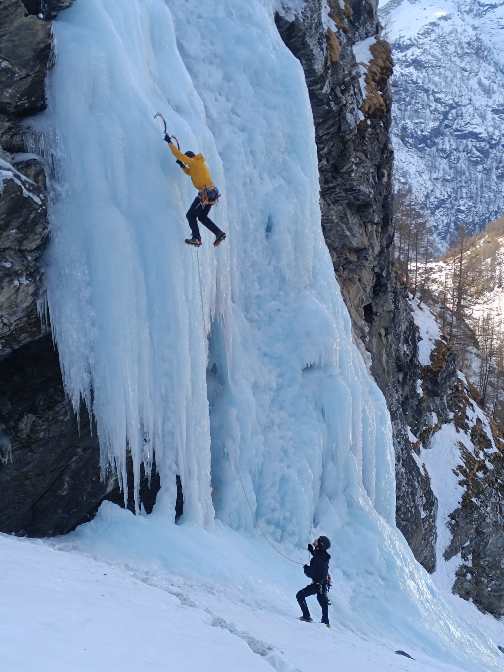
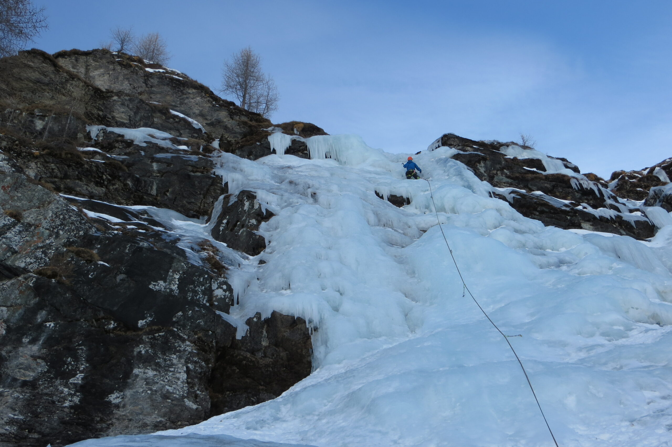
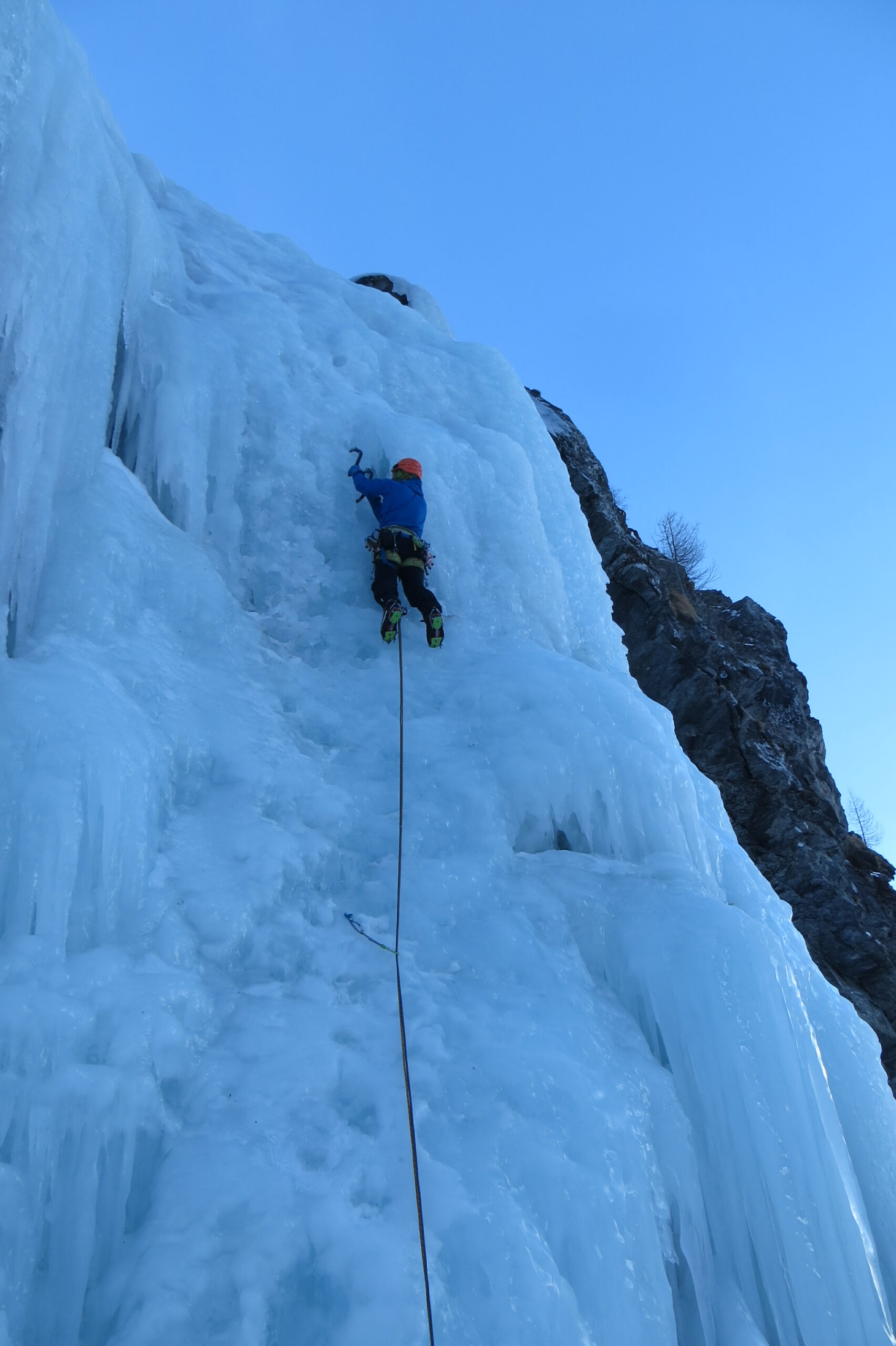
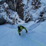
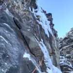
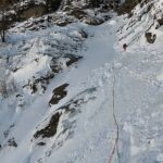
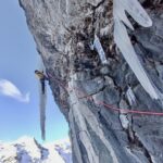
Descrizione
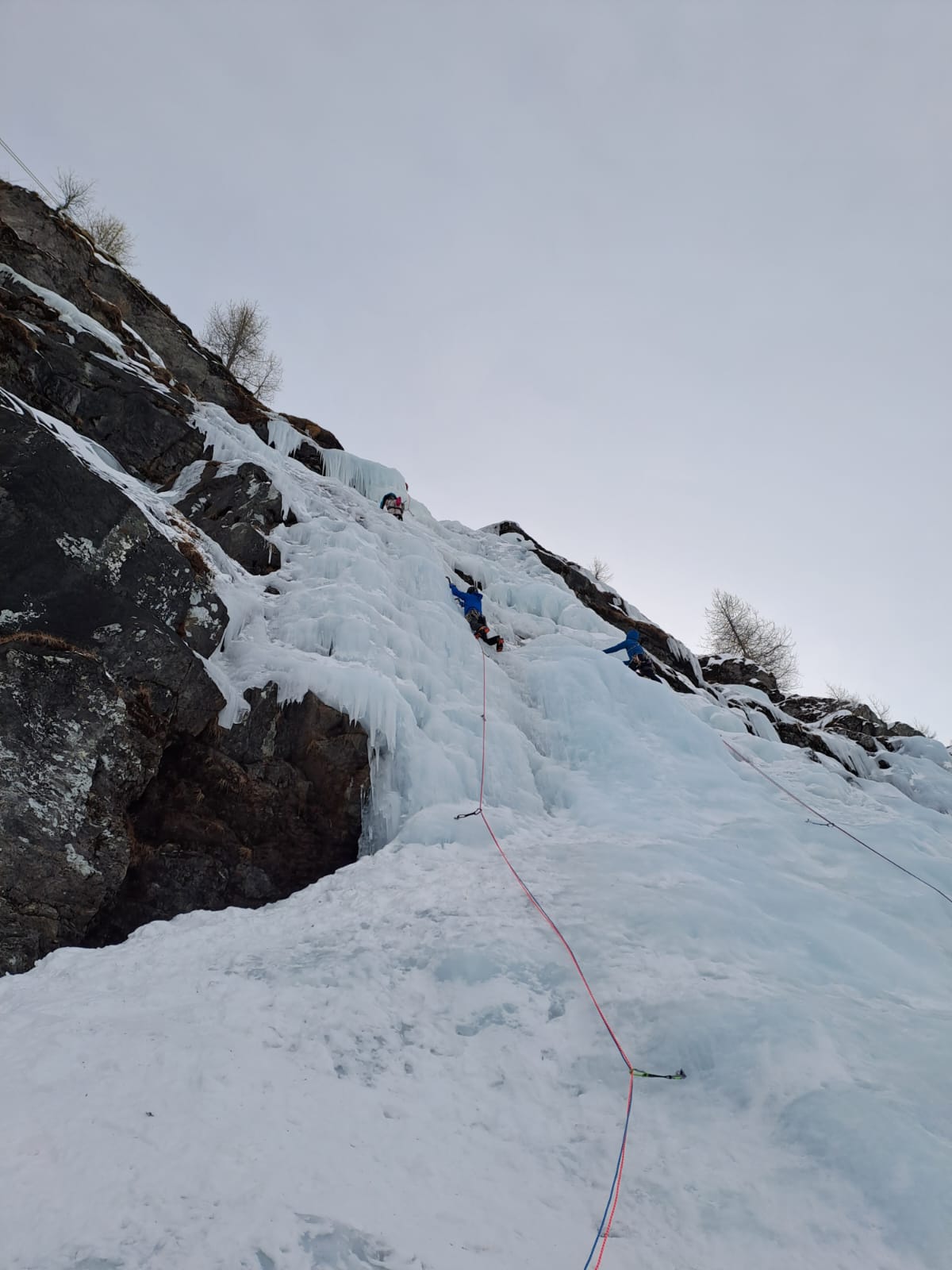
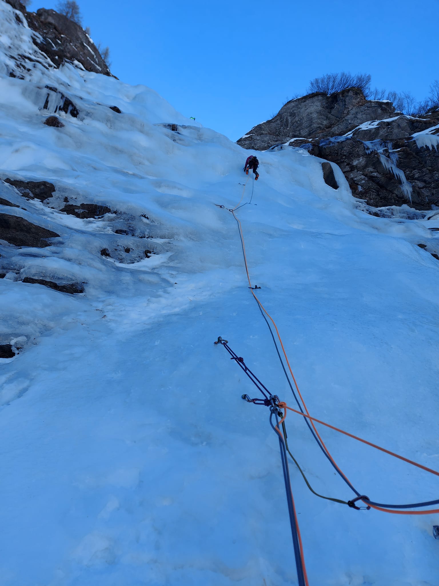
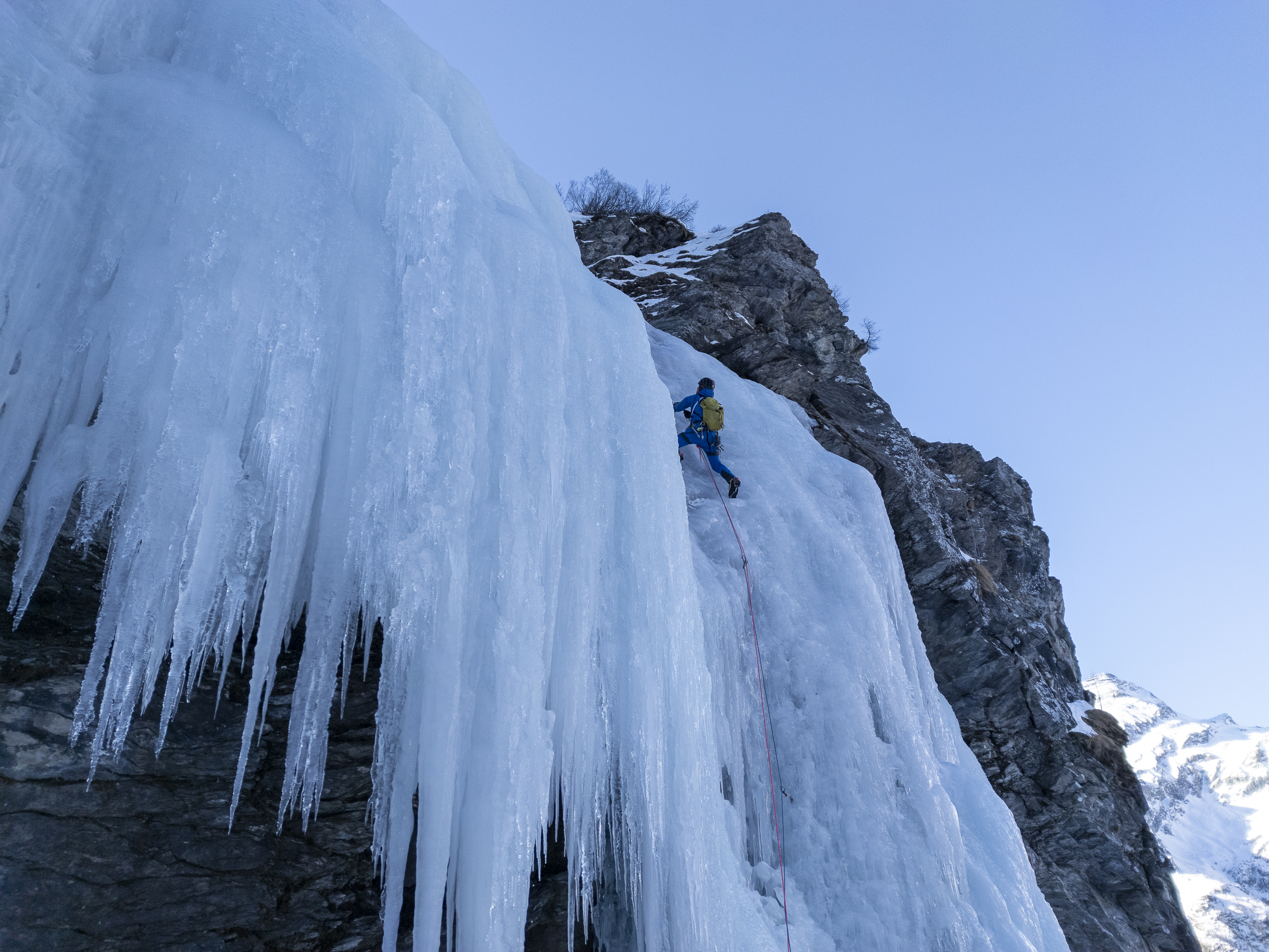
- L1 40m, più facile a sx (qualche metro a 85-90°, 3+/4) oppure a dx più sostenuto (4/4+)
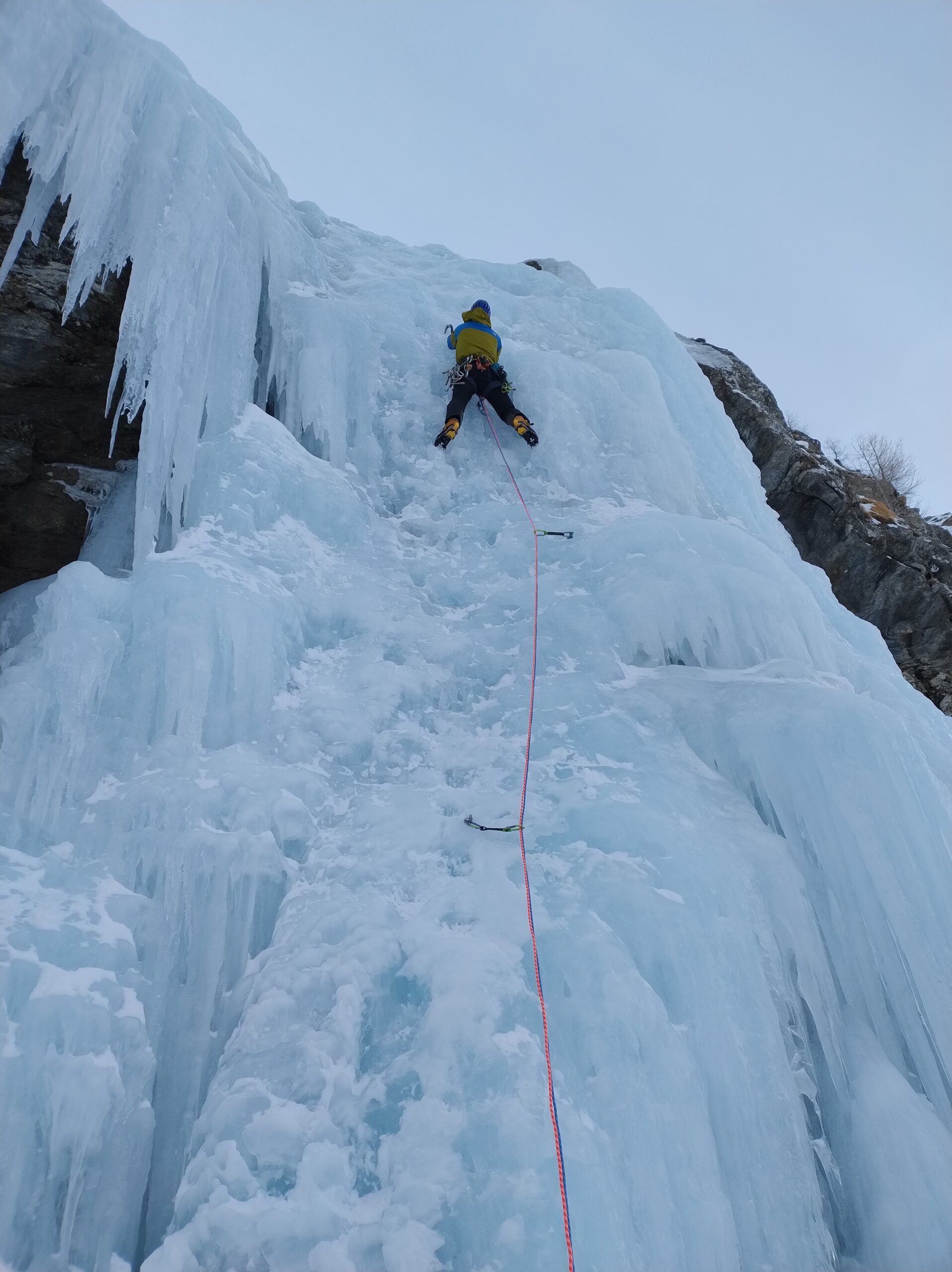
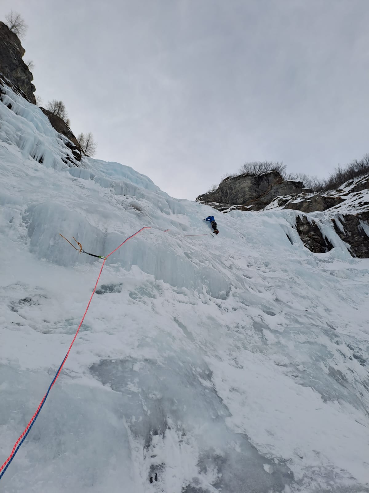
- L2 40m, muretti a 75°
- L3 55m, a proprio piacimento più ripido a sx (brevi muretti fino a 85°) e più facile a dx (max 75-80°)
- L4 con 3 possibilità: a destra (facile e poco sostenuto) 40m, in centro (classica, sul WI 3) 50m, a sinistra (muretti fino a 85°, sul WI 3+) 40m
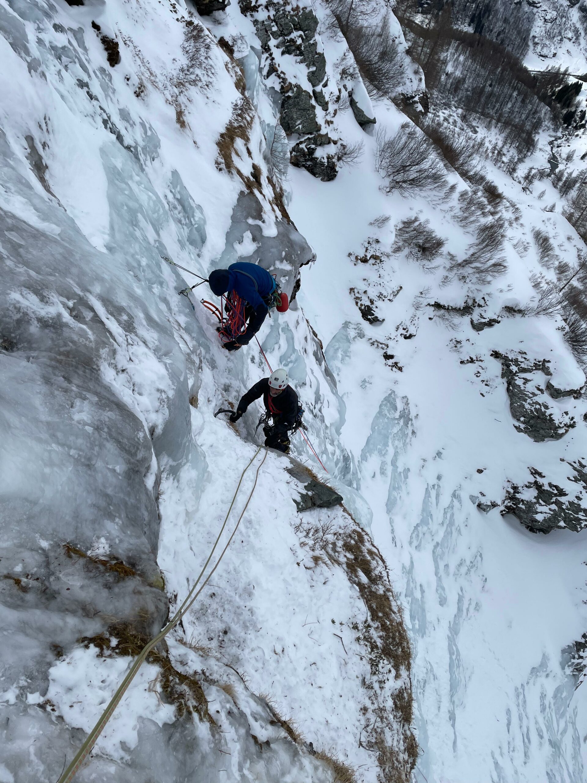
Discesa: tre doppie da 60m, le prime due da cordoni su larici, l’ultima da abalakov.
Cavaglià & Jaccod, 1986
- Bibliografia:
- Matteo Giglio - Effimeri Barbagli - 2014 Tipografia Valdostana
Nelle vicinanze Mappa
Itinerari
22/02/2025 AO, Gressoney-La-Trinitè 150 m III, 3+ Ovest
Vallone di Netcho – Spissen di destra (Cascata)
 200m
200m
04/02/2024 AO, Gressoney-la-Trinitè 100 m III, 3 Ovest
Vallone del Netcho – Piccola Fiumana di Spissen (Cascata)
 300m
300m
12/01/2026 AO, Gressoney-la-Trinitè 150 m II, 4+ Ovest
Vallone di Netcho – Echi Liquidi (Cascata)
 350m
350m
04/01/2024 AO, Gressoney-la-Trinitè 180 m III, 4+, M6 Ovest
Vallone di Netcho – Netcho e la Luna (Cascata)
 800m
800m
11/01/2026 AO, Gressoney-la-Trinitè 200 m III, 3 Ovest
Vallone di Netcho – Uomo Storto (Cascata dell’)
 800m
800m
24/01/2024 AO, Gressoney-La-Trinité 80 m III, 5+, M8 Sud-Ovest
Vallone di Netcho, Assalto a Mordor (Cascata)
 900m
900m
18/01/2017 AO, Gressoney-Saint-Jean 210 m IV, 4+, M4 Sud
Gressoney Saint Jean – Isengard (Cascata)
 1.8Km
1.8Km
26/01/2019 AO, Gressoney-la-Trinitè 100 m I, 3+ Nord
Gressoney la Trinitè – Velo azzurro (Cascata)
 2.4Km
2.4Km
06/01/2024 AO, Gressoney-la-Trinitè 25 m III, 5, M1 Ovest
Gressoney la Trinitè – Salice Piangente (Cascata)
 2.5Km
2.5Km
03/02/2013 AO, Gressoney-la-Trinitè 35 m II, 5 Nord-Ovest
Gressoney la Trinitè – LysBalma, Chandelle Alice (Cascata)
 2.6Km
2.6Km
Servizi
1.9Km
2.4Km
AlpenHutte Lys Ristorante
Gressoney-la-Trinitè
2.9Km
Hirsch stube Ristorante
Gressoney-la-Trinitè
4Km
Orestes Hütte Rifugio
Gressoney-la-Trinitè
5Km
Gnifetti Rifugio
Gressoney-la-Trinitè
5.2Km
Guglielmina Rifugio
Alagna Valsesia
5.2Km
Kleine bar Ristorante
Gressoney-Saint-Jean
5.5Km
Bìerfall Ristorante
Gressoney-Saint-Jean
6.8Km
Flying brasserie (Paul Verlaine) Ristorante
Gressoney-Saint-Jean
7.5Km