6.2Km
6.2Km

Note
 0m
0m
0m
50m
50m
50m
50m
50m
50m
0m
0m
0m
50m
50m
50m
50m
50m
50m
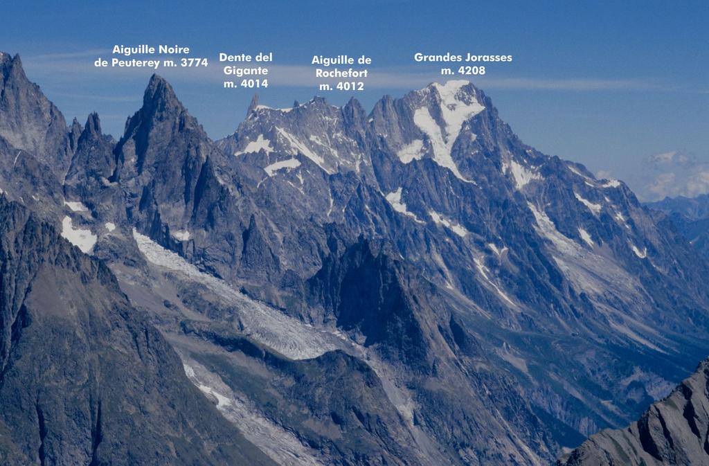
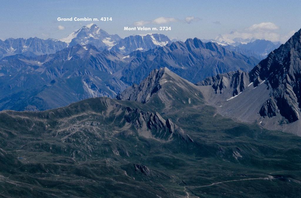
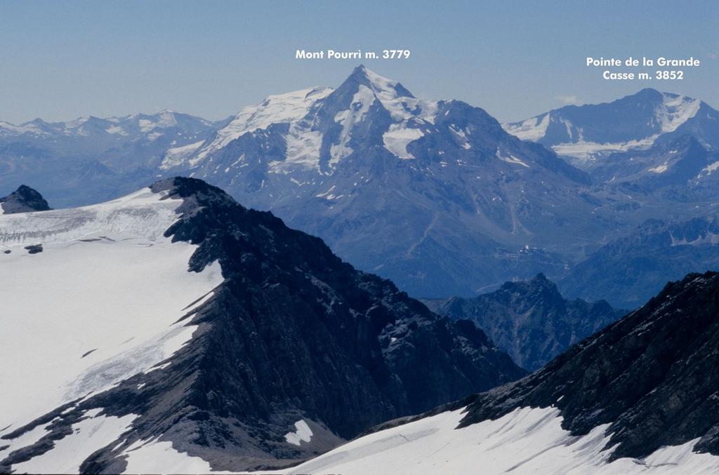
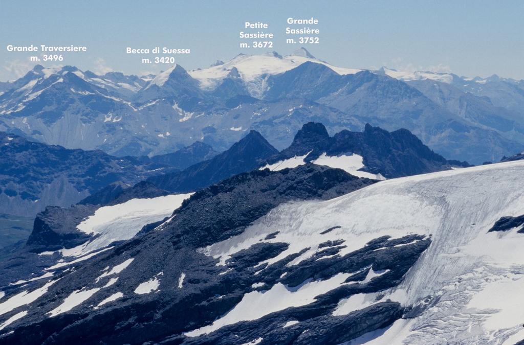
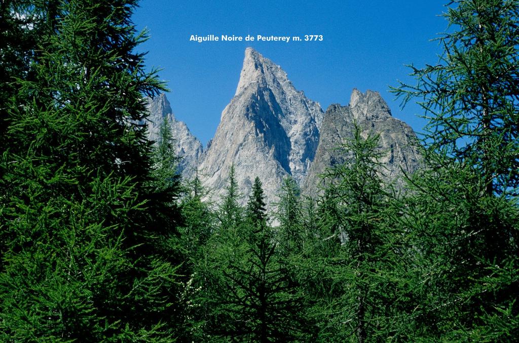
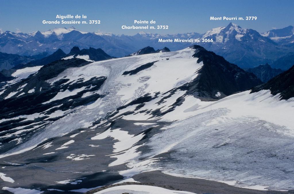
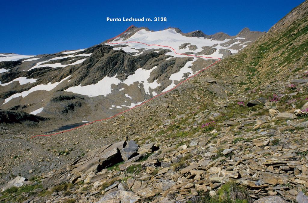
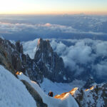
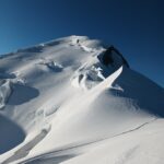
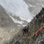
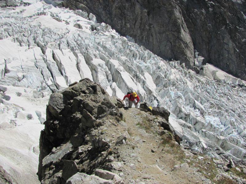
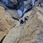
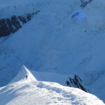
La Punta Lechaud è la cima più elevata tra quelle poste sulla cresta di confine tra il Piccolo San Bernardo e il Colle de la Seigne. Sul versante Est è ricoperta dal Ghiacciaio di Chavannes, mentre dal versante Ovest scende una ripida parete costituita però da rocce molto friabili e sfasciumi (quindi sconsigliabile salire da questo versante). E' una montagna di facile accesso, che presenta l'attraversamento del ghiacciaio di Chavannes, che a volte si trova in ghiaccio vivo e qualche piccolo crepaccio, ma percorribile senza particolari difficoltà. Si tratta di una bella escursione valutabile E fino al Colle di Chavannes e F dal colle alla cima. I primi salitori di questa bella montagna sono rimasti ignoti, e probabilmente si trattava di cacciatori locali, salita in seguito anche da ufficiali cartografi dello Stato Maggiore Sardo per redigere le prime carte topografiche della zona. Viene molto frequentata, sia per la facilità dell'accesso che per l'eccellente panorama che si può ammirare dalla cima nelle giornate di bel tempo. Viene salita sia dal Vallone di Chavannes con partenza da La Thuile che dalla Val Veny (come descritto in questa relazione). E' un itinerario abbastanza lungo, con circa 1500 m. di dislivello, fattibile in giornata oppure pernottando al Rifugio Elisabetta. Per il soggiorno ed il pernottamento al Rifugio Elisabetta è consigliabile prenotare, dato che viene molto frequentato e spesso è pieno zeppo ! Il toponimo Lechaud sta ad indicare alpeggio, pascoli alti. Spesso il nome di un alpeggio e/o di una stalla si estendeva anche al vallone e alle cime circostanti, cosa frequente in Valle d'Aosta. Il periodo migliore per compiere questa piacevole salita va da inizio giugno a settembre. Per salire lungo il Ghiacciaio di Chavannes (solitamente privo di crepacci) basta avere al seguito piccozza e ramponi, si può procedere slegati, ma valutate voi quando raggiungete l'inizio del ghiacciaio (in base alle condizioni) se sia il caso di salire legati in cordata o meno.
Avvicinamento
.
Descrizione
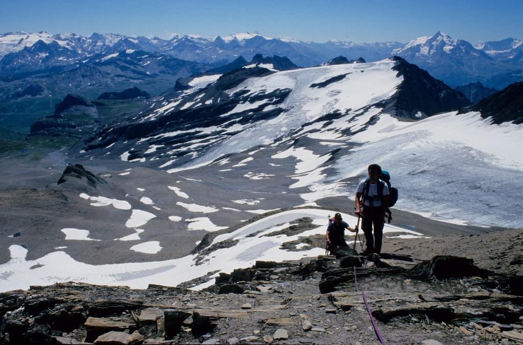
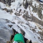
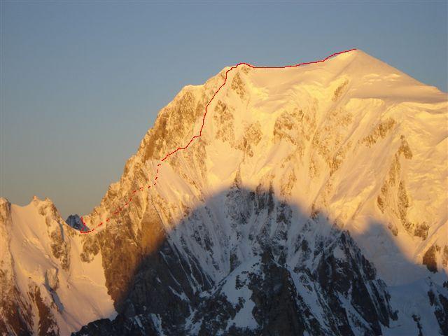
Da Courmayeur, imboccata la Val Veny, si segue la strada fino a La Visaille m. 1660, si valica il Ponte di Plan Lognan m. 1670 e poi si parcheggia l’auto. Da qui la strada è stata chiusa al traffico già nel 1992 per il rischio di caduta sassi. La prima parte dell’avvicinamento è abbastanza monotona, in quanto segue la strada asfaltata, che nella parte alta diventa sterrata. Raggiunto un ponticello vicino al Lago Combal, si prosegue verso sinistra nel pianoro (trascurando la diramazione di destra (sentieri per il Bivacco Rainetto e il Rifugio Gonella), valica un altro ponte e raggiunge le Baite dell’Alpe inferiore della Lex Blanche m. 2156. Da qui nel giro di pochi minuti si sale al ben visibile Rifugio Elisabetta (ore 2 da Plan Lognan). Ridiscesi brevemente all’alpeggio (indicazioni e cartelli segnaletici) si inizia a salire lungo una stradina nel Vallone della Lex Blanche (segnavia 12 e Alta Via n. 2). Dopo alcuni minuti si incontra un bivio con indicazioni e cartelli segnaletici, si deve piegare a sinistra seguendo l’Alta Via n. 2. Ora si sale per prati e pendii erbosi con una lunga serie di tornanti, si raggiunge un avvallamento, dove il terreno diventa detritico, si volge ora a destra per salire lungo la pietraia, che con alcuni zig-zag conduce al Colle di Chavannes m. 2603. Dal colle si deve abbandonare il sentiero segnalato che inizia a scendere nel Vallone di Chavannes, seguendo un sentiero sulla destra (indicato da ometti), che passa nei pressi dei ruderi di una vecchia casermetta e poi attraversa in piano il ripidissimo versante orientale del Monte Lechaud (ci sono alcuni canali da attraversare, se si trovano innevati questo tratto potrebbe rivelarsi insidioso e delicato, attenzione !) fino a raggiungere un pianoro morenico con un piccolo laghetto. La traccia prosegue sulla destra, sempre non lontana dalla cresta del Monte Lechaud e supera un valloncello di pietrame o neve, raggiungendo prima un crestone di detriti e rocce rotte che sale verso il Monte Lechaud (che non va seguito) e poi l’ampia conca dove è collocato il Ghiacciaio di Chavannes. Calzati i ramponi si mette piede sul ghiacciaio (spesso si trova una pista o tracce di passaggio) salendo in diagonale verso sinistra, puntando ad un dosso nevoso sotto la cima della Punta Lechaud. Dal dosso si volge gradualmente a destra puntando direttamente alla cima, che si raggiunge superando alcuni tratti di facili roccette a gradoni. La vetta è indicata da un semplice ometto di pietre. Panorama vastissimo e spettacolare sul versante italiano del Monte Bianco (ore 3,30 dal Rifugio Elisabetta alla cima. Ore 5,30 se fatta direttamente da Plan Lognan). In discesca si segue esattamente lo stesso percorso di salita.
- Cartografia:
- IGC foglio 107
Nelle vicinanze Mappa
Itinerari
29/08/2021 AO, Courmayeur D+ 3237 m D+ Sud
Bianco (Monte) Cresta dell’Innominata
 0m
0m
21/06/2026 AO, Courmayeur D+ 3110 m AD- Varie
Bianco (Monte) Via Normale Italiana o Via Ratti dal Rifugio Gonella
 0m
0m
14/06/2026 AO, Courmayeur D+ 2200 m AD- Varie
Trelatete (Aiguille de) traversata dal Bivacco Rainetto al Rifugio Elisabetta
 0m
0m
02/04/2021 AO, Cormayeur D+ 950 m ED Sud-Est
Bianco (Monte) Hypercouloir du Brouillard
50m
21/08/2013 AO, Courmayeur D+ 3200 m D+ Sud-Est
Bianco (Monte) Cresta di Peuterey dal Col Eccles
 50m
50m
24/08/2025 AO, Courmayeur D+ 1400 m PD- Sud
Estellette (Aiguille d’) da La Visaille
 50m
50m
18/08/2021 AO, Courmayeur D+ 1300 m F+ Sud
Gonella Francesco (Rifugio) al Dome da La Visaille
 50m
50m
09/08/2024 AO, Courmayeur D+ 3400 m ED- Sud-Est
Bianco (Monte) Pilone Centrale Freney – Via classica
 50m
50m
02/07/2021 AO, Courmayeur D+ 400 m TD+ Sud-Est
Brouillard (Pilastro Rosso del) – Via Bonatti-Oggioni
 50m
50m
12/08/2021 AO, Courmayeur D+ 2600 m AD Est
Bionnassay (Aiguille de) Cresta Est
 50m
50m