150m
150m
Avvicinamento
 4Km
6.4Km
6.4Km
6.4Km
25.7Km
4Km
6.4Km
6.4Km
6.4Km
25.7Km
Da Courmayeur con la funivia si sale al Pavillon du Mont Frety 2174 m.
Descrizione
Si segue la antica mulattiera per il rifugio Torino, che parte dietro la stazione stessa, costeggiando il giardino botanico. Si sale con larghi tornanti sino al bivio a quota 2220 m. dove si prende a sinistra.
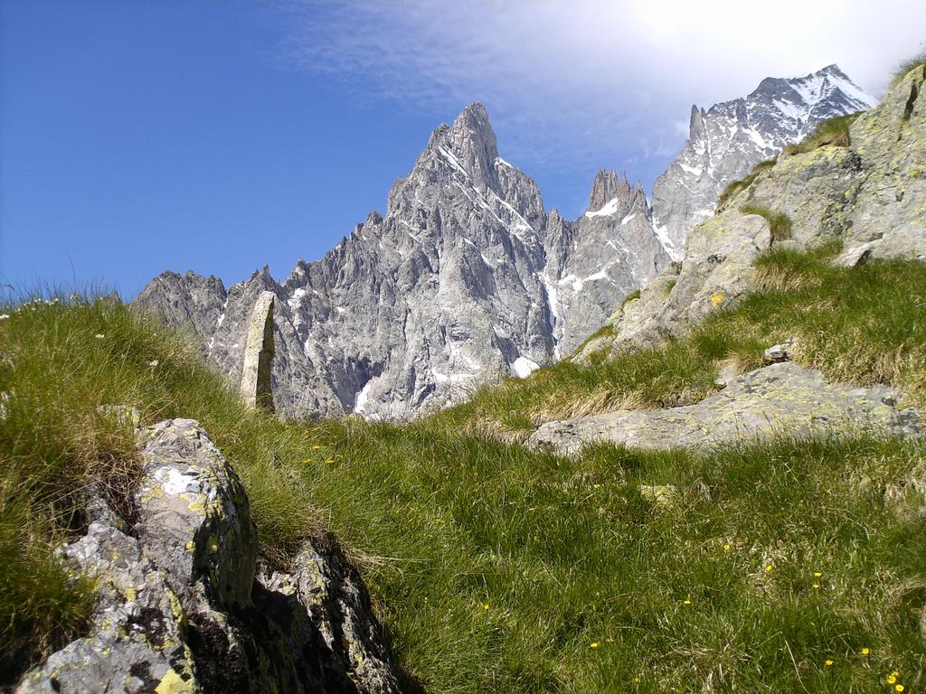
Il sentiero (segnato 20A belvedere) taglia a mezza costa per prati e pascoli attraversando modesti ruscelli che scendono dal ghiacciaio.
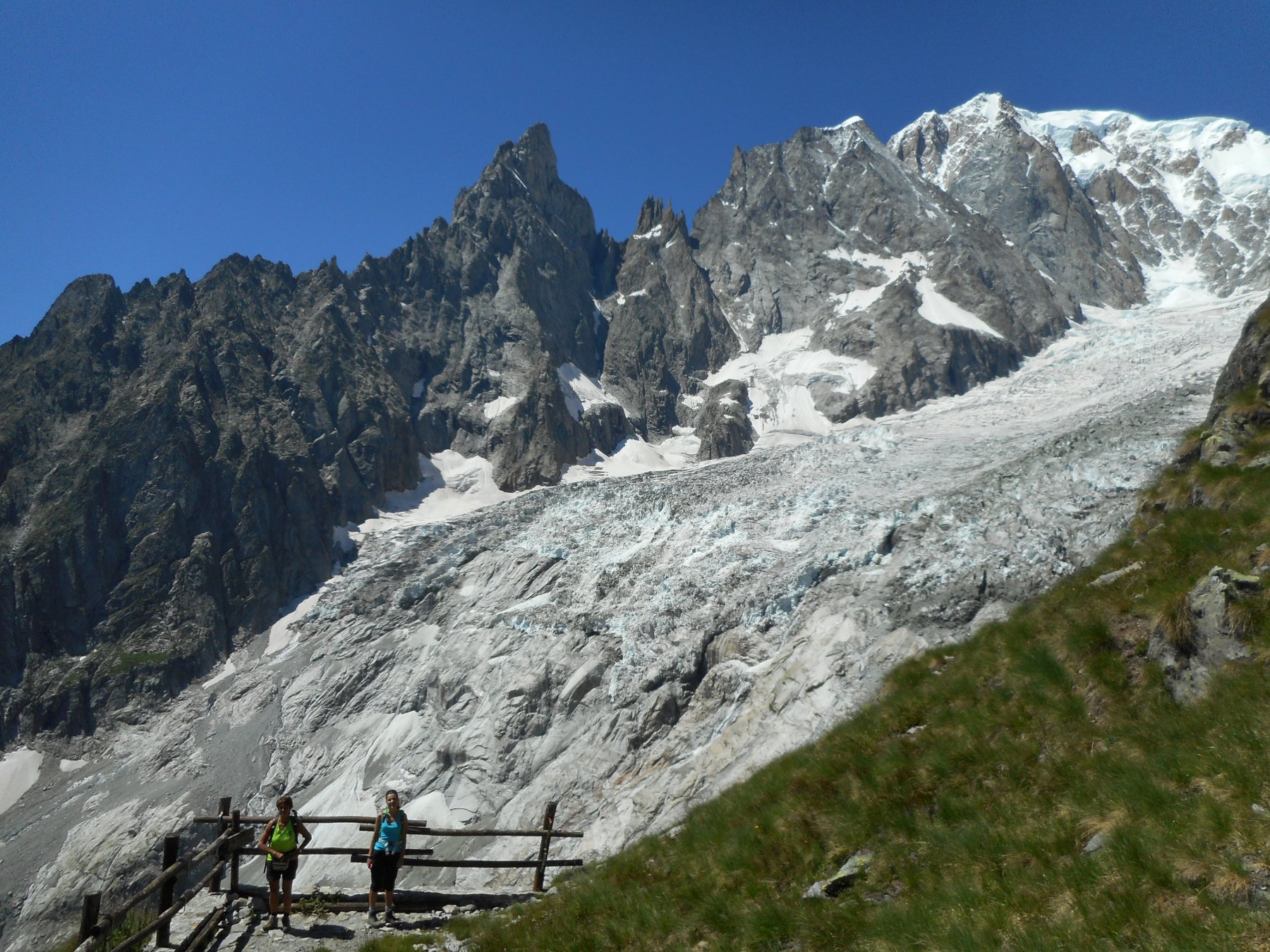
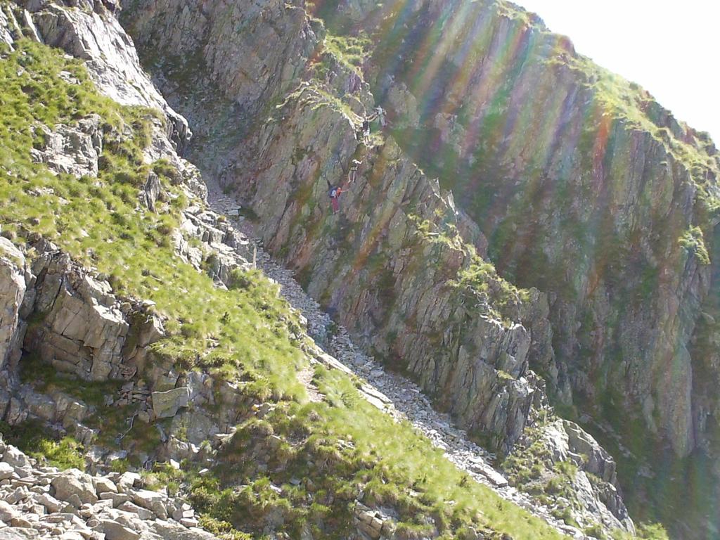
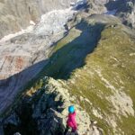
Procedendo è impossibile non concedersi frequenti soste, affascinati dal complesso di cime, dominato dall’Aguille Noire, che svetta sulle altezze del Monte Bianco. Dopo aver attraversato il contrafforte roccioso del Torrione d’Entrèves, si arriva ad una piattaforma panoramica, da cui si ammira la valle sottostante.
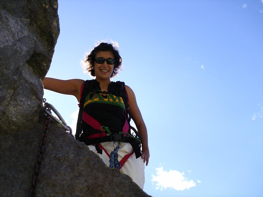
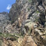
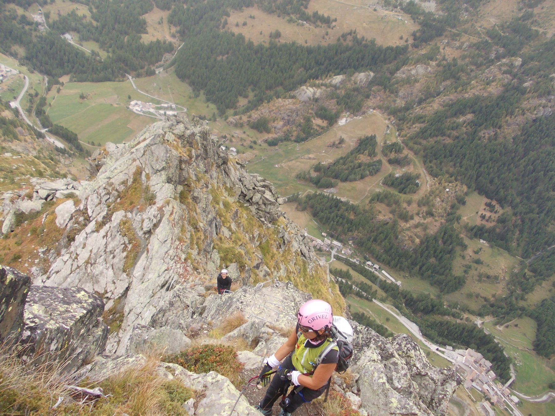
Quì termina la prima parte prettamente escursionistica, un grosso cartello avverte che stà per iniziare la via ferrata, ed il proseguo è riservato ad escursionisti con pratica alpinistica, in quanto in alcuni punti è attrezzato con catene e corde fisse. Dalla piattaforma panoramica su cui termina il primo tratto di sentiero, si sprofonda nella scarpata orientale del Monte della Brenva con tratto scosceso, attrezzato con catene fisse.
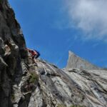
Poi con percorso a sali-scendi si guada
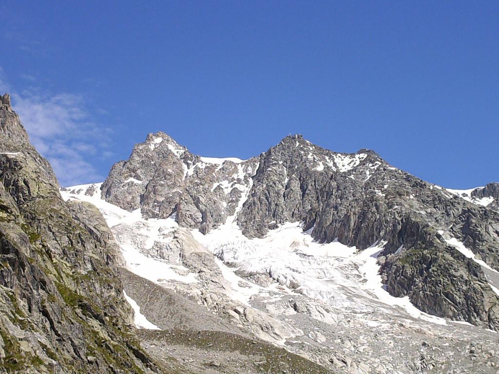
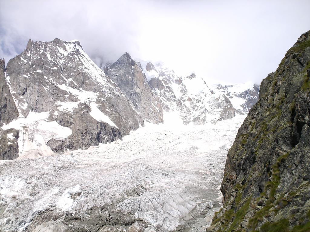
il ruscello che scende dal Ghiacciaio di Entrèves per arrivare all’attacco della parete est del Monte della Brenva. Ci si innalza in traverso a mezza costa su roccette (sempre attrezzate nei punti più esposti) fino a sbucare sulla cresta di arrivo (2300 m.)
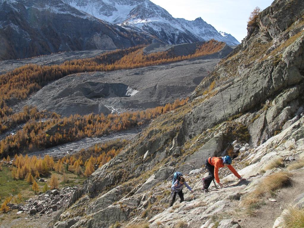
Quì si apre un panorama straordinario: il Ghiacciaio della Brenva dominato dal Monte Bianco incombe dall’alto, serrato tra il Monte Bianco di Courmayeur, l’Aiguille Blanche, l’Aiguille Noire e le Dames Anglaises,un insieme di rocce accuminate, di picchi aguzzi come denti di squalo.
Insomma, uno dei più affascinanti panorami delle Alpi è di fronte a noi. Il ritorno avviene per lo stesso percorso di salita e richiede praticamente lo stesso tempo (1 ora e 30 minuti).
- Cartografia:
- TCI,Gruppo Monte Bianco 1:50.000
- Bibliografia:
- Le vie ferrate vol.2 di Dario Gardiol
Nelle vicinanze Mappa
Itinerari
25/06/2026 AO, Courmayeur 300 m PD Sud
Borelli – Pivano (Rifugio, Ferrata del) da Peuterey
 4Km
4Km
18/07/2026 AO, Courmayeur 300 m F Sud
Monzino Franco (Rifugio) Via Ferrata Franco Garda
 6.4Km
6.4Km
22/08/2024 AO, Courmayeur 1200 m PD Varie
Chasseur (Col) traversata Rifugio Monzino – Rifugio Borelli per il sentiero attrezzato Too de la Granta Coursa
 6.4Km
6.4Km
09/08/2021 AO, Courmayeur F Sud-Ovest
Monzino Franco (Rifugio) da la Visaille, vecchio sentiero Capanna Gamba
 6.4Km
6.4Km
19/08/2025 AO, Valgrisenche 1300 m PD Varie
Aouille (Becca dell’) Via Ferrata Bethaz-Bovard
 25.7Km