3.7Km
3.7Km
Note
 50m
50m
2.6Km
3.4Km
3.4Km
3.4Km
3.4Km
3.8Km
3.9Km
50m
50m
2.6Km
3.4Km
3.4Km
3.4Km
3.4Km
3.8Km
3.9Km
da Lavachey a Planpincieux navetta ogni 15-30 minuti (altrimenti a piedi per circa 40 minuti sulla strada).
Avvicinamento
,
Descrizione
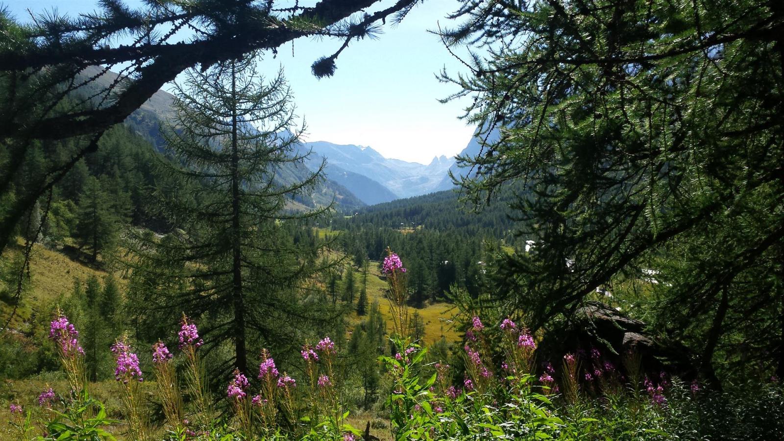
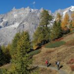
Dal parcheggio di Planpincieux si prosegue sulla strada asfaltata fino alla chiesetta a sx.
Di fronte parte il sentiero che attraversa la Dora della Val ferret. Inizialmente su sterrato ampio, poi per sentiero segnalato, si raggiunge il rifugio. L’inizio della traversata è posto 150 mt sotto il rifugio, sul sentiero appena percorso.
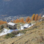
Diramazione per alpeggio La Lichere (cartello in legno). il sentiero prosegue tra sali e scendi nel bosco, raggiunge in circa un’ora l’alpeggio Armina nell’omonimo vallone, dove attraversa un fiumiciattolo.
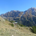
Si prosegue sull’evidente sentiero e in circa mezzora si giunge in vista del rifugio Bonatti. il sentiero si collega con la via di salita classica.
La discesa può avvenire dal rifugio Bonatti, in circa 40 minuti si è sulla strada (fermata bus proprio alla fine del sentiero), volendo fare l’anello tornando a piedi fino a Planpincieux i Km totali sono 17,5.
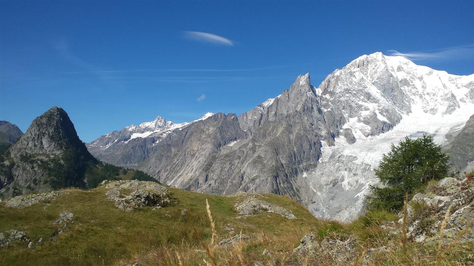
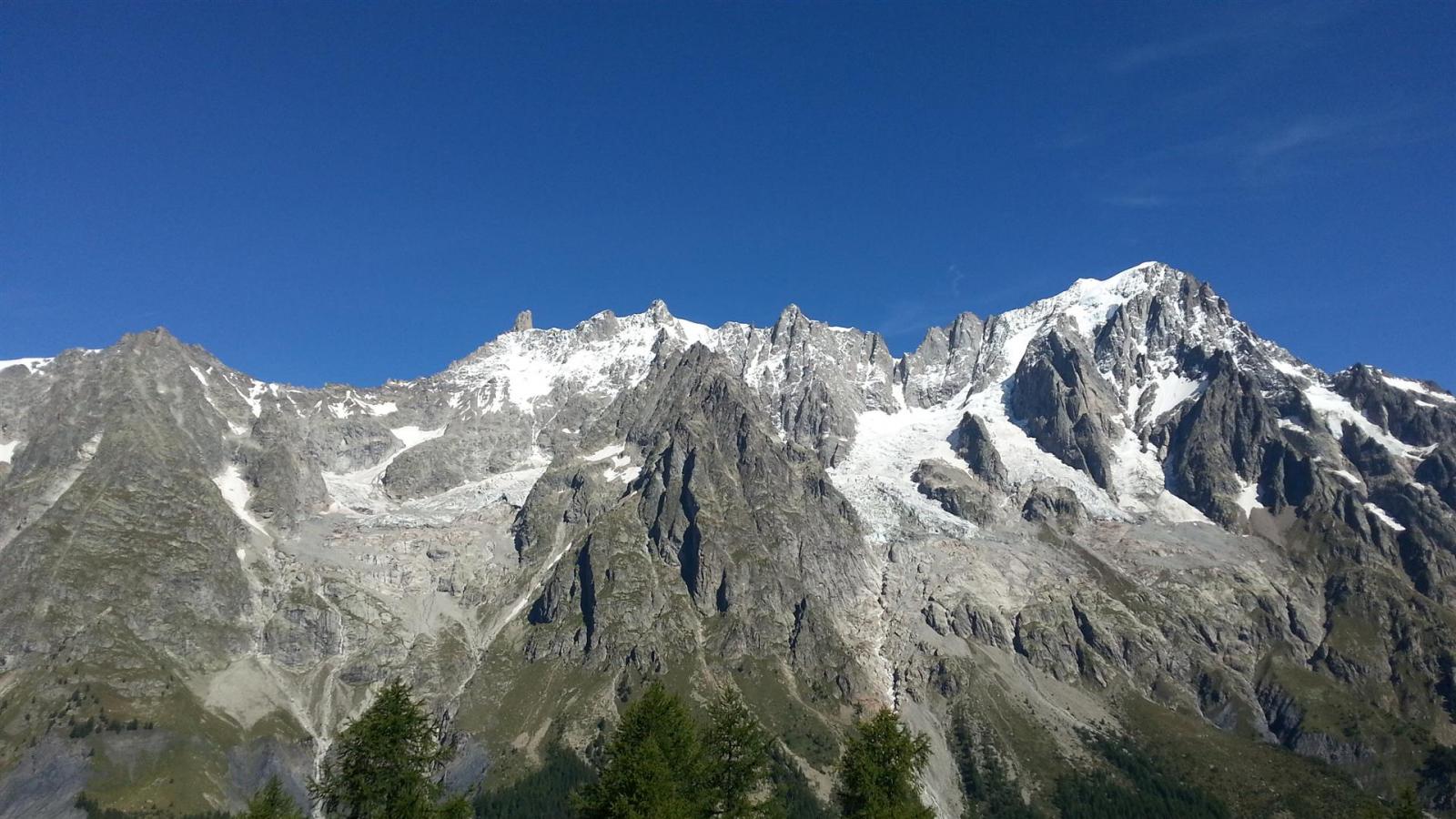
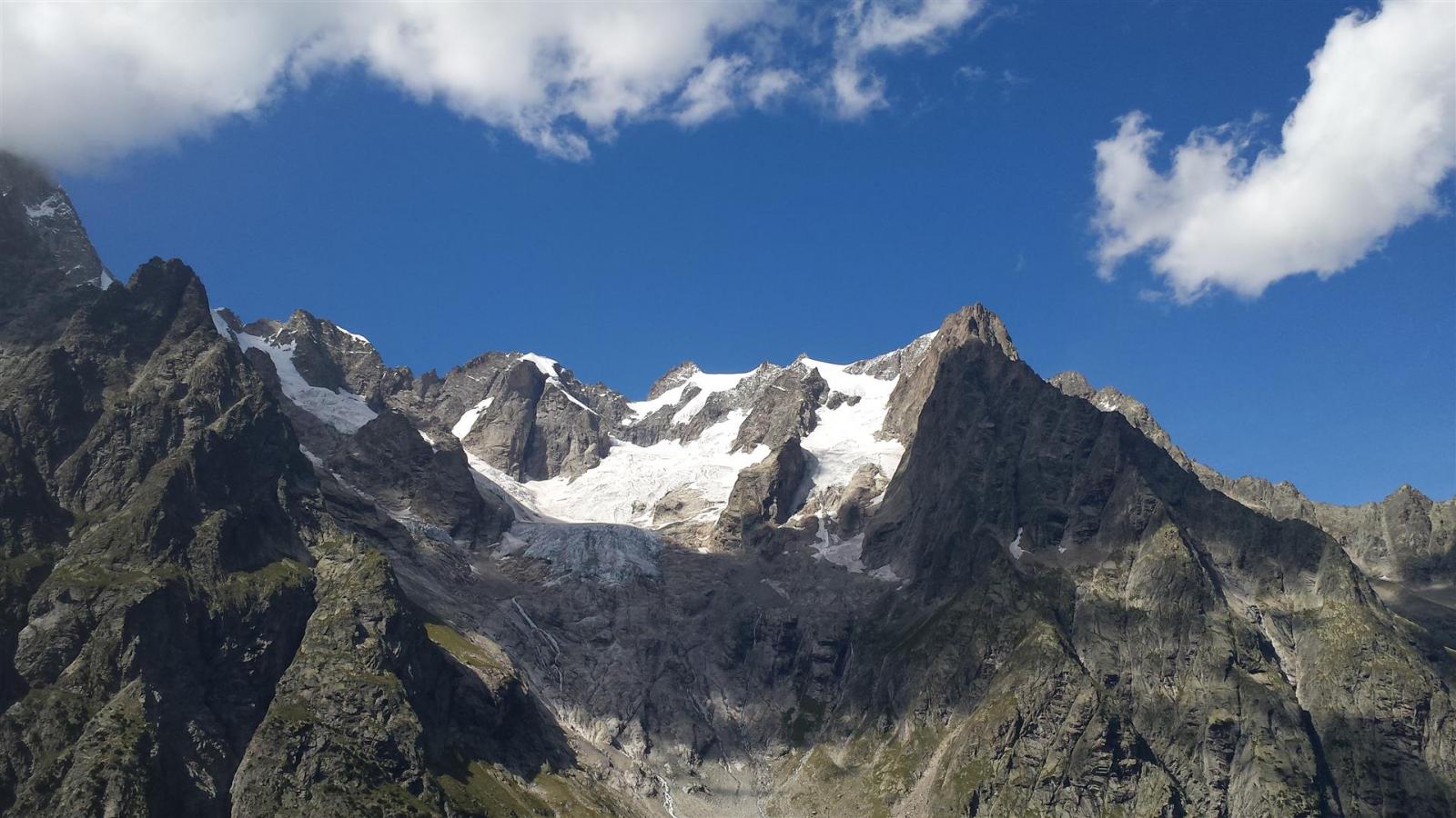
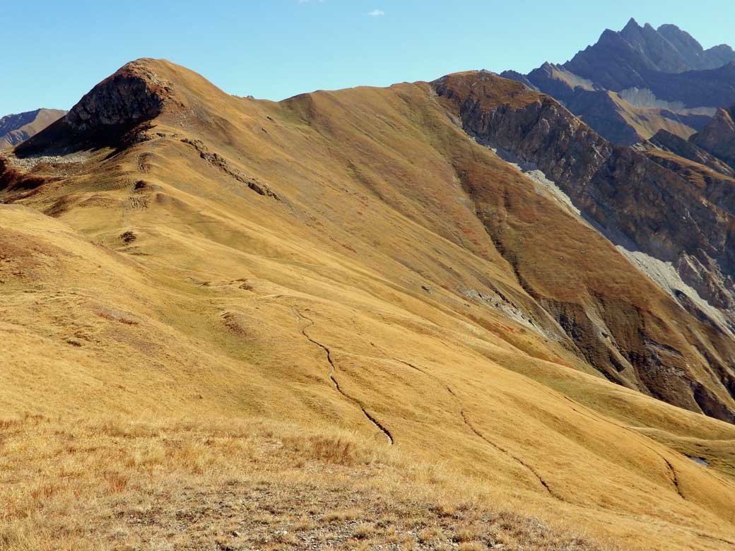
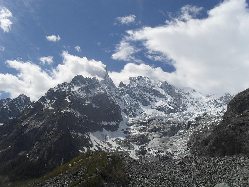
Su tutto il percorso vista panoramica del Monte Bianco e delle Gran Jorasses.
- Cartografia:
- Monte Bianco IGC scala 1:25000
Nelle vicinanze Mappa
Itinerari
15/10/2025 AO, Courmayeur D+ 902 m E Varie
Bernarda (Testa) da Planpincieux
 50m
50m
13/11/2025 AO, Courmayeur D+ 692 m E Varie
Bertone Giorgio (Rifugio) da Planpincieux, anello
 50m
50m
14/08/2017 AO, Courmayeur D+ 993 m EE Varie
Tronche (Testa della) da Planpincieux, anello per il Col Sapin
50m
02/06/2026 AO, Courmayeur D+ 803 m EE Sud-Est
Frety (Mont) o Pavillon da la Palud
 2.6Km
2.6Km
06/10/2025 AO, Courmayeur D+ 671 m E Sud
Bertone Giorgio (Rifugio) da Villair
 3.4Km
3.4Km
29/10/2023 AO, Courmayeur D+ 1300 m E Tutte
Tronche (Testa della) da Villair, anello della Val Sapin
 3.4Km
3.4Km
20/07/2025 AO, Courmayeur D+ 1355 m E Sud
Tronche (Testa della) e Testa Bernarda da Villair, anello per i Monts de la Saxe e Col Sapin
 3.4Km
3.4Km
08/11/2024 AO, Courmayeur D+ 1530 m EE Ovest
Liconi (Testa di) da Villair per la Val Sapin
 3.4Km
3.4Km
04/05/2012 AO, Courmayeur D+ 300 m T Ovest
Freney (Alpe) da Entreves
 3.8Km
3.8Km
27/09/2015 AO, Courmayeur D+ 500 m E Ovest
Tirecorne (Baite) da Courmayeur, anello per la Suche
 3.9Km
3.9Km