1.5Km
1.5Km


Note
 650m
700m
750m
750m
750m
800m
800m
850m
650m
700m
750m
750m
750m
800m
800m
850m
1.5Km
4.7Km
7.4Km
7.6Km
7.7Km
7.8Km
7.8Km
8Km
8Km
8Km
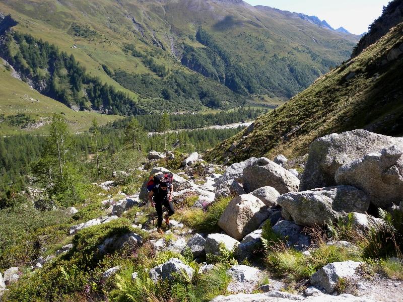
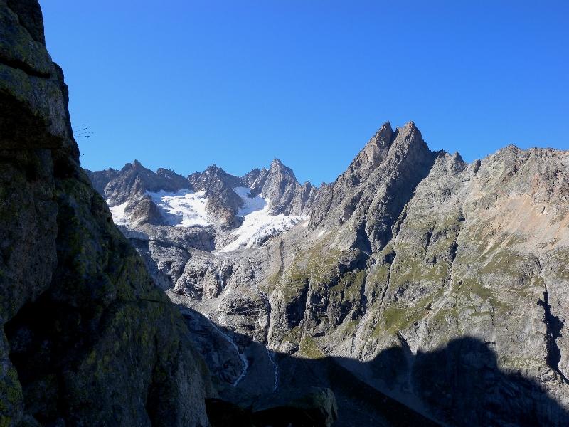
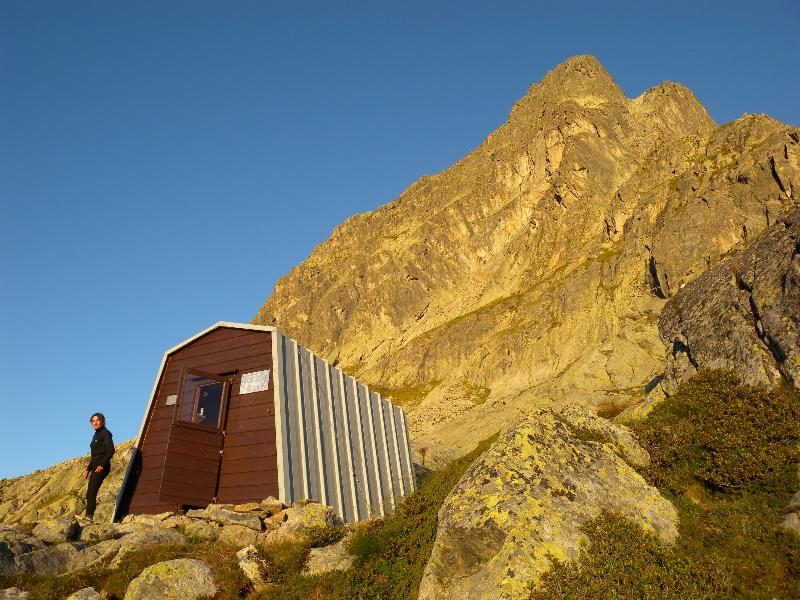
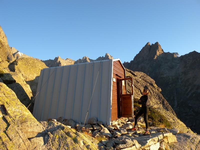
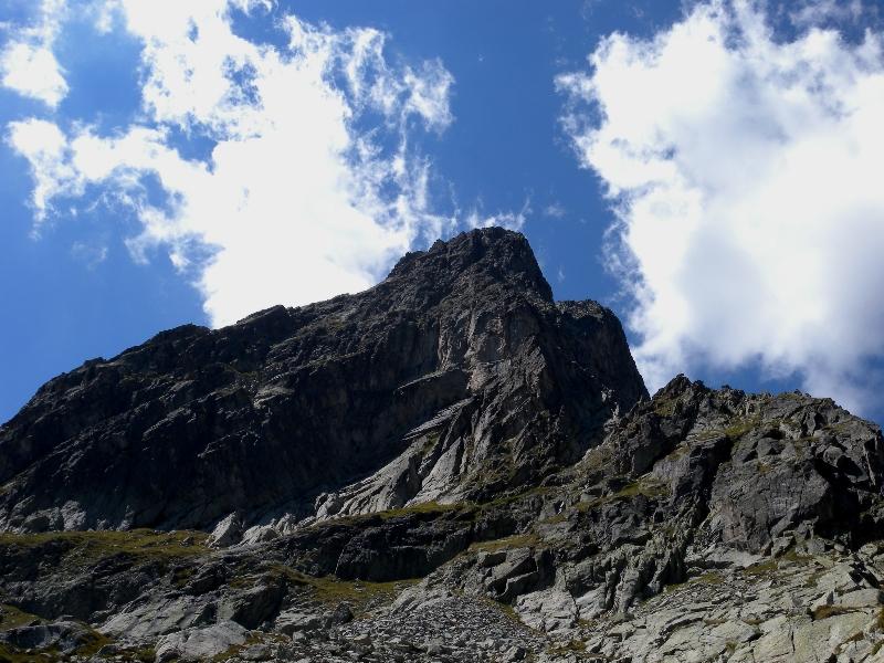
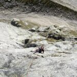
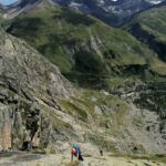
Bella via di recente chiodatura. la via è ben spittata ma sono comunque utili i friends. Parcheggiata la macchina a l'Arnouaz si segue il sent x il biv. Comino (2 ore).
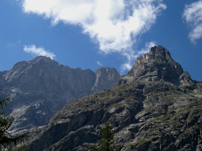
Dal bivacco diriggersi verso la parete caratterizzata da delle belle placche verdi, la via parte su di esse(spit ben visibile).
Dal biv. all' attacco calcolare 10 minuti.
Avvicinamento
Dal bivacco diriggersi verso la parete caratterizzata da delle belle placche verdi, la via parte su di esse(spit ben visibile).
Dal biv. all' attacco calcolare 10 minuti.
.
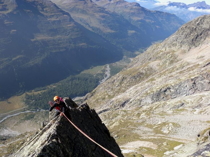
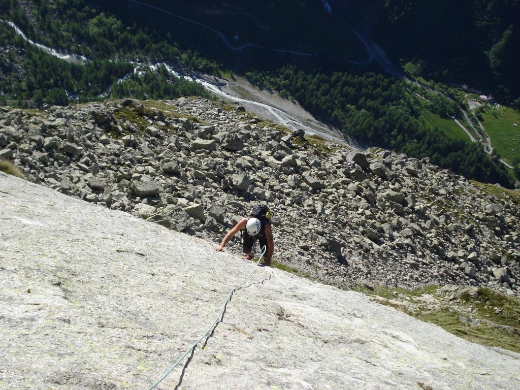
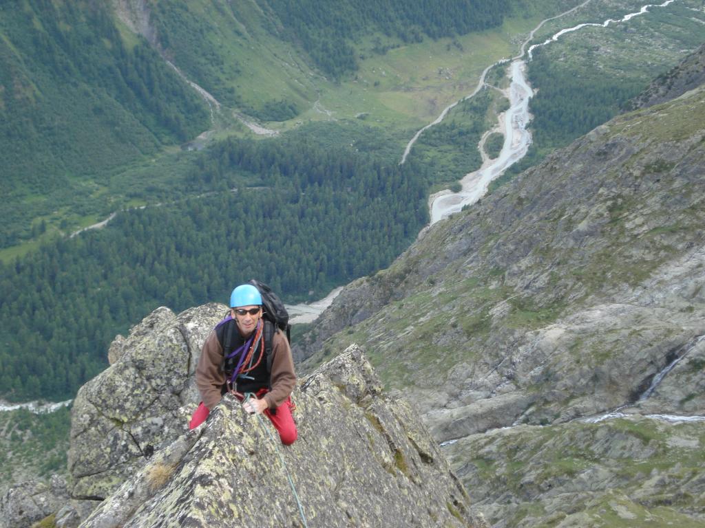
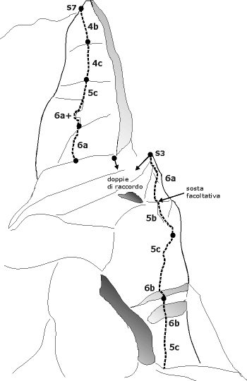
Descrizione
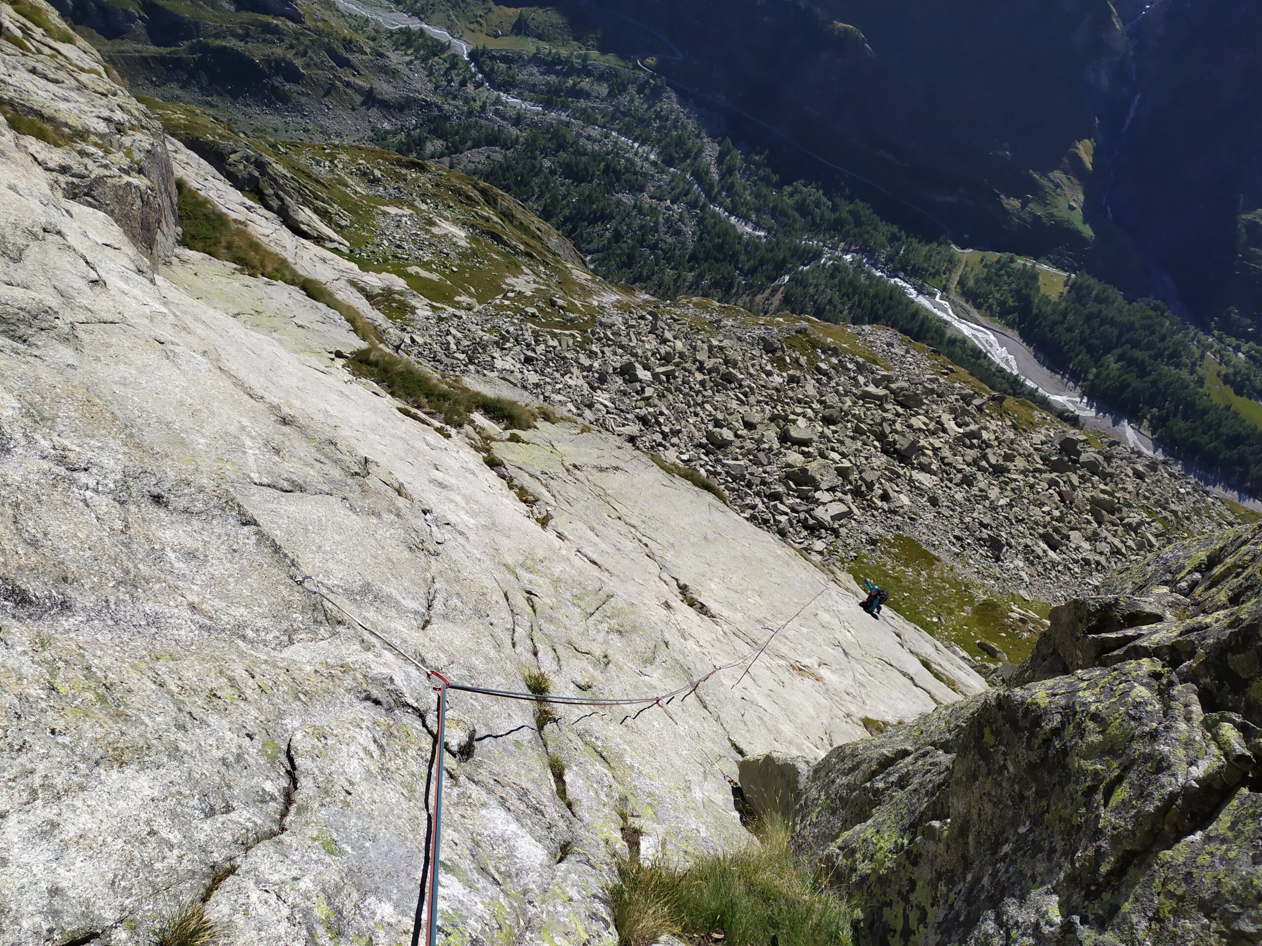
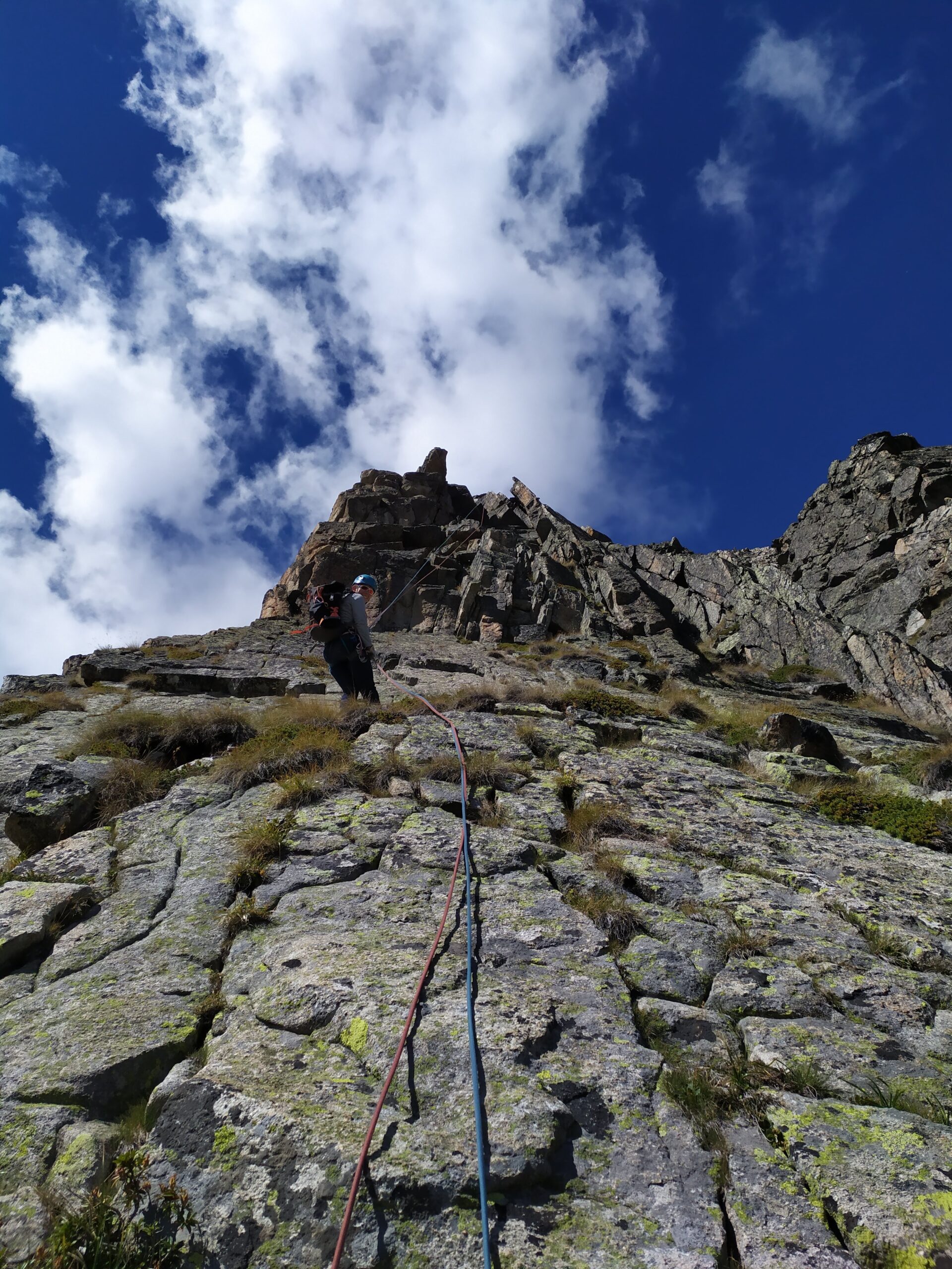
9 tiri Max 6b ( x dettagli vedere foto ).
DISCESA in doppia (soste a spit)
- Cartografia:
- Monte Bianco
Nelle vicinanze Mappa
Itinerari
20/09/1997 AO, Courmayeur 6b, 6a obbl. Sud-Ovest
Val Ferret, Parete Sfulingo – Fiaccola dell’Anarchia
 650m
650m
06/09/2025 AO, Courmayeur 6b+, 6a obbl. Sud-Ovest
Val Ferret, Parete dei Titani – Venus
 700m
700m
08/09/2021 AO, Courmayeur 6a+, 6a+ obbl. Sud
Val Ferret, Parete dei Titani – Via dei Fiorentini
 750m
750m
07/10/2023 AO, Courmayeur 6b, 5c obbl. Sud-Ovest
Val Ferret, Parete dei Titani – 6X4
 750m
750m
11/07/2024 AO, Courmayeur 6c, 6a+ obbl. Sud-Ovest
Val Ferret, Parete dei Titani – Garage
750m
20/08/2024 AO, Courmayeur 6a, 5c obbl. Sud
Val Ferret, Parete dei Titani – Génépy 1
 750m
750m
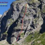
13/02/2023 AO, Courmayeur 7c, 6c+ obbl. Sud-Ovest
Val Ferret, Parete dei Titani – Pegaso
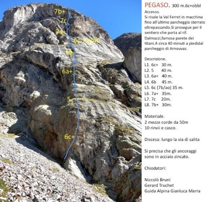 800m
800m
02/06/2023 AO, Courmayeur 6a, 5c obbl. Sud
Val Ferret, Parete dei Titani – Génépy 2
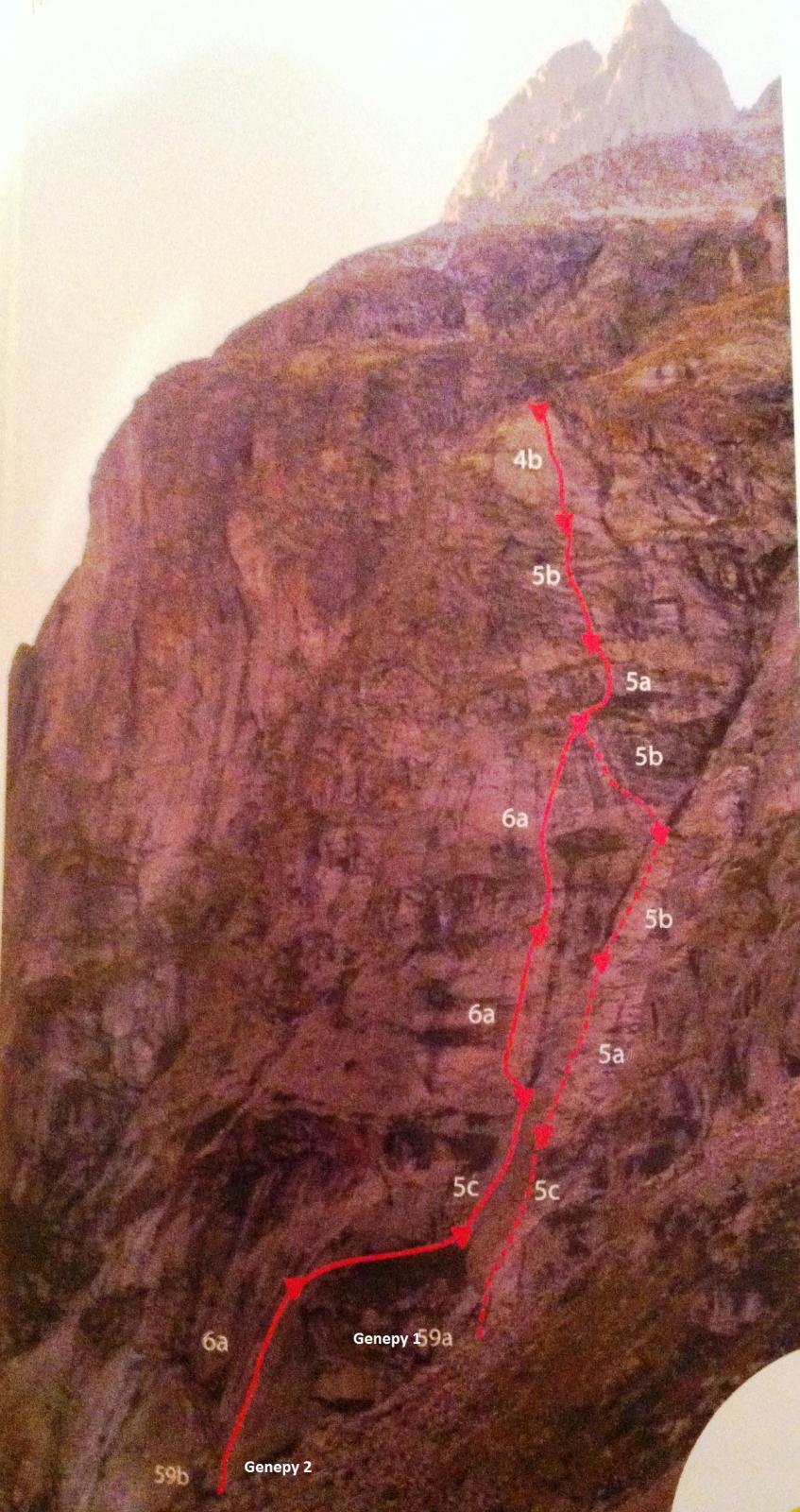 800m
800m
20/06/2020 AO, Courmayeur 5c, 5c obbl. Sud-Est
Val Ferret, Parete dei Titani – Hey Man … Coste Vè ‘n Genepy
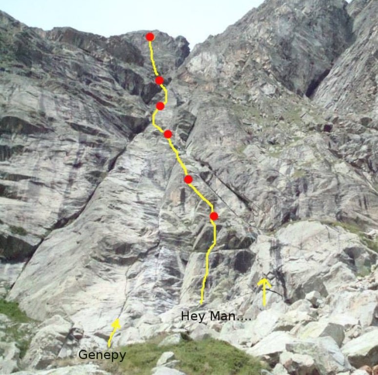 850m
850m
24/08/2017 AO, Courmayeur 6b, 5c obbl. Sud-Ovest
Val Ferret, Parete dei Titani – Black Block
900m
Servizi
1.5Km
4.7Km
Lavachey Albergo
Courmayeur 7.4Km
7.4Km
Hôtel du Col de Fenêtre Albergo
La Fouly 7.6Km
7.6Km
Chalet le Dolent B&B
La Fouly
7.7Km
Cabane de l’A Neuve Rifugio
La Fouly 7.8Km
7.8Km
Majya-Joie Ristorante
La Fouly 7.8Km
7.8Km
Auberge de Maya Joie Albergo
La Fouly 8Km
8Km
Zanskar Sport Servizi
La Fouly 8Km
8Km
Auberge des Glaciers Albergo
La Fouly 8Km
8Km