 1.1Km
1.1Km
Note
Storico
 1.1Km
3.3Km
5.5Km
8.3Km
10.4Km
11.6Km
11.8Km
12.1Km
14.3Km
1.1Km
3.3Km
5.5Km
8.3Km
10.4Km
11.6Km
11.8Km
12.1Km
14.3Km
1.1Km
1.7Km
1.8Km
4Km
5.1Km
7Km
7Km
8.1Km
8.8Km
8.9Km
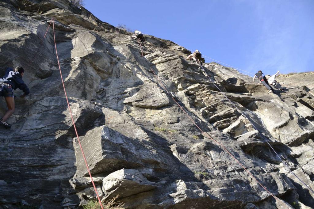
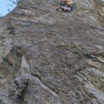
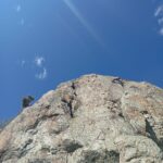
La falesia è composta da 2 settori: uno con 6/7 tiri dal 5c al 6b leggermente appoggiato e l’altro, con tiri strapiombanti a 45° circa, dal 6c+ al 9a tutti scavati.
Si arrampica da primavera fino a circa Novembre. Ottima nella mezza stagione.
Al rumore delle auto sulla SS26 ci si abitua subito. Bellissimo panorama sul castello di Aymavilles e sui monti che sovrastano Aosta (Becca di Nona e monte Emilius)
Avvicinamento
Si arrampica da primavera fino a circa Novembre. Ottima nella mezza stagione.
Al rumore delle auto sulla SS26 ci si abitua subito. Bellissimo panorama sul castello di Aymavilles e sui monti che sovrastano Aosta (Becca di Nona e monte Emilius)
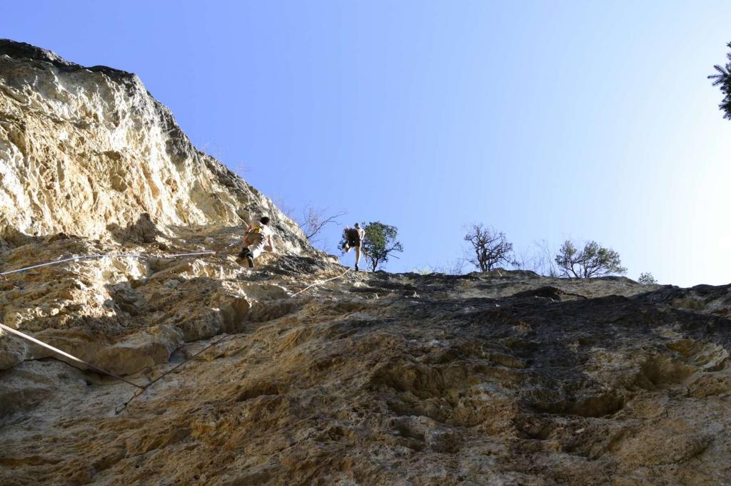
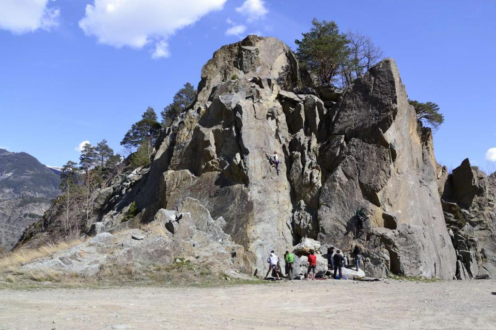
La falesia è situata sopra un tunnel della ferrovia ormai in disuso (non passano più treni). Dalla SS26, dopo aver oltrepassato il Castello di Sarre, imboccare sulla destra una salita con indicazioni per Lalex. A fine salita, sulla sinistra, il parcheggio dove lasciare l'auto.
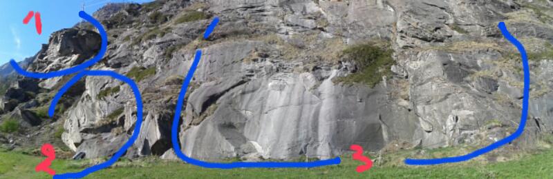
Imboccare l'unica sterrata che parte dal parcheggio. Al primo tornante verso destra proseguire dritto per traccia evidente e dopo una breve discesa si arriva in falesia (5 minuti dall'auto).
Descrizione
Imboccare l'unica sterrata che parte dal parcheggio. Al primo tornante verso destra proseguire dritto per traccia evidente e dopo una breve discesa si arriva in falesia (5 minuti dall'auto).
Il Tetto (partendo da sinistra)
- La pista degli elefanti 6c+
- Madre coraggio 7b
- Kriptonite 8b (L2)
- Sogno di Kriptonite 8b+ (L3)
- Sogno di nessuno 7c+
- Sogno di nessuno plus 8a (ext alla catena di 02)
- Smalto 7b+
- Smalto 8a+ (L2)
- L’Avaro 8c+/9a (L3)
- Parsifal 8a
- Parsifal 2000 8b (L2)
- Sarre 2000 7a+
- Sarre 2000 8a+ (L2)
- Ground zero 9a (L3)
- Lovely Calì-Sarsifal 8b (da Sarre 2000 traversino a sx e poi fessura)
- Lovely Calì-Sarsifal 8b+
- Quarta dimensione 8c
- Kabuki 7c
- Kabuki 8a (L2)
- Kabuki Cruditè 8a+ (L3)
- Cruditè perverse 7b (L2)
- Cruditè perverse 7c+ (L3)
Vie sulla parete adiacente (partendo da sinistra):
- Diedrangolo 6b
- Crudité perverse 6b
- Dynamite 6a
- Barra Mina 6a
- Il Minatore 5c/6a+
- ? 5c
Primo 9a italiano "Ground Zero" liberata l'11 settembre del 2002 da Alberto Gnerro.
Nelle vicinanze Mappa
Itinerari
10/11/2024 AO, Saint-Pierre 5a, 6b Sud
Saint Pierre – Priorato (Falesia del)
 1.1Km
1.1Km
30/05/2021 AO, Aymavilles 5a, 8a Nord-Ovest
Ozein – Ross (Mont, Falesia)
 3.3Km
3.3Km
17/01/2015 AO, Villeneuve dal 6a, al 8b Nord
Villeneuve (Falesia di)
3.8Km
03/09/2020 AO, Aymavilles 6a, 8a Nord-Est
Aymavilles – Pont d’Aël (Falesia del)
 5.5Km
5.5Km
18/05/2025 AO, Gignod 4, al 7a Sud-Est
Excenex (Falesia di)
 8.3Km
8.3Km
17/06/2026 AO, Arvier 4, al 8b Nord-Est
Leverogne (Falesia di)
 10.4Km
26/07/2014 AO, Arvier 4, 7a Sud
Arvier – Ravoire (Falesia de la)
 11.6Km
23/08/2023 AO, Cogne 4, 8a Sud-Ovest
Epinel (Falesia di)
 11.8Km
15/08/2022 AO, Arvier 3, 5a Nord
Arvier – Palestra del Centenario (Falesia)
 12.1Km
30/04/2026 AO, Doues 4, 7a+ Sud
Doues – Berrio della Croix (Falesia)
 14.3Km
Servizi
1.1Km
1.7Km
Chez Marisa Ristorante
Sarre
1.8Km
Gran Paradiso B&B
Jovencan
4Km
Carillon Bar
Aymavilles
5.1Km
Le Vieux Noyer B&B
Saint-Pierre
7Km
Vetan Ristorante
Saint-Pierre
7Km
Notre Maison Albergo
Saint Pierre
8.1Km
la tana Ristorante
Aymavilles
8.8Km
Beau Sejour Albergo
Arvier
8.9Km