 2.8Km
2.8Km
Note
 3.3Km
3.4Km
3.4Km
3.4Km
3.4Km
3.4Km
3.4Km
3.4Km
4.7Km
4.7Km
3.3Km
3.4Km
3.4Km
3.4Km
3.4Km
3.4Km
3.4Km
3.4Km
4.7Km
4.7Km
EE il tratto in salita tra q. 1275 e la punta (segnato in nero sulla carta L'Escursionista n. 13, 1/25.000 e indicato come sentiero n° 7 su http://geonavsct.partout.it/pub/geosentieri/)per difficoltà a trovare il sentiero.
Avvicinamento
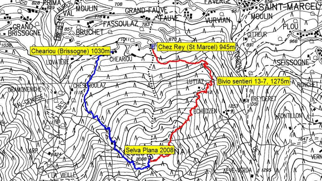
dalla strada statale della valle d'aosta, girare in direzione di Brissogne, salire a Grand Fauve e proseguire fino a Chez Rey 945m.
Descrizione
Da Chez Rey, si segue il sentiero n°13 fino a q. 1275 circa, lo si lascia prendendo il sentiero che sale ripido a destra (difficoltà a trovare il giusto percorso causa alberi e rami caduti, sono comunque di aiuto vecchi segnavia rossi).
Dalla punta si scende seguendo il sentiero 7A, senza segnavia ma evidente, fino a Cheariou (Brissogne) 1030.
Da Cheariou a Chez Rey ci sono circa 1 Km di strada asfaltata.
- Cartografia:
- L'Escursionista n. 13, 1/25.000
- Bibliografia:
- http://geonavsct.partout.it/pub/geosentieri/
Nelle vicinanze Mappa
Itinerari
11/10/2020 AO, Saint-marcel D+ 405 m E Nord
L’Eve Verda (l’Acqua Verde) Sentiero delle Miniere di Saint Marcel
 3.3Km
3.3Km
12/09/2025 AO, Brissogne D+ 2060 m EE Nord
Leppe (Punta di) da Grand Brissogne per il Bivacco Menabreaz e Colle di Leppe
 3.4Km
3.4Km
31/07/2024 AO, Brissogne D+ 2300 m EE/F Nord
Garzotto (Punta) da Grand Brissogne per il Colle di Leppe
 3.4Km
3.4Km
16/08/2011 AO, Brissogne D+ 2527 m EE/F Varie
Emilius (Monte) da Grand Brissogne per il Vallone di Laures
 3.4Km
3.4Km
22/09/2018 AO, Brissogne D+ 3060 m EE/F Varie
Tre Cappuccini (Colle dei) da Grand Brissogne, giro del Monte Emilius
 3.4Km
3.4Km
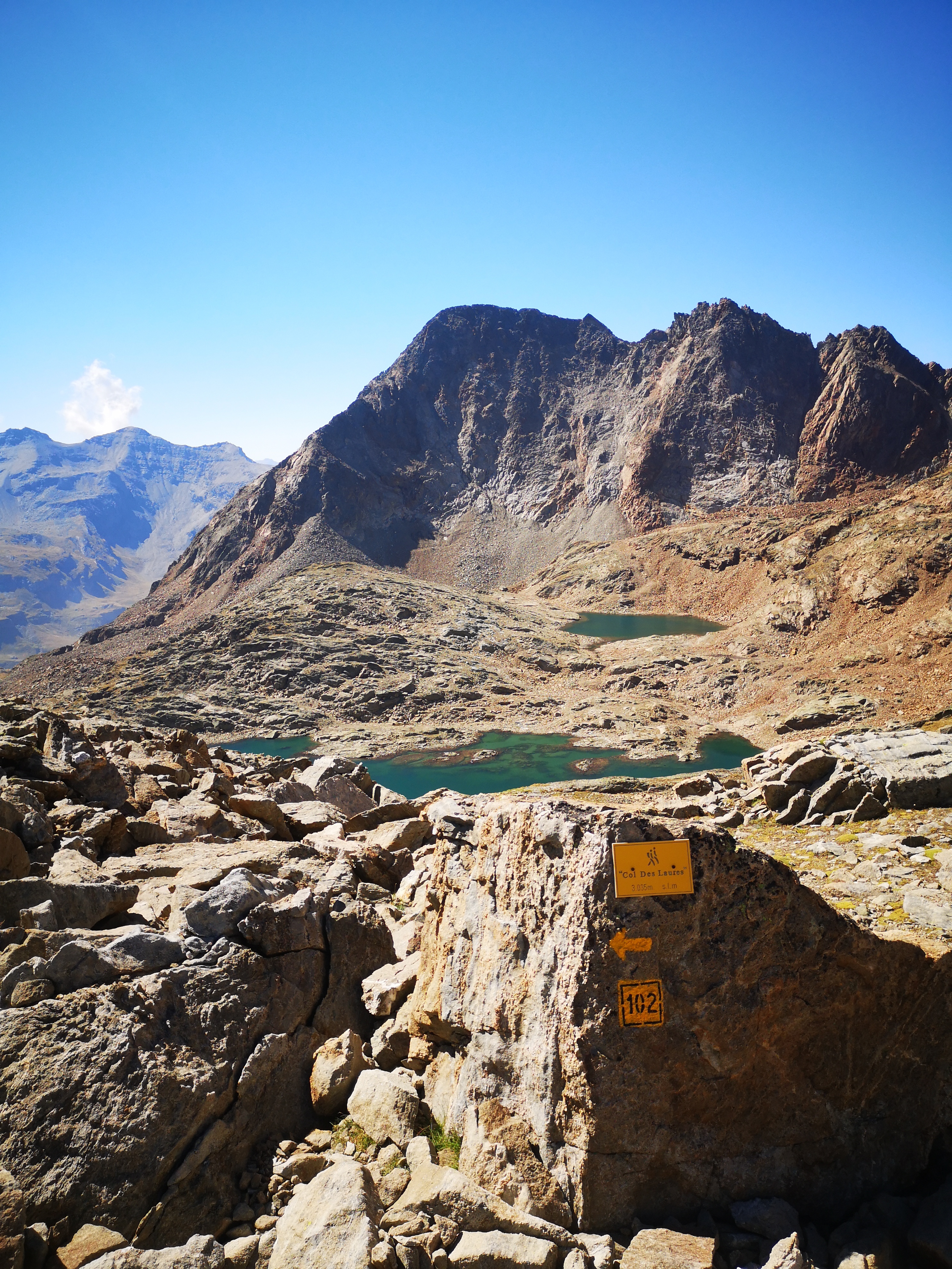
12/08/2022 AO, Brissogne D+ 2035 m EE Nord
Laures (Colle di) e Bivacco Menabreaz da Grand Brissogne
 3.4Km
3.4Km
06/09/2025 AO, Brissogne D+ 1600 m E Nord
Laures (Laghi di) e Bivacco Menabreaz da Grand Brissogne per il Vallone di Laures
 3.4Km
3.4Km
11/09/2025 AO, Brissogne D+ 2150 m EE Varie
Salè (Becca di) da Grand Brissogne per il Bivacco Menabreaz e Colle di Salé
 3.4Km
3.4Km
10/10/2015 AO, Quart D+ 1297 m EE Sud-Est
Grand Pays da Fonteil, anello per Collet e Colle Lechè
 4.7Km
4.7Km
09/07/2022 AO, Quart D+ 1504 m EE Sud-Est
Conge (Becca), anticima da Fonteil
 4.7Km
4.7Km

