 1.9Km
1.9Km
Note
 50m
50m
50m
50m
50m
2.1Km
3.1Km
3.2Km
3.2Km
50m
50m
50m
50m
50m
2.1Km
3.1Km
3.2Km
3.2Km
1.9Km
2.1Km
3.4Km
3.7Km
4.3Km
4.4Km
5.2Km
5.9Km
5.9Km
6.9Km
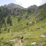
Salita facile e piacevole, discesa divertente completamente su sentiero e mulattiere; bel panorama sui Tremila meridionali della Vallèe e sul Granpa, fuori stagione è probabile incontrare qualche animale; acqua presente alla partenza e in ogni frazione attraversata.
Avvicinamento
Strada Regionale 46 Chatillon - Cervinia fino ad Antey Saint Andrè. Nelle vicinanze del bivio per La Magdeleine (S.R. 8) presenza di vari e ampi parcheggi (area giochi bambini, palestra artificiale di arrampicata, area mercato...)
Descrizione
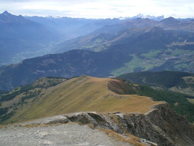
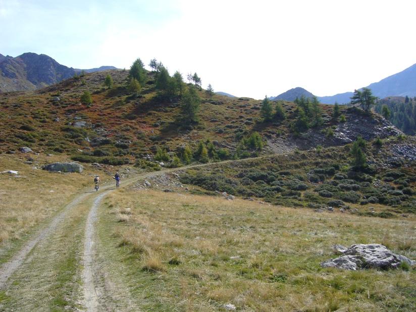
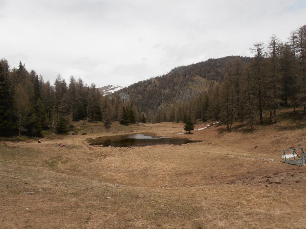
Da Antey salire a La Magdeleine con la S.R.8, proseguire alla Fraz. Artaz e continuare sulla strada comunale che dopo qualche tornante diventa sterrata e si addentra nel bosco (Bois de Layè). Giunti al lago e Alpeggio Les Croux, tralasciare le varie tracce agricole in piano e continuare su una mulattiera erbosa un po’ nascosta, molto ripida per pochi metri, finchè il sentiero (segnavia 3) torna quasi pianeggiante fino a raggiungere il Col Pilaz, dove si trova un’area pic nic con fontana (aperta solo in stagione estiva) e una panchina gigante, con vista Gran Becca! Dal Colle scendere a La Magdeleine con il sentiero 1A, (BC/S2) divertente con tre quattro passaggini molto tecnici (OC/S3) soprattutto nella prima parte, raggiunta una stradina asfaltata proprio in prossimità di un tornante, riprendere subito il sentiero 1A nello stesso punto; giunti a Vieu raggiungere la chiesa del Capoluogo su asfalto e reperire il sentiero 8 che passa a fianco di un lago e porta alla Fraz. LOD; il sentiero è piacevole e divertente, prevalentemente flow con qualche passaggino meno liscio e compatto (S1). Da LOD, imboccare il sentiero 4 fino ad Antey; questo tratto di diff. BC/S2 è molto vario, con qualche tornantino stretto, qualche passaggio più tecnico e ripido. Prestare attenzione ad un paio di attraversamenti della Strada Regionale 8 percorsa in salita. Giunti ad Antey Bourg entrare nelle viuzze lastricate della frazione e con la mulattiera (segnavia 105-107) scendere fino al torrente Marmore e in breve ai parcheggio
- Cartografia:
- Carta dei Sentieri n. 7 "Valtournenche", 1:25.000, L'escursionista editore
Nelle vicinanze Mappa
Itinerari
10/08/2006 AO, Antey-Saint-André D+ 2200 m BC, TC, S1 Tutte
Nana (Col di) da Antey Saint André
 50m
50m
15/09/2019 AO, Antey-Saint-André D+ 2526 m OC+, OC, S3 Tutte
Cignana (Finestra di) da Antey Saint André, Grande Balconata del Cervino
 50m
50m
15/10/2012 AO, Antey-Saint-André D+ 1320 m MC+, BC, S2 Tutte
Cheneil (Colle di) da Antey Saint Andrè, giro per Cheneil
 50m
50m
29/05/2023 AO, Antey-Saint-André D+ 1600 m MC+, BC, S2 Tutte
Champlong (Col) da Antey Saint André, giro per Chamois e La Magdeleine
 50m
50m
01/07/2021 AO, Antey-Saint-André D+ 1700 m OC+, OC+, S3 Varie
Aver (Becca d’) e Cima Longhede da Antey Saint Andrè
 50m
50m
05/08/2025 AO, Torgnon D+ 1300 m MC+, MC, S1 Varie
Tsan o Cian (Bivacco e Lago) da Torgnon
 2.1Km
2.1Km
22/10/2023 AO, La Magdeleine D+ 1300 m MC+, OC, S3 Varie
Zerbion (Monte) da Promiod, giro per il Colle di Biere e Col Portola
 3.1Km
3.1Km
25/09/2013 AO, La Magdeleine D+ 1000 m BC, TC, S1 Sud-Ovest
Pillonet (Col) da La Magdeleine, anello
 3.2Km
3.2Km
01/06/2025 AO, La Magdeleine D+ 360 m MC, MC, S0 Sud-Ovest
Lod (Lago di) e Chamois da La Magdeleine per il Col Pilaz
 3.2Km
3.2Km
29/08/2004 AO, Antey-Saint-André D+ 1140 m BC, BC+ Nord-Est
Fontana Fredda (Punta) da Buisson, giro
3.3Km
Servizi
1.9Km
2.1Km
Jour et Nuit Ristorante
Torgnon
3.4Km
Pession Ristorante
Antey-Saint-André
3.7Km
Lo scoiattolo Ristorante
La Magdeleine
4.3Km
Lavesè Ristorante
Saint-denis
4.4Km
Maison de Suis B&B
Chamois
5.2Km
Bellevue Rifugio
Chamois
5.9Km
Blanche Neige Bar
Verrayes
5.9Km
da Bruna Ristorante
Chamois
6.9Km