 200m
200m
Note
 50m
50m
50m
1.2Km
1.2Km
1.2Km
1.2Km
1.2Km
1.2Km
1.2Km
50m
50m
50m
1.2Km
1.2Km
1.2Km
1.2Km
1.2Km
1.2Km
1.2Km
200m
4.1Km
4.2Km
5.1Km
5.9Km
7Km
8.9Km
9.1Km
9.1Km
9.2Km
Percorso alternativo e più lungo rispetto a quello che parte da le Pontet, e generalmente poco frequentato. Il vallone di salita fino al Colle di Roburent è esposto a sud-est, quindi è poco consigliabile con giornate eccessivamente calde.
Richiede neve assestata, in particolare sul pendio conclusivo per la salita alla cima, dove possono tornare utili i ramponi (ed eventualmente la piccozza)
Avvicinamento
Richiede neve assestata, in particolare sul pendio conclusivo per la salita alla cima, dove possono tornare utili i ramponi (ed eventualmente la piccozza)
Da Borgo San Dalmazzo si risale la Valle Stura di Demonte fino ad Argentera. Qui si posteggia nel piccolo piazzale a fianco della chiesa oppure in altri posteggi poco oltre il paese.
Descrizione
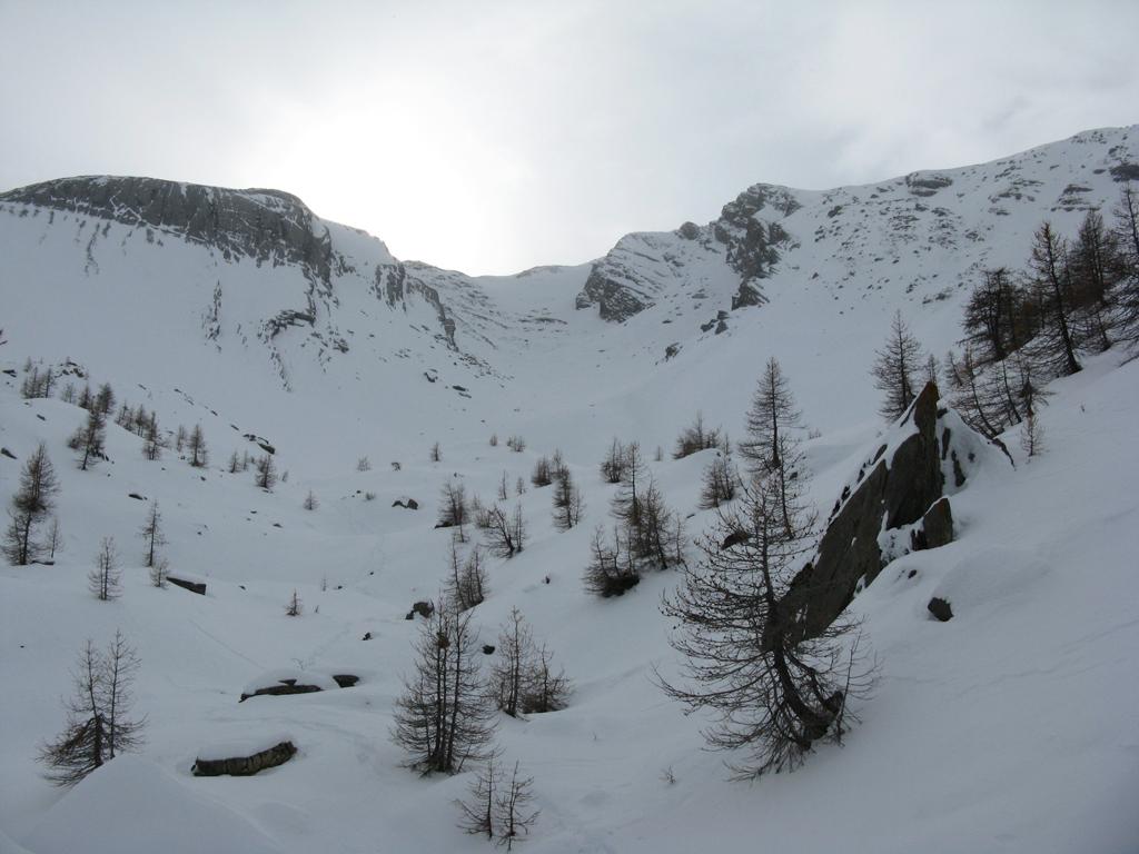
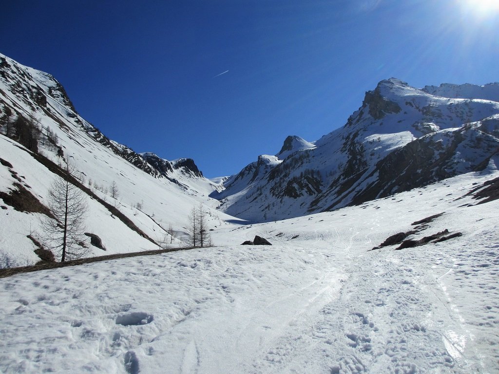
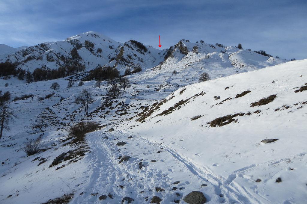
Dalla piazzetta a fianco della chiesa di Argentera, inizia il sentiero segnalato per i Laghi di Roburent. Si sale subito ripidamente con numerose serpentine nel rado bosco (solitamente questo tratto molto soleggiato risulta spoglio di neve) raggiungendo una sella denominata la la Tinetta, dove si vede il lungo vallone della salita con la meta già identificabile sullo sfondo.
Si compie ora un traverso in leggera discesa che immette nel vallone, riprendendo a salire l’avvallamento che si conclude con il Gias di Roburent. Qui si continua seguendo l’andamento del percorso estivo, se visibile, che prosegue in piano e poi con una perdita di quota sulla destra, fino ad una piccola conca con il torrente emissario dei laghi. Qui si riprende a salire con percorso mai difficile, sinuoso, dapprima verso est, poi aggirato un promontorio roccioso, verso ovest.
Costeggiata una paretina rocciosa si scende leggermente al Lago Inferiore di Roburent 2330 m.
Si prosegue per dossi e avvallamenti con massi affioranti, percorrendo una sorta di dorsale con in basso a destra il Lago Mediano di Roburent.
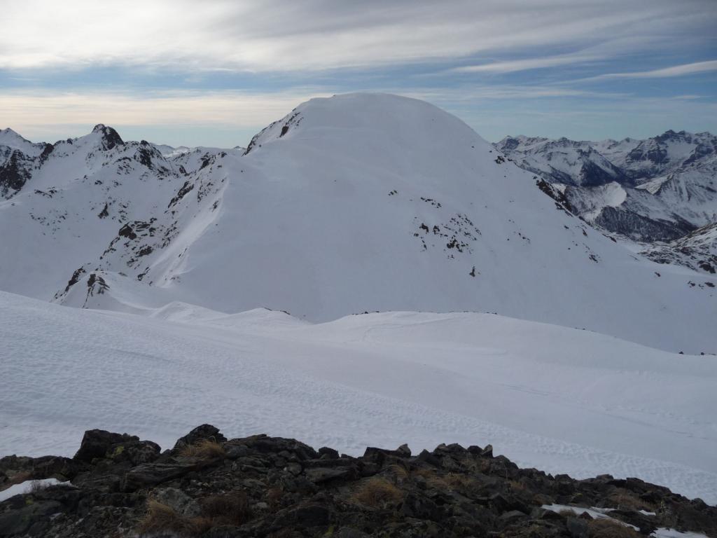
Ora il vallone si apre ulteriormente, e percorrendolo al centro molto dolcemente si raggiunge la conca con il Lago Superiore di Roburent 2426 m, nonchè il più grande.
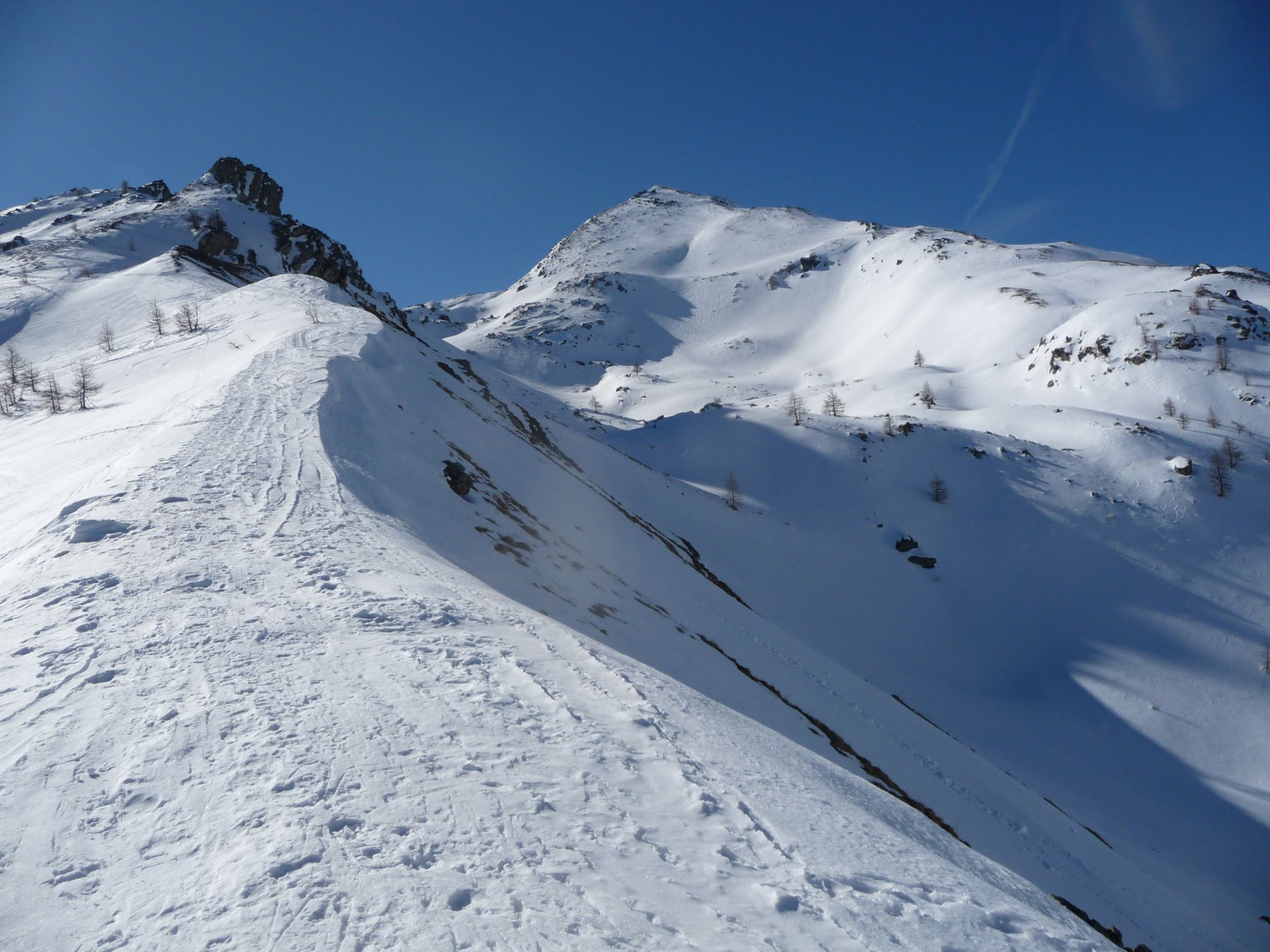
Lo si aggira sulla destra (volendo si può attraversarlo se l’innevamento lo permette) e si supera il breve pendio che conduce al Colle di Roburent 2496 m.
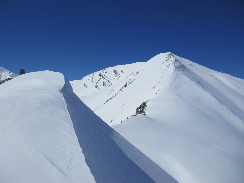
A sinistra risulta già evidente la vicina Cima di Roburent: per raggiungerla ci si dirige verso la verticale, per poi scegliere tra due possibilità, anche in base alle condizioni di innevamento:
A- si devia a sinistra, puntando ad un breve pendio nevoso un po’ più ripido, raggiungendo un’ampia sella alla base del crestone est. Ora lo si percorre tra neve ed rocce rotte senza particolari problemi (eventualmente con i ramponi vista la pendenza) toccando rapidamente la Cima di Roburent 2629 m.
B- si affronta direttamente il breve ma ripido pendio rivolto a nord-ovest, che conduce alla cima. Molto utili i ramponi ed anche la piccozza toccando la cima di Roburent.
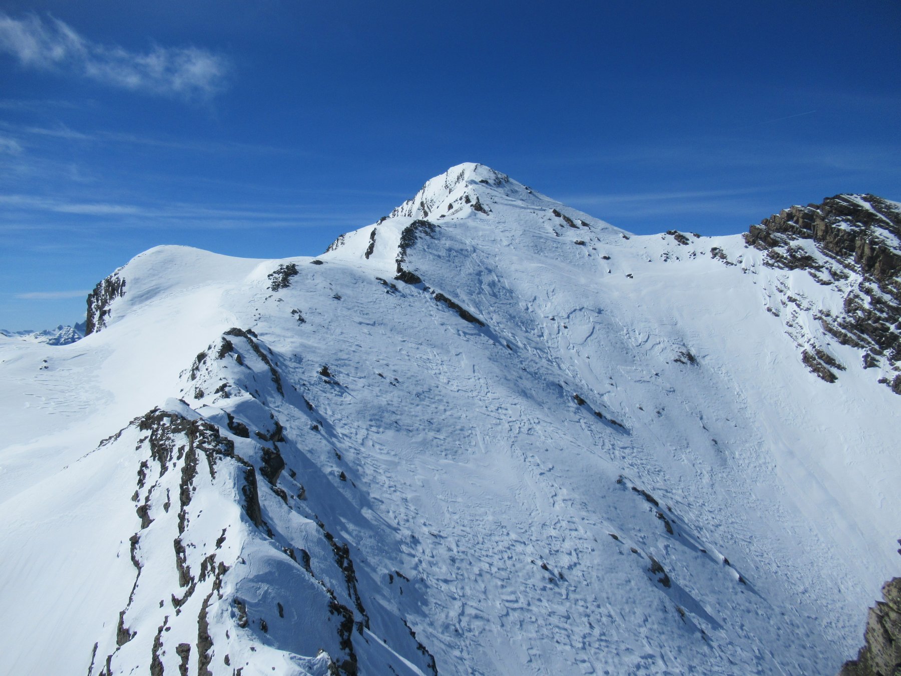
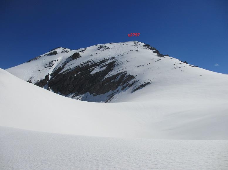
Ben evidente ora la parte del percorso rimanente per raggiungere il Monte Pierassin.
Ponendo attenzione ad eventuale cornici si percorre una facile insellatura poco inclinata, per giungere alla base del pendio finale, nuovamente piuttosto ripido, che va salito con percorso a piacere. Si raggiunge il grosso ometto posto in cima 2757 m.
Per la discesa si fa ritorno al Colle di Roburent per una delle due opzioni precedenti, oppure si può percorrere l’itinerario scialpinistico nei pressi del Colle Pierassin, scendendo poi i pendii moderatamente ripidi verso il Lago dell’Oronaye. Da qui con breve risalita si torna al Colle di Roburent. Oppure ancora si può compiere la traversata scendendo a Le Pontet lungo il vallone del Rio Oronaye, per poi rientrare ad Argentera in autostop o con una seconda auto preventivamente predisposta.
Da questo punto in pochi minuti si raggiunge dapprima il lago Mediano e poi il bellissimo lago Superiore di Roburent. Numerosi resti di trune militari. Dal Lago Superiore di Roburent si tralascia la traccia a destra che sale decisa al Passo Scaletta, per proseguire diritto fino al piatto ed erboso Colle di Roburent 2502 m.
Dal Colle di Roburent per salire alla Punta omonima si può passare sia dal versante Nord per ripidi pendii detritici (tracce e qualche ometto), sia da dud scavalcando la dorsale S/SE e risalendo una valletta detritica (preferibile per il terreno più stabile). In entrambi i casi si raggiunge la cresta tra Monte Pierassin e Punta di Roburent a 50 m da quest’ultima che si raggiunge in breve senza difficoltà. Proseguendo verso sud, con un breve tratto pianeggiante, si arriva alla base del ripido costone di erba e detriti del Monte Pierassin, che si raggiunge senza alcuna difficoltà.
Nelle vicinanze Mappa
Itinerari
25/04/2021 CN, Bersezio/Argentera D+ 1129 m BRA Nord-Est
Lose (Cima delle) da Argentera
 50m
50m
25/04/2021 CN, Bersezio/Argentera D+ 900 m MR Nord
Incianao (Punta) da Argentera
 50m
50m
01/04/2018 CN, Bersezio/Argentera D+ 1129 m OR Nord-Ovest
Lose (Cima delle) da Argentera per il Vallone del Puriac e la dorsale nord
 50m
50m
28/03/2019 CN, Bersezio/Argentera D+ 737 m MR Nord-Est
Puriac (Colle del) da Grange
 1.2Km
1.2Km
14/03/2019 CN, Bersezio/Argentera D+ 974 m BRA, PD- Est
Pe de Jun (Testa) da Grange per il Canale NE del Bail
 1.2Km
1.2Km
29/12/2014 CN, Bersezio/Argentera D+ 950 m BRA, F+ Varie
Ventasuso (Monte) da Grange, anello per Canale Est del Valejas
 1.2Km
1.2Km
19/03/2019 CN, Bersezio/Argentera D+ 1240 m BR Varie
Pebrun (Monte) o Pel Brun e Monte Aiga da Grange per la cresta di confine
 1.2Km
1.2Km
24/03/2019 CN, Bersezio/Argentera D+ 1067 m BRA, F Varie
Lose (Cima delle) da Grange per il vallone del Puriac, spalla e cresta SO
 1.2Km
1.2Km
08/05/2013 CN, Bersezio/Argentera D+ 1150 m BR Est
Pe de Jun (Testa) e Monte Ventasuso da Grange, anello per l’Enclausetta
 1.2Km
1.2Km
06/04/2017 CN, Bersezio/Argentera D+ 950 m BRA, F Nord-Est
Ventasuso (Monte) da Grange per il Bec del Pui e la cresta Est
 1.2Km
1.2Km
Servizi
200m
4.1Km
da Mo Ristorante
Bersezio/Argentera
4.2Km
Bruno Ristorante
Bersezio/Argentera
5.1Km
Della Pace Rifugio
Bersezio/Argentera
5.9Km
B&b del Villaggio B&B
Bersezio/Argentera
7Km
Viviere Rifugio
Acceglio
8.9Km
Gardetta Rifugio
Canosio
9.1Km
La Tavernetta Ristorante
Acceglio
9.1Km
Chialvetta Rifugio
Acceglio
9.2Km