 8Km
8Km
Note
 100m
2.8Km
5Km
6.1Km
6.9Km
8.7Km
8.7Km
10.5Km
100m
2.8Km
5Km
6.1Km
6.9Km
8.7Km
8.7Km
10.5Km
8Km
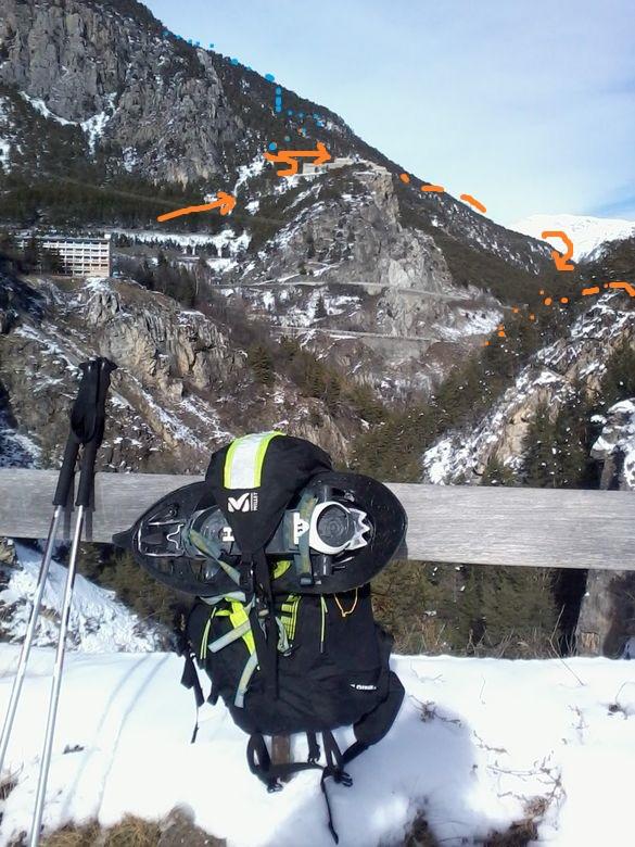
Necessari picca e ramponi e condizioni di neve primaverile. Consigliata in tarda stagione quando si può salire con l'auto almeno fino al ponticello a quota 1626 m, dopo le Pas du Rif.
Avvicinamento
Dal Colle del Monginevro, raggiunta Briancon, si prosegue in direzione di Embrun fino a Saint Martin de Queyrieres 1202 m. Dalla borgata le Villaret si prende la strada verso Roche Baron. Con innevamento normale si lascia l'auto a Rocher Baron a quota 1200 m (aggiungere 400 m di disl.). In stagione avanzata si può accorciare decisamente il dislivello (forbice compresa tra 1700 m. e 1300 m.), arrivando con l'auto ad una quota tra 1610 m. (le Pas du Rif) e i 1800 m. circa, in prossimità del ripiano del Calvaire du Vallon. La sterrata in molti punti non è in buone condizioni.
Descrizione
poco oltre il ponticello 1626, si lascia la sterrata a favore di un sentiero sulla sinistra che permette di tagliarne i tornanti. Per bosco e radure si prosegue fino a raggiungere il ripiano del Calvaire du Vallon.
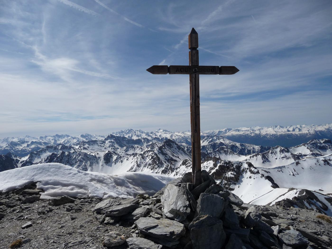
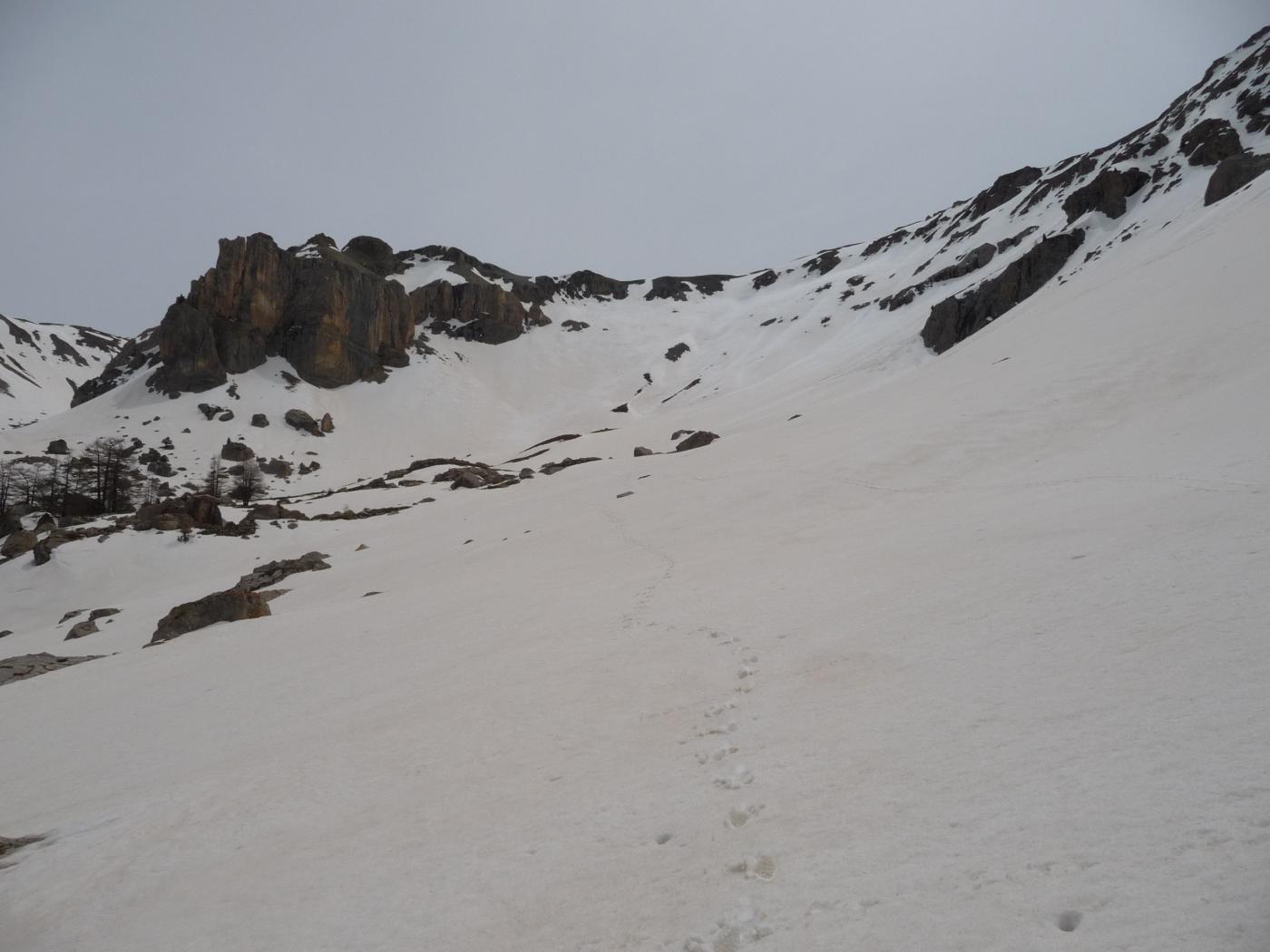
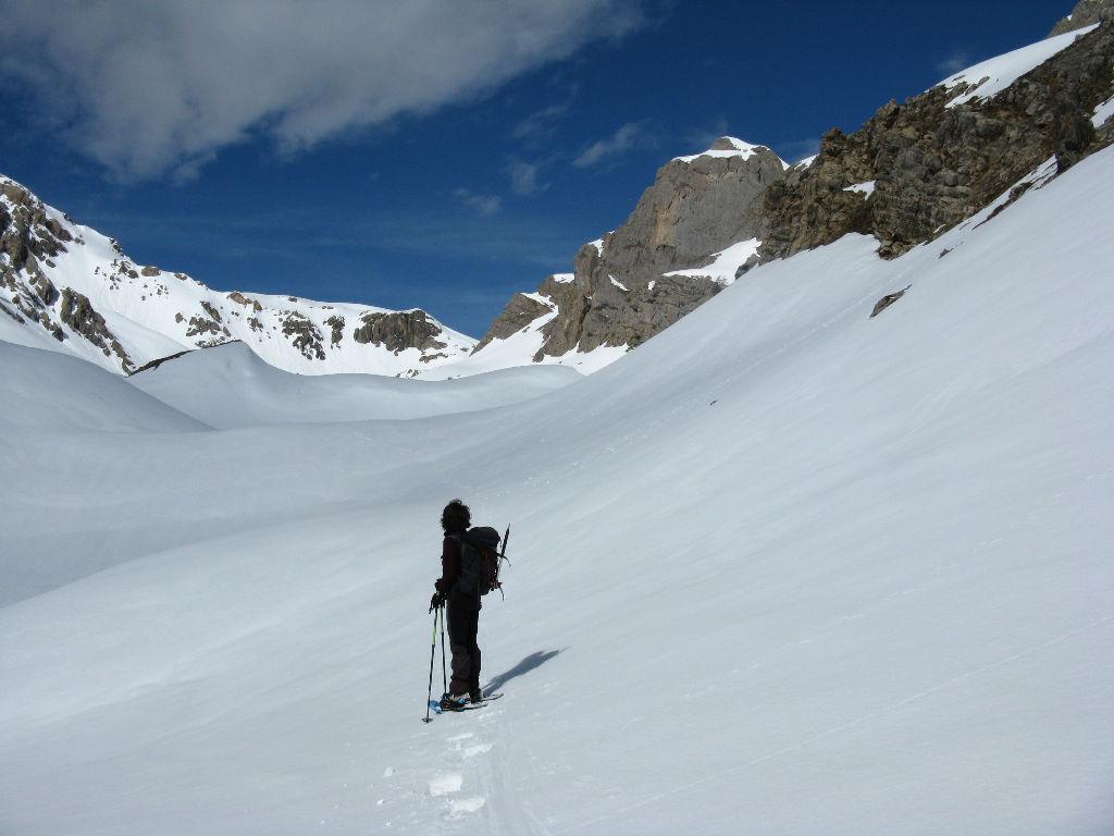
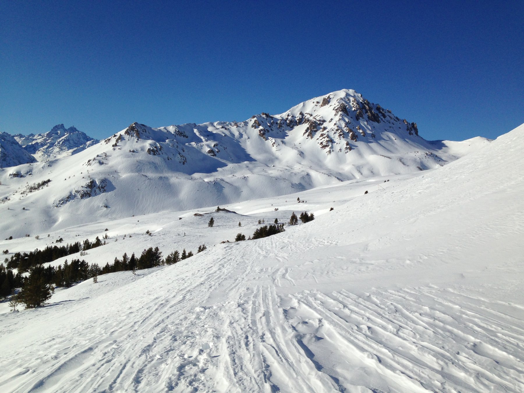
Dal ripiano si risale un sostenuto pendio, tra larici e massi e si perviene al bellissimo ripiano Fond Froid 2200 m circa. Si volge quindi a sinistra, direzione sud est e, per pendii sempre più ripidi (ramponi), aggirando alcune barre rocciose, si accede al sostenuto pendio finale 35°. Spostandosi via via sulla destra si raggiunge il finale della cresta S dove si prosegue per un tratto in piano verso sinistra, costeggiando le cornici e in breve si raggiunge la croce di vetta. Panorama spettacolare sugli Ecrins, Guisane, Queyras, Ubaye…
Volendo, a seconda delle condizioni, si può risalire la cresta S.
Discesa dallo stesso itinerario
- Cartografia:
- Carte IGN 35360T Briançon
Nelle vicinanze Mappa
Itinerari
01/02/2015 Hautes-Alpes, Saint-Martin-de-Queyrières D+ 1110 m BR Nord
Alpavin (Crete de l’) Versante N
 100m
100m
05/01/2014 Hautes-Alpes, Saint-Martin-de-Queyrières D+ 650 m MR Sud
Ratiere (Chalets de) da Sachas
 2.8Km
2.8Km
16/03/2013 Hautes-Alpes, Saint-Martin-de-Queyrières D+ 1250 m OR Est
Montbrison (Dome de) da Bouchier, Combe Brune
3.2Km
26/04/2014 Hautes-Alpes, Puy-Saint-André D+ 1069 m BR Sud-Est
Eychauda (Sommet de l’) da Puy Chalvin
3.7Km
28/12/2012 Hautes-Alpes, Villar-Saint-Pancrace D+ 450 m MR Nord
Ayes (Chalets des) da Villar-Saint-Pancrace
 5Km
5Km
08/06/2014 Hautes-Alpes, Puy-Saint-André D+ 1050 m BR Varie
Lauzières (Tete de la) o le Sablier da les Combes
 6.1Km
6.1Km
25/02/2017 Hautes-Alpes, Villar-Saint-Pancrace D+ 700 m MR Varie
Croix de Bretagne (Fort de la) da Villar SaintPancrace
 6.9Km
6.9Km
08/02/2015 Hautes-Alpes, Briançon D+ 450 m MR Sud
Coins (les) da Briançon, anello Fort de Salettes – Fontenil
 8.7Km
8.7Km
25/04/2014 Hautes-Alpes, Briançon D+ 550 m MR Ovest
Toulouse (Croix de) da Briançon per Serre Lan
 8.7Km
8.7Km
14/01/2024 Hautes-Alpes, Saint-Chaffrey D+ 989 m MR Sud-Ovest
Granon (Col de) da le Villard Laté per la Bergerie Saint Joseph
 10.5Km
Servizi
8Km