 6.6Km
6.6Km
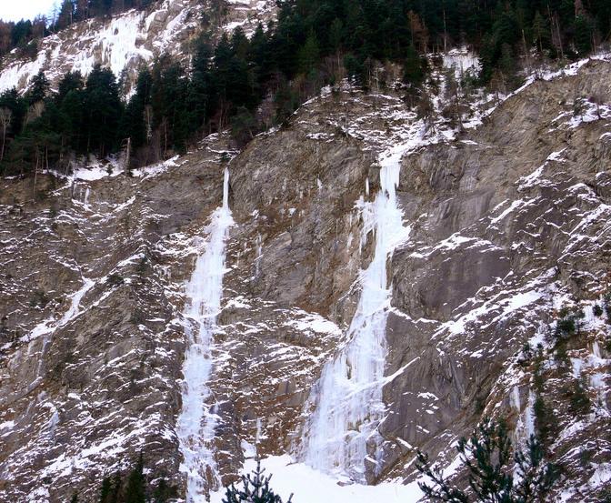
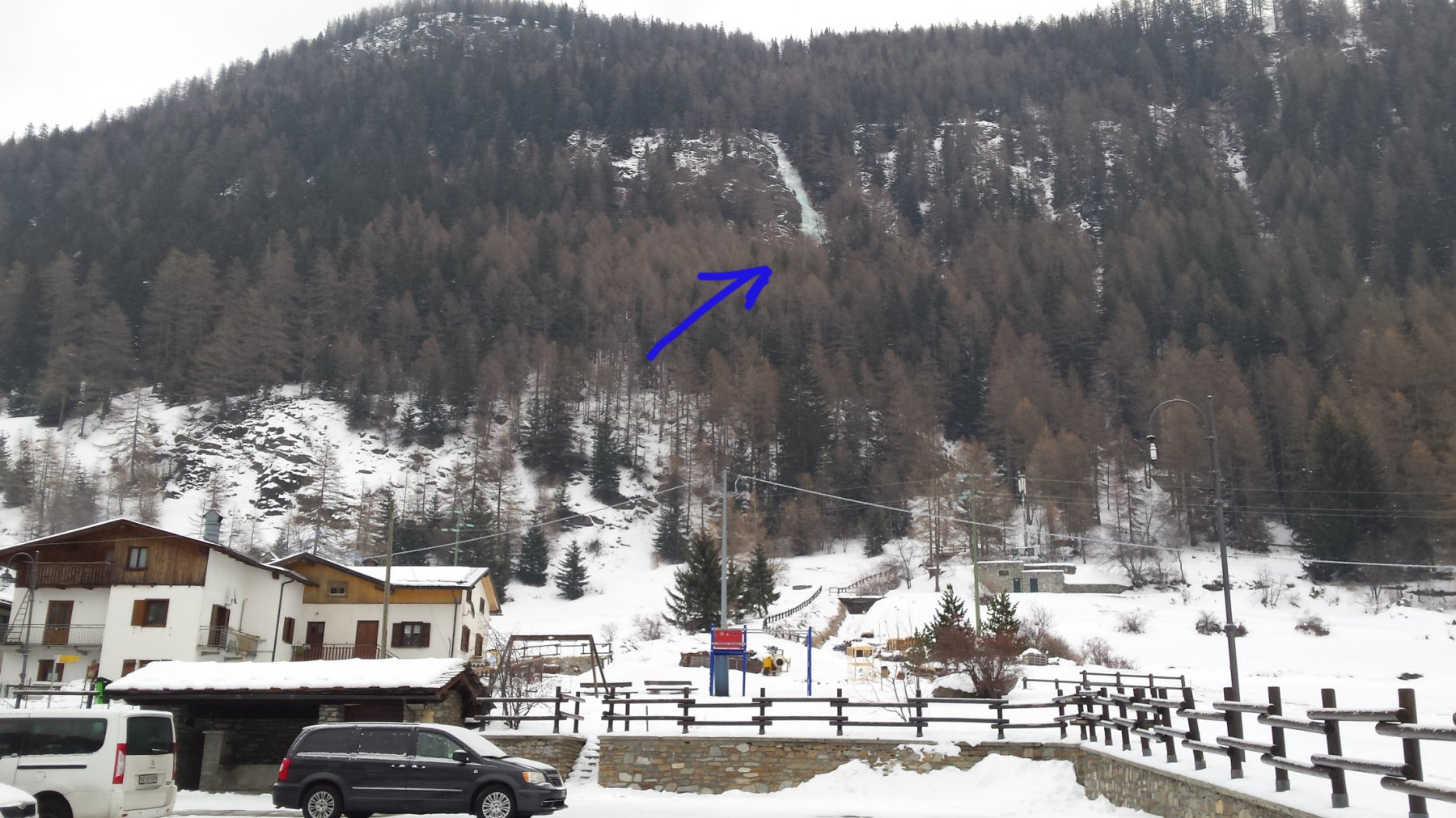
Avvicinamento
Storico
 1.6Km
3.8Km
4Km
4.8Km
5.4Km
1.6Km
3.8Km
4Km
4.8Km
5.4Km
.
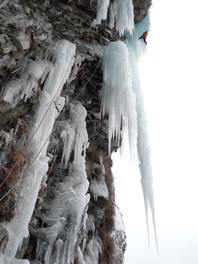
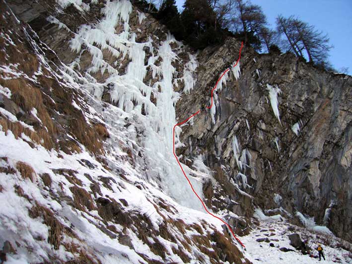
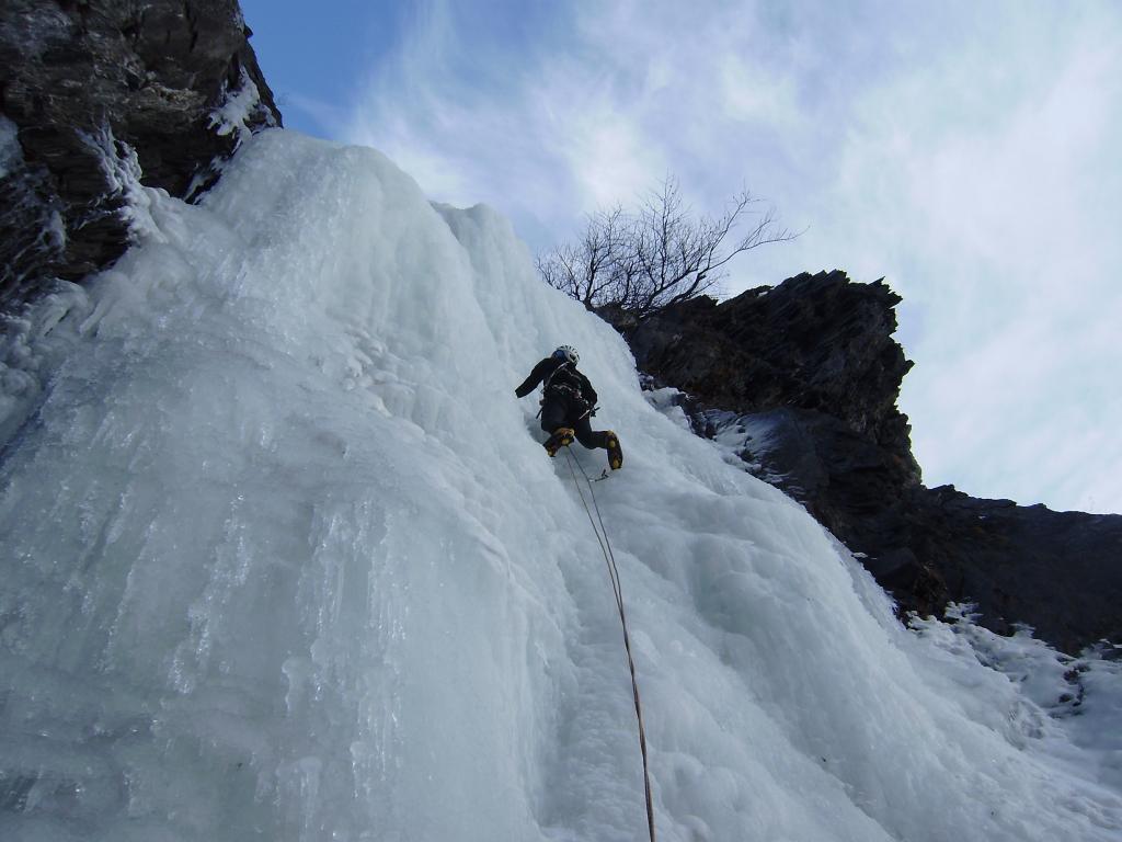
Descrizione
L1: diritto fino alla fine del ghiaccio abbondante (4+, 60 m, sosta su ghiaccio).
L2: in diagonale a destra su ghiaccio fine e/o roccia di dubbia qualità fino alla grande stalattite finale che si supera interamente fino in cima (6+ M R X, 45 m, sosta su ghiaccio).
L3: traverso su roccia/misto a sinistra, prima ascendente poi discendente, fino al ghiaccio che si risale fino allo spit della sosta di *Hot spring*.
Discesa con 2 doppie: la prima da uno spit + maillon (58 m), la seconda da un vecchio ancoraggio a chiodi nonchè seconda sosta di *Hot spring* (60 m).
Prima salita: F. Aubert, F. Damilano, F. Pallandre - marzo 1996.
Prima ripetizione: T. Renault & C. - gennaio 2011.
Seconda ripetizione: A. Clavel, M. Giglio - gennaio 2011.
Prima ripetizione: T. Renault & C. - gennaio 2011.
Seconda ripetizione: A. Clavel, M. Giglio - gennaio 2011.
- Bibliografia:
- Matteo Giglio - Effimeri Barbagli - 2014 Tipografia Valdostana
Nelle vicinanze Mappa
Itinerari
01/03/2003 AO, Pré-Saint-Didier 150 m II, 5 Varie
Pré Saint Didier – Alexandra (Cascata)
950m
25/01/2003 AO, Pré-Saint-Didier 90 m II, 5 Nord-Est
Champex – Chougnagawa (Cascata)
1.2Km
01/02/2009 AO, Pré-Saint-Didier 160 m I, 5 Ovest
Pré Saint Didier – Au Bout des Thermes (Cascata)
1.5Km
26/12/2005 AO, Pré-Saint-Didier 80 m II, 5 Nord-Est
Champex – Happy Birthday (Cascata)
 1.6Km
1.6Km
08/01/2011 AO, Morgex 120 m I, 5+ Nord
Morgex – Grande Vacherie (Cascata)
 3.8Km
3.8Km
07/01/2011 AO, Morgex 120 m I, 5 Nord
Morgex – Vacherie de gauche (Cascata)
 4Km
4Km
03/01/2026 AO, La Thuile 90 m II, 2 Nord
La Thuile – Thovex (Cascata del)
 4.8Km
4.8Km
26/01/2011 AO, Courmayeur 100 m III, 4 Nord-Est
Curmayeur – Esse (Cascata)
 5.4Km
5.4Km
19/01/2003 AO, Morgex 100 m II, 2+ Nord-Est
Morgex – Echos (Cascata)
6.2Km
07/01/2010 AO, Morgex 90 m II, 4+ Nord-Est
Morgex – Rideau de Morgex (Cascata)
6.4Km