 6Km
6Km

Note
Storico
 0m
3Km
3Km
3Km
3Km
3Km
3Km
3Km
0m
3Km
3Km
3Km
3Km
3Km
3Km
3Km
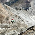
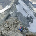
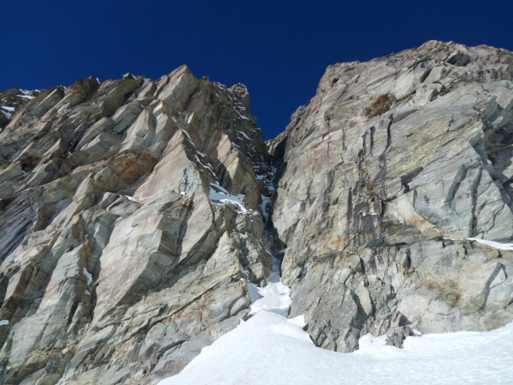
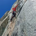
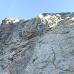
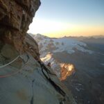
Salita diretta per un evidente speroncino sulla parete sud .
Portare due corde da 60 metri .
10 rinvii
una serie di friends piccoli e medi
Avvicinamento
Portare due corde da 60 metri .
10 rinvii
una serie di friends piccoli e medi
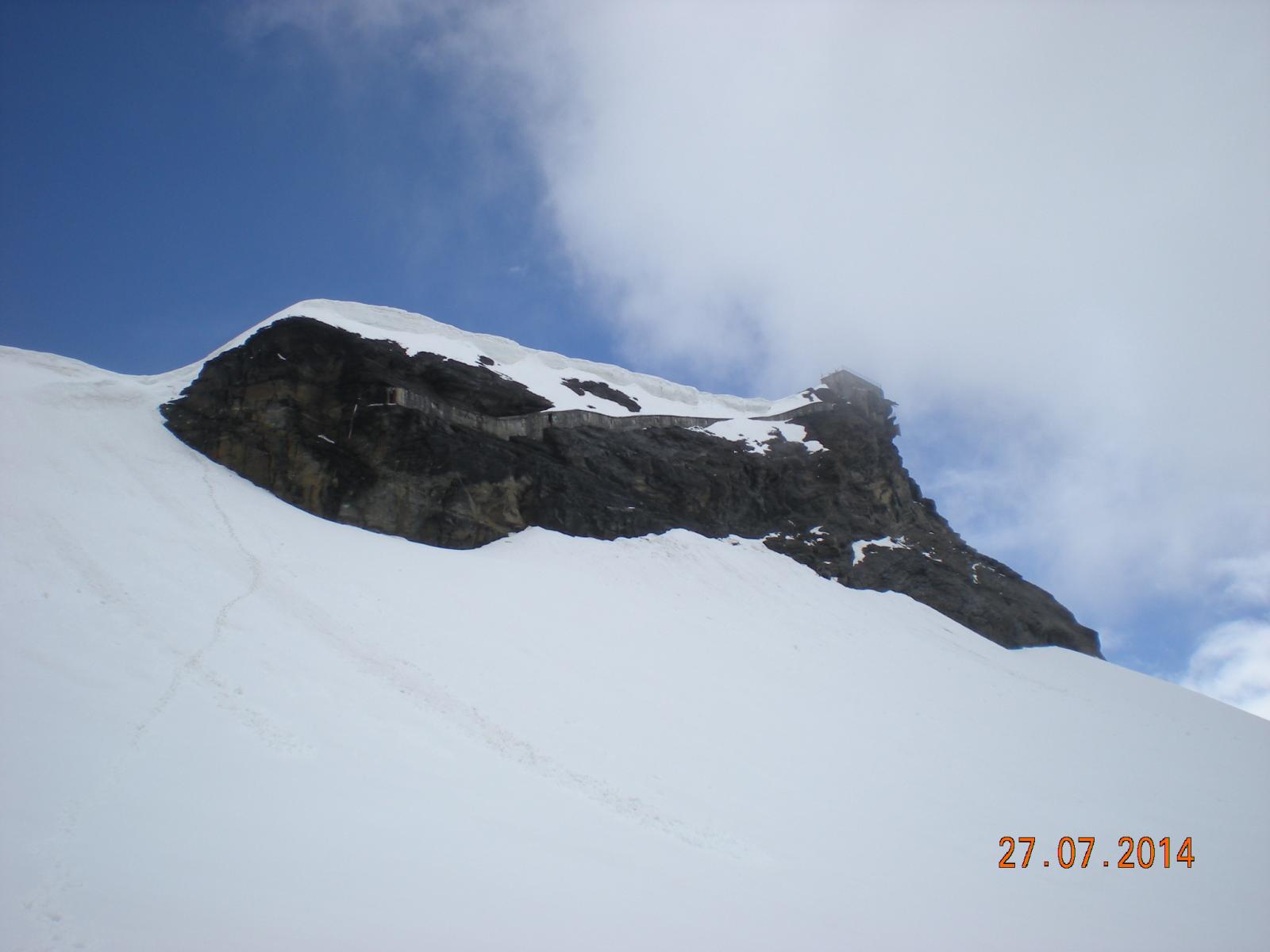
La base della via si raggiunge dalla stazione funiviaria di Plan Maison in circa 1,20 ora .
Descrizione
1° tiro 5c 15 m 2 spit
2° tiro 6b 25 m 4 spit
3° tiro 5a 60 m 4 spit
4° tiro 6a 40 m 4 spit
5° tiro 5c 30 m 3 spit –diedro con uscita verso destra più cengia
6° tiro 6a 40 m 2 spit e uscita verso sinistra .
7° tiro 5b 30 m 2 spit e uscita verso destra sotto il tetto .
Poi conserva fino a destra della base dell’ultimo risalto della stazione : 15 min.
8° tiro 4 “marcio “ 20 m. 2 spit
9° tiro 6a+ “marcietto” 9 spit zig zag sotto la stazione e uscita sullo spigolo destro della casa.
Discesa in doppie per la via !
Prima salita 31/07/2012 G.A. Gianni Gorret e G.A. Patrick Poletto
Nelle vicinanze Mappa
Itinerari
17/08/2025 AO, Valtournenche D+ 1920 m TD Sud-Est
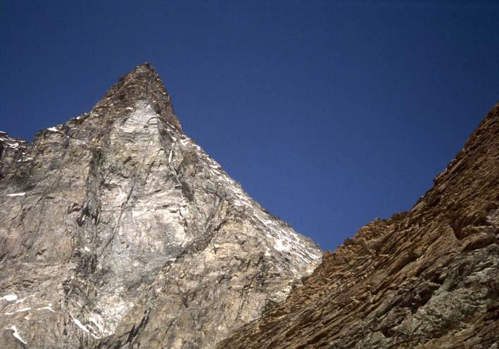
Cervino o Matterhorn – Cresta del Furggen, Diretta degli Strapiombi
 0m
0m
19/07/2010 AO, Valtournenche D+ 1000 m AD+ Nord
Breithorn Occidentale Cresta Triftjigratt
3Km
13/08/2024 AO, Valtournenche D+ 1709 m PD- Sud
Leone (Testa del) Via Normale da Cervinia
 3Km
3Km
09/08/2011 AO, Valtournenche D+ 1486 m F+ Est
Furggen (Cima di) o Tete de la Forclaz da Cervinia, Cresta di Furggen
 3Km
3Km
15/12/2016 AO, Valtournenche D+ 250 m TD+ Est
Tournanche (Col), contrafforte – La Belle Endormie
 3Km
3Km
04/07/2026 AO, Valtournenche D+ 2006 m ED Sud-Est
Cervino o Matterhorn, Pilier dei Fiori – Padre Pio Prega per Tutti
 3Km
3Km
18/09/2020 AO, Valtournenche D+ 1500 m F Sud-Ovest
Furggen (Cima di) o Tete de la Forclaz da Cervinia
 3Km
3Km
18/07/2022 AO, Valtournenche D+ 1831 m PD Sud-Ovest
Carrel (Rifugio) da Cervinia
 3Km
3Km
07/07/2026 AO, Valtournenche D+ 2400 m D Ovest
Cervino o Matterhorn Cresta del Leone
 3Km
3Km
15/10/2010 AO, Valtournenche D+ 700 m TD Sud-Est
Cervino o Matterhorn – Spigolo dei Fiori
3Km