 1.3Km
1.3Km
Avvicinamento
Storico
 450m
550m
550m
850m
1.2Km
1.3Km
1.3Km
1.3Km
1.3Km
450m
550m
550m
850m
1.2Km
1.3Km
1.3Km
1.3Km
1.3Km
1.3Km
2.5Km
3Km
3.4Km
4Km
4.2Km
6.3Km
7.6Km
8.4Km
8.9Km
prima del secondo tornante , vedi mappa, parcheggiare o comunque recarsi , all ingresso di una villa in vendita, dopo il grosso masso con fessura vicino alla strada.
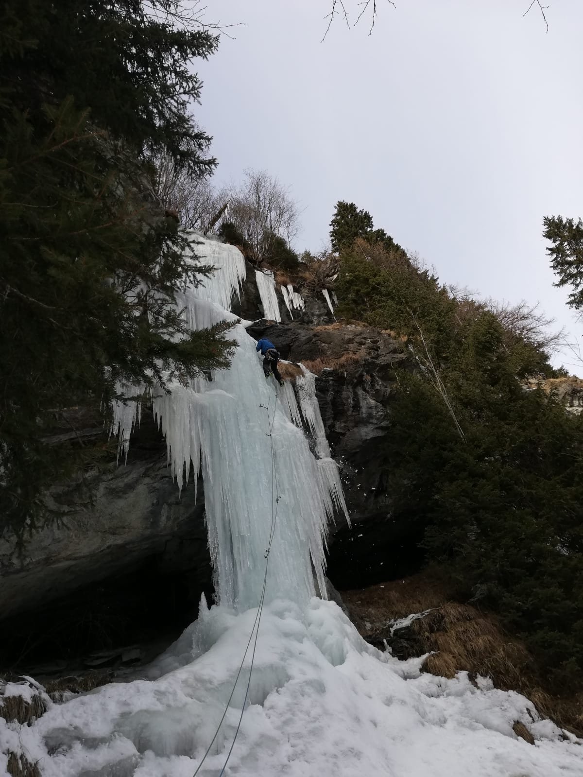
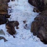
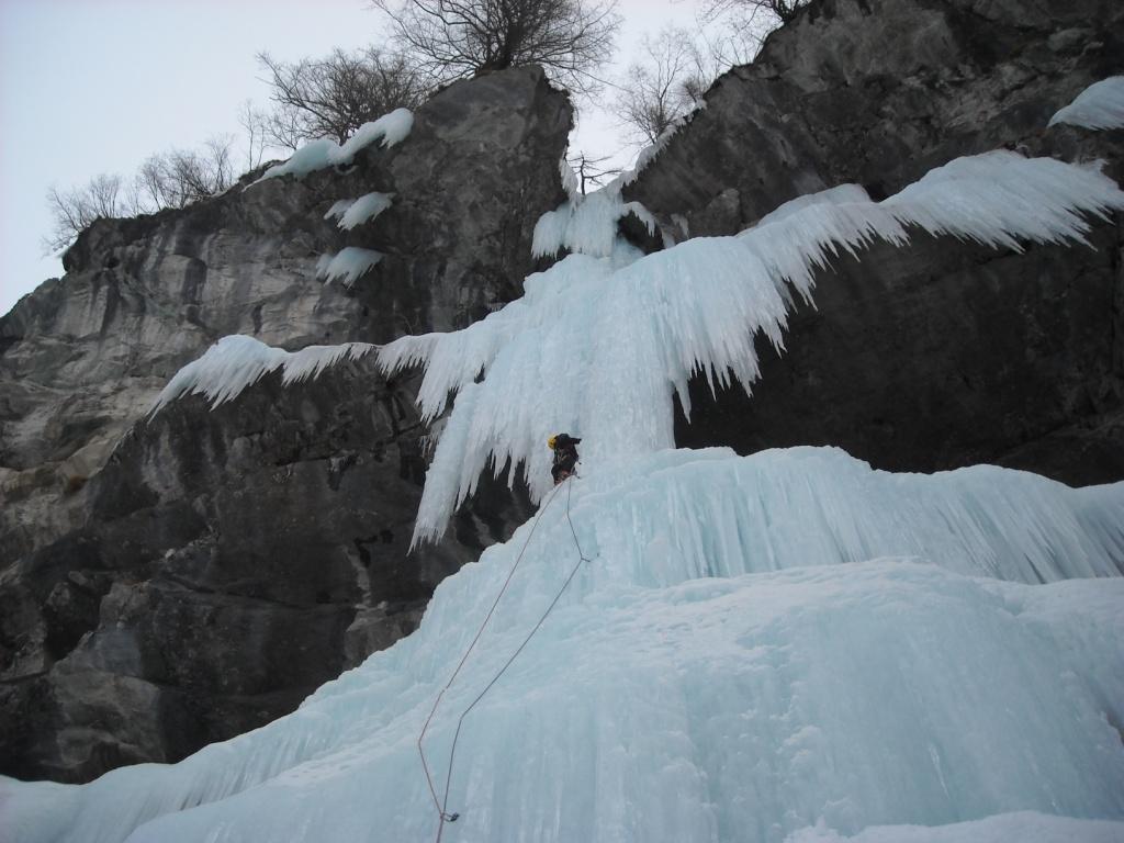
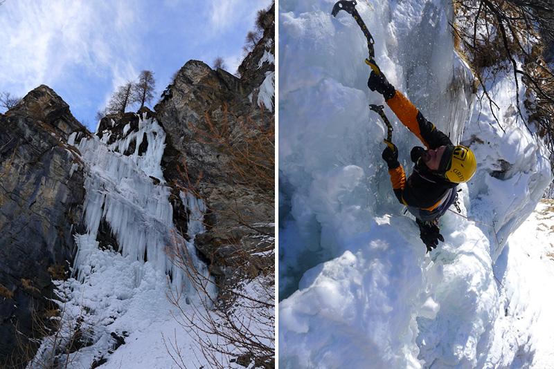
proseguire nel bellissimo bosco fino a un grande masso alto una trentina di metri, che nasconde dietro una stretta forra, solo entrando si puo vedere se la cascata e formata.
Descrizione
proseguire nel bellissimo bosco fino a un grande masso alto una trentina di metri, che nasconde dietro una stretta forra, solo entrando si puo vedere se la cascata e formata.
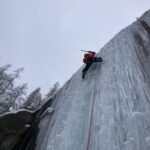
Due tiri con un muretto verticale di una decina di metri. se la base non e formata si può fare qualche metro di dry nel fondo per poi passare sul muro a dx, necessari friend in questo caso. discesa in doppia su albero a lato.
diego margiotta e pezzini
- Bibliografia:
- effimeri barbagli, m giglio
Nelle vicinanze Mappa
Itinerari
23/01/2011 AO, Gressoney-Saint-Jean 100 m II, 4+ Est
Gressoney Saint Jean – Chandelle Mireille (Cascata)
 450m
450m
18/01/2026 AO, Gressoney-Saint-Jean 150 m II, 3 Est
Gressoney Saint Jean – Cava (Cascata della)
 550m
550m
23/01/2021 AO, Gressoney-Saint-Jean 110 m II, 5 Est
Gressoney Saint Jean – Bonne Anneè (Cascata)
 550m
550m
17/01/2026 AO, Gressoney-Saint-Jean 180 m I, 3+ Est
Gressoney Saint Jean – Alpenzù (Cascata dell’)
 850m
850m
08/02/2019 AO, Gressoney-Saint-Jean 240 m II, 4+ Nord
Gressoney Saint Jean – Chemonal (Cascata di) ramo dx
 1.2Km
1.2Km
10/02/2019 AO, Gressoney-Saint-Jean 240 m II, 4 Nord
Gressoney Saint Jean – Chemonal (Cascata di) ramo sx
1.2Km
03/02/2019 AO, Gressoney-Saint-Jean 150 m II, 2+ Ovest
Gressoney Saint Jean – Valdobbiola (Cascata di)
 1.3Km
1.3Km
21/02/2026 AO, Gressoney-Saint-Jean 150 m II, 4+ Ovest
Gressoney Saint Jean – Ciampa (Cascata del)
 1.3Km
1.3Km
13/03/2010 AO, Gressoney-Saint-Jean 70 m III, 6 Nord
Gressoney Saint Jean – Avanti Savoia (Cascata)
 1.3Km
1.3Km
25/01/2013 AO, Gressoney-Saint-Jean 100 m II, 5 Ovest
Gressoney Saint Jean – Un Fiore per i Cava (Cascata)
 1.3Km
1.3Km
Servizi
1.3Km
2.5Km
Hirsch stube Ristorante
Gressoney-la-Trinitè
3Km
Bìerfall Ristorante
Gressoney-Saint-Jean
3.4Km
Flying brasserie (Paul Verlaine) Ristorante
Gressoney-Saint-Jean
4Km
Gran Baita Albergo
Gressoney-Saint-Jean
4.2Km
Punta jolanda Ristorante
Gressoney-la-Trinitè
6.3Km
AlpenHutte Lys Ristorante
Gressoney-la-Trinitè
7.6Km
Orestes Hütte Rifugio
Gressoney-la-Trinitè
8.4Km
A Barma Drola B&B
Brusson
8.9Km