3.5Km
3.5Km
Note
 50m
50m
50m
50m
50m
2.2Km
2.2Km
7.4Km
7.5Km
8.7Km
50m
50m
50m
50m
50m
2.2Km
2.2Km
7.4Km
7.5Km
8.7Km
3.5Km
4.9Km
6.4Km
6.4Km
6.4Km
6.5Km
7.7Km
9.4Km
9.9Km
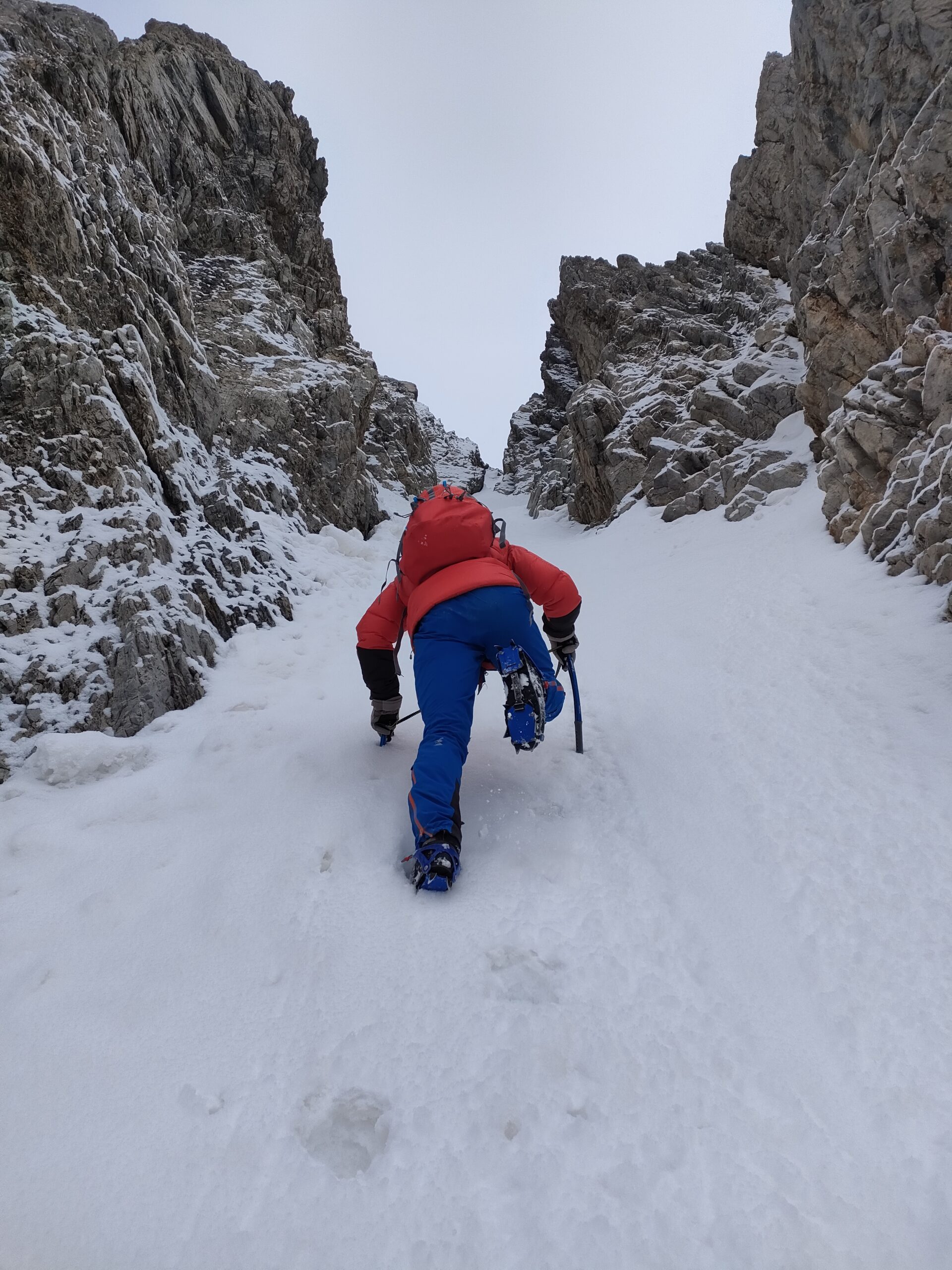
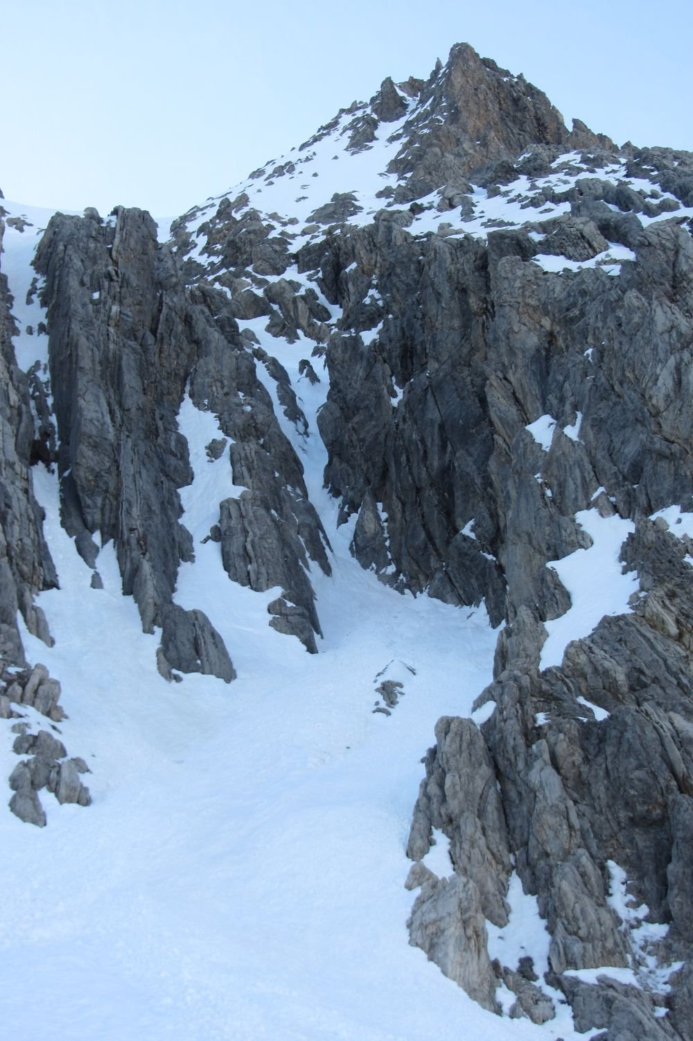
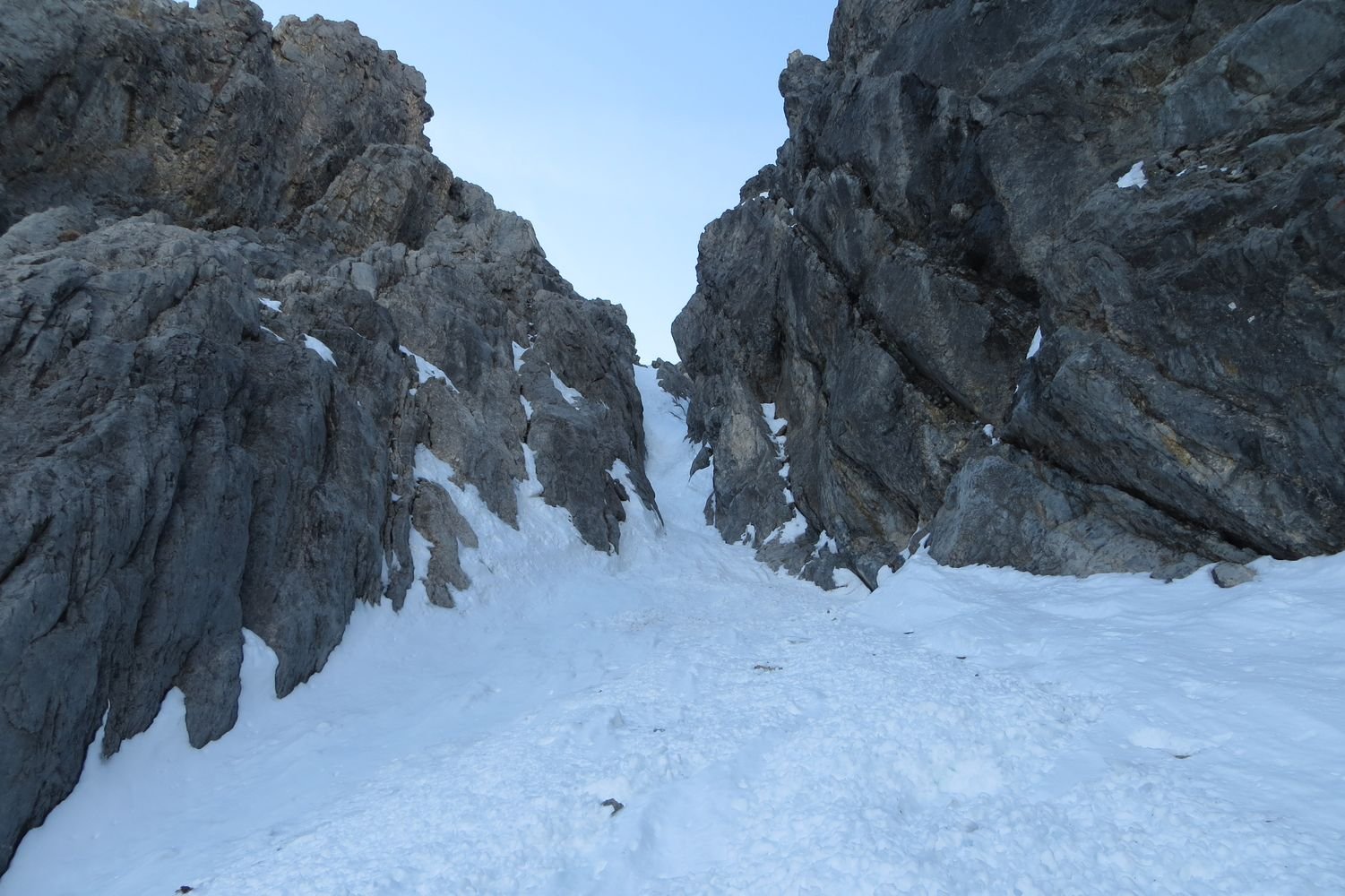
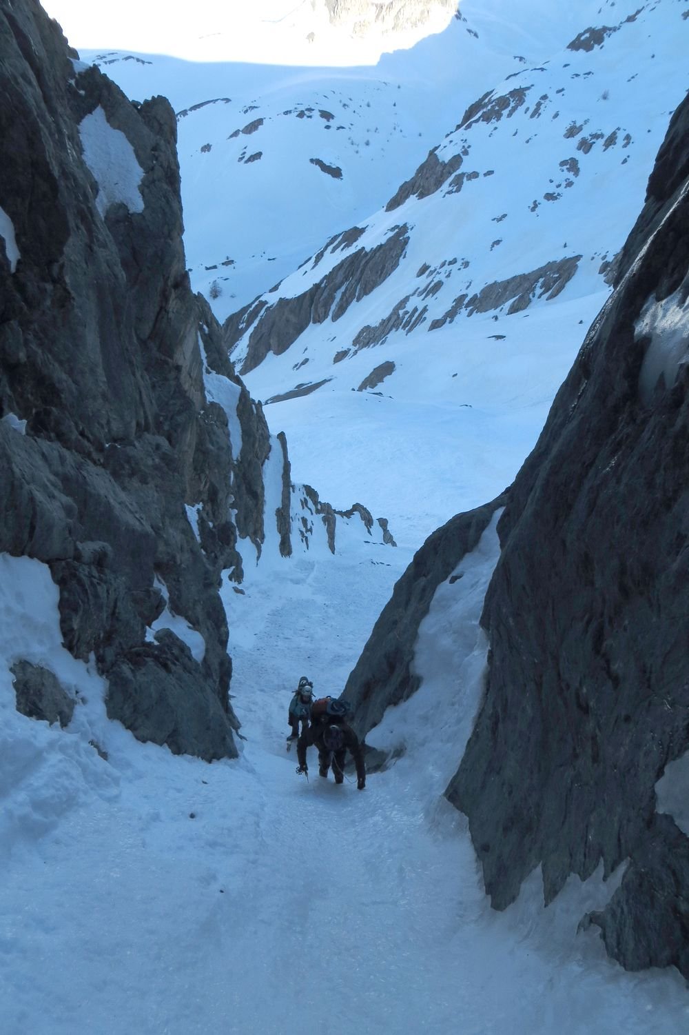
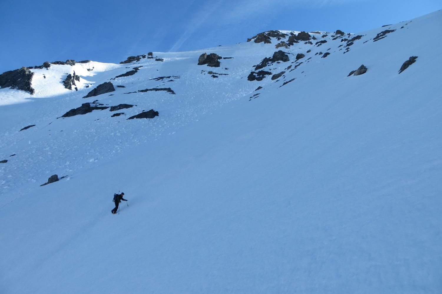
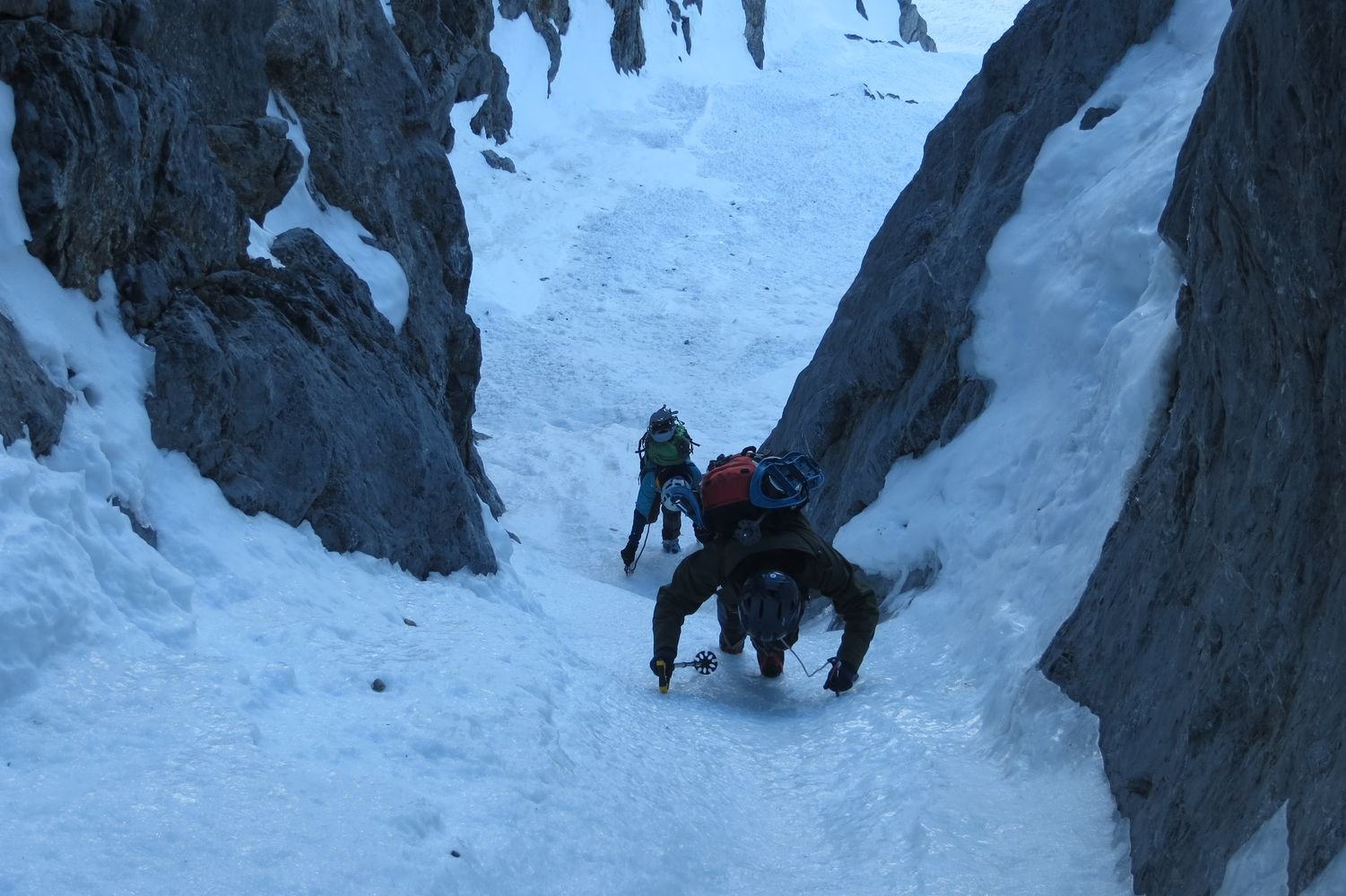
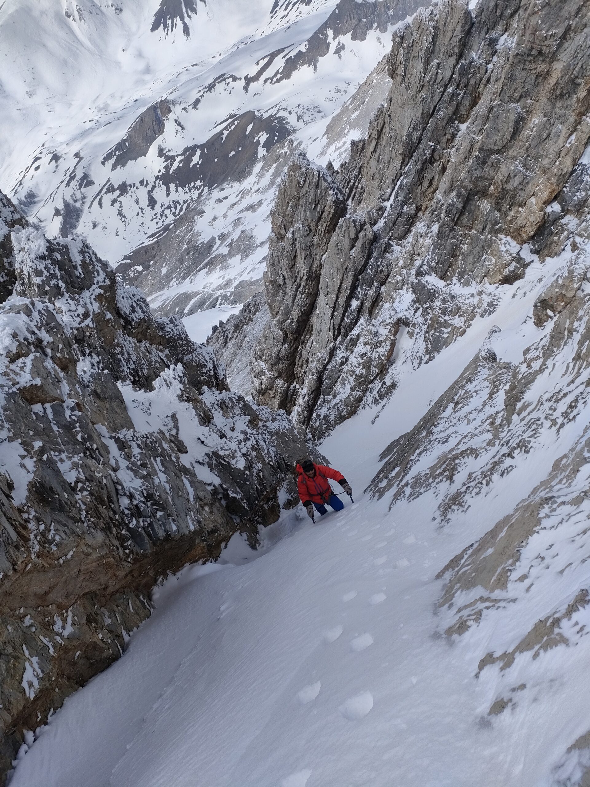
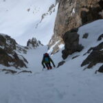
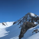
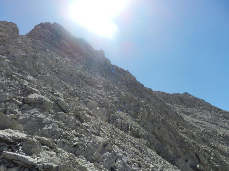
E' un itinerario per neve tardo invernale/primaverile che percorre la parete ovest. A seconda delle condizioni la goulotte iniziale può presentare dei passi di ghiaccio o misto. La parte alta invece può essere più o meno innevata a seconda dell'azione del vento.
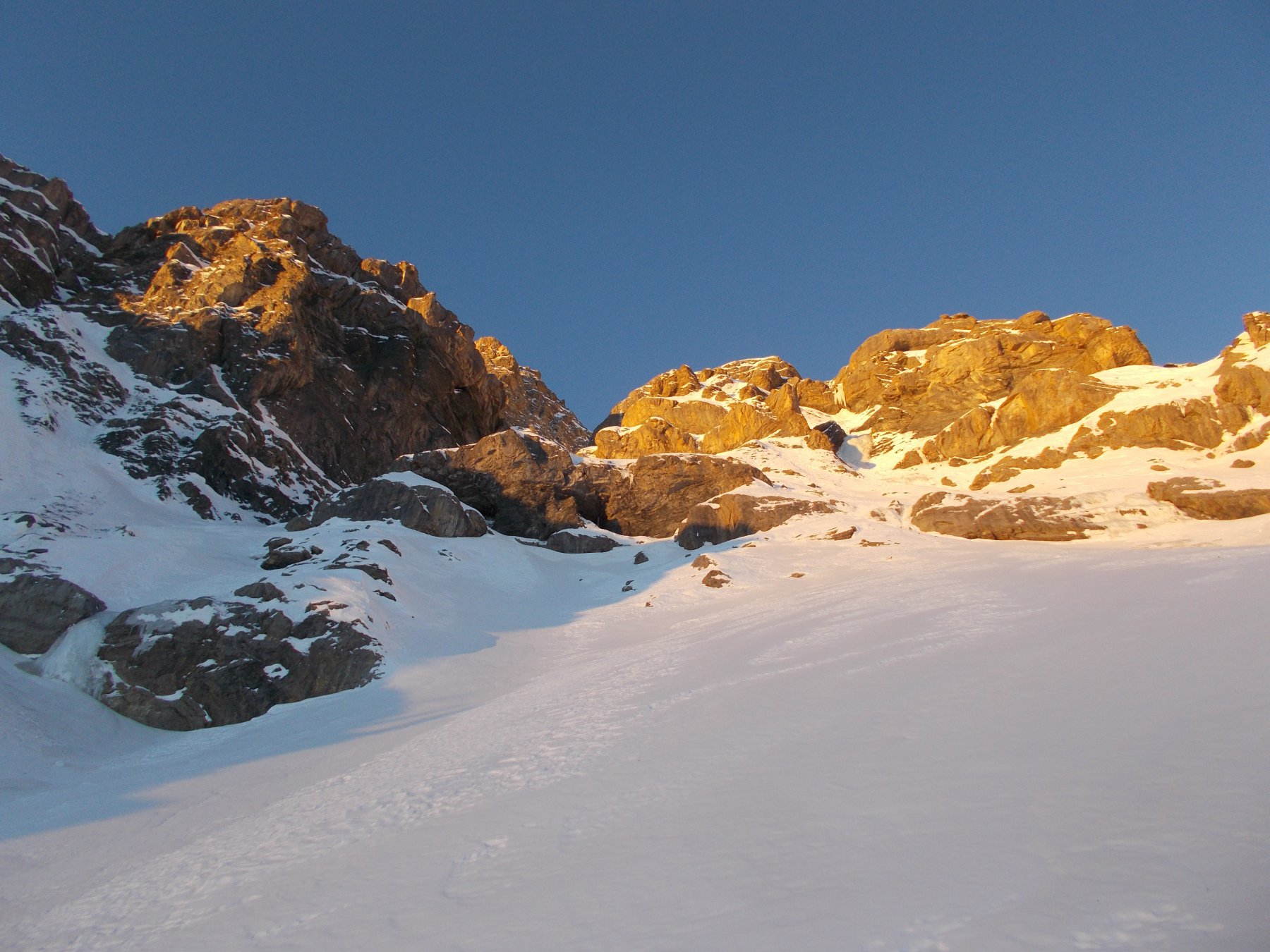
Pendenze: 50m 50/55°; 600 m 40° (brevi tratti a 45°).
E' anche un itinerario di sci ripido raramente percorso.
Sci o racchette utili per l'avvicinamento e la discesa.
Avvicinamento
Pendenze: 50m 50/55°; 600 m 40° (brevi tratti a 45°).
E' anche un itinerario di sci ripido raramente percorso.
Sci o racchette utili per l'avvicinamento e la discesa.
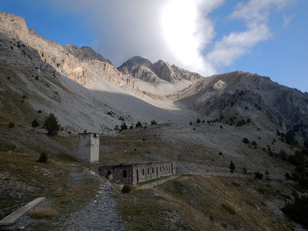
A Montgenevre, superata la dogana, prendere la prima strada a dx e percorrerla per circa 300 m.
Descrizione
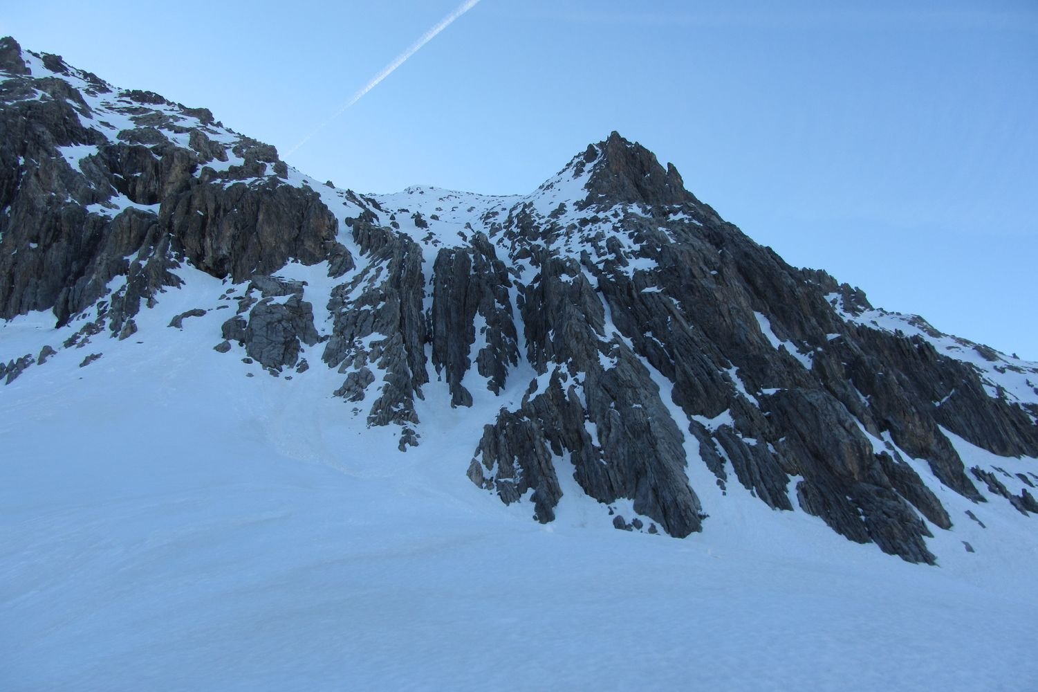
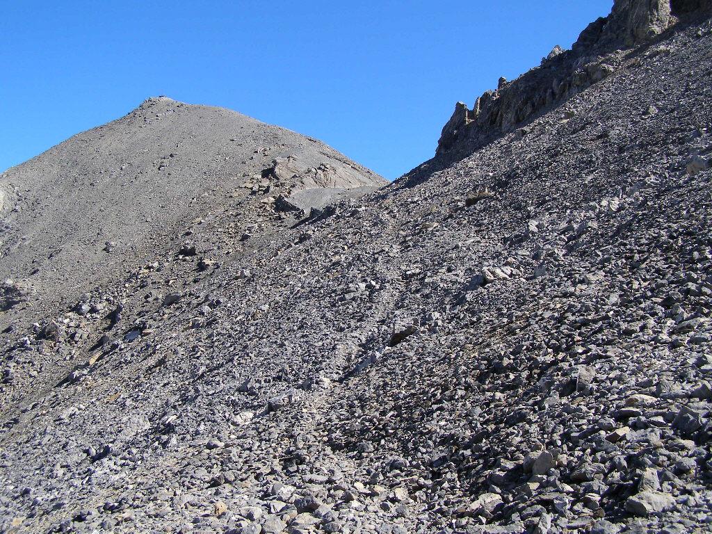
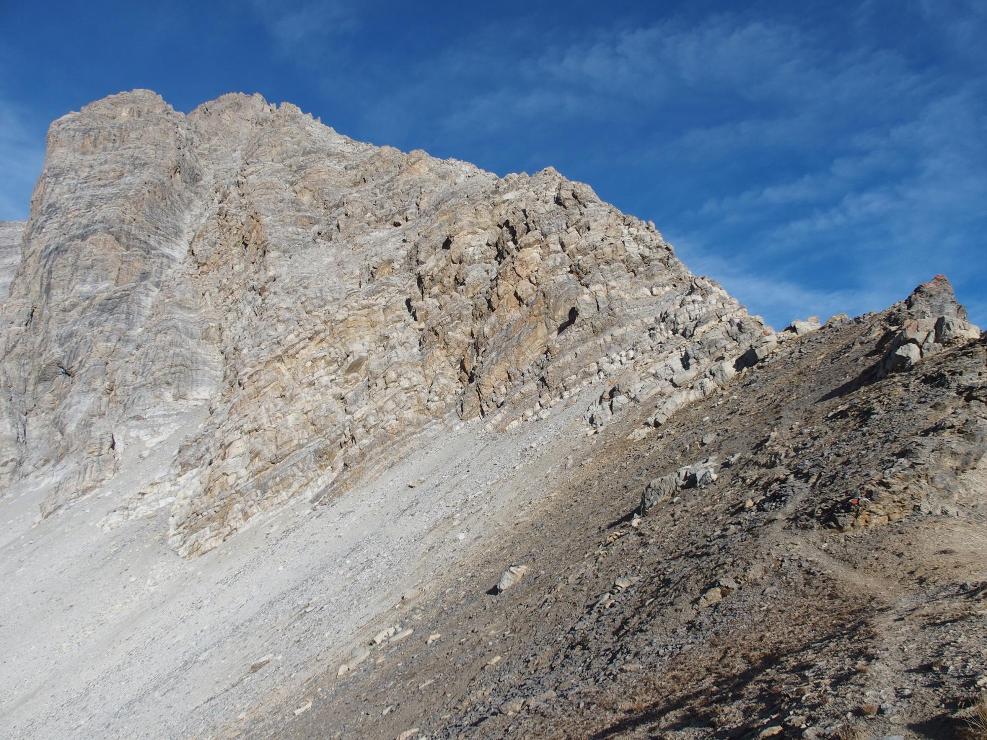
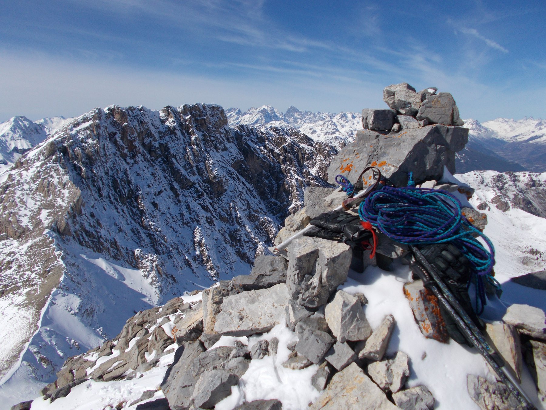
Imboccare la strada che si inoltra nel vallone del Rio Secco e seguire l’itinerario classico della via normale dello Chaberton. A 2250 m, attraversato il vallone, nei pressi della tabella geologica esplicativa all’inizio del valloncello che conduce al colle dello Chaberton, piegare a dx (ovest) e salire fino alla base della parete, dove si vede finalmente la stretta e incassata goulotte iniziale. La si supera (50 m, 50/55°, ghiaccio possibile), quindi si prosegue nel canale ora più appoggiato, che si apre a ventaglio. Senza percorso obbligato si sale per ampi pendii (40°) fino a sotto la vetta (volendo si può raggiungere la cresta SO). Qui il pendio si restringe nuovamente (breve tratto a 45°) e si esce sulla via normale in corrispondenza di uno degli ultimi tornanti prima della spianata sommitale.
Discesa dalla via normale.
- Cartografia:
- IGN 1:25.000 3536 OT
- Bibliografia:
- Ripido!
Nelle vicinanze Mappa
Itinerari
31/08/2013 TO, Cesana Torinese D+ 1444 m D+ Est
Trois Scies (Pointe des) Sperone Est – Via Elisa
 50m
50m
30/08/2017 Hautes-Alpes, Montgenèvre D+ 1250 m F Sud-Est
Malapas o Marapa (Rochers de) da Montgenèvre
 50m
50m
24/03/2024 Hautes-Alpes, Montgenèvre D+ 1200 m PD Ovest
Trois Scies (Pointe des) canalino e pendio ovest
 50m
50m
22/08/2008 Hautes-Alpes, Montgenèvre D+ 1500 m F+ Tutte
Chalance Ronde (Pointe de) da Montgenèvre traversata di cresta per Rochers Charniers e Pointe des Trois Scies e Colle dello Chaberton
 50m
50m
06/04/2025 Hautes-Alpes, Montgenèvre D+ 1300 m PD+ Sud-Ovest
Rochers Charniers (Pointe des) Canale SO
 50m
50m
21/08/2024 TO, Claviere D+ 1370 m PD+ Sud-Est
Chaberton (Monte) Cresta SE – Via Mario Perona (ora Via Ferrata)
 2.2Km
2.2Km
21/06/2026 TO, Claviere D+ 1371 m F+ Sud
Chaberton (Monte) da Claviere per la Batteria Alta
 2.2Km
2.2Km
25/08/2019 TO, Cesana Torinese D+ 840 m AD Nord-Est
Lago (Rocca del) Cresta N/NE
 7.4Km
7.4Km
26/04/2026 TO, Cesana Torinese D+ 1542 m AD- Nord-Est
Chaberton (Monte) Canale NE
 7.5Km
7.5Km
04/10/2015 Hautes-Alpes, Cervières D+ 1380 m F+ Nord
Grand Peygu (le) da la Combe de la Lause per il Col des Peygu e il versante SO
 8.7Km
8.7Km
Servizi
3.5Km
4.9Km
La vachette Bar
Montgenèvre
6.4Km
Casa Cesana Bar
Cesana Torinese
6.4Km
L’Ibarus Rifugio
Cesana Torinese
6.4Km
Piergiorgio Frassati B&B
Cesana Torinese
6.5Km
Ottima Scelta Ristorante
Cesana Torinese
7.7Km
Terre Rouge Rifugio
Cervières
9.4Km
Centro Ristorante
Cesana Torinese
9.9Km