 3Km
3Km
Note
 0m
850m
4.5Km
6.4Km
7.3Km
7.3Km
8.7Km
0m
850m
4.5Km
6.4Km
7.3Km
7.3Km
8.7Km
3Km
6.2Km
6.3Km
7Km
7.1Km
7.9Km
8.7Km
9Km
9.3Km
9.3Km
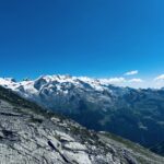
Anello di circa 58 km che tocca i comuni della bassa valle del Cervino. Il percorso è in buona parte molto scorrevole, ma presenta dopo circa 20 km una salita ripidissima. La quota massima è l'oratorio di Gilliarey a 2180 metri.
Avvicinamento
.
Descrizione
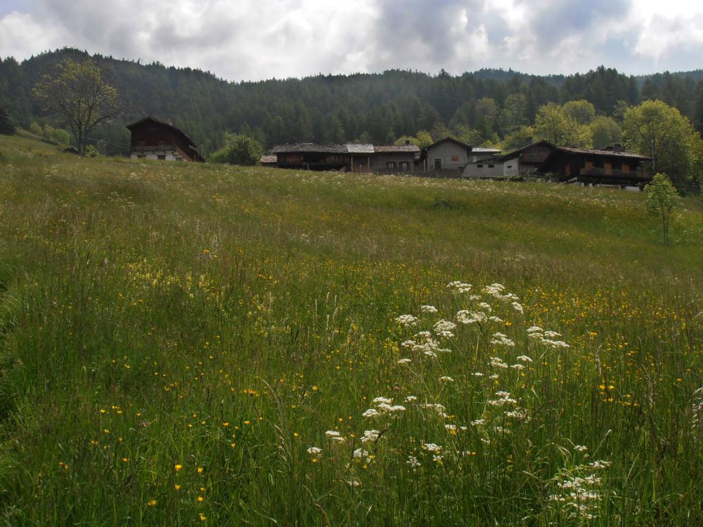
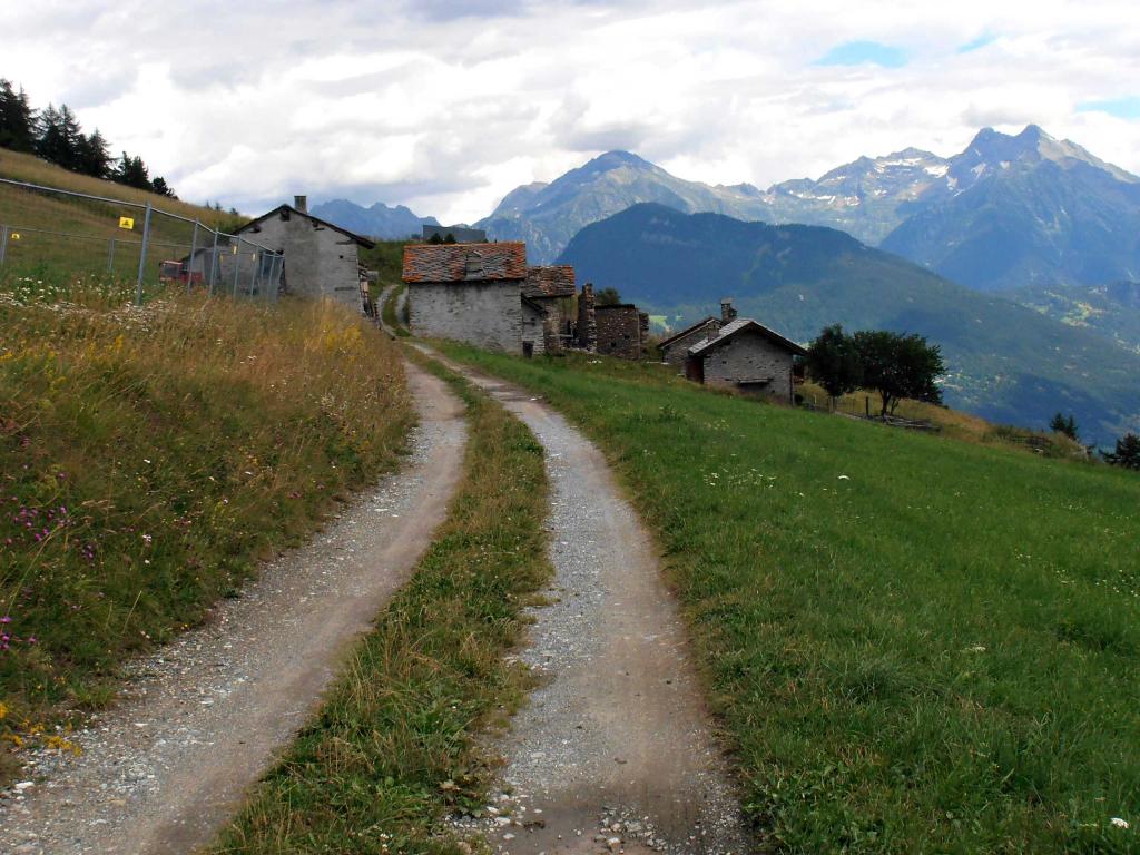
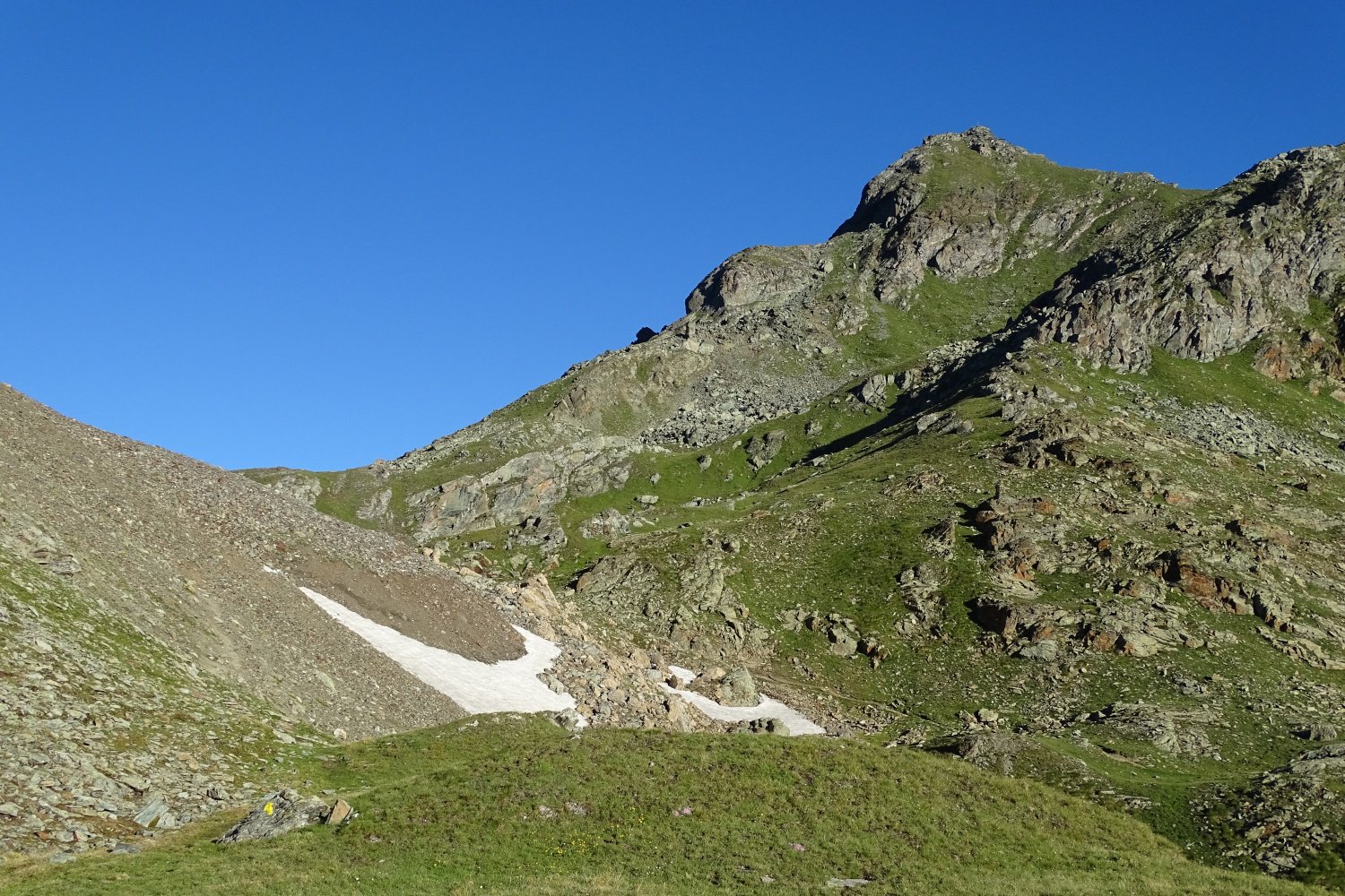
Dal parcheggio delle terme di St.Vincent si scende per 500 metri e si imbocca sulla destra Via Monte Bianco (cartelli segnaletici). Seguendo il piacevole percorso lungo il Ru de Verdetta si giunge nei pressi di Conoz, dove si incrocia il sentiero n°6 che si segue sino a Promiod. Si esce dal villaggio e si prosegue col sentiero n°7 fino a raggiungere La Magdeleine. Si prosegue per un tratto su asfalto seguendo le indicazioni per Chamois, che si raggiunge lungo la pista sterrata. Dalla stazione di arrivo della funivia, si scende a La Ville seguendo le indicazioni per Buisson.Il ripido sentiero con numerosi tornanti conduce a Nuarsaz. Si segue in discesa la regionale della Valtournenche fino a uscire da Buisson. In corrispondenza dell’ultima casa del villaggio a monte della strada, parte il sentiero, subito poco marcato, che in meno di 3 km porta a superare i 1100 metri di dislivello fino all’oratorio di Gilliarey, toccando l’alpeggio sospeso di Levaz.
Da Gilliarey in discesa su Tellinod e poi a sinistra sull’alpeggio di Lo Cré. Da qui si punta al ponticello sottostante per poi risalire brevemente sullo sterrato proveniente da Chantorné. Seguendo le indicazioni si giunge con percorso pressochè pianeggiante all’area picnic. Da qui si prosegue in leggera salita sino al Col les Bornes e da qui a sinistra al Col St.Pantalèon. Si segue a destra la carrozzabile per pochi metri, per prendere poi il sentiero nel bosco fino alla cappella di St.Evence. Poco dopo si va a destra in direzione Semon e dopo un tratto di sterrato si prende a sinistra il sentiero n°2 che conduce alla frazione di Plau. Da qui si segue il sentiero numero 1 che tagliando in più punti la strada asfaltata, scende verso Petit Bruson, Saint Denis e il castello di Cly. Continuando a sinistra si raggiunge poco dopo il villaggio di Orsières. Ancora un breve tratto di discesa e si incrocia il Ru de Chandianaz. Si procede ora fedelemente a fianco del canale irriguo oltrepassando il villaggio di Farys. Giunti in prossimità di Chameran, si continua ancora in piano sulla pista che copre il Ru, qui completamente interrato, sino al suo termine poco sotto Champlong. 500 metri di leggera salita sulla regionale della Valtournenche ci conducono in vista di un ponticello in pietra che ci permette di oltrepassare il Marmore. La sterrata in leggera discesa ci riporta così nei pressi di Conoz, da dove percorrendo a ritroso il percorso fatto al mattino, si ritorna a St.Vincent.
- Cartografia:
- L'escursionista - 13 Valle Centrale
Nelle vicinanze Mappa
Itinerari
08/06/2013 AO, Saint-Vincent D+ 1050 m Sud
Joux (Col de) da Saint Vincent
 0m
0m
02/10/2019 AO, Châtillon D+ 1985 m Sud
Zerbion (Monte) da Domianaz
 850m
850m
07/09/2013 AO, Montjovet D+ 3450 m Tutte
Barbeston (Monte) da Montjovet, giro del parco del Monte Avic
 4.5Km
4.5Km
17/08/2019 AO, Emarese D+ 1400 m Varie
Trail Emarese
 6.4Km
6.4Km
16/10/2025 AO, Brusson D+ 850 m Varie
Comagna (Testa di) da Extrapieraz, anello per Col de Joux ed Emarese
7.3Km
13/07/2024 AO, Extrepiéraz D+ 1750 m Varie
Palasina (Colle di) da Extrapieraz, anello per Mascognaz e Rifugio Arp
 7.3Km
7.3Km
25/08/2011 AO, Brusson D+ 1600 m Varie
Zerbion (Monte) da Extrepieraz, giro
7.3Km
20/07/2024 AO, Brusson D+ 2000 m Varie
Nana (Bec di) o Falconetta da Extrapieraz per il Ru Cortod, anello per il Rifugio Tournalin
 7.3Km
7.3Km
17/07/2016 AO, Ayas D+ 1334 m Sud-Est
Trécare (Becca) da Antagnod
 8.7Km
8.7Km
25/04/2007 AO, Montjovet D+ 1100 m Varie
Comagna (Testa di) dal Col d’Arlaz, anello per i colli Tzecore e de Joux
8.8Km
Servizi
3Km
6.2Km
Nigra Albergo
Montjovet
6.3Km
Da Vincenzo Ristorante
Montjovet
7Km
Lavesè Ristorante
Saint-denis
7.1Km
Lo scoiattolo Ristorante
La Magdeleine
7.9Km
Le petit monde Ristorante
Ayas
8.7Km
Le Solitaire Ristorante
Ayas
9Km
Laghetto Albergo
Brusson
9.3Km
Boule de neige B&B
Antey Saint Andrè
9.3Km