 3.4Km
3.4Km
Note
 50m
50m
50m
50m
50m
50m
3.6Km
3.6Km
5Km
50m
50m
50m
50m
50m
50m
3.6Km
3.6Km
5Km
Gita con dislivello e sviluppo considerevole che percorre sentieri e valloni poco frequentati,la salita poi del Mont Avic dalla cresta Ovest e discesa dalla Est ne fa a mio avviso un percorso completo e di soddisfazione
Avvicinamento
Autostrada Torino-Aosta uscita Nus,seguire indicazione per l'abitato di Fenis e imboccare la strada che conduce nel vallone di Clavalité seguendo la strada che sale per diversi chilometri fino al divieto di transito alle auto dove si parcheggerà l'auto in un ampio parcheggio sterrato 1511m
Descrizione
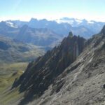
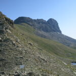
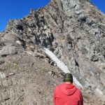
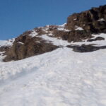
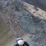
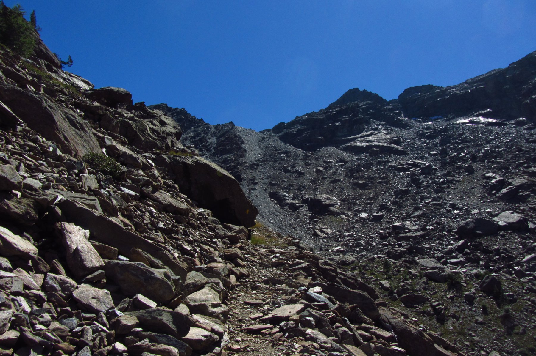
Lasciata l’auto nei pressi del divieto di transito si percorre un tratto di sterrata in piano che di li a poco conduce nel bello e isolato piano di Clavalité.Lo si percorre fino alla località Maisonasse 1533m dove,sulla sinistra diparte il sentiero N3 che conduce al colle De Raye Chevrere 2703m.Il sentiero sale ripido,prima nel bosco poi per prati e arbusti ove in alcuni punti scompare,la vista in lontananza del colle ne indica comunque la via da seguire.Giunti al colle la meta è ben chiara,come lo è la sella che bisognerà raggiungere per prendere la cresta.Scendere dunque per una decina di metri su sentiero,dopodiché abbandonarlo per seguire i numerosi ometti,che dapprima con percorso pianeggiante ci porteranno verso la base del canalone da salire,qui sempre su evidente traccia tra sfasciumi si raggiunge il punto di partenza della cresta Ovest,che con facile arrampicata seguendo i vari ometti ci porterà alla madonna posta sulla cima.
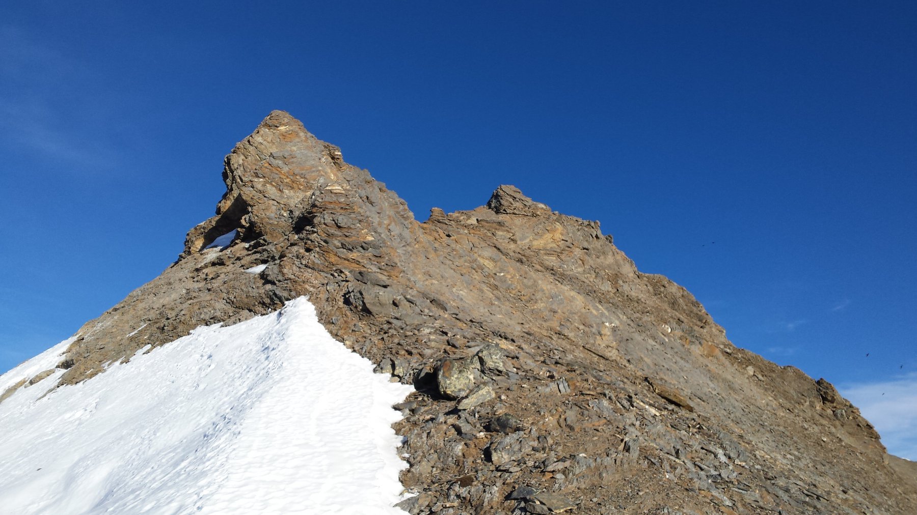
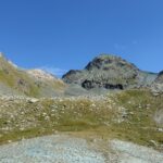
La discesa si svolgerà dunque lungo la cresta Est,ove alcuni tratti attrezzati con cavi metallici e canaponi ne agevoleranno la discesa.Giunti alla base si seguiranno i numerosi ometti che tra pietraie e grossi massi ci porteranno a incrociare a quota 2300 metri circa il sentiero numero 7 per il colle Varotta 2589m che seguiremo fino a quest’ultimo.Dal colle con discesa nel vallone di Ponton,tralasciando,a quota 2152 il sentiero numero 7 per il numero 7A superando un piccolo ricovero di colore verde 2163m già visibile da lontano,fino a raggiungere la deviazione sulla sinistra a quota 2100 circa per il sentiero che ci condurrà al colle di Bella Lanaz 2500m,sentiero che sale su terreno ripido e poco battuto ma ricco di frecce gialle,ove la parte finale è stata attrezzata con corde fisse e scalini.Raggiunto il colle si seguirà in discesa il comodo ed evidente sentiero numero 2B che ci porterà fino alla frazione di Robbioz 1511m e di li all’auto
- Cartografia:
- L'escursionista editore N13 Valle Centrale
Nelle vicinanze Mappa
Itinerari
27/07/2025 AO, Fenis D+ 2000 m PD Sud-Est
Tersiva (Punta) Cresta Sud dalla Val Clavalité
 50m
50m
03/07/2025 AO, Fenis D+ 1600 m F Nord
Avic (Monte) Via Normale dalla Val Clavalitè
 50m
50m
18/06/2022 AO, Fenis D+ 2000 m AD Nord-Est
Tersiva (Punta) Cresta Est da Val Clavalitè
 50m
50m
13/09/2020 AO, Fenis D+ 1700 m PD Varie
Pontonnet (Torre di) Cresta SE dalla Val Clavalitè
 50m
50m
06/06/2021 AO, Fenis D+ 2000 m AD+ Nord-Est
Tersiva (Punta) Parete NE
 50m
50m
27/08/2022 AO, Fenis D+ 1800 m F Varie
Grand Avert dalla Val Clavalité
 50m
50m
19/11/2015 AO, Saint-Marcel D+ 1670 m F Nord
Tessonet (Punta) da Les Druges
 3.6Km
3.6Km
05/08/2025 AO, Saint-Marcel D+ 1306 m F Varie
Grand Avert da Les Druges
 3.6Km
3.6Km
05/09/2016 AO, Fenis D+ 2400 m F Varie
Avic (Mont) da Fenis per la cresta NO
 5Km
5Km
11/09/2016 AO, Chambave D+ 1846 m F Varie
Avic (Mont) da Luxé per la cresta NO
7.1Km