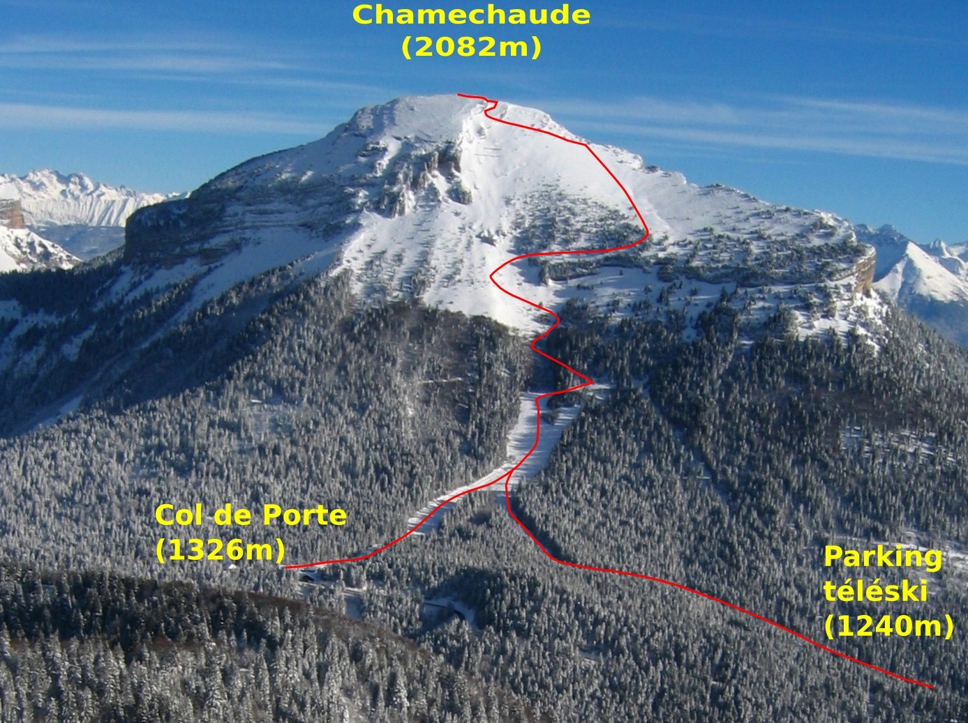
In alternativa, si può anche parcheggiare al Col de Porte, nei pressi del comprensorio di sci nordico e partire da qui, accorciando leggermente la gita.
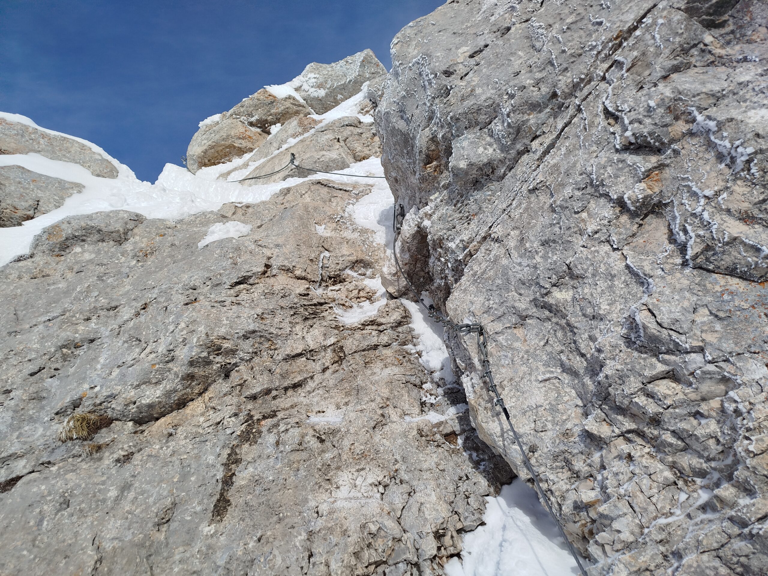
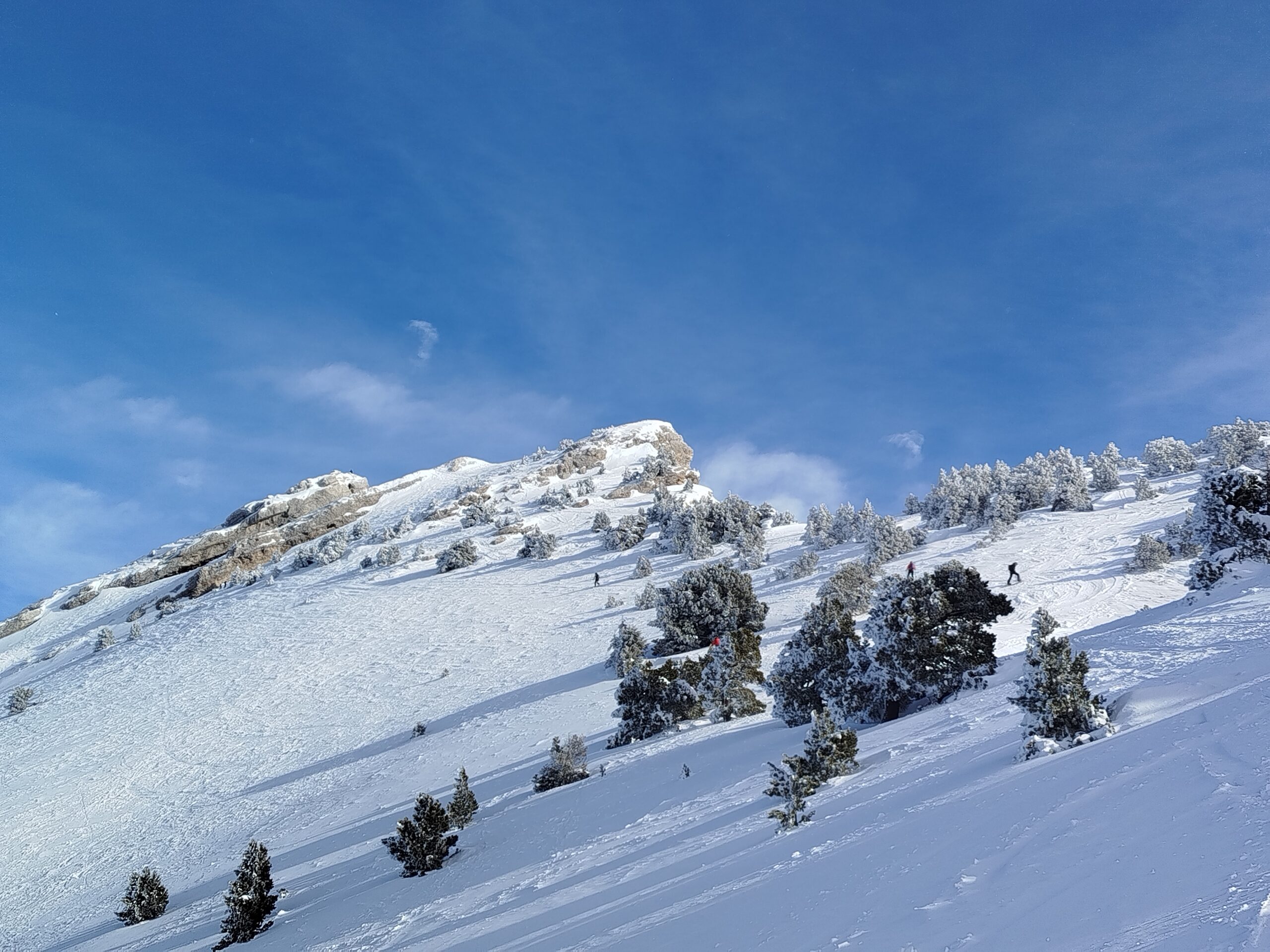
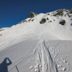
Dal parcheggio, attraversare la strada e risalire sul bordo la pista che accanto alla partenza del vecchio skilift. In alto, la pista gira verso dx e passa vicino all’arrivo di un altro skilift più corto; questo è il punto dove l’itinerario proveniente dal Col de Porte si riunisce a quello qui descritto. Si sale ora su terreno più ripido, fino ad individuare un sentiero che parte ripido nel bosco a sx; si attraversa un bosco di sempreverdi e poi uno più rado fino ad arrivare su terreno più aperto. Si sale in direzione di una roccia dalla forma bizzarra (la Pierre Folatière) e si gira a dx verso il bosco poco prima di raggiungerla. Dopo un breve tratto nel bosco, si perviene sugli ampi pendii aperti sommitali, si raggiunge la cresta e la si segue fino alle rocce di vetta. Si lasciano gli sci e con l’aiuto di un cavo in acciaio si supera una balza rocciosa e si raggiunge la croce di vetta.
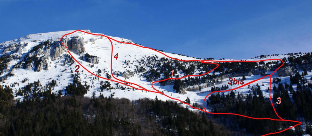
In discesa si hanno diverse opzioni, a parte la discesa normale, le altre linee hanno bisogno di neve sicura:
-l’itinerario percorso in salita, BS;
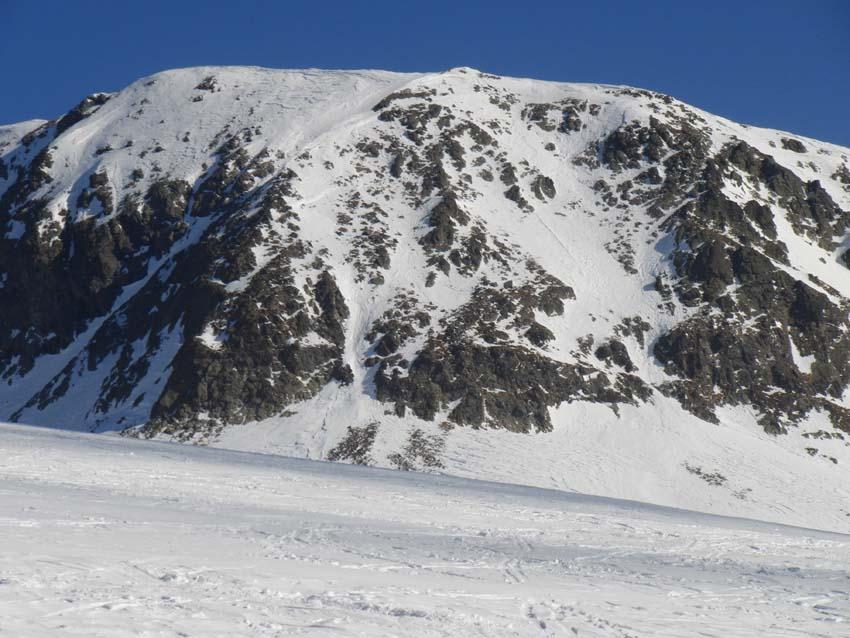
-il Canyon, stretto canale direttamente sotto la cima, breve ma con tratti a 40°, 3.2 S4;
-le Cirque, seguire la cresta verso sud e poi scendere tra le rocce (corda fissa per superare un risalto);
-les Paravalanches, da dove si lasciano gli sci, scendere direttamente verso ovest e passare a sx dei paravalanghe, tratto a 35°, per poi ritrovare l’itineratio di salita nei pressi della Pierre Folatière.
- Cartografia:
- IGN 3334 OT - 1:25.000
Nelle vicinanze Mappa
Itinerari
Charmant Som dal Col de Porte
 100m
100m
Gran Van da Chamrousse
Jasse (Cime de la) da Prabert
Pra (Dent du) da Prabert
 23.3Km
Chamrousse (Croix de) da Chamrousse
 23.3Km
Grand Rocher da La Coche
Taillefer (Le) da Alpe du Grand Serre, per il Pas de la Mine
 29.7Km