7.9Km
7.9Km


Note
 1.2Km
1.2Km
3.5Km
3.6Km
3.6Km
4.6Km
4.9Km
5.1Km
5.1Km
5.2Km
1.2Km
1.2Km
3.5Km
3.6Km
3.6Km
4.6Km
4.9Km
5.1Km
5.1Km
5.2Km
Utili i ramponi
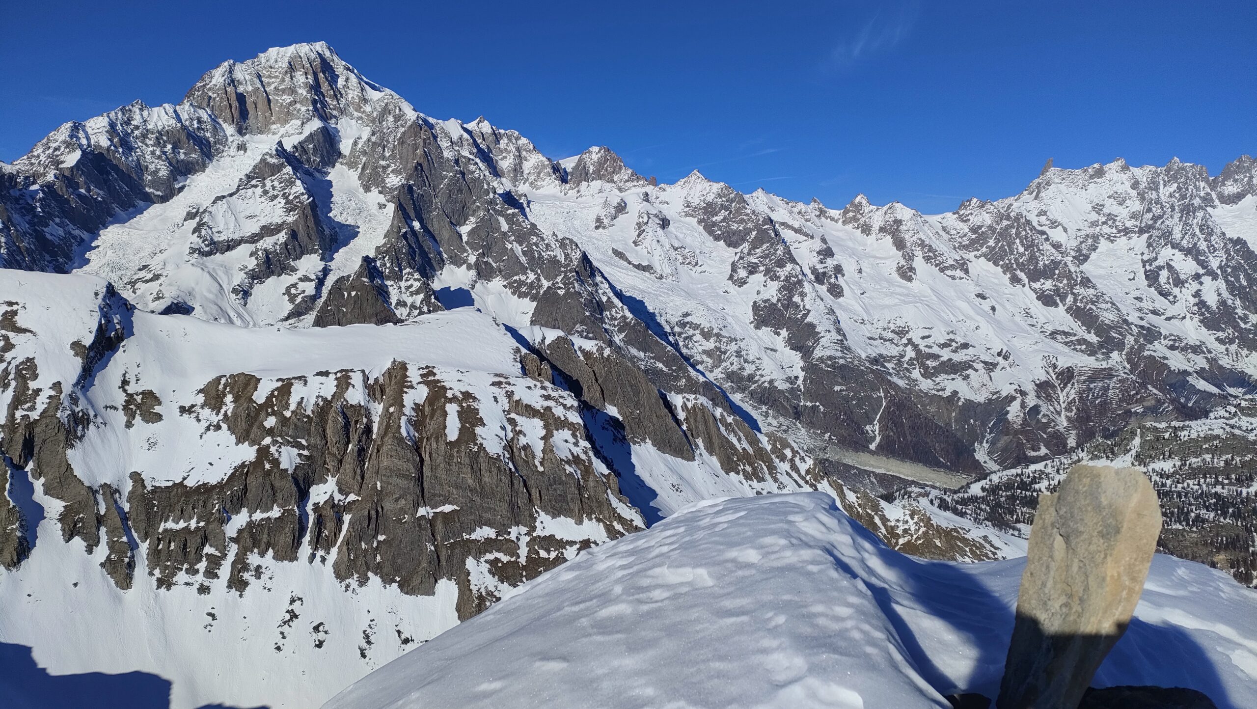
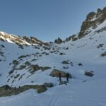
Avvicinamento
Da Pré-Saint-Didier seguire la strada regionale che sale a La Thuile. Nel rettilineo che segue i tornanti e le gallerie, prendere il bivio a Dx che in breve porta alla frazione di Elevaz.
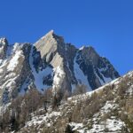
Descrizione
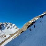
Dopo aver lasciato l’auto nella piccola frazione di Elevaz, se l’innevamento lo consente, invece di seguire la strada poderale, si può tagliare per prati per prendere quota.
Quando la strada traversa a destra, seguirla fino alle baite di Combemby.
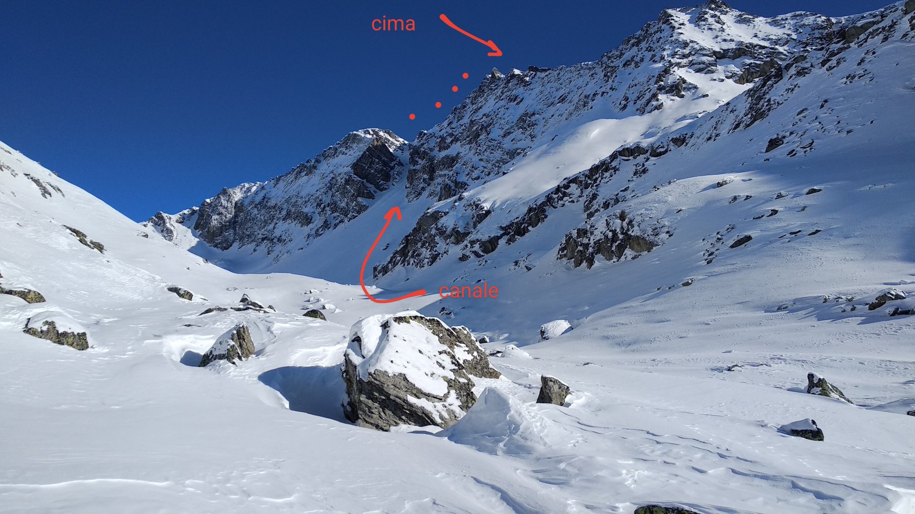
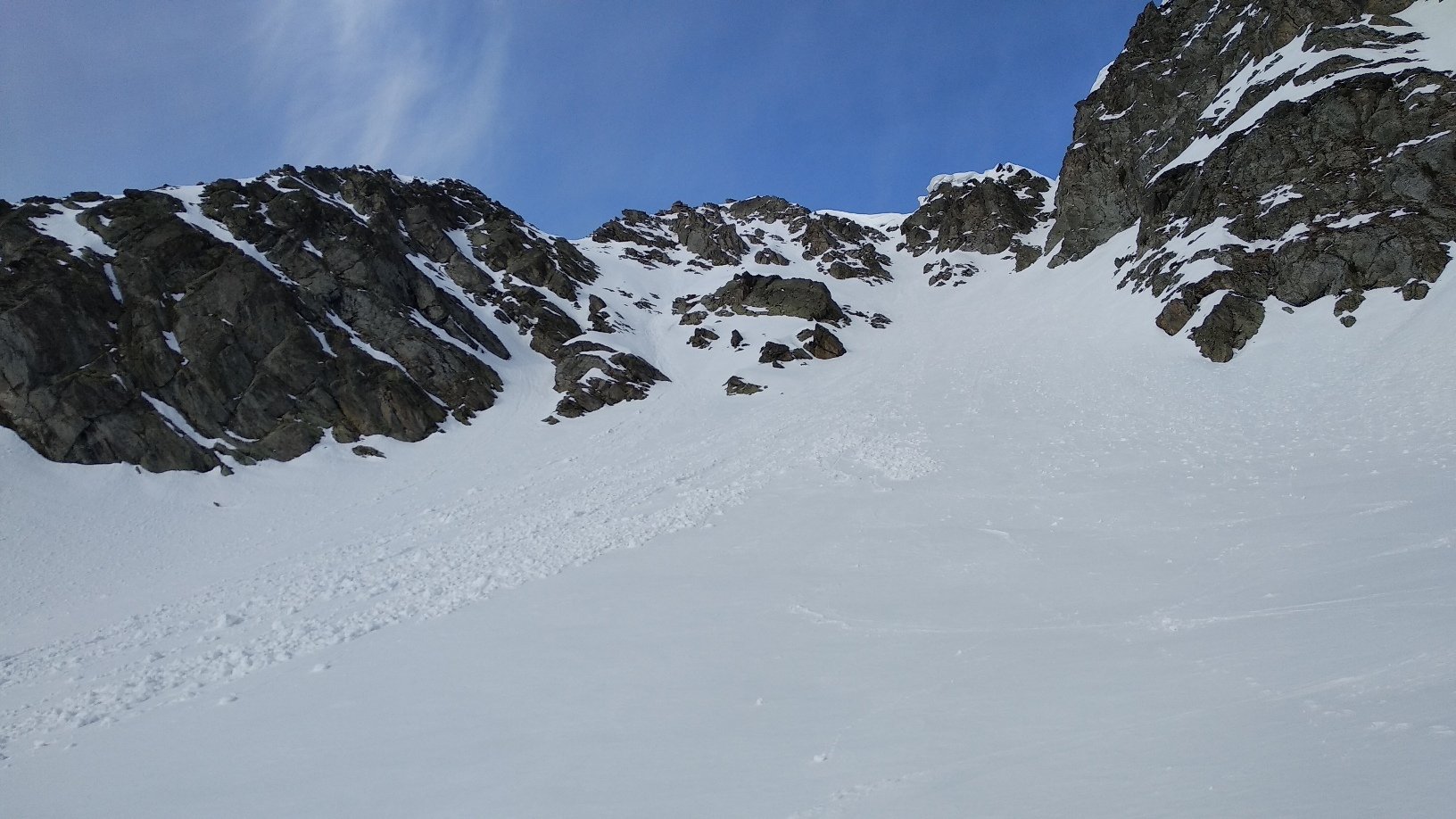
Da qui, si salgono gli ampi pratoni ripidi fino a quota 2000. Si devia ora a sx e si sbarca nel pianoro di Plan Praz.
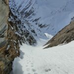
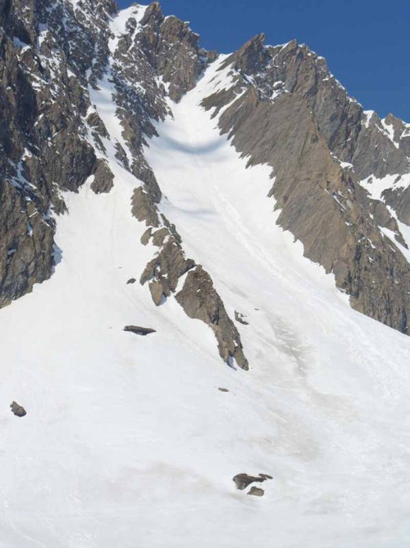
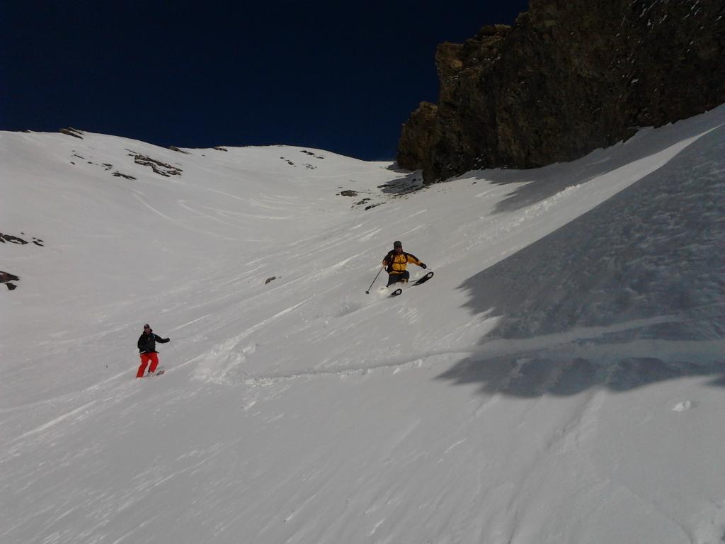
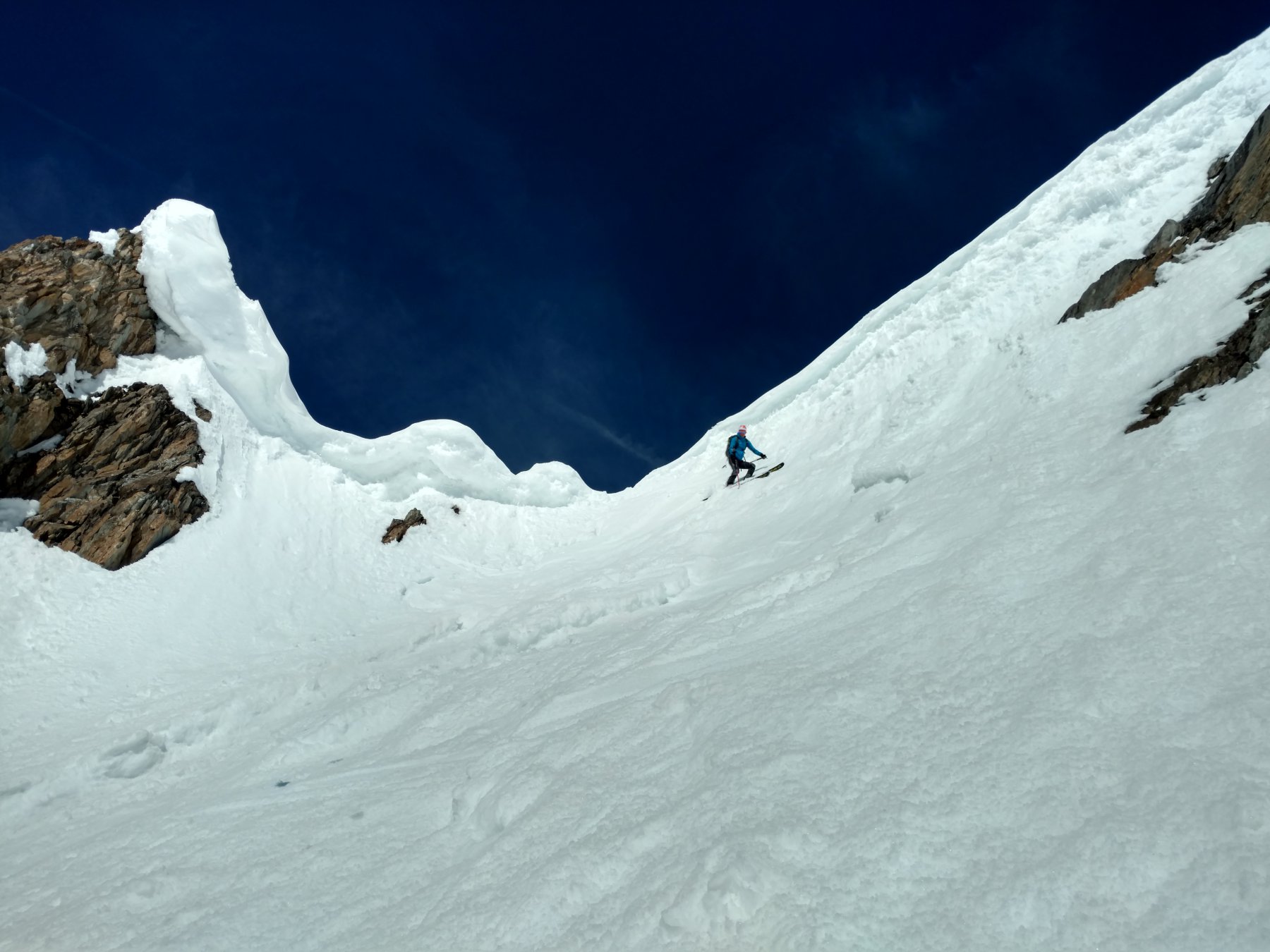
Si segue il fondo del vallone fin quasi al suo fondo. Un canale via via più ripido conduce direttamente alla vetta.
Nelle vicinanze Mappa
Itinerari
22/01/2022 AO, La Thuile D+ 1538 m II, 4.3, E2 Nord-Est
Belleface (Mont, punta sud) Canale NE
 1.2Km
1.2Km
15/12/2025 AO, La Thuile D+ 1430 m II, 3.3, E1 Varie
Vieux (Tete de) cresta Tete de l’Ane quota 2747 m Canale del Buco da La Balme
 1.2Km
1.2Km
04/06/2008 AO, Pré-Saint-Didier D+ 1600 m 4.2, E3 Nord
Vieux (Tete de) Canale dx – Couloir delle Placche
 3.5Km
3.5Km
16/02/2025 AO, La Thuile D+ 1105 m II, 4.1, E1 Sud-Ovest
Belleface (Mont, punta sud) Canale SO
 3.6Km
3.6Km
03/04/2026 AO, Pré-Saint-Didier D+ 1676 m III, 5.1, E3 Nord-Est
Vieux (Tete de) Canale centrale
 3.6Km
3.6Km
18/01/2020 AO, La Thuile D+ 1540 m III, 4.1, E2 Ovest
Lussè (Mont) Canale Ovest
 4.6Km
4.6Km
22/02/2025 AO, Courmayeur D+ 1400 m III, 4.1, E1 Nord
Crammont (Mont) Canale Nord
 4.9Km
4.9Km
19/03/2026 AO, La Thuile D+ 1650 m II, 4.1, E1 Sud-Est
Berrio Blanc (Mont) Versante SE
 5.1Km
5.1Km
06/02/2023 AO, Morgex D+ 1000 m 4.1, E2 Ovest
Tereza (Passage de) da Arpy
 5.1Km
5.1Km
07/05/2019 AO, Morgex D+ 1160 m I, 4.1, E2 Ovest
Pouegnenta o Pougnenta (Becca) Couloir Ovest
 5.2Km
5.2Km