 2.6Km
2.6Km
Note
 50m
3.9Km
4.3Km
4.3Km
4.7Km
5.3Km
6.1Km
6.1Km
50m
3.9Km
4.3Km
4.3Km
4.7Km
5.3Km
6.1Km
6.1Km
2.6Km
2.7Km
3.2Km
3.5Km
3.9Km
4.8Km
5.9Km
6.1Km
6.4Km
6.4Km
Salita molto faticosa e ripida da fare in gran parte in portage in ambiente selvaggio d'alta quota, ci sono dei brevi tratti di facile, ma da affrontare con la massima cautela in quanto fortemente esposti, arrampicata di cui il più impegnativo attrezzato con scalini e mancorrente di corda.
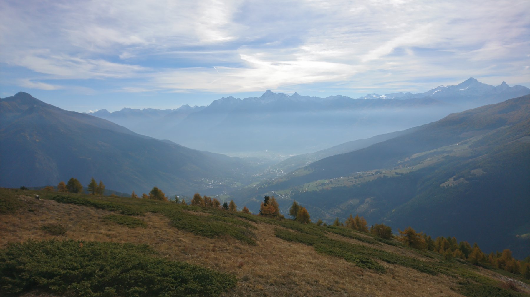
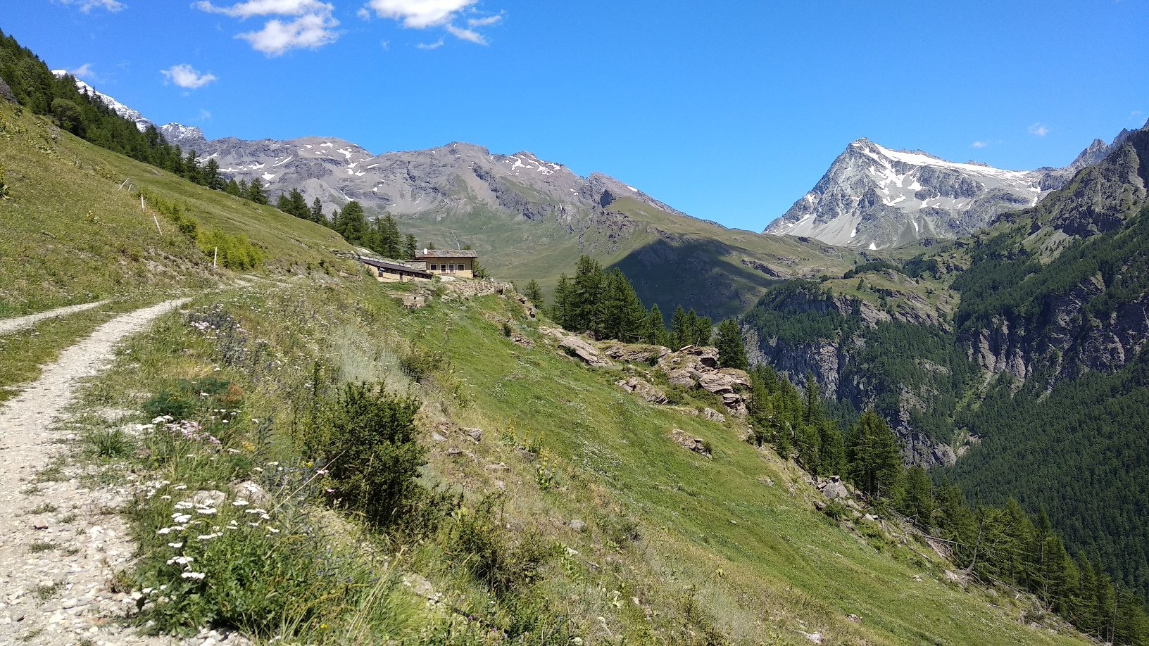
Il plateau sommitale è molto selvaggio e la vetta offre un panorama notevole su Gran Combin e montagne circostanti.
La discesa è una serie infinita di tornanti di ogni difficoltà che impegnano parecchio e in maniera costante; difficoltà in prevalenza S3-S4.
Avvicinamento
Il plateau sommitale è molto selvaggio e la vetta offre un panorama notevole su Gran Combin e montagne circostanti.
La discesa è una serie infinita di tornanti di ogni difficoltà che impegnano parecchio e in maniera costante; difficoltà in prevalenza S3-S4.
Da Doues salire a Plan Debat.
Descrizione
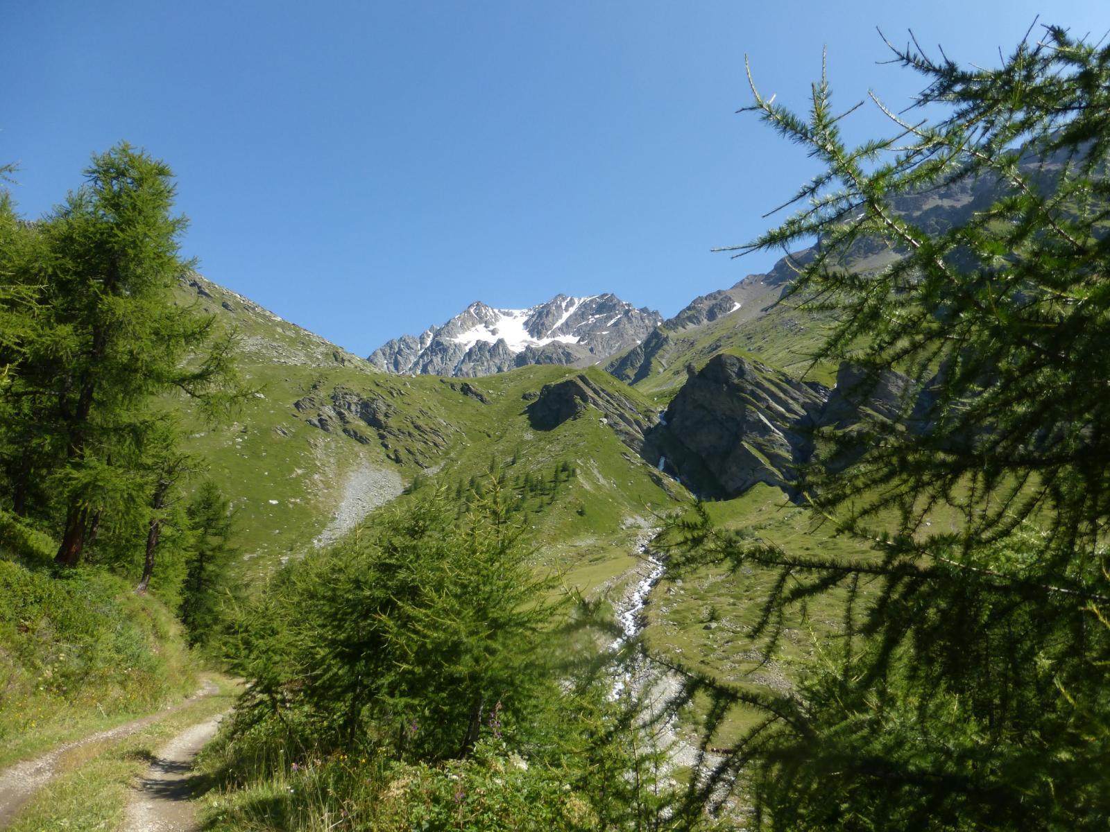
Da Plan Debat proseguire brevemente lungo la sterrata per il Rifugio Champillon per abbandonarla subito in favore del Ru de By (segnavia TDC) che taglia a mezzacosta tutto il vallone.
Seguire fedelmente il tracciato del corso d’acqua che presenta una serie di suggestivi passaggi tra cui uno stretto buco nella roccia dove alcune bici faticheranno a passare per intero senza togliere le ruote!
Dopo circa 45′ di percorso in prossimità di un incrocio con una sterrata a quota 2170mt. si può decidere se scendere lungo la stessa (direzione A.Porchere) e una volta giunti sulla principale svoltare a sx oppure proseguire fino ad incrociare un tecnico sentiero sulla destra che si segue fino nella conca sottostante.
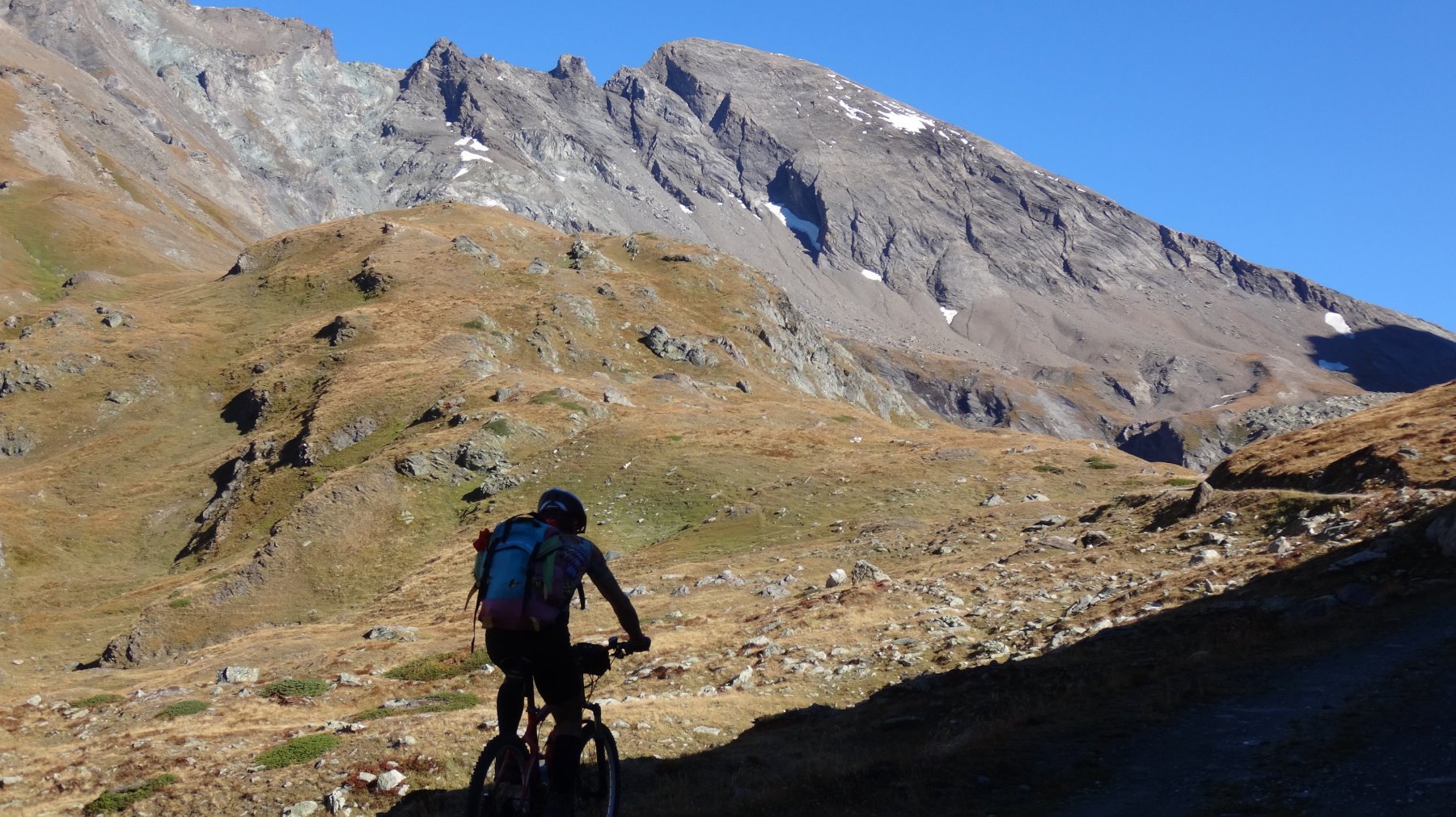
Con entrambe le soluzioni si giunge a quota 2070 circa dove si deve svoltare a sinistra in direzione Tza dell’Alpe Comune; si segue lo sterrato restando ancora in sella fino a quota 2200 circa dove comincia il lungo e faticoso portage.
Si transita di fianco la Tza e si prosegue lungo il ripido pendio soprastante (segnavia 4).
Si giunge nei pressi di una barriera rocciosa dove il tratto più impegnativo è attrezzato con scalini e corda (5mt in tutto, tenendo bene la bike sulla spalla sx si sale senza problemi); occorre prestare molta attenzione invece alle placche con detriti poste nel tratto appena prima di quello attrezzato.
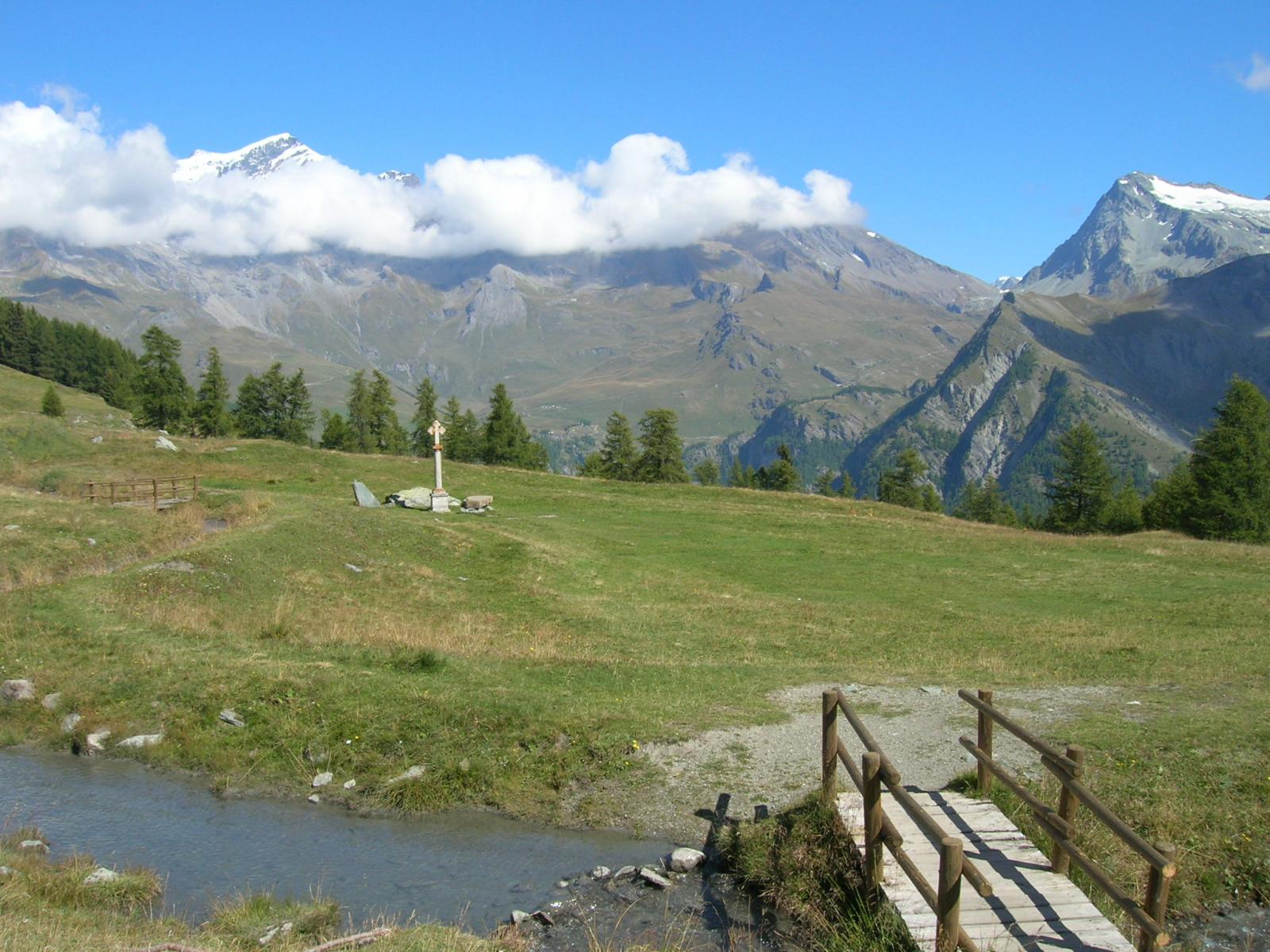
Usciti dal tratto ostico si riprende il sentiero fino al Rif. Chiarella all’Amianthe e si prosegue fino contro una seconda barriera rocciosa: occorre uscire sullo spigolo di destra affrontando un breve, ma molto delicato ed esposto, passo di arrampicata.
A questo punto siamo sul Plateau sommitale dove una lunga serpentina ci porta alla ripida parete finale e alla panoramica vetta.
DISCESA:
Partenza facile on-bike, sequenza di bei tornanti (da S2 a S4) fino alla fascia rocciosa dove alcuni tratti NC ci costringono a scendere più volte dalla bici.
Superata questa parte inizia il vero divertimento..lunghi tratti scorrevoli (S2) vengono alternati da altri più impegnativi a tornanti (S3-S4) fino al delicato spigolo con passo di arrampicata.
Tornati in sella si supera un primo tratto fortemente esposto (S2-S3) per poi continuare su terreno più semplice e divertente fino al tratto attrezzato (S2, tratti S3).
Superato anche questo tratto e la placconata alla sua base inizia la parte più continua ed interessante della discesa: una serie infinita di tornanti di ogni difficoltà e fattezza..scavati, con ostacoli, stretti..le difficoltà sono sempre costanti ed elevate (S3-S4)
Tornati sullo sterrato inerbito, a quota 2170 circa sulla nostra destra parte il sentiero 4 che ci permette di raggiungere la strada principale.
A questo punto le fatiche non sono ancora finite perchè si deve tornare alla macchina; ci sono circa 200mt di dislivello da fare in salita e svariati km.
Si può scegliere se percorrere il Ru de By oppure seguire la strada principale.
Nelle vicinanze Mappa
Itinerari
22/10/2017 AO, Doues D+ 1000 m MC, BC+, S1 Sud
Durand (Fenetre) e Conca di By da Champillon, giro
 50m
50m
16/07/2023 AO, Ollomont D+ 1935 m BC, OC+, S3 Sud-Est
Avril (Mont) da Glassier per la Fenetre Durand
 3.9Km
3.9Km
09/08/2016 AO, Allein D+ 1325 m TC+, MC+, S2 Sud
Menouve (Col Nord de) da Allein per il Ru de Menouve
 4.3Km
4.3Km
31/08/2019 AO, Allein D+ 1543 m BC, BC+, S2 Sud
Champillon (Col) da Allein, giro per il Ru de Menouve
 4.3Km
4.3Km
17/07/2018 AO, Valpelline D+ 1900 m MC, OC, S3 Tutte
Regondi-Gavazzi (Bivacco) da Valpelline, giro per la conca di By e i laghi Baseya, Leita e Clusa
4.7Km
07/07/2019 AO, Valpelline D+ 1600 m MC, OC, S3 Varie
By (Conca di) e Alpe Thoules da Valpelline, giro con discesa Glacier
 4.7Km
4.7Km
05/07/2024 AO, Doues D+ 1200 m BC+, MC, S1 Varie
Ru de By e Ru du Mont da Doues, giro
 5.3Km
5.3Km
11/06/2023 AO, Etroubles D+ 600 m TC, BC, S2 Sud
Barasson (Alpe) da Etroubles
 6.1Km
6.1Km
01/09/2022 AO, Etroubles D+ 1000 m MC+, BC+, S2 Varie
Bois de Quart (Téte de) da Etroubles, giro del Vallone Flassin
 6.1Km
6.1Km
15/10/2025 AO, Gignod D+ 1068 m BC, BC, S2 Tutte
Tardiva (Costa) da Buthier, giro per il rifugio Chaligne
6.1Km
Servizi
2.6Km
2.7Km
Vecchia Miniera Rifugio
Ollomont
3.2Km
Rustic Chalet de Nos Ristorante
Glacier
3.5Km
Le Vieux Alpage Ristorante
Doues
3.9Km
Chiarella – Amiante Rifugio
Ollomont 4.8Km
4.8Km
Compagnie des Guides de la Valpelline et du Gran Saint Bernard Professionisti
Aosta
5.9Km
Lievre Amoureux Albergo
Valpelline 6.1Km
6.1Km
Flavio Mario Dalle Professionisti
Etroubles 6.4Km
6.4Km
Echevennoz Posto Tappa Rifugio
Etroubles 6.4Km
6.4Km