3.2Km
3.2Km
Note
 50m
750m
2Km
2.2Km
2.2Km
2.2Km
2.2Km
2.2Km
2.2Km
50m
750m
2Km
2.2Km
2.2Km
2.2Km
2.2Km
2.2Km
2.2Km
3.2Km
3.2Km
3.2Km
3.3Km
4.4Km
5.3Km
5.8Km
6.5Km
7.3Km
7.9Km
Percorso alternativo alla classica salita alla Punta Gardiol, che consente di toccare tutte le elevazioni secondarie che costituiscono la lunga dorsale est che ha origine dalla cima. Non ci sono difficoltà di rilievo ma svolgendosi al di fuori dei sentieri segnalati, è richiesta buona visibilità ed un po' di "fiuto", seppur camminando quasi sempre su antichi sentieri/mulattiere militari ormai dimenticati.
Volendo abbreviare il percorso, si può iniziare l’escursione direttamente a Prà Claud raggiungendo il Colletto Rosso. Si risparmiano circa 250 m di dislivello.
Avvicinamento
Volendo abbreviare il percorso, si può iniziare l’escursione direttamente a Prà Claud raggiungendo il Colletto Rosso. Si risparmiano circa 250 m di dislivello.
Da Oulx, seguendo la SS24 del Monginevro. Raggiunto il bivio per Fenils (semaforo), scendere a destra attraversando il ponte sulla Ripa, e posteggiare successivamente nel parcheggio all'ingresso della frazione.
Descrizione
Dopo il posteggio, all’altezza della prima via sulla destra tra le prime case si incontrano i cartelli segnaletici per il Colletto Rosso e Colletto Grigio e Desertes. Si segue la stradina che diventa sterrata, alternandola eventualmente con il sentiero scorciatoia abbastanza ripido su fondo sassoso.
Si raggiunge abbastanza velocemente il Colletto Grigio 1566 m; proseguire in leggera discesa sul versante boscoso a nord, ignorando però la sterrata che si stacca a destra e che porta alla borgata Desertes, raggiungendo invece con una breve ma ripida salita il Colletto Rosso 1616 m, sempre su strada militare. Qui, proseguendo sul costone boscoso a sinistra in pochi attimi si tocca la prima elevazione del percorso (facoltativa), il Monte Finet 1625 m.
Dal colletto, senza scendere alle baite sottostanti sul versante di Fenils, si deve intercettare una traccia, inizialmente non molto visibile, che si mantiene sul versante sud aggirando le pendici del Monte Pessiol. Via via il sentiero militare assume una connotazione più evidente, e con un panoramico traverso ascendente, raggiunge una sella boscosa 1442 m ad ovest del Monte Pessiol. Se si vuol salire la cima boscosa, in pochi per comodi prati la si raggiunge 1776 m. Da notare la presenza di una trincea che costeggia tutto il perimetro della montagna sul lato nord-ovest.
Dalla selletta si incontra a breve distanza una palina segnaletica, indicante con evidente errore il Monte Pessiol e poi (correttamente) il percorso di collegamento con la militare dello Chaberton.
Si prosegue lungo il sentiero nel fianco boscoso in leggera discesa, che aggira dal basso il ripido versante della Cima Curran. Non sono presenti segnavia ma il percorso è evidente.
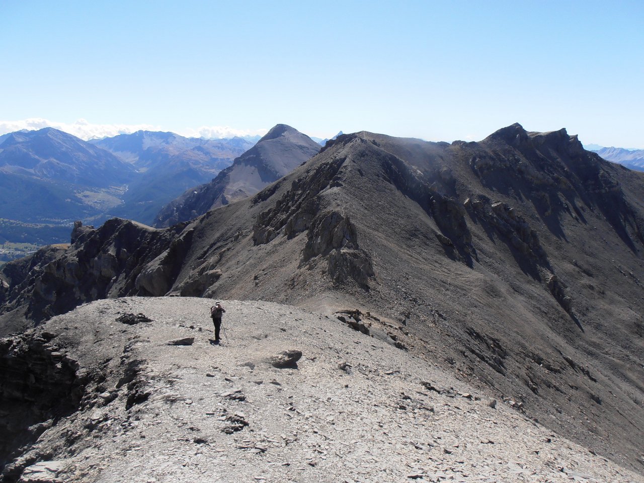
Dopo un lungo traverso si arriva ad una sorgente (possibile non attiva nel periodo estivo) contraddistinta da un tombino e da un tubo di plastica, qui occorre abbandonare la mulattiera finora seguita, per salire il ripido ma facile pendio boscoso che adduce alla Cima Curran. Il percorso non è mai obbligato, si raggiunge un primo ripiano erboso che si lascia a destra, poi successivamente un secondo che si attraversa per puntare ad una depressione sulla dorsale sovrastante. Raggiuntala, tornando brevemente verso est si tocca la Cima Curran 2014 m.
A questo punto si potrebbe percorrere già integralmente la dorsale est per la Cima Gardiol, ma la presenza di un breve salto roccioso lo sconsiglia. Per cui si fa ritorno al primo pianoro che si incontra, circa 30 m sotto la dorsale, dove si dovrà individuare una traccia di sentiero piuttosto evidente, sempre sul versante sud della montagna, che riprende a salire mantenendosi a mezza costa. Ogni tanto si fa un po’ fatica a seguire il percorso, tuttavia non ci sono punti problematici. Si raggiunge una zona con alcune altre sorgenti, ancora nel fitto bosco, prima di raggiungere un vasto pianoro erboso adibito a pascolo, con in vista già la croce di Cima Gardiol.
Ora, proprio all’inizio del ripiano, sulla destra una vecchia mulattiera inerbita sale lungo il crinale con numerose giravolte, per portarsi sulla dorsale est poco più sopra.
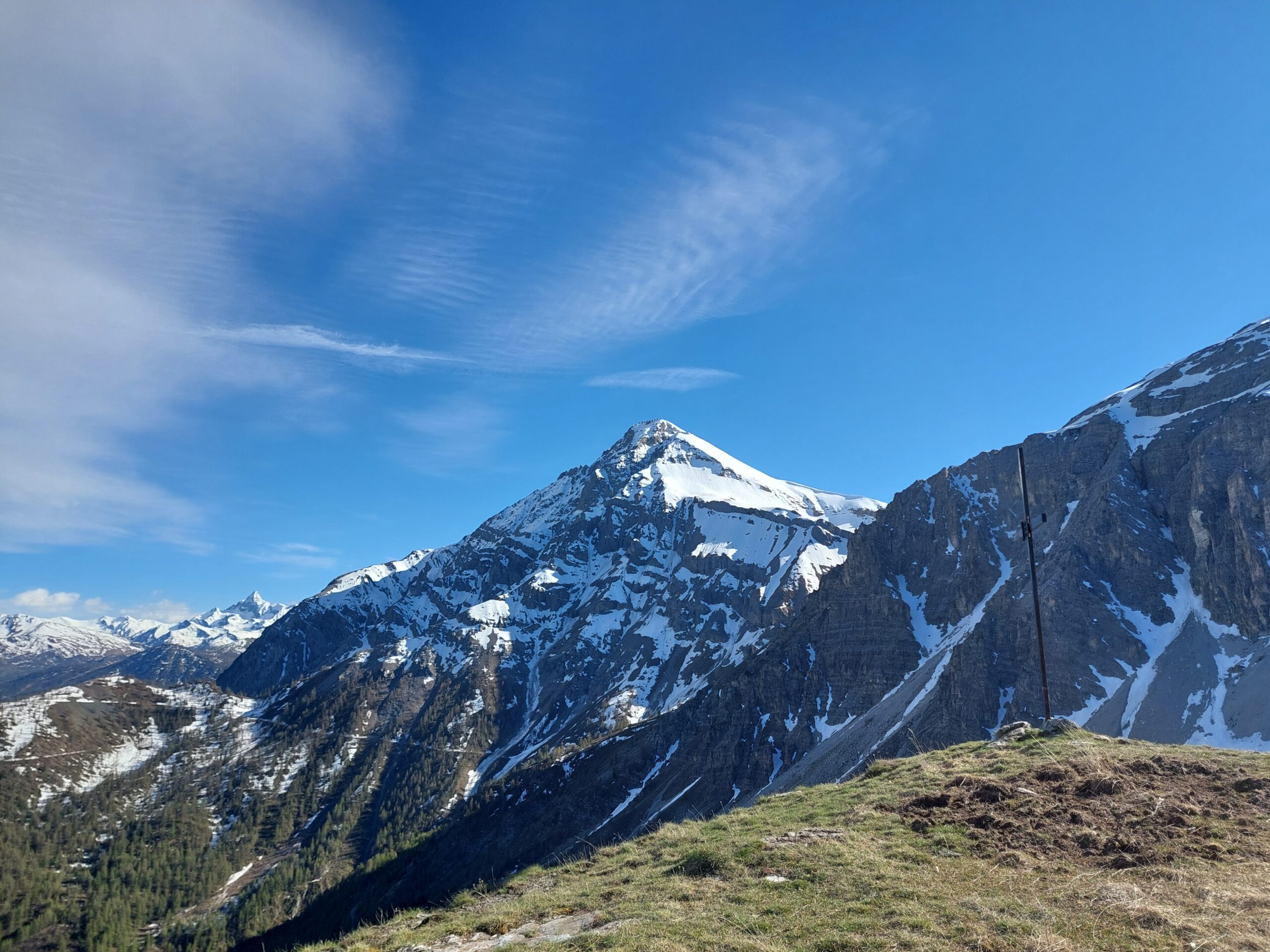
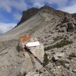
Ora non resta che seguire la traccia di sentiero, che dopo un breve passaggio sul versante nord per aggirare un modesto ostacolo, seguirà fedelmente il crinale spartiacque con il Vallone di Desertes. Gli ultimi 50 m di salita su terreno detritico sono un po’ più ripidi ma privi di difficoltà. Si tocca così la Croce Faure posta in cima 2340 m.
Per la discesa ci sono due possibilità (oltre ovviamente al ritorno dal percorso dell’andata), che consentono di percorrere un giro ad anello.
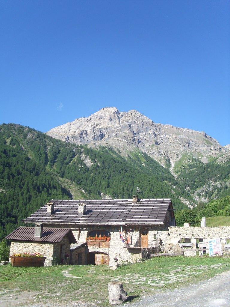
1-Dalla Cima Gardiol si scende al colletto del Lago, non lontano dal piccolo Lago di Desertes, quindi seguendo sulla sinistra un comodo sentiero si scende verso Prà Claud intercettando la strada militare dello Chaberton a quota 1900 m circa. Seguendone il tracciato in discesa, e le scorciatoie dove possibile, si raggiunge la borgata Prà Claud 1595 m, e da questa si fa rientro a Fenils.
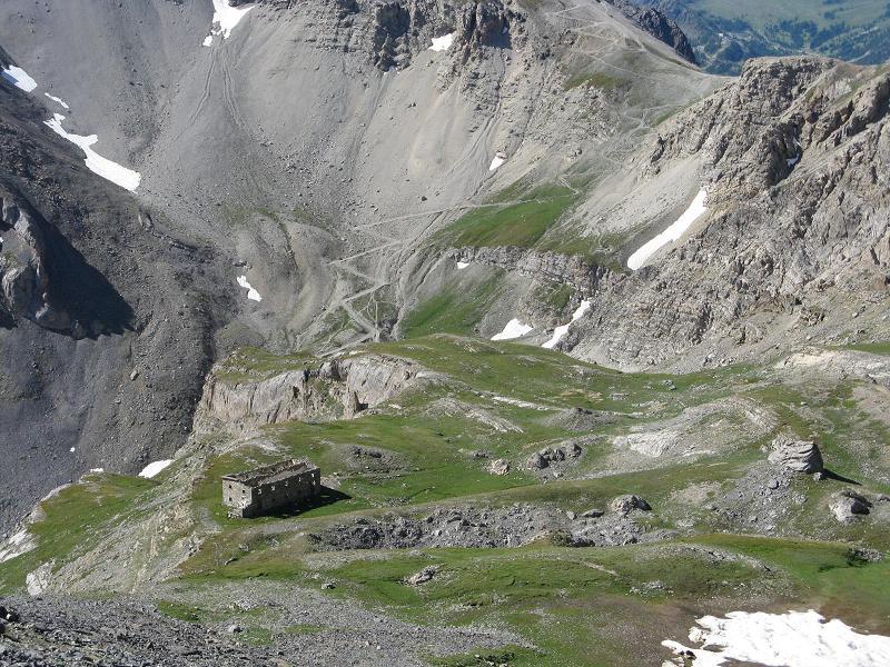
2- Dal Colletto del Lago si scende nel versante di Desertes raggiungendo il tracciato militare Cotolivier-Passo di Desertes in prossimità di un ricovero militare (ricovero Rochette). Scendere verso destra. Poco dopo il bivio per la Croce di San Giuseppe (visibile in alto a sinistra, prendere un sentiero militare che scende a destra (indicazione Desertes, Fenils), trascurando un sentiero che parte a sinistra a mezza costa, fino ad una caserma diroccata (ricovero Plan la Selle).
Qui il sentiero non è segnato ed è inizialmente poco evidente ma attraversa il prato a sinistra della caserma parallele al torrente. Diventa poi molto evidente fino a Grange Millaures da dove si scende per sterrata e poi sentiero fino al paesino di Desertes. All’inizio del paese prendere a destra il sentiero balcone dell’alta Valsusa (indicazione Colletto Grigio, Fenils). Arrivati ad una sterrata che sale da Fenils, si gira a destra, direzione Colletto Rosso.
Poco dopo il colletto, si passa in mezzo ad un gruppetto di case per imboccare a destra il sentiero di ritorno a Prà Claud.
Nelle vicinanze Mappa
Itinerari
13/11/2021 TO, Cesana Torinese D+ 353 m T Sud-Est
Rosso (Colletto) e Colletto Grigio da Fenils, anello per Prà Claud
 50m
50m
23/08/2025 TO, Cesana torinese D+ 625 m E Nord-Ovest
Autagne (Alpeggio) da Solomiac, anello per Colombiere e Mollieres
 750m
750m
10/07/2019 TO, Oulx D+ 1191 m EE Est
Lago (Rocca del) da Desertes per il Passo di Desertes
 2Km
2Km
23/08/2024 TO, Cesana Torinese D+ 1500 m EE Sud
Chalanche Ronde (Pointe de) da Prà Claud
 2.2Km
2.2Km
12/07/2017 TO, Cesana Torinese D+ 1530 m E Nord-Est
Chaberton (Monte) da Prà Claud
 2.2Km
2.2Km
25/07/2009 TO, Cesana Torinese D+ 1474 m EE Sud-Est
Rochers Charniers (Pointe des) da Prà Claud e il Pian del Morti
 2.2Km
2.2Km
21/10/2012 TO, Cesana Torinese D+ 700 m E Varie
Nera (Cresta) da Prà Claud
2.2Km
09/06/2026 TO, Cesana Torinese D+ 751 m E Sud-Est
Gardiol (Punta) da Prà Claud, anello per Desertes
 2.2Km
2.2Km
14/07/2021 TO, Cesana Torinese D+ 1293 m EE Sud-Est
Clotesse (Punta) da Pra Claud per il Passo Desertes
 2.2Km
2.2Km
30/09/2018 TO, Cesana Torinese D+ 1200 m E Varie
Vallonetto (Croce del) da Pra Claud
 2.2Km
2.2Km
Servizi
3.2Km
3.2Km
L’Ibarus Rifugio
Cesana Torinese
3.2Km
Piergiorgio Frassati B&B
Cesana Torinese
3.3Km
Casa Cesana Bar
Cesana Torinese
4.4Km
La Chardouse Rifugio
Oulx
5.3Km
La Moretta Ristorante
Oulx
5.8Km
Centro Ristorante
Cesana Torinese
6.5Km
L’Eitabl Ristorante
Oulx
7.3Km
La Fontana del Thures Rifugio
Cesana Torinese
7.9Km