4.6Km
4.6Km
Note
 50m
50m
50m
50m
50m
50m
50m
1.6Km
1.6Km
50m
50m
50m
50m
50m
50m
50m
1.6Km
1.6Km
4.6Km
4.6Km
4.6Km
4.7Km
4.7Km
4.9Km
4.9Km
6.4Km
7.1Km
7.2Km
La cima Orientale della Leitosa è l'unica raggiungibile senza arrampicare offrendo una bella ed impegnativa escursione, sempre su terreno ripido ed una panoramica cresta finale. Sconsigliata con terreno umido, gelato o scarsa visibilità.
Avvicinamento
Da Lanzo Torinese ad Ala di Stura ed a Mondrone
Descrizione
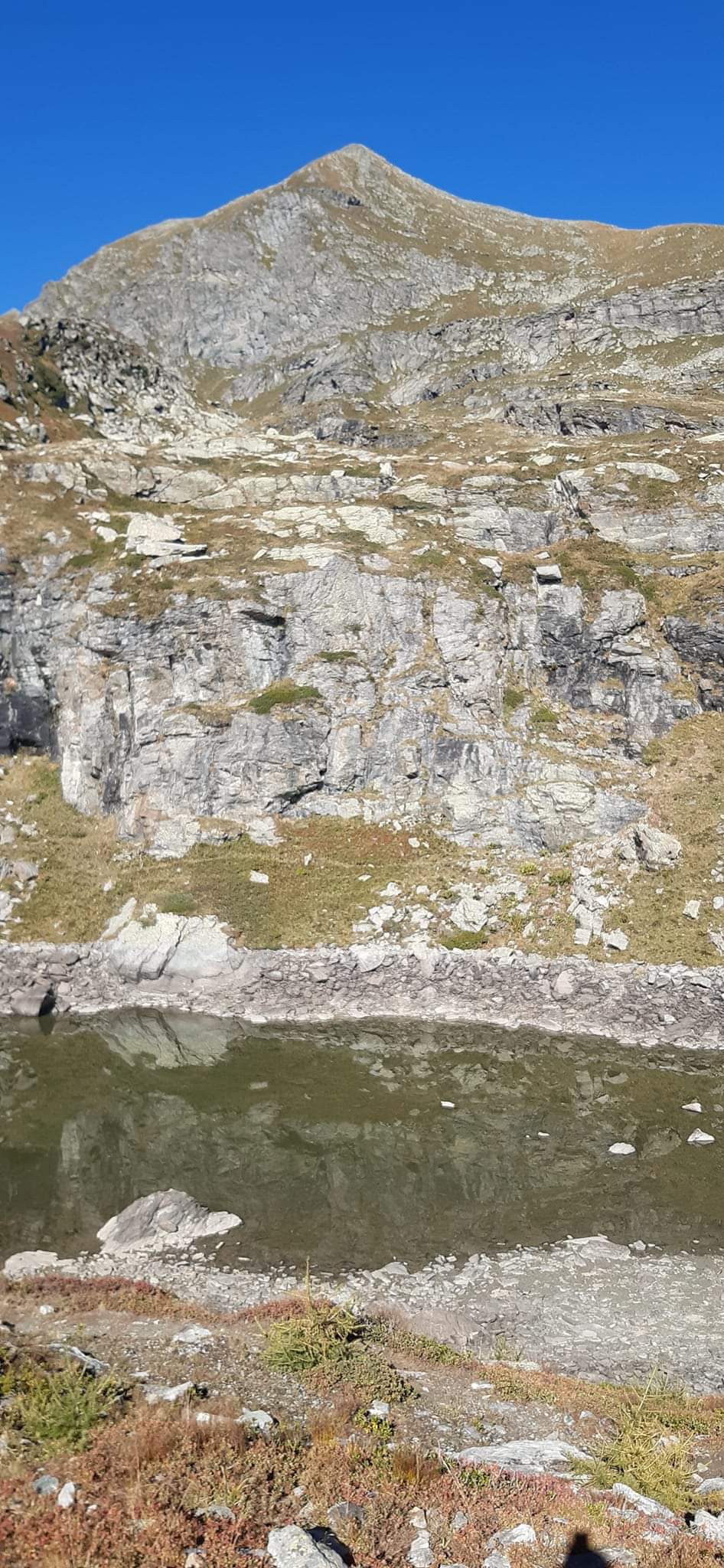
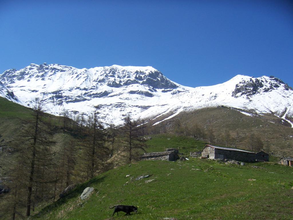
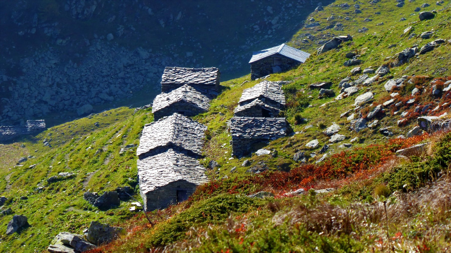
Da Mondrone, ampio park nella piazzetta della chiesa, seguire il sentiero 234 per il Lago Vasuero ed il Colle del Trione. Giunti al lago, si ha una bella visione della quasi perfetta piramide della cima con la cresta Est contro il cielo che si salirà. Continuare sul sentiero per il colle fino ad un pianoro dal quale si vede bene sulla sx, un dosso erboso a dx di una valletta. Lasciare quindi il sentiero in corrispondenza di un ometto ed agevolmente raggiungere la base del dosso per risalirlo su una traccia di sentiero, alcuni ometti presenti. Al sommo del dosso, stare nella valletta per evitare un traverso alto verso Ovest fino alla base di un ripido pendio erboso da risalire, ometti, che dà accesso all’unico passaggio agevole ma esposto per i ripidi pendii erbosi sopra la lunga e caratteristica fascia rocciosa. Al di sopra del passaggio, compiere un lungo traverso ascendente fino a raggiungere la visibile cresta Est, ometti, attenzione con terreno umido o gelato. Seguire ora la facile cresta, prima erbosa poi su pietraia stabile uscendo direttamente all’ometto di vetta.
- Cartografia:
- Valli di Lanzo e Moncenisio
Nelle vicinanze Mappa
Itinerari
20/06/2014 TO, Ala di Stura D+ 1520 m EE/F Nord
Rosso d’Ala (Monte) da Mondrone direttissima versante nord
50m
16/06/2024 TO, Ala di Stura D+ 830 m E Varie
Casias (Lago del) da Mondrone
 50m
50m
13/09/2019 TO, Ala di Stura D+ 1900 m EE Nord
Ciorneva (Monte) da Mondrone per i laghi Casias e Bianchi
 50m
50m
30/12/2022 TO, Ala di Stura D+ 990 m E Est
Armentera (Truc) da Mondrone
 50m
50m
08/10/2011 TO, Ala di Stura D+ 606 m E Sud
Pian Pra (Alpe) da Mondrone, anello
 50m
50m
05/10/2025 TO, Ala di Stura D+ 1278 m E Sud
Rous (Punta del) da Mondrone per il Colle del Trione
 50m
50m
24/06/2023 TO, Ala di Stura D+ 1750 m EE Tutte
quota 2807 m da Mondrone, giro del Monte Rosso d’Ala da Mondrone per il Lago Casias e Alpe Lusignetto
 50m
50m
02/05/2026 TO, Ala di Stura D+ 980 m E Sud-Ovest
Vasuero (Lago) da Mondrone
 50m
50m
21/01/2024 TO, Ala di Stura D+ 530 m E Varie
Prati di Sopra (Alpe) da Martassina
 1.6Km
1.6Km
13/09/2019 TO, Ala di Stura D+ 1700 m EE Nord-Est
Rosso d’Ala (Monte) da Martassina
 1.6Km
1.6Km
Servizi
4.6Km
4.6Km
Les Montagnards Albergo
Balme
4.6Km
Camussot Albergo
Balme
4.7Km
Stella Alpina Ristorante
Balme
4.7Km
Masinà B&B
Balme
4.9Km
Maronero Ristorante
Ala di Stura
4.9Km
corbassera Ristorante
Ala di Stura
6.4Km
Il Saloon Ristorante
Groscavallo
7.1Km
Daviso Rifugio
Groscavallo
7.2Km