1.7Km
1.7Km


Avvicinamento
 350m
350m
400m
600m
650m
2.2Km
2.2Km
2.3Km
350m
350m
400m
600m
650m
2.2Km
2.2Km
2.3Km
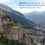
parcheggiare al Pré de Pascal. Salire subito per il prato in direzione proprio della parete di salita, ben visibile. Poi si segue il sentiero ben marcato che piega a sinistra e costeggia il Mont Chetif sul lato Est, abbandondando dalla vista la parete di salita. Quando il sentiero spiana, in prossimità del bivio che sale verso le vie della parete Est, piegare per tracce verso destra tornando in direzione Nord Ovest e continuando a salire.
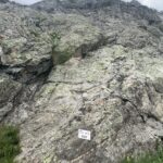
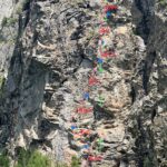
Girare intorno allo spigolo Nord-Est della montagna e reperire dei consumati bolli blu. Seguirli verso la parete Nord-Ovest. Giunti in una ripida zona di prato (eventualmentr presenti due o tre piccoli nevai) l'attacco di "Madonna dell'Est" rimane tutto a sinistra, mentre l'attacco di "Via 27 Luglio" tutto a destra.
Descrizione
Girare intorno allo spigolo Nord-Est della montagna e reperire dei consumati bolli blu. Seguirli verso la parete Nord-Ovest. Giunti in una ripida zona di prato (eventualmentr presenti due o tre piccoli nevai) l'attacco di "Madonna dell'Est" rimane tutto a sinistra, mentre l'attacco di "Via 27 Luglio" tutto a destra.
attacco: spit con cordone
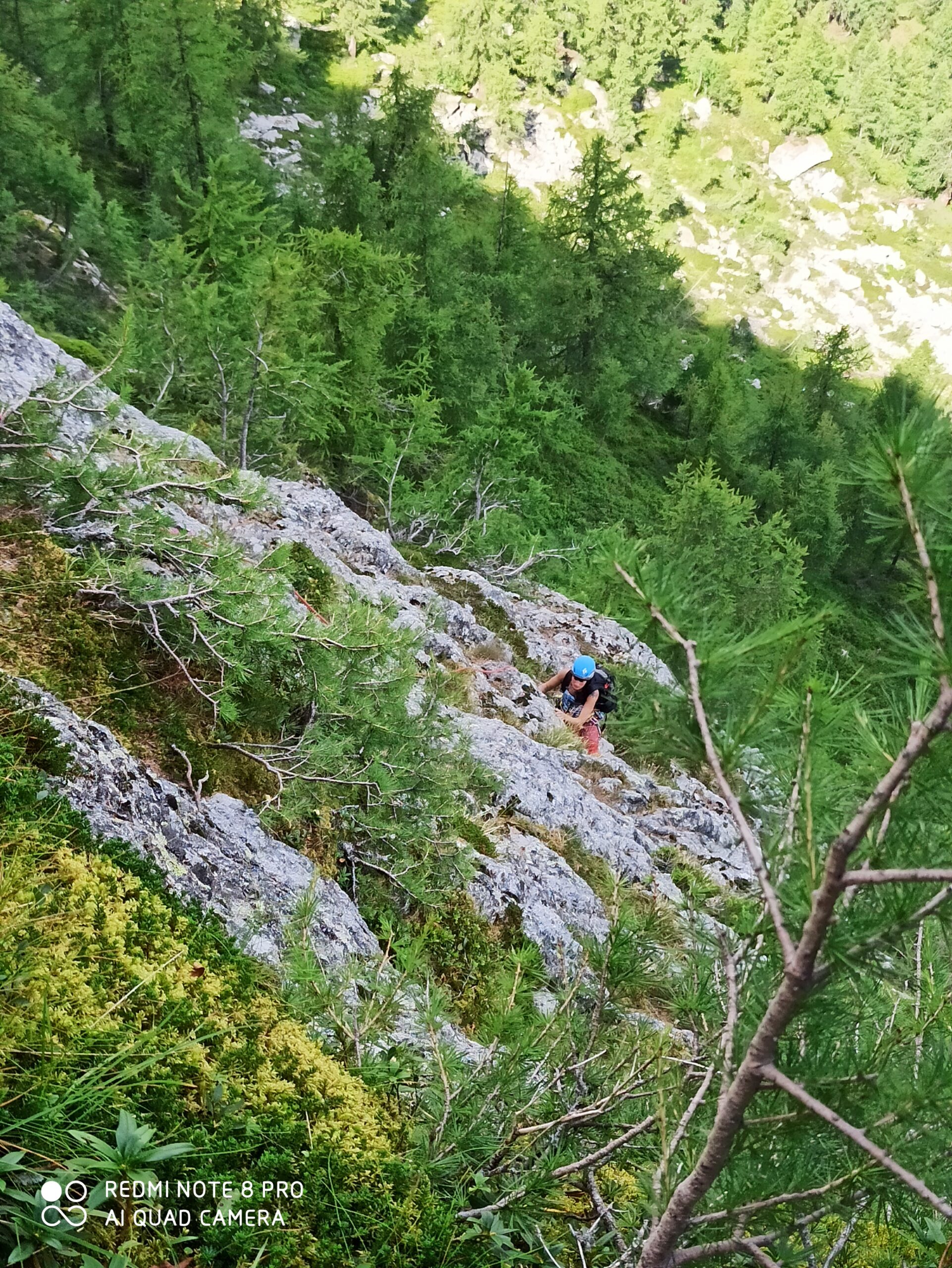
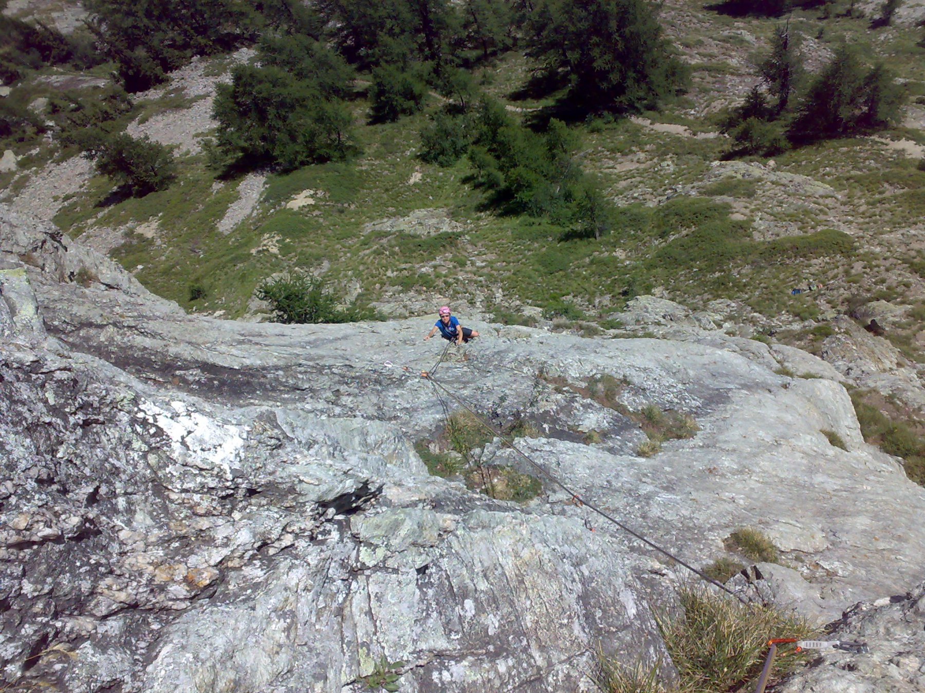
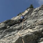
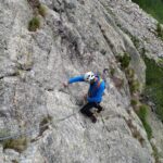
- L1: 4c – potrebbe risultare un pò scivoloso per licheni ed aghi di larice (30m)
- L2: 5c – bel muro abbastanza verticale (la lunghezza più impegnativa della via)
- L3: 5b – dopo una prima sezione un uscita più verticale che supera un bel diedro che conduce alla sosta (35m).
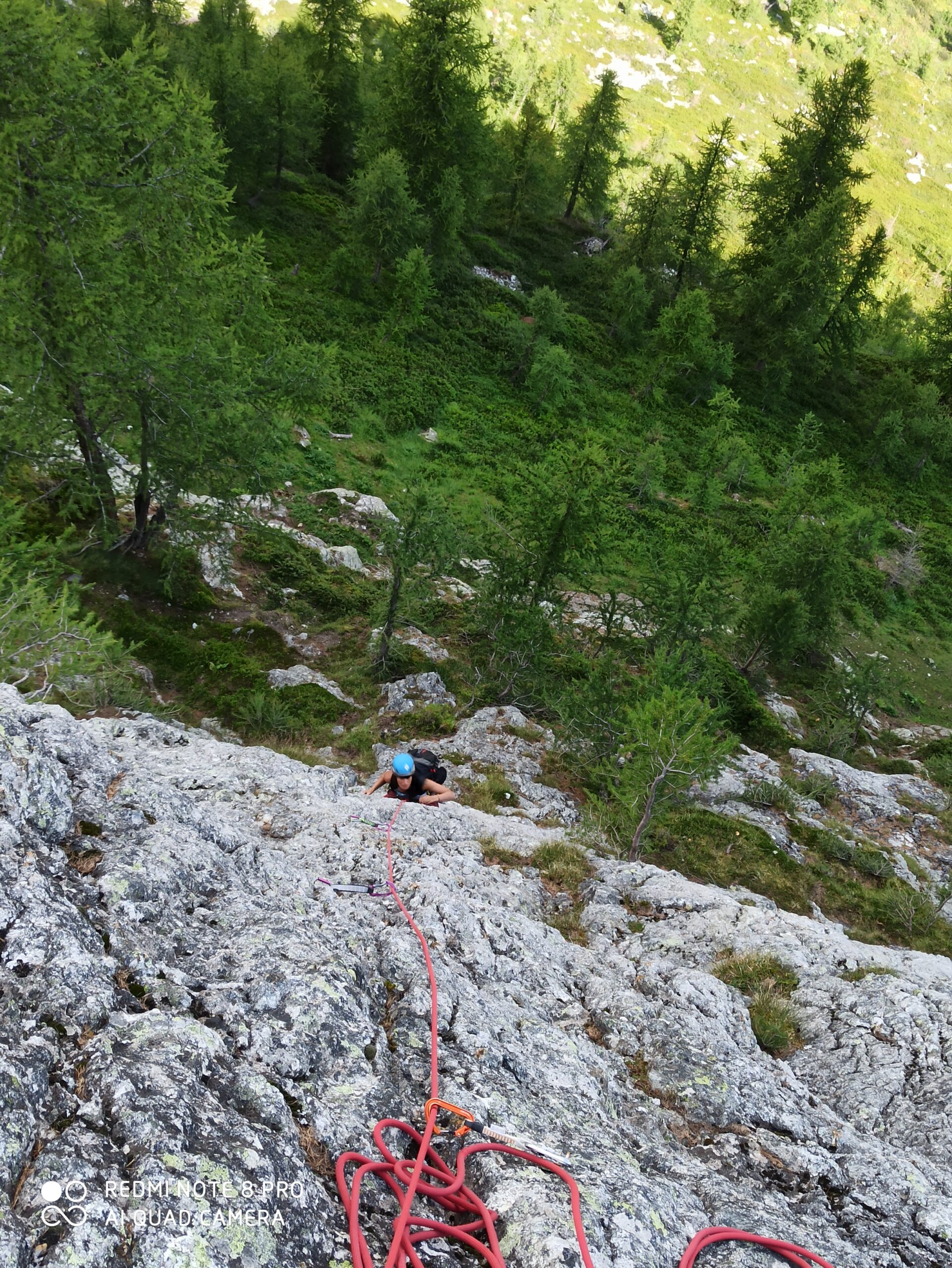
- L4: 5a – seguire qualche bel muretto che lascia sulla sinistra una zona ricca di muschio e vegetazione
- L5: 5a – una breve pacca e poi seguire verso destra una corda fissa che consente di arrivare attraverso grandi cespugli di rododendri alla base del salto finale
- L6: 5c – fatti pochi metri sopra la sosta, seguire un diedro qualche metro e poi traversare a sinistra per un pilastrino verticale che si supera con un tratto verticale.
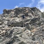
- L7: 4b – con facile arrampicata fino alla sella fra la Statua e la piattaforma di cemento.
Discesa a piedi per il sentiero fino a Courba Tzeleuna e rientro a Pre de Pascal. Doppie attrezzate ma sicuramente sconsigliabili causa la vegetazione.
Nelle vicinanze Mappa
Itinerari
04/10/2025 AO, Courmayeur 6a+, 6a obbl. Sud-Ovest
Chetif (Mont) – Incredulix
350m
10/08/2024 AO, Courmayeur 5a, 4 obbl. Sud-Est
Chetif (Mont) – Alisee e gli Amici Canterini
 350m
350m
22/08/2025 AO, Courmayeur 6a, 5c obbl. Sud-Est
Chetif (Mont) – Pierre Navigatore delle Creste
 350m
350m
08/07/2023 AO, Courmayeur 6b+, 6a obbl. Sud-Est
Chetif (Mont) – Bersagli Mobili
 400m
400m
20/08/2023 AO, Courmayeur 6a+, 6a obbl. Nord-Est
Chetif (Mont) – Madonna dell’Est o Madonnina
 600m
600m
11/08/2022 AO, Courmayeur 6c, 6a+ obbl. Est
Chetif (Mont) – Punta Rovente
 650m
650m
06/06/2024 AO, Courmayeur 6c+, 6b obbl. Ovest
Saxe (Mont de la), Pilastro Bertone – Solo per Vecchi Coglioni
 2.2Km
2.2Km
24/07/2025 AO, Courmayeur 6a+, 5c obbl. Sud
Eveque (Aiguille de l’), contrafforti – Impressioni di Settembre
 2.2Km
2.2Km
31/08/2022 AO, Courmayeur 7a, 6b+ obbl. Ovest
Saxe (Mont de la) – Birintite
 2.3Km
2.3Km
04/01/2023 AO, Courmayeur 7a+, 6c obbl. Sud-Ovest
Saxe (Mont de la) – Non Toccatemi il Pilastro
2.3Km