3.5Km
3.5Km
Note
Storico
 100m
350m
600m
5.3Km
5.3Km
5.3Km
5.3Km
5.4Km
5.5Km
5.5Km
100m
350m
600m
5.3Km
5.3Km
5.3Km
5.3Km
5.4Km
5.5Km
5.5Km
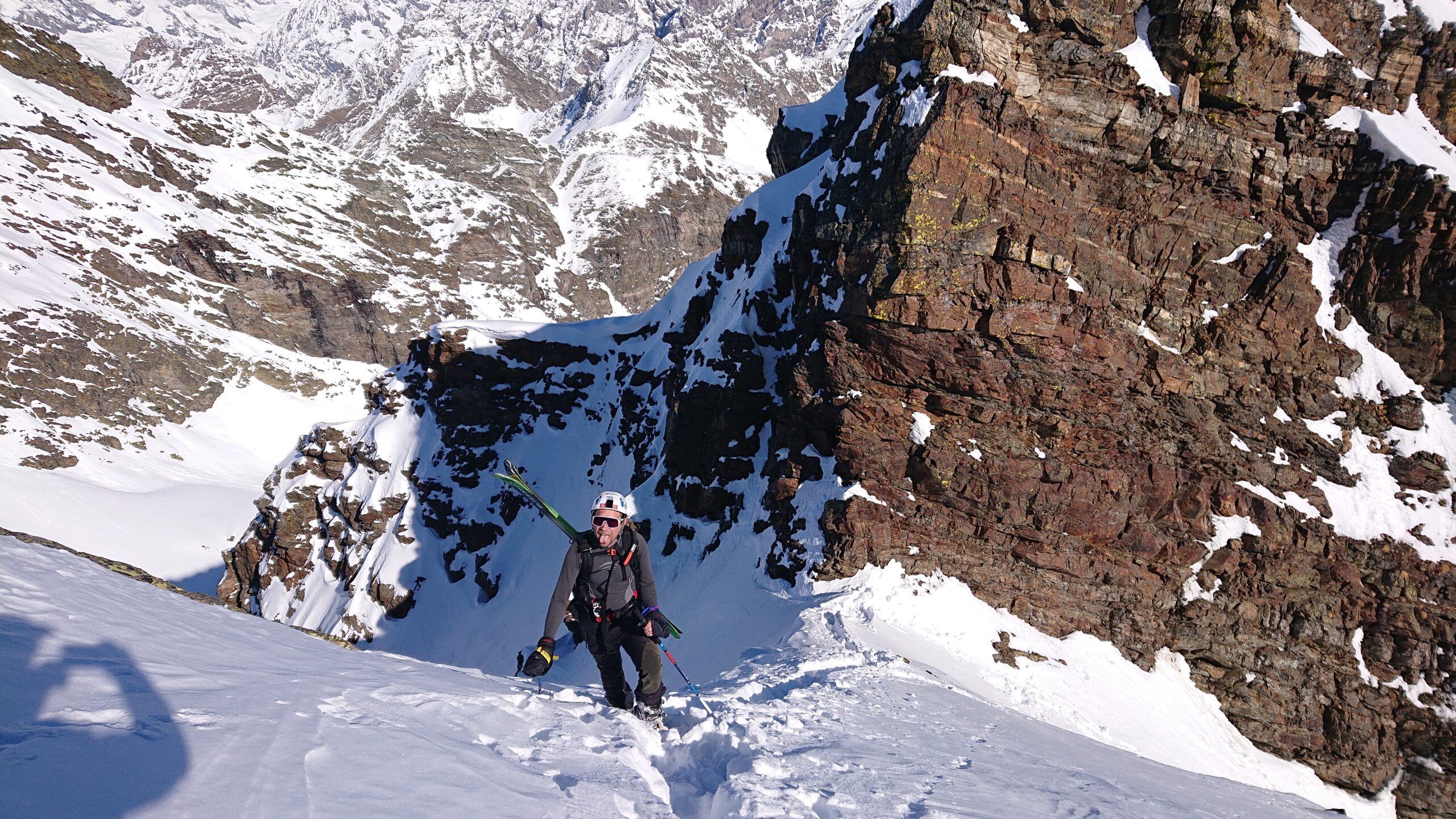
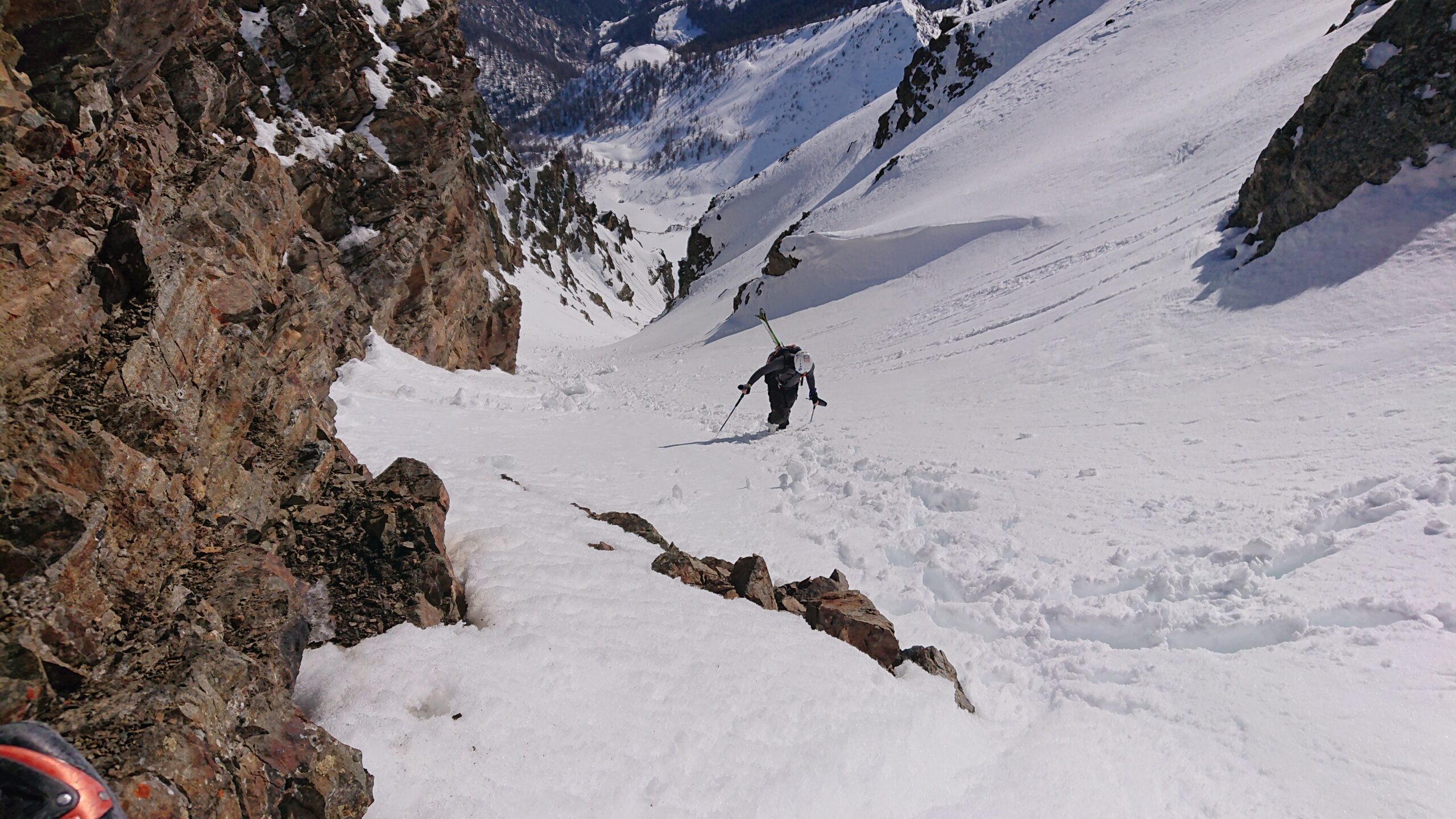
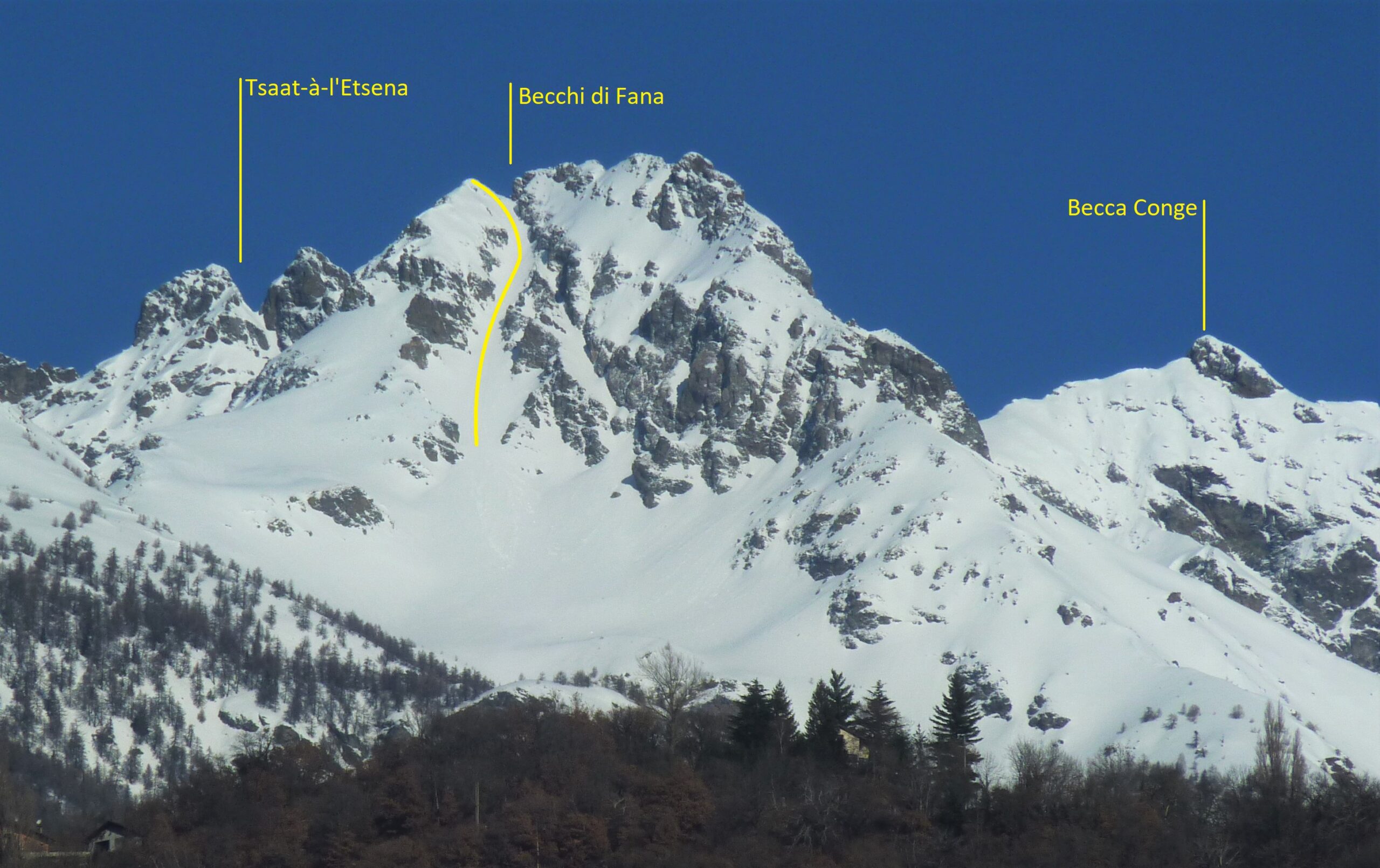
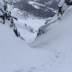
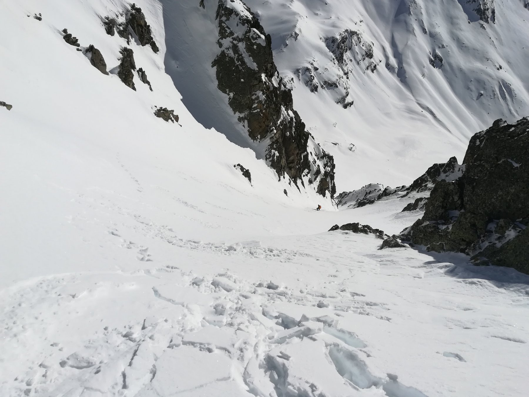
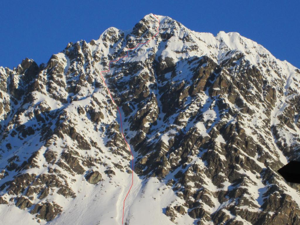
Bellissimo canale, immerso in un ambiente isolato e tranquillo. Ben visibile dal fondovalle, dalla SS26 nei pressi di Nus.
Avvicinamento
Da Quart (o da Nus passando per Seran), raggiungere Avisod e da qui l'abitato di Fonteil.
Descrizione
Da Fonteil seguire la strada sterrata che attraversa la Comba Dèche fino a Clavé (1990 m). Attenzione: a 200 m da Pesse, proseguire a sinistra al bivio, anziché andare dritti.
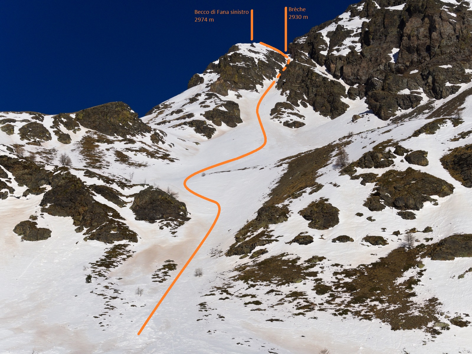
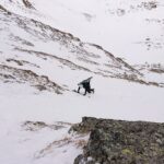
Da Clavé, imboccare il ripido sentiero che conduce ad una presa d’acqua (2075 m). Da qui, il sentiero si perde: continuare quindi nel bosco che, con un graduale calo di pendenza, porta al pianoro sottostante i Becchi di Fana (2300 m circa).
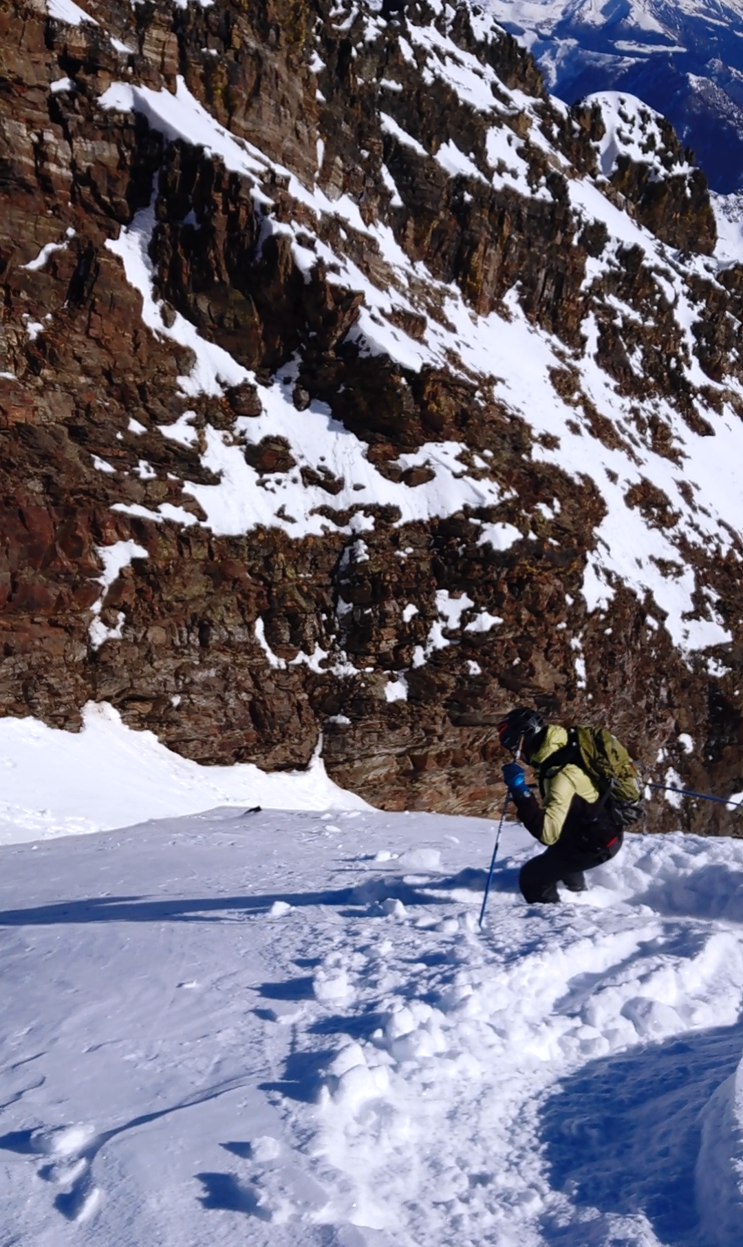
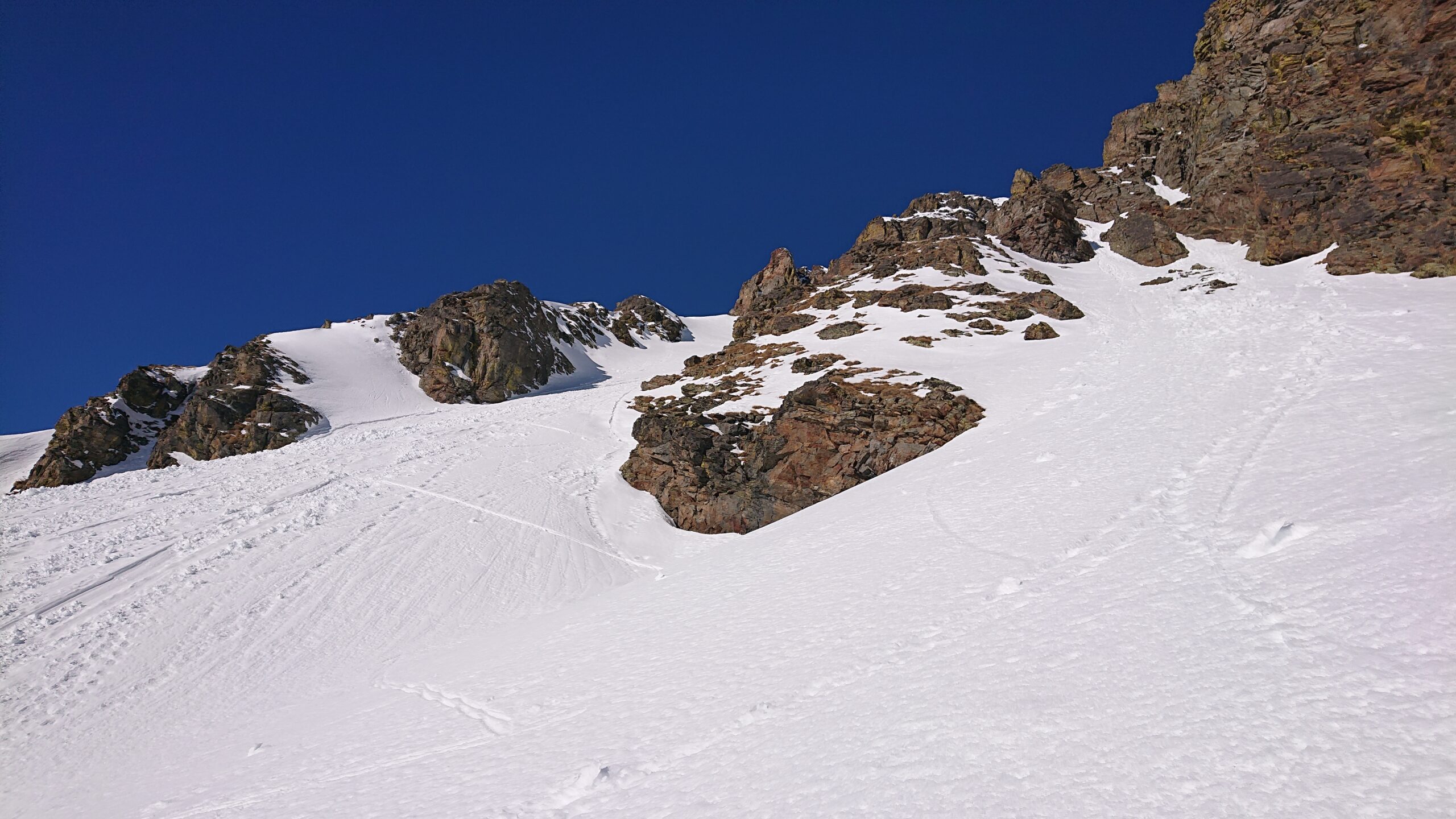
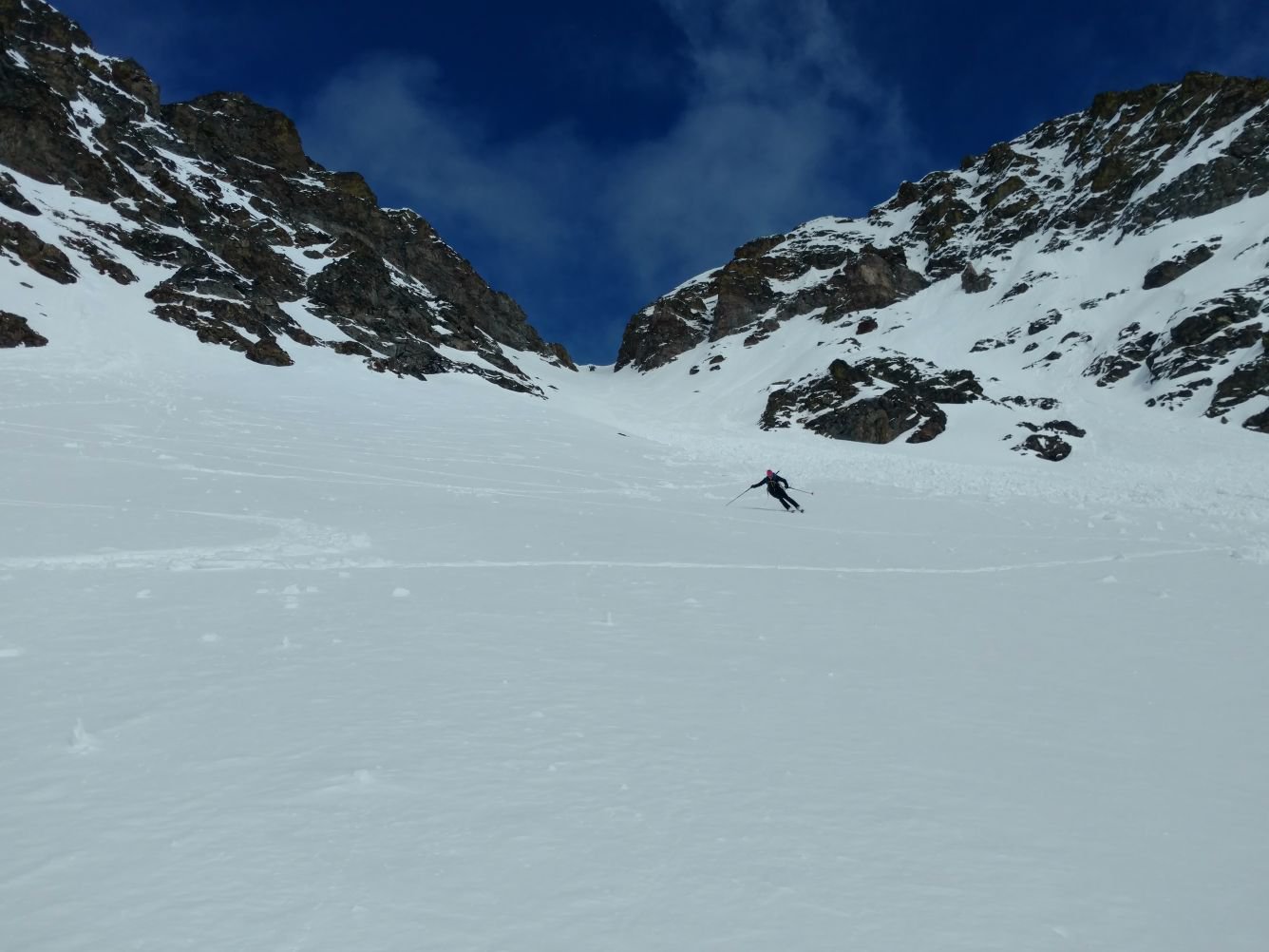
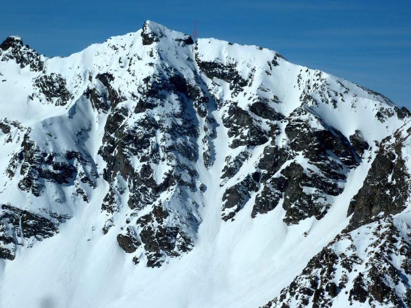
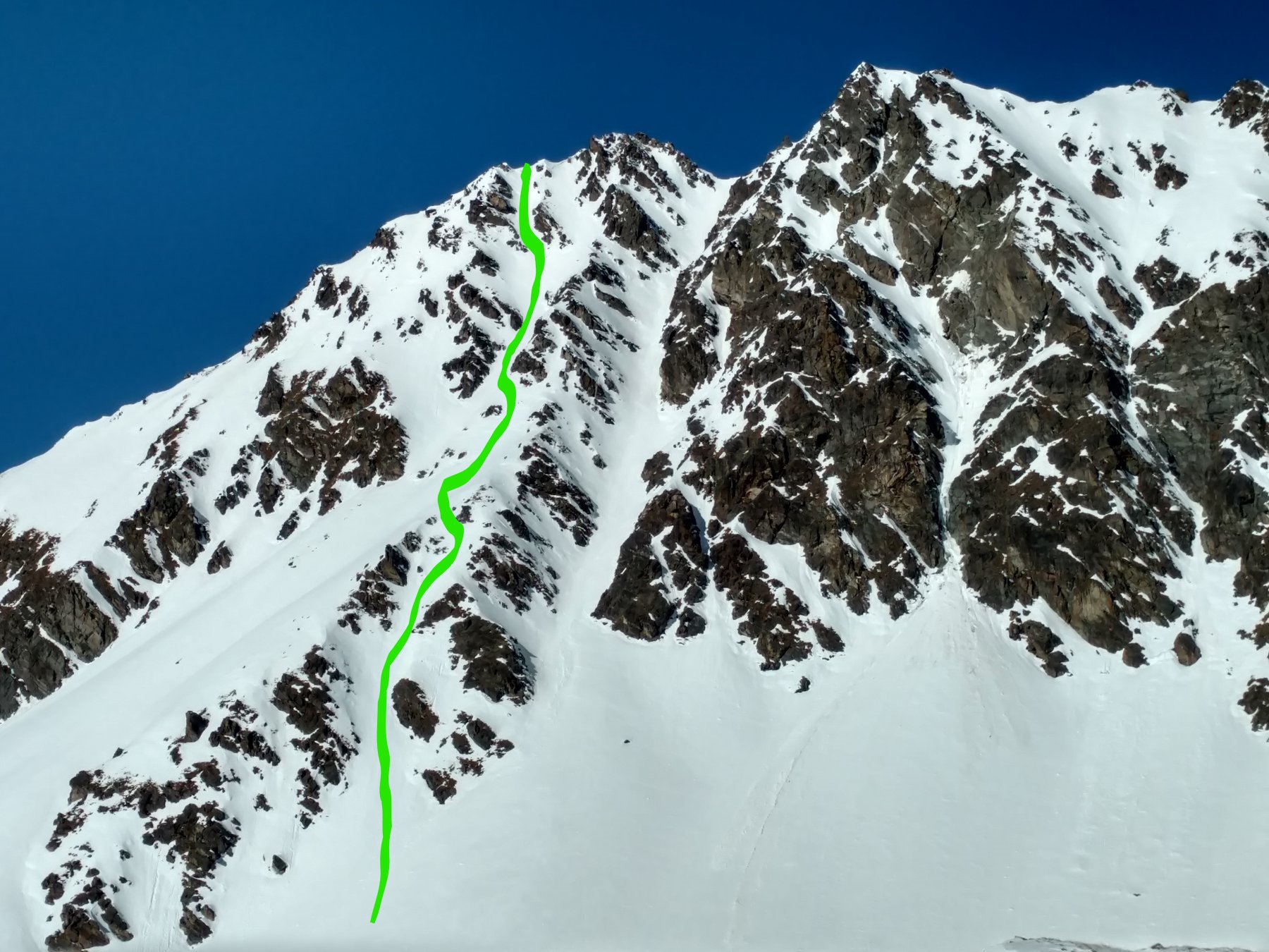
Risalire quindi il primo pendio ripido che conduce alla base del cono (2450 m), proseguire su quest’ultimo fino all’imbocco dell’evidente canale, e da qui nel canale fino alla brèche tra i due Becchi (2930 m) o fino alla cima sinistra (2974 m).
ignoti
- Cartografia:
- Carta 1:10000 (OziExplorer), Valle Centrale (Carta L'EScursionista).
Nelle vicinanze Mappa
Itinerari
08/12/2023 AO, Quart D+ 1530 m I, 3.3, E1 Sud-Ovest
Fana (Colle di) Canale SO
 100m
100m
25/02/2012 AO, Quart D+ 1450 m I, 4.2, E2 Sud-Est
Conge (Becca) Canale Est
 350m
350m
30/01/2026 AO, Quart D+ 1500 m I, 4.1, E1 Est
Cénévé (Pointe de) colle 2850 m Couloir SE
 600m
600m
04/03/2021 AO, Nus D+ 1700 m I, 4.1, E2 Varie
Vessona, Faroma e Léché (Colli) da Clemensod, tour del Monte Faroma
 5.3Km
5.3Km
18/02/2022 AO, Nus D+ 1000 m I, 4.1, E1 Nord-Est
Aveille (Becca d’) Parete Nord
 5.3Km
5.3Km
26/03/2018 AO, Nus D+ 1550 m III, 4.2, E2 Sud
Verdona (Punta di) Canale S/SE
 5.3Km
5.3Km
27/02/2019 AO, Nus D+ 1600 m I, 4.1, E1 Sud
Verdona (Punta di) Canale Sud
 5.3Km
5.3Km
16/03/2013 AO, Nus D+ 1400 m III, 5.3, E4 Sud
Faroma (Mont) Parete Sud
 5.4Km
5.4Km
26/01/2026 AO, Nus D+ 1426 m I, 4.1, E1 Sud-Est
Fontaney (Becca di) Canale SE
 5.5Km
5.5Km
02/02/2008 AO, Nus D+ 1350 m 4.2, E2 Sud-Est
Faroma (Mont) Couloir SSE
 5.5Km
5.5Km