3.6Km
3.6Km

Note
 600m
700m
950m
5.8Km
5.8Km
5.8Km
5.8Km
6Km
6.1Km
6.1Km
600m
700m
950m
5.8Km
5.8Km
5.8Km
5.8Km
6Km
6.1Km
6.1Km
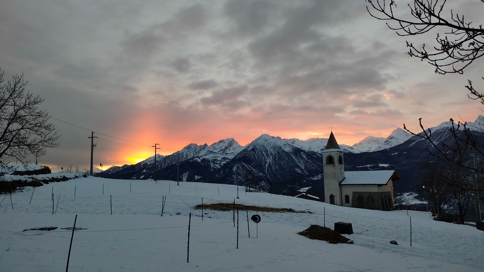
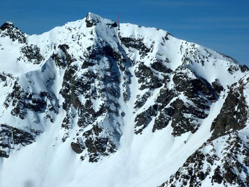
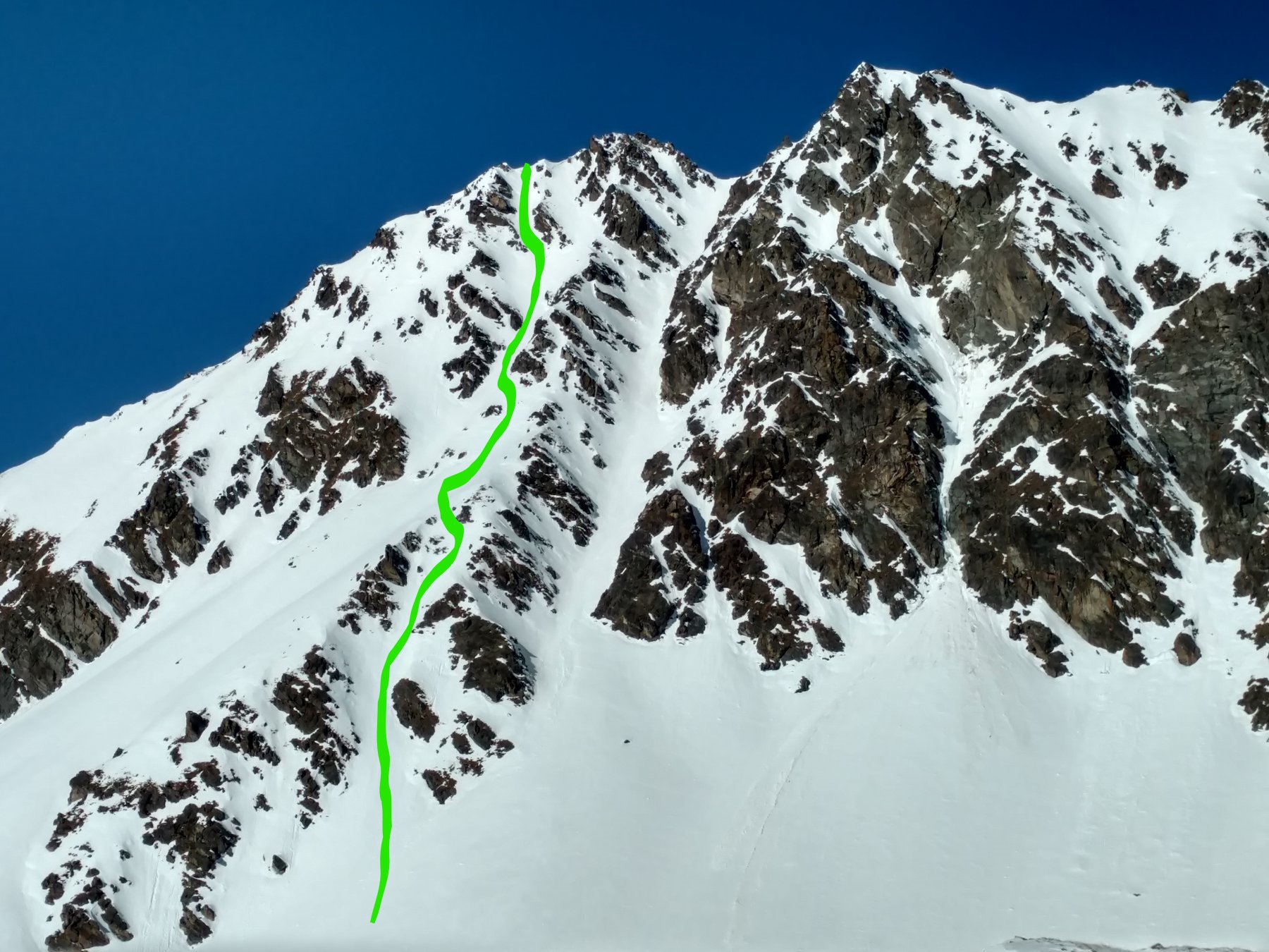
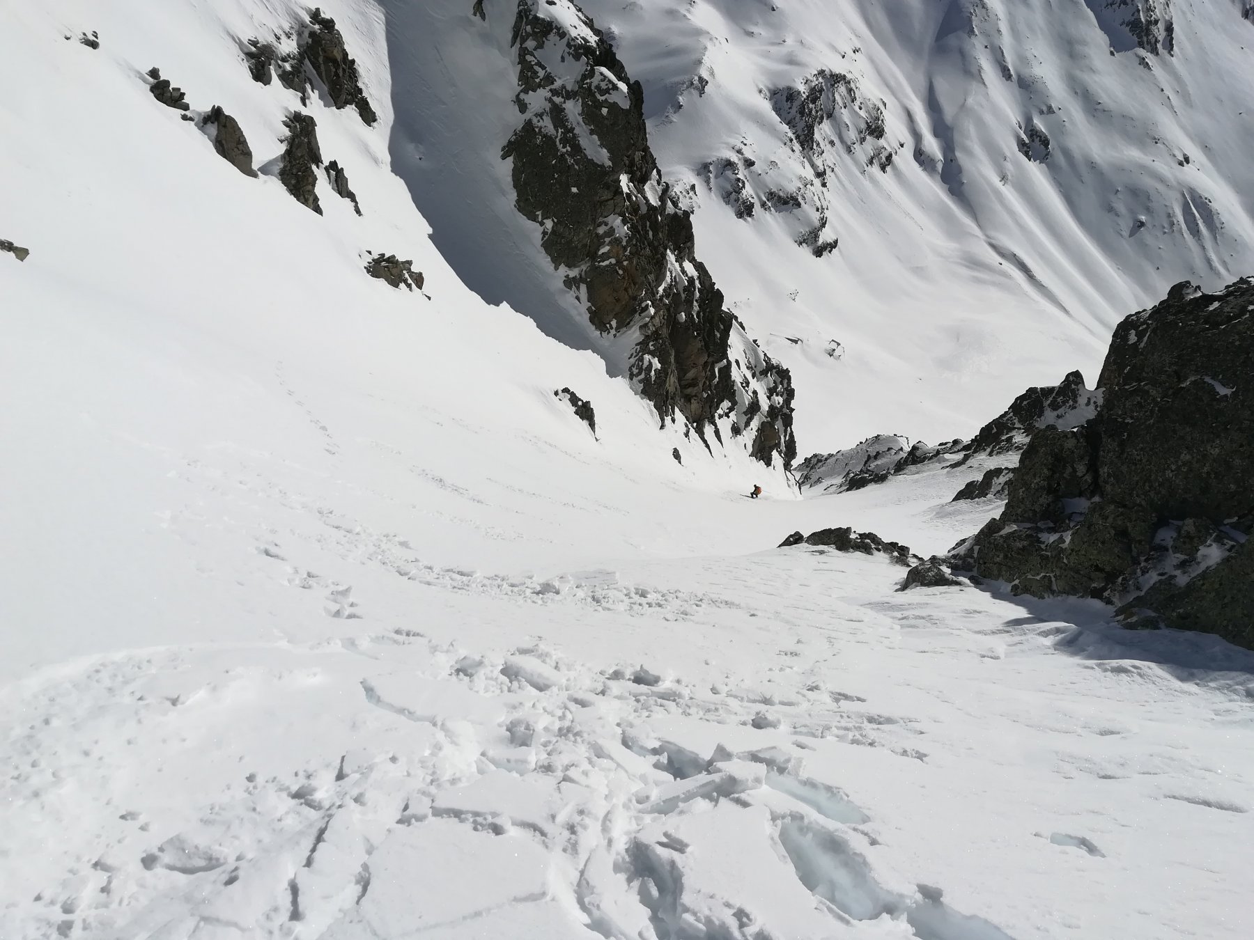
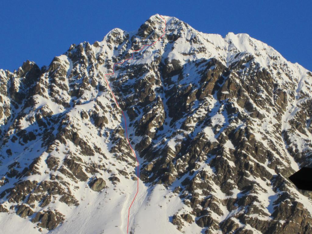
Bel canale, meno visibile dal fondovalle rispetto a quello evidentissimo del Colle di Fana. Data l'esposizione a SE riceve il sole molto presto. L'itinerario in sé è molto interessante, ma occorre mettere in conto un certo spostamento, a piedi su poderale, a meno di condizioni particolari di innevamento, che consentano di trovare neve ben stabilizzata già in basso , oppure al contrario di poter percorrere un buon tratto della poderale in auto.
Avvicinamento
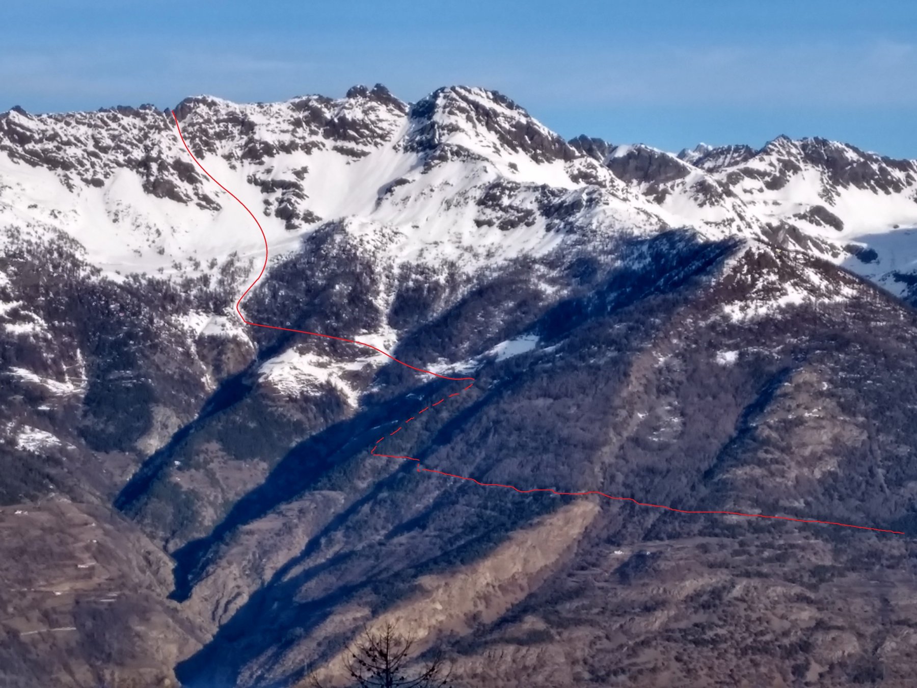
Da Avisod seguire la poderale per l'alpe Cénévé, volendo in auto, finché l'innevamento lo consente, poi proseguire a piedi. Verso q. 2050 abbandonare la poderale e salire direttamente per i pendii soprastanti in direzione N, puntando all'evidente canale, che si trova a sx di quello del Colle di Fana.
Descrizione
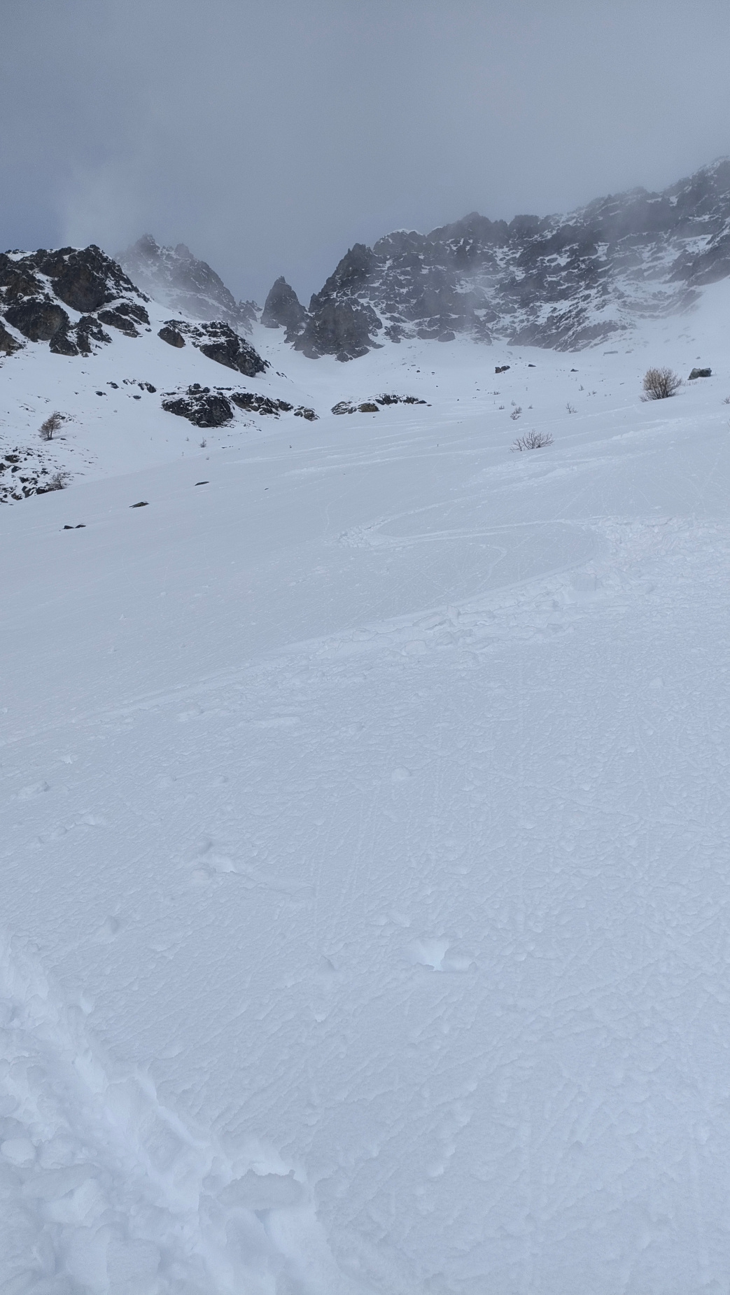
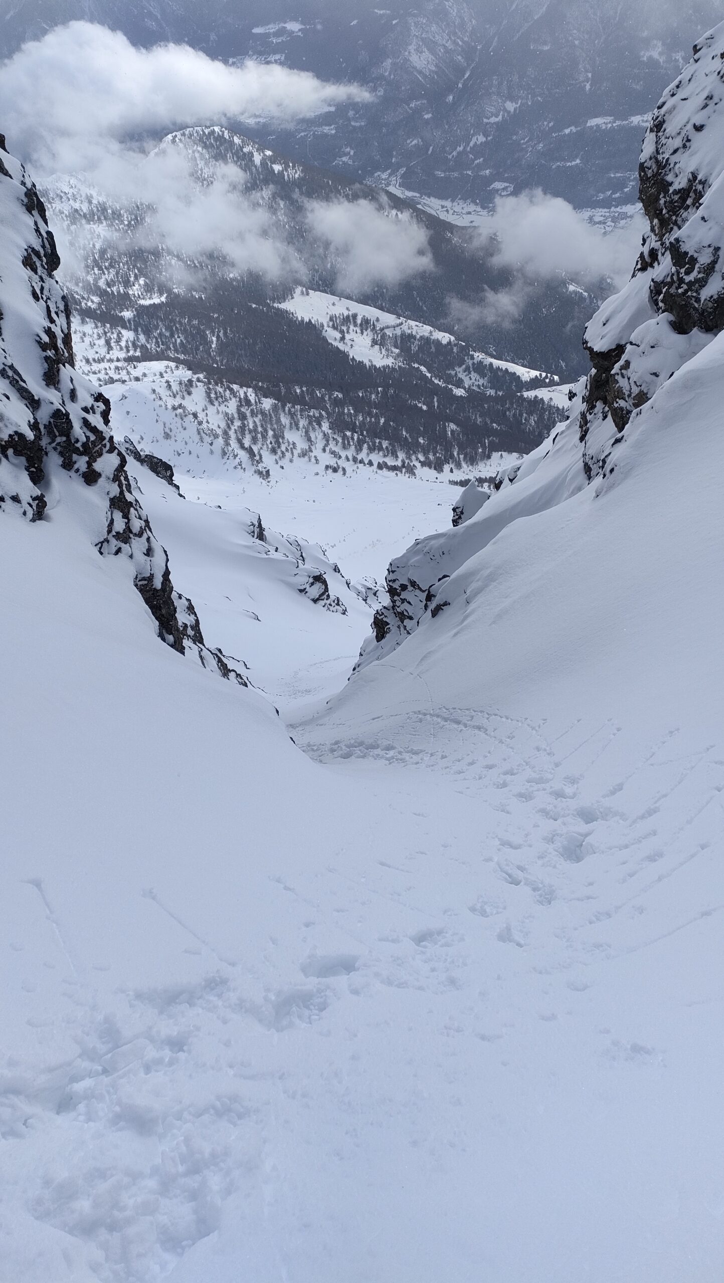
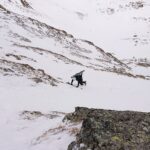
Risalire dapprima i bei pendii alla sua base, poi il canale stesso, fin quando possibile con le pelli, poi a piedi. Negli ultimi 50 m di dislivello il canale si triforca. Si può scegliere l’uscita che si vuole, in funzione anche del tipo di neve.
La pendenza va dai 35 ai 40° circa, un po’ di più soltanto negli ultimi 50 m.
Nelle vicinanze Mappa
Itinerari
06/02/2025 AO, Quart D+ 1600 m I, 4.1, E1 Sud-Est
Fana (Becchi di) Canale SE
 600m
600m
08/12/2023 AO, Quart D+ 1530 m I, 3.3, E1 Sud-Ovest
Fana (Colle di) Canale SO
 700m
700m
25/02/2012 AO, Quart D+ 1450 m I, 4.2, E2 Sud-Est
Conge (Becca) Canale Est
 950m
950m
04/03/2021 AO, Nus D+ 1700 m I, 4.1, E2 Varie
Vessona, Faroma e Léché (Colli) da Clemensod, tour del Monte Faroma
 5.8Km
5.8Km
18/02/2022 AO, Nus D+ 1000 m I, 4.1, E1 Nord-Est
Aveille (Becca d’) Parete Nord
 5.8Km
5.8Km
26/03/2018 AO, Nus D+ 1550 m III, 4.2, E2 Sud
Verdona (Punta di) Canale S/SE
 5.8Km
5.8Km
27/02/2019 AO, Nus D+ 1600 m I, 4.1, E1 Sud
Verdona (Punta di) Canale Sud
 5.8Km
5.8Km
16/03/2013 AO, Nus D+ 1400 m III, 5.3, E4 Sud
Faroma (Mont) Parete Sud
 6Km
6Km
26/01/2026 AO, Nus D+ 1426 m I, 4.1, E1 Sud-Est
Fontaney (Becca di) Canale SE
 6.1Km
6.1Km
05/12/2019 AO, Nus D+ 1450 m 5.1, E3 Est
Faroma (Mont) Diagonale delle Spezie
 6.1Km
6.1Km