2.6Km
2.6Km

Note
 0m
0m
0m
0m
0m
0m
0m
0m
2.6Km
2.6Km
0m
0m
0m
0m
0m
0m
0m
0m
2.6Km
2.6Km
Itinerario preferibilmente primaverile quando l'innevamento è consistente in quota ma al contempo consolidato e il punto di partenza è raggiungibile in auto (in inverno il versante potrebbe essere poco innevato per via dei forti venti da ovest, la neve sulla cresta farinosa e la strada per Seleiraut non percorribile per neve o ghiaccio).
Avvicinamento
Pinerolo-Val Chisone-Villaretto-Seleiraut
Descrizione
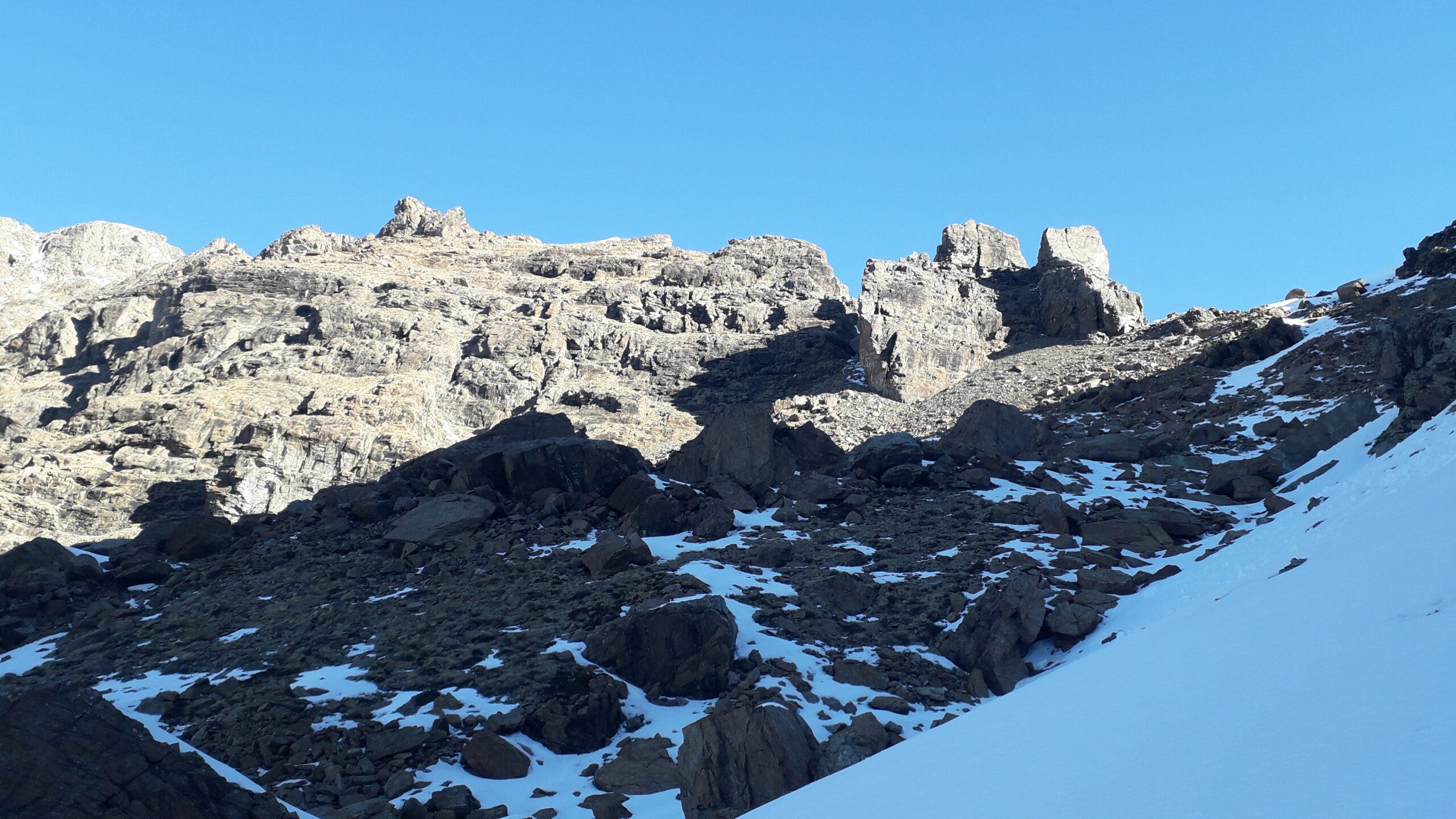
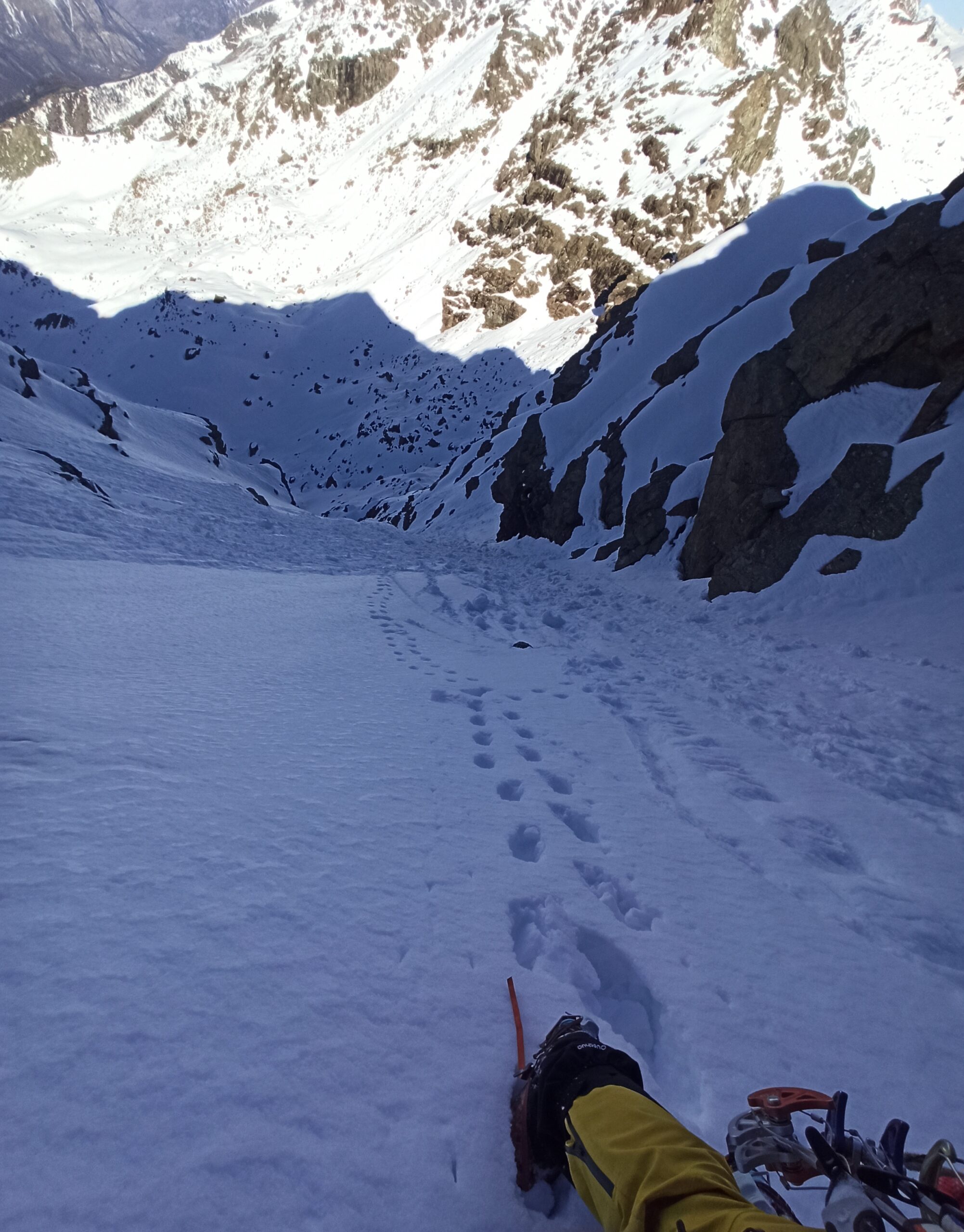
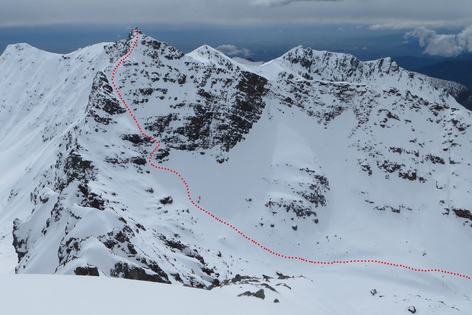
Da Seleiraut seguire le indicazioni per il Truc del Cuculo (il sentiero parte all’inizio della frazione, nei pressi della bacheca del Parco e punta verso est), raggiungere il colletto a E del Cuculo, proseguire ancora in piano per qualche centinaio di metri in direzione N, quindi piegare a dx (NE) e risalire il vallone delle Vallette in direzione del colle di Pra Reale.
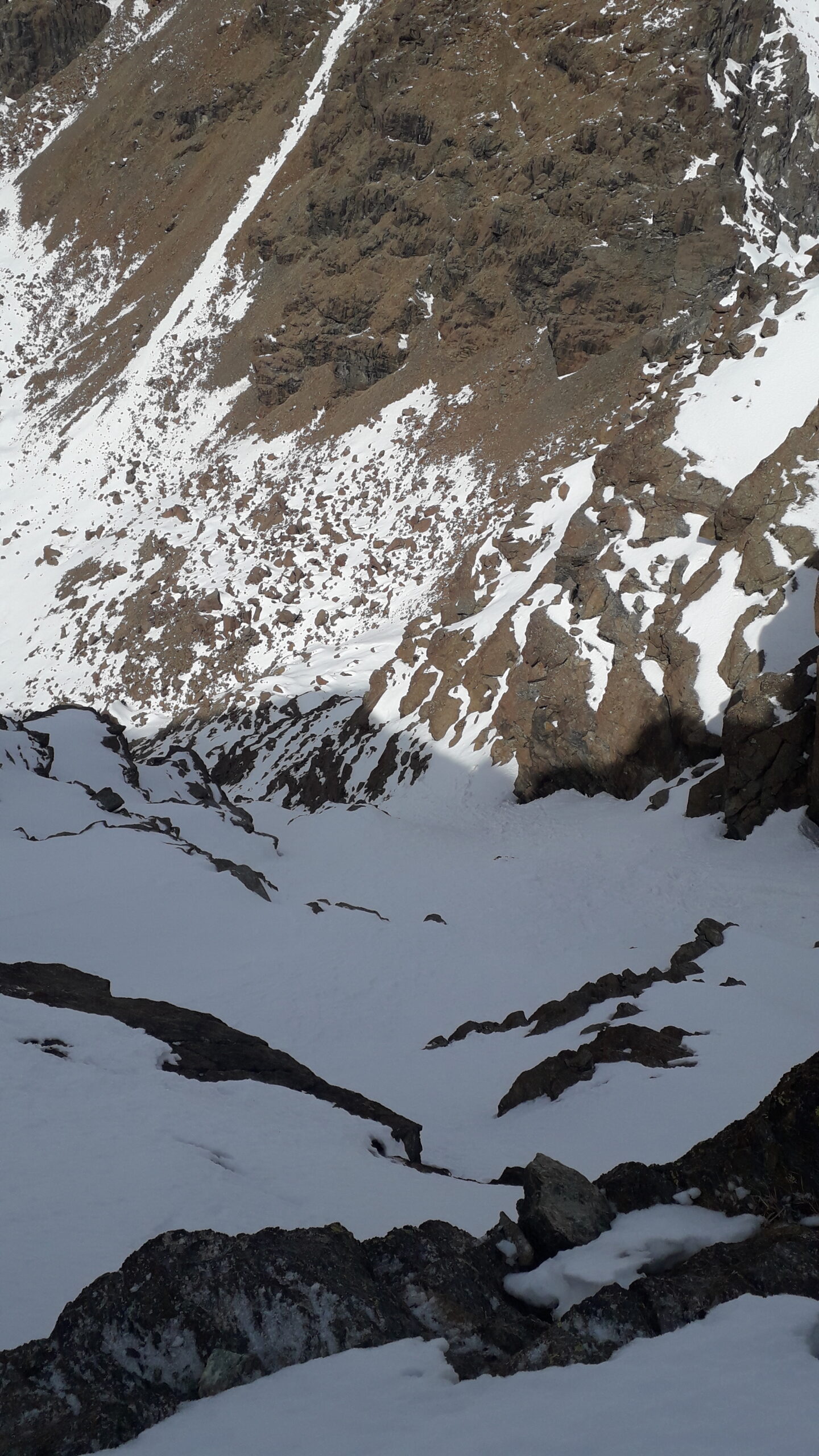
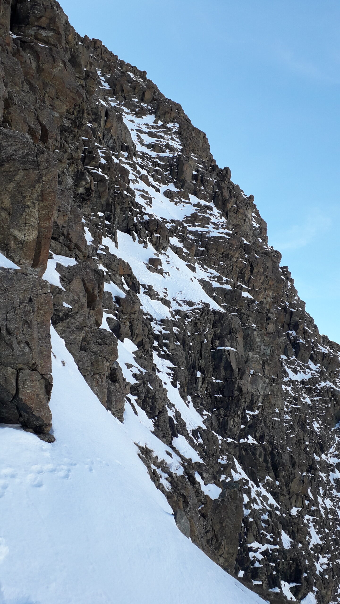
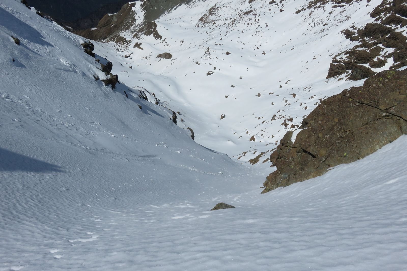
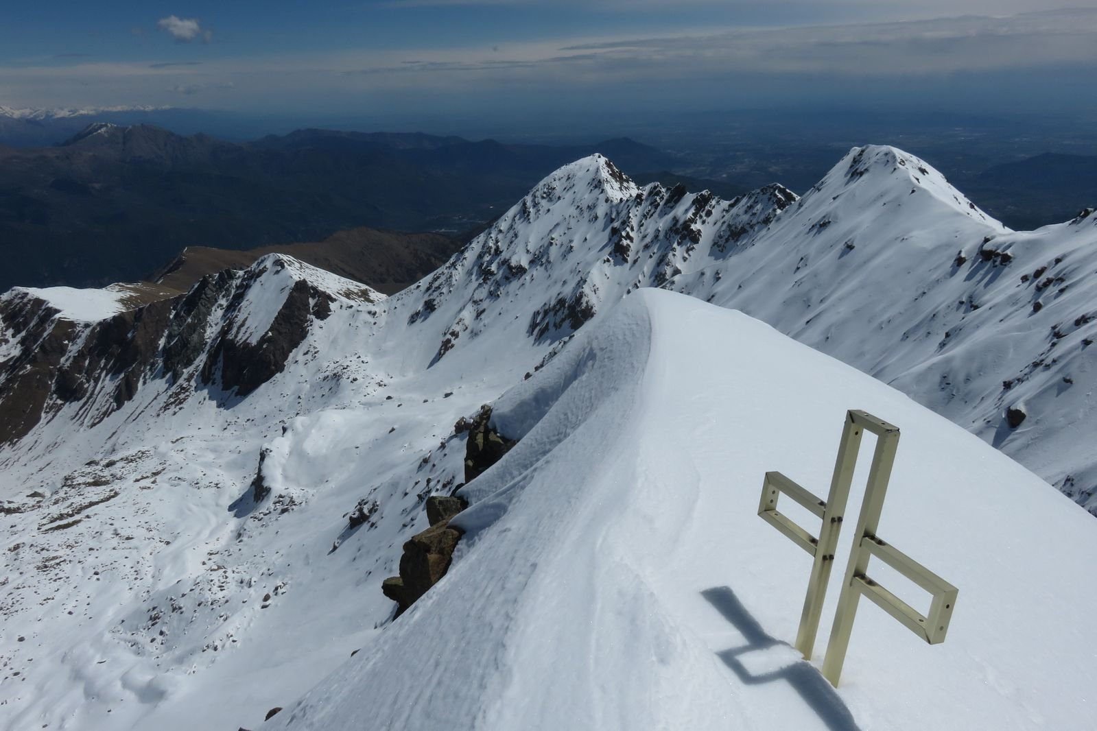
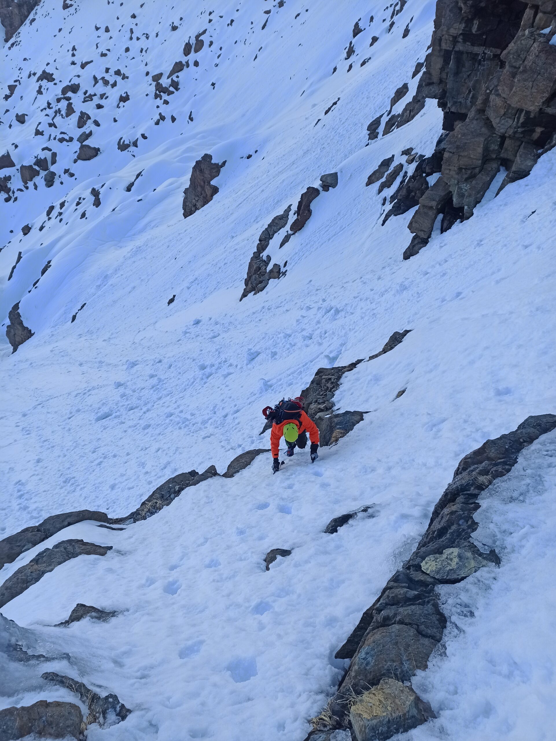
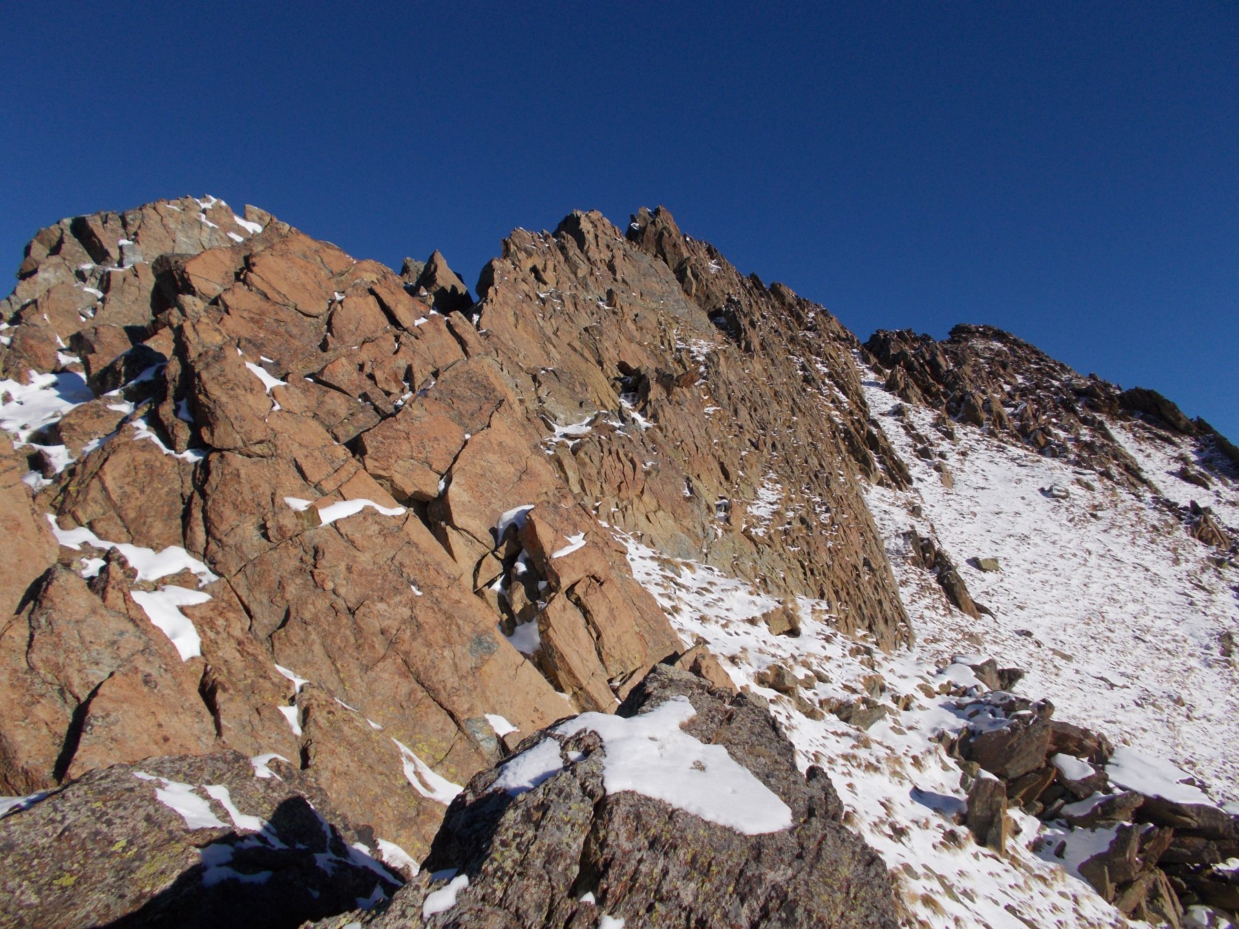
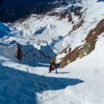
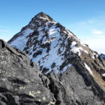
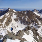
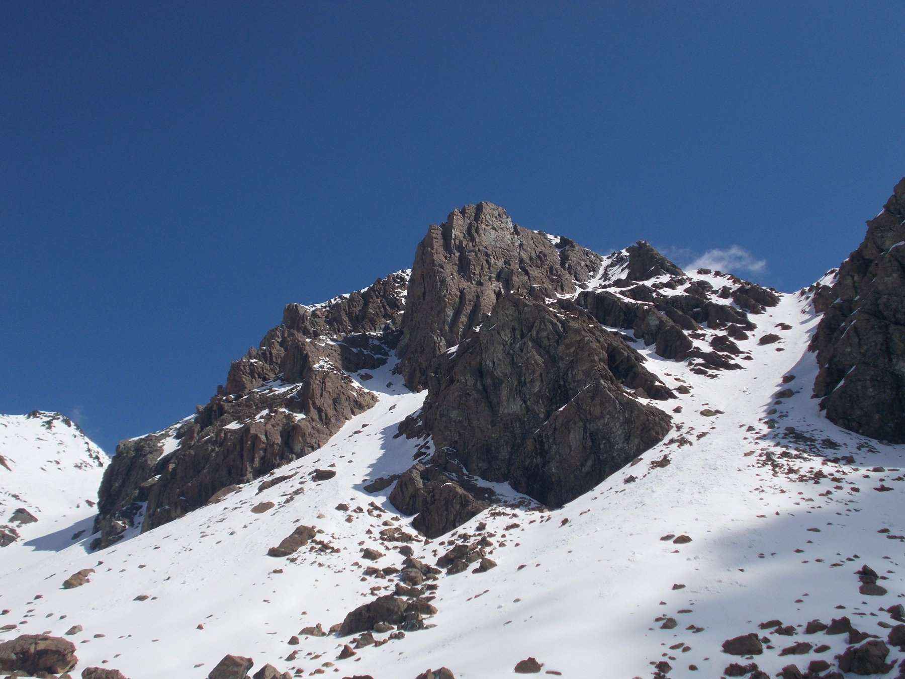
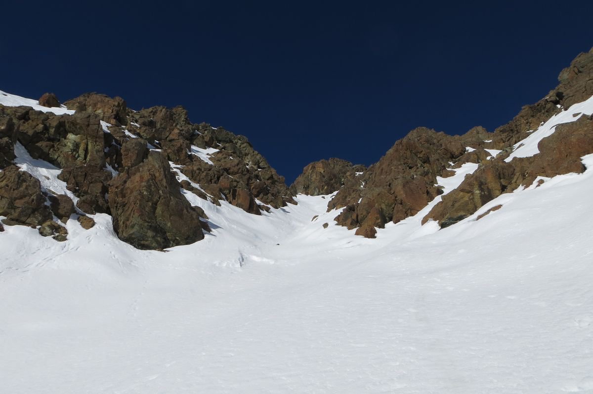
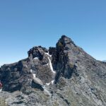
Se l’innevamento è scarso si può seguire il sentiero in dx orografica, altrimenti il fondo del vallone. In entrambi i casi si giunge in una conca alla base del colle e del versante ovest del Rocciavrè. Qui prende a dx e si sale in direzione del canale che solca il versante e che forma un enorme diedro molto aperto. La parte bassa del canale è ostruita da una barra rocciosa che si supera ai lati (preferibilmente quello sx) con un traverso ripido ed esposto (45°). Si risale quindi il canale dall’andamento un po’ sinuoso (200 m, 40-45°), fin quasi alla sella sulla cresta NO dove termina. Poco prima di raggiungere il colletto si prende a dx e si raggiunge la cresta poco sopra un salto di rocce. Si segue ora la cresta verso dx (neve ripida 45°, pass. a 50°, o misto) fino alla base del castello roccioso finale, che si scala superando un camino verticale (5m, II). Sulla vetta c’è una croce.
Discesa:
1) dalla via di salita (la più corta e rapida);
2) dal canale/diedro sud fra le due cime del Rocciavrè, che scende nel vallone Rouen fino a 2450 m dove si trova (se non innevato) il sentiero per il Robinet che si segue verso dx (SO) fino al colletto Glantin da dove si scende nel vallone delle Vallette e si ritrova il percorso di salita;
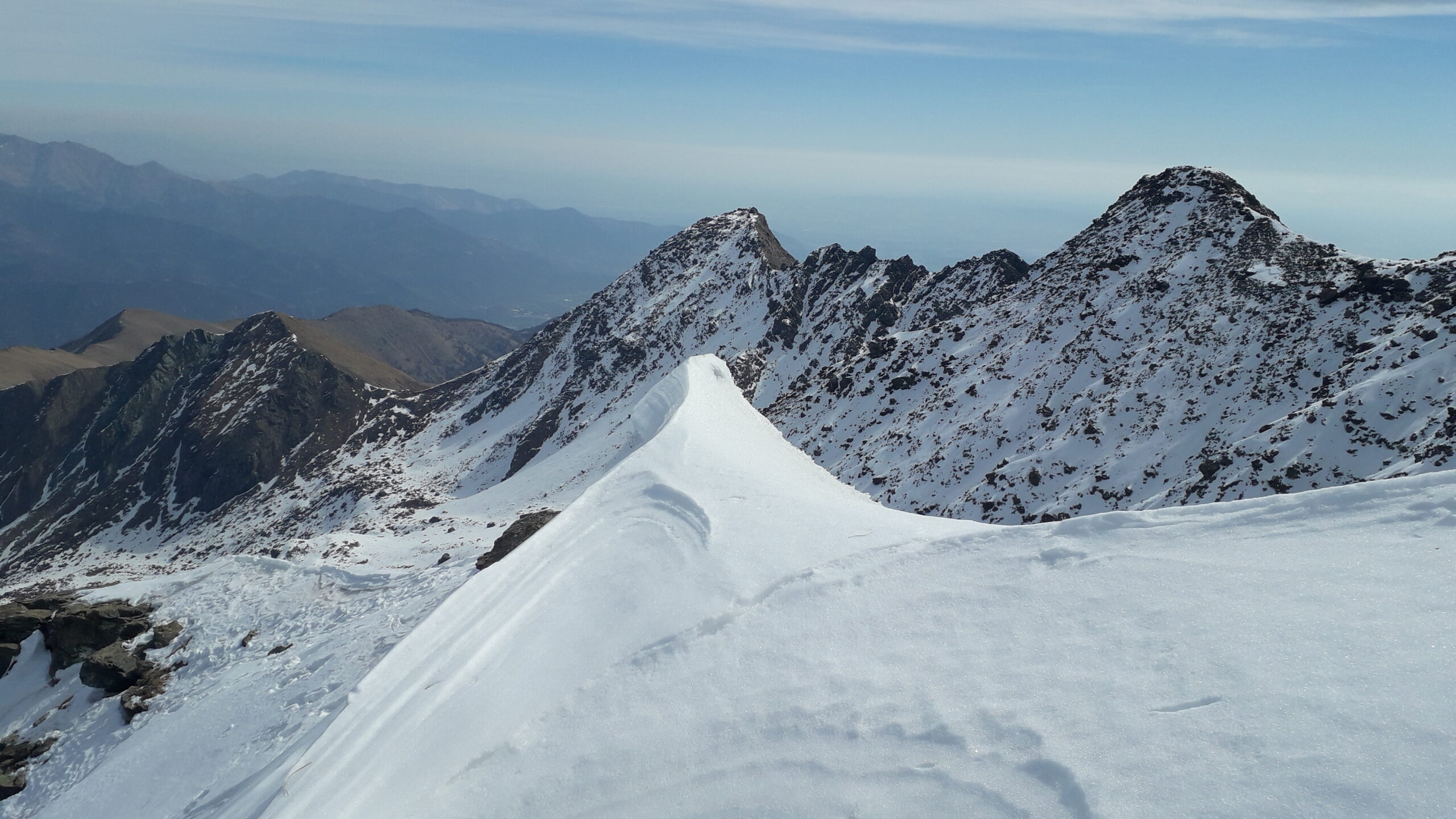
3) proseguire verso la cima Est (5 metri più alta, statua della Madonna), toccando il colletto fra le due cime e salendo sul versante nord (molto delicato ed esposto con neve, specie se inconsistente). Da questa seguirei il percorso estivo che porta al colletto Robinet da dove si scende verso Ovest, prima per un comodo pendio, quindi per un ripido canalino nevoso e si raggiunge il fondo della testata del Vallone Rouen alla base del canale fra le due cime. Da qui si segue il percorso 2).
- Cartografia:
- Fraternali 1:25000 n.5 Val Germanasca, Val Chisone
Nelle vicinanze Mappa
Itinerari
06/01/2022 TO, Roure D+ 1100 m PD+ Sud
Malanotte (Punta) anticima 2657 m – Scivolo Sud
 0m
0m
03/08/2025 TO, Roure D+ 1300 m PD- Nord-Ovest
Rocciavrè (Monte) da Seleiraut per la cresta NO
 0m
0m
24/06/2026 TO, Roure D+ 1300 m PD- Sud-Ovest
Rocciavrè (Monte) Cresta SO o Costa di Glantin
 0m
0m
25/04/2024 TO, Roure D+ 1280 m PD+ Sud-Ovest
Cristalliera (Punta) Canale del Torrione
 0m
0m
18/09/2022 TO, Roure D+ 1300 m F+ Varie
Malanotte (Punta) Cresta O/SO
 0m
0m
02/03/2021 TO, Roure D+ 1350 m AD- Varie
Orsiera (Monte, Punta Sud) Sperone NE
 0m
0m
19/02/2023 TO, Roure D+ 1280 m D Ovest
Cristalliera (Punta) Canalino Nord Ovest del Torrione
 0m
0m
16/02/2020 TO, Roure D+ 1300 m PD+ Varie
Cristalliera (Punta) Canale SE
 0m
0m
17/07/2026 TO, Roure D+ 800 m PD- Sud
Cristalliera (Punta) Cresta S/SO o delle Scuole
 2.6Km
2.6Km
02/11/2024 TO, Roure D+ 1100 m PD+ Varie
Rocca Nera (Punta) Cresta N/NE in traversata dalla Punta di Mezzodì
 2.6Km
2.6Km