3Km
3Km

Note
 50m
2.6Km
6Km
6Km
6Km
6Km
6Km
6Km
6Km
6Km
50m
2.6Km
6Km
6Km
6Km
6Km
6Km
6Km
6Km
6Km
3Km
5.8Km
5.8Km
5.8Km
6Km
6.1Km
7.7Km
8.1Km
8.1Km
8.3Km
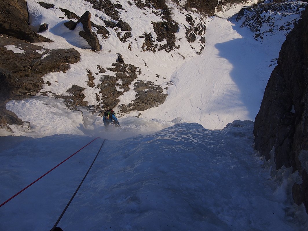
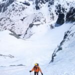
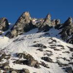
Itinerario d'ambiente da affrontare quando le condizioni del manto nevoso sono sicure per il pericolo di valanghe e attenzione alle temperature alte, potrebbero scaldare l'altare di ghiaccio che in caso di distacco percorrerebbe il canale.
Avvicinamento
Per raggiungere il tornante a quota 1645 in auto, si sale da Salbeltrand o da Exilles verso il Rifugio Levi Molinari, salvo poi deviare a sinistra per la frazione Moncellier, e continuare sulla strada per il Pramand fino al ponte che attraversa il torrente Rio Secco dove si lascia la macchina.
In caso di neve l'avvicinamento inizia a Moncellier.
Descrizione
In caso di neve l'avvicinamento inizia a Moncellier.
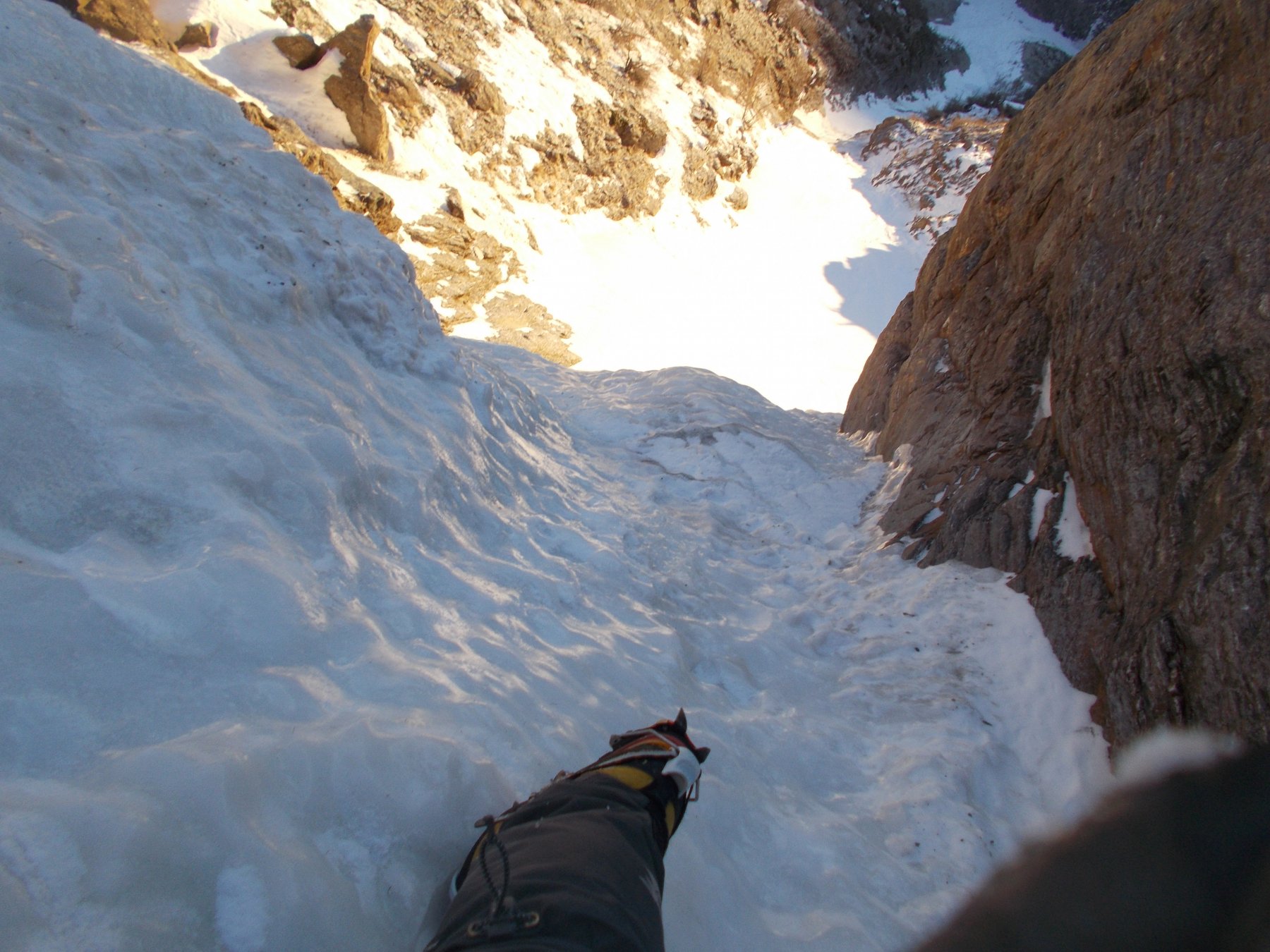
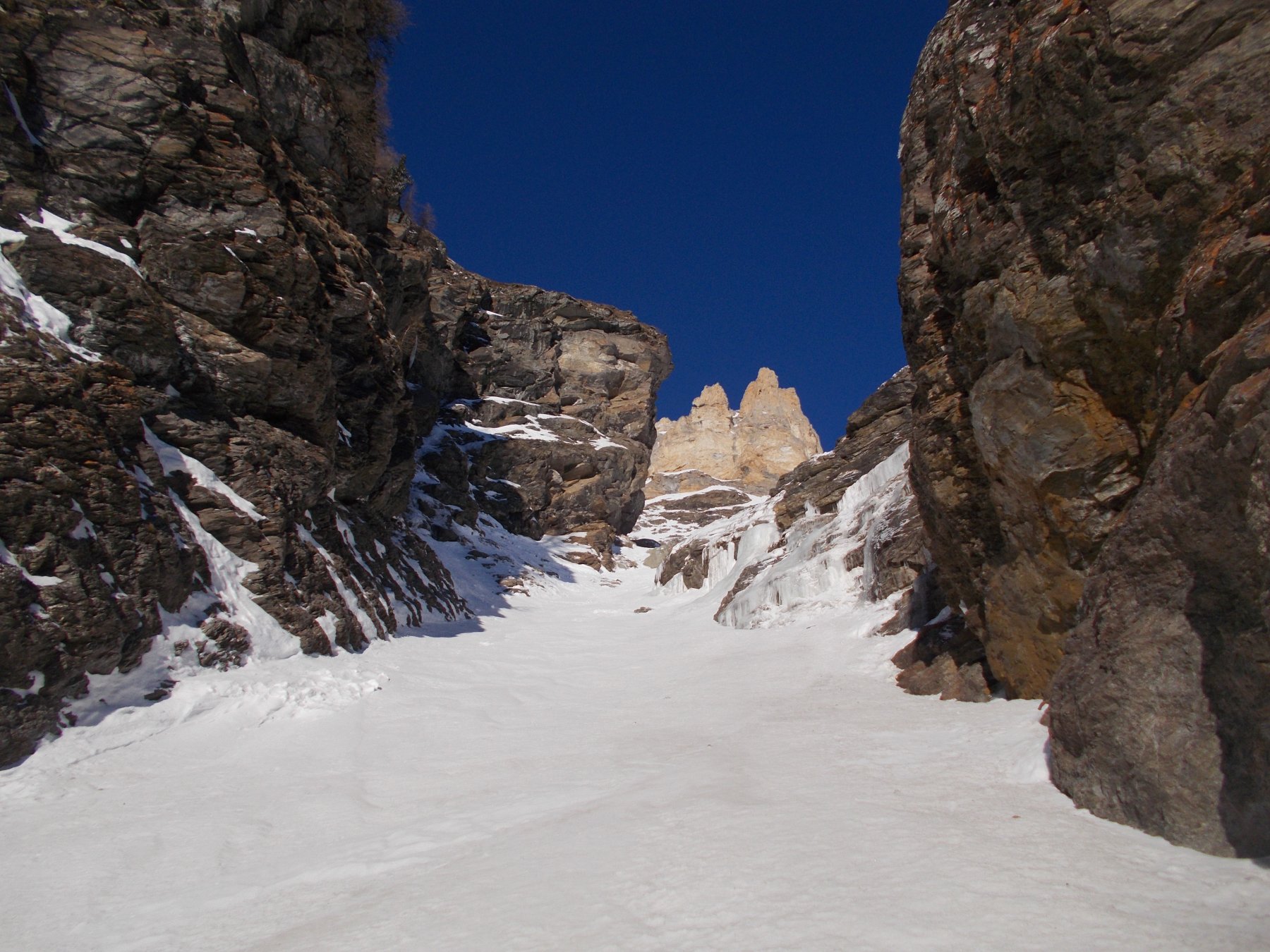
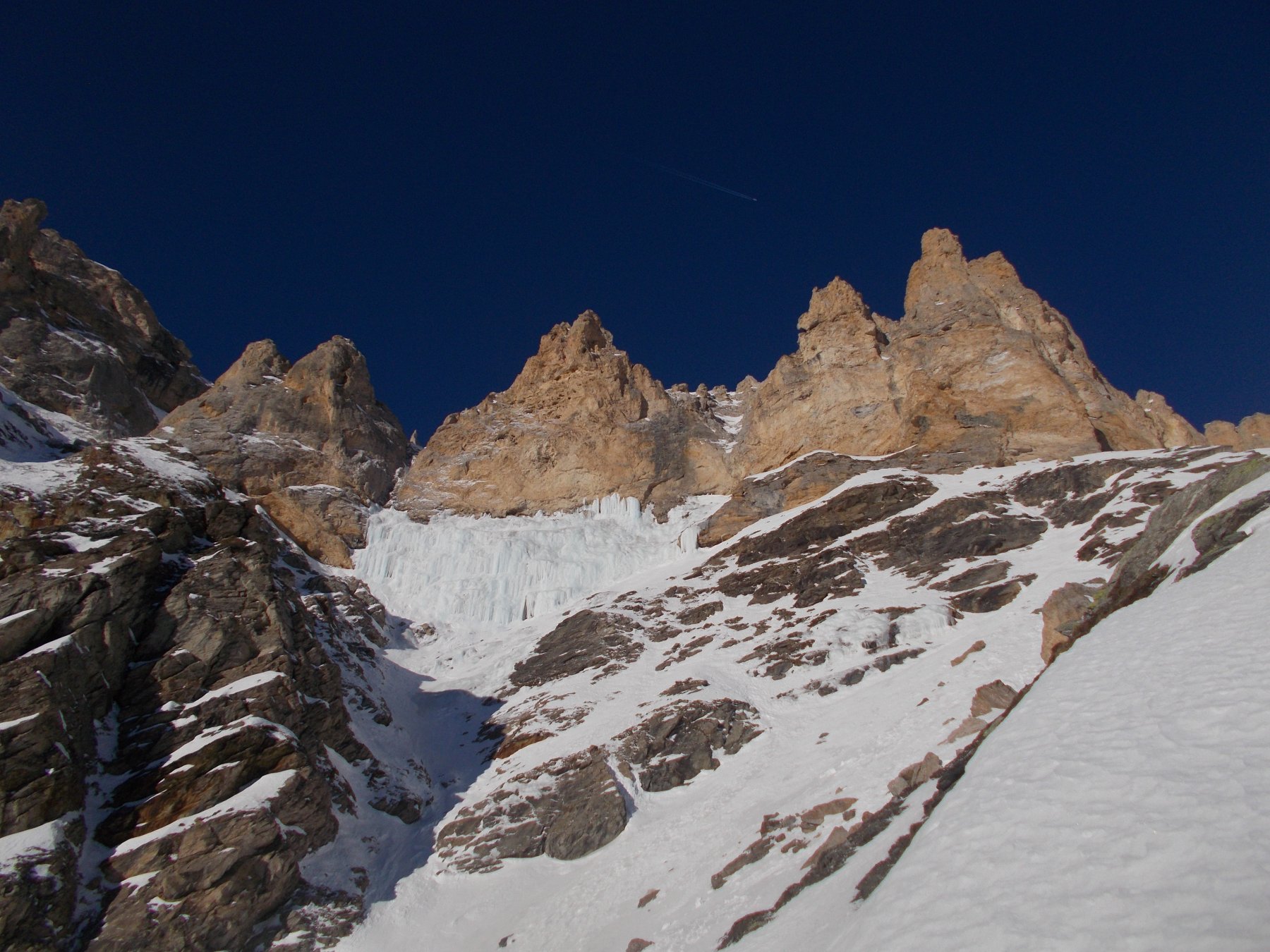
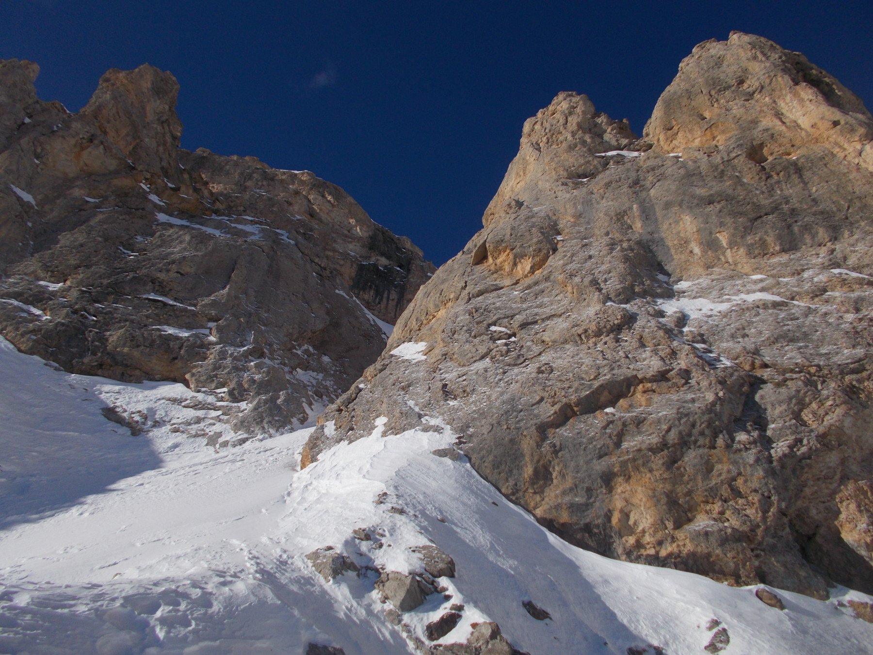
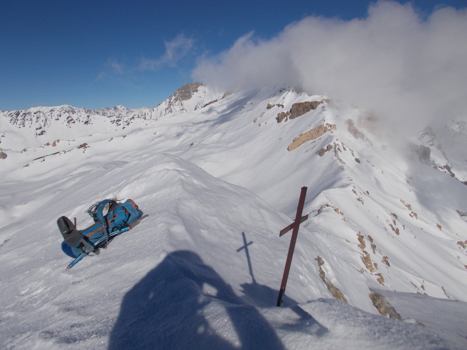
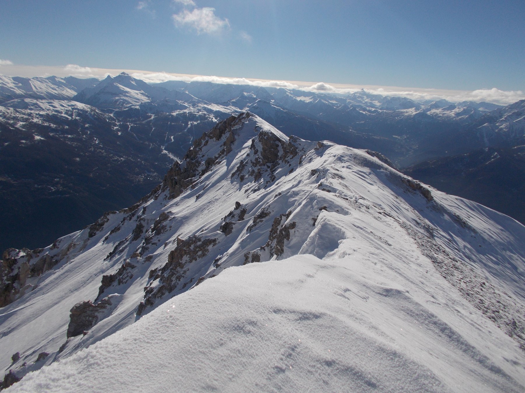
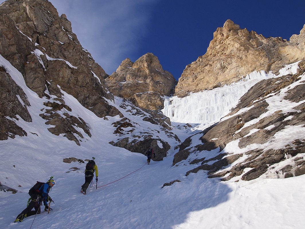
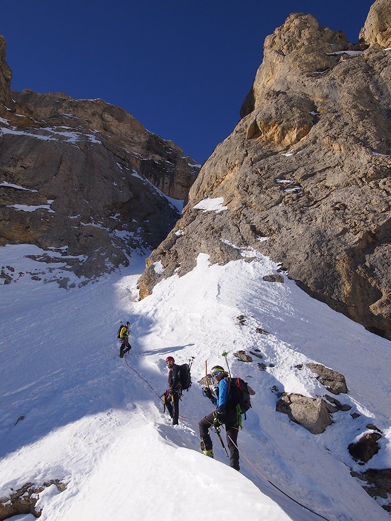
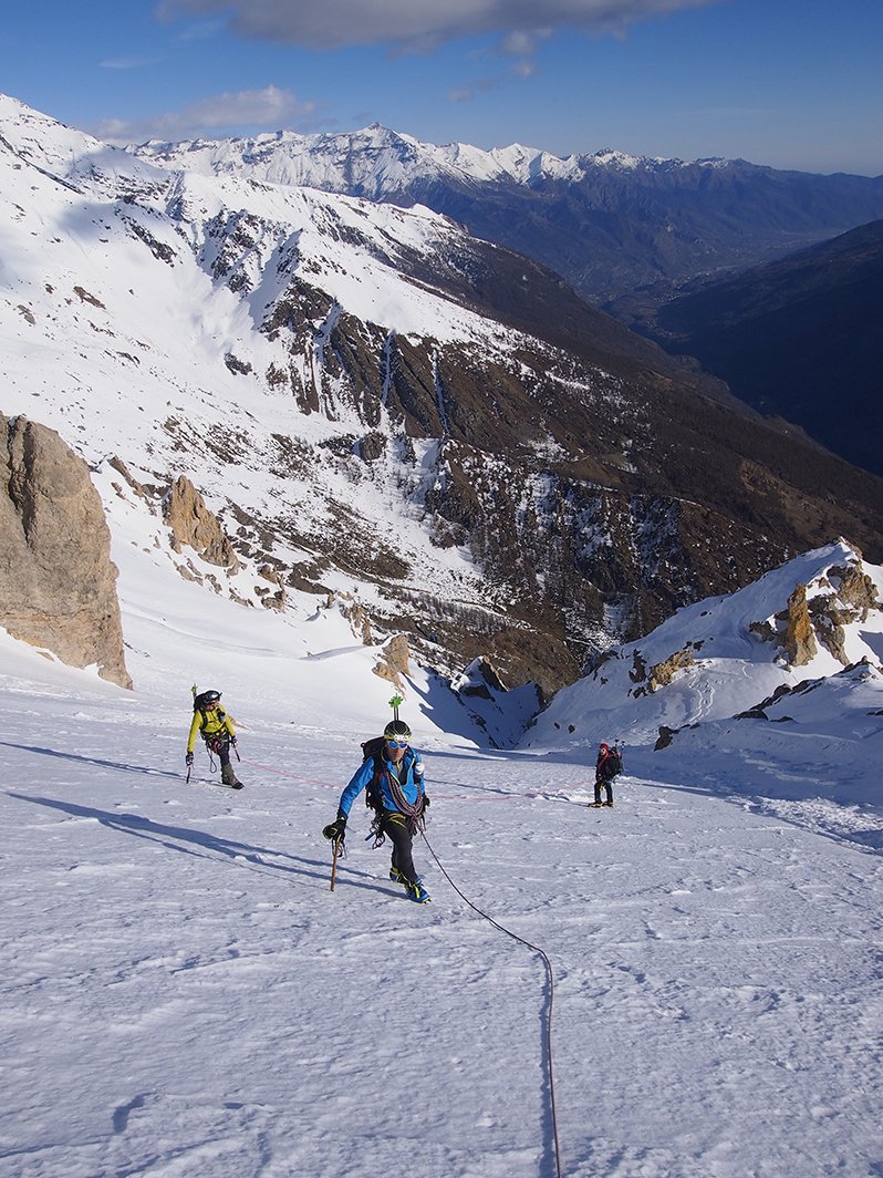
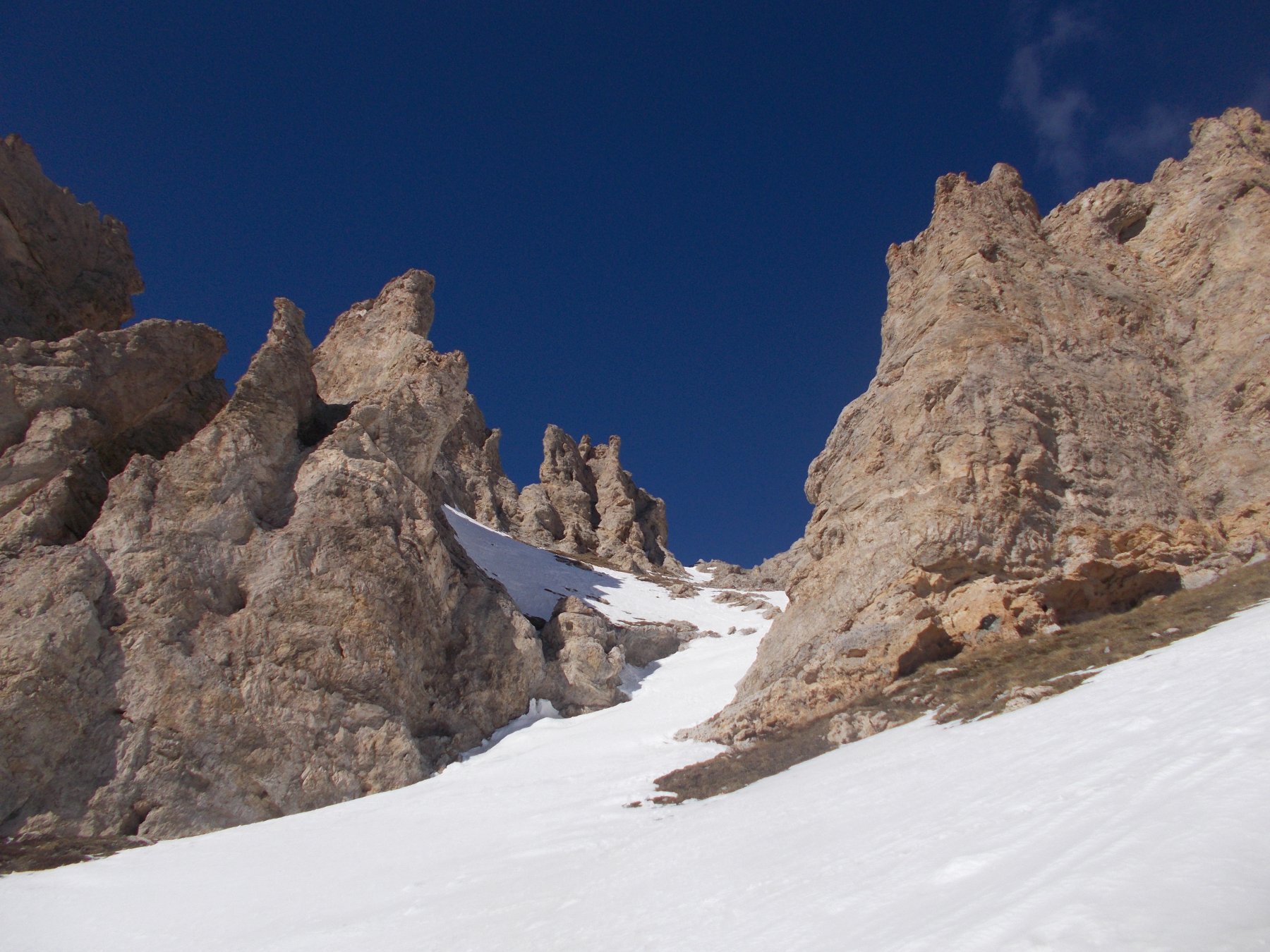
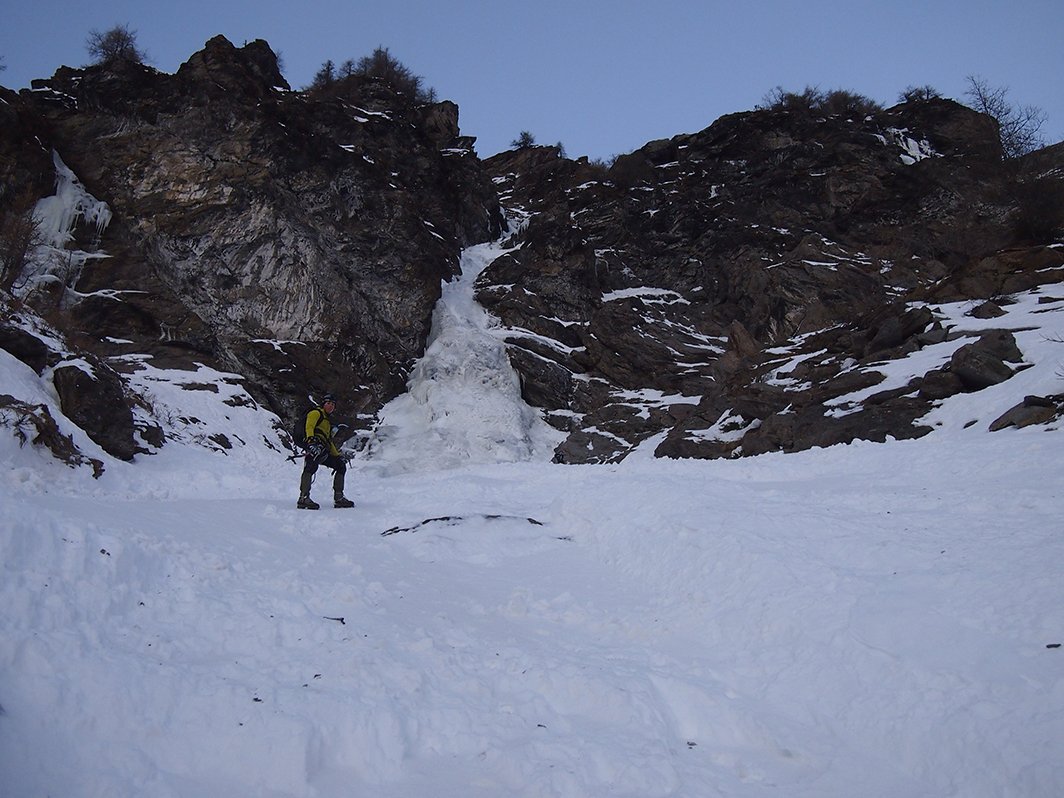
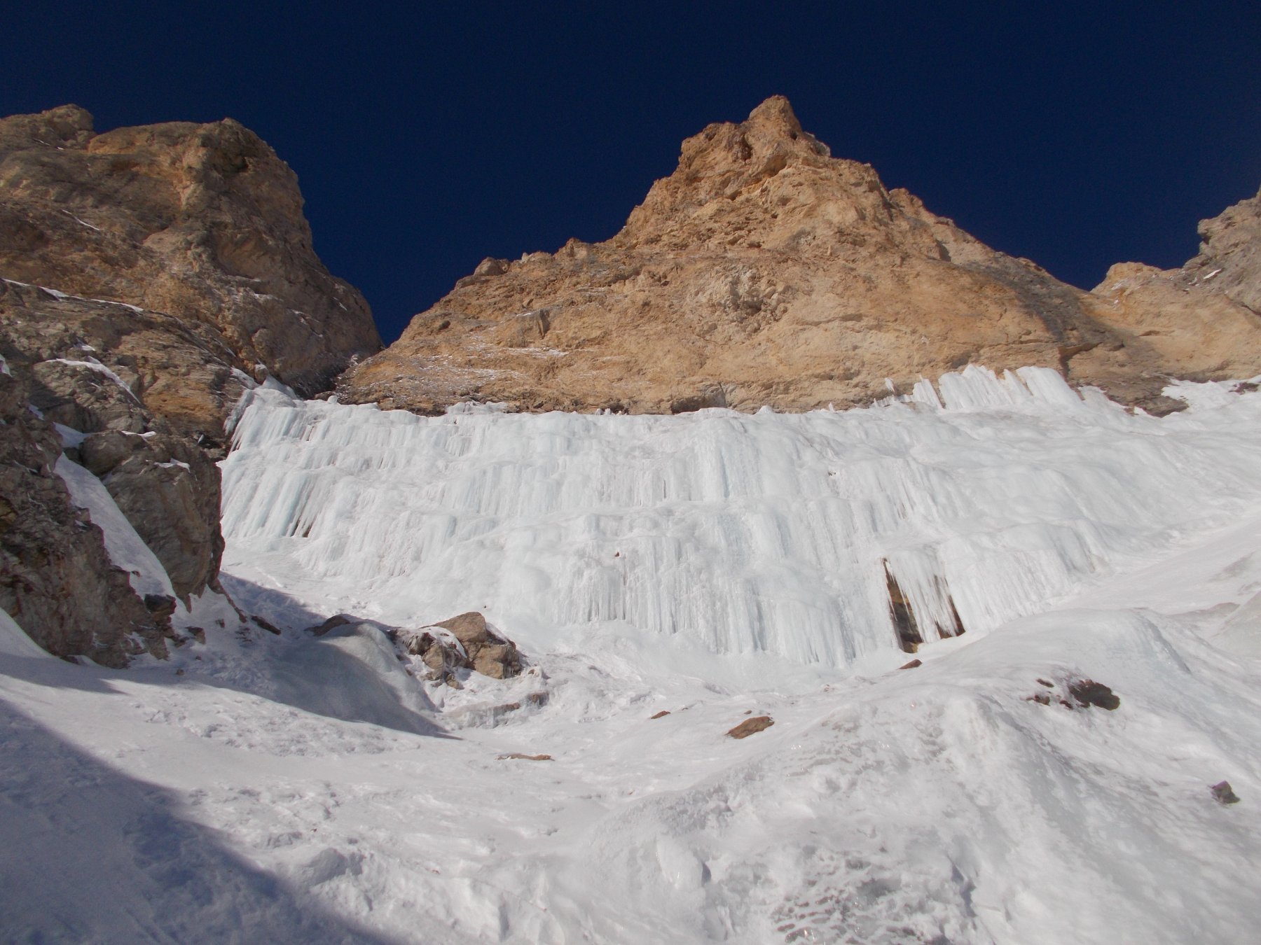
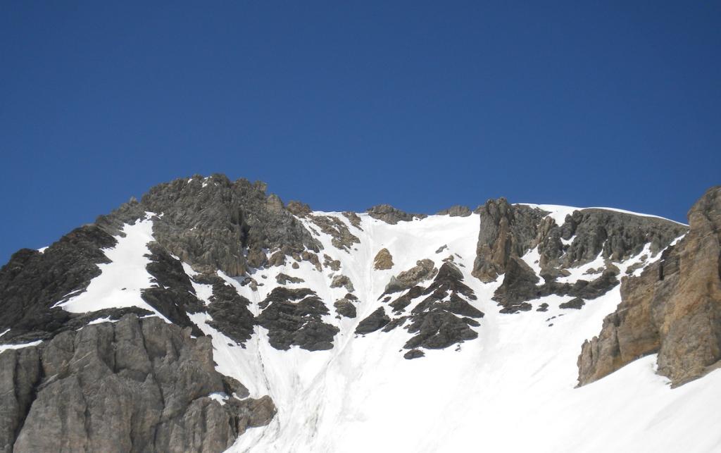
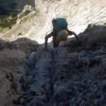
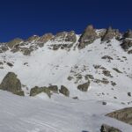
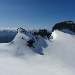
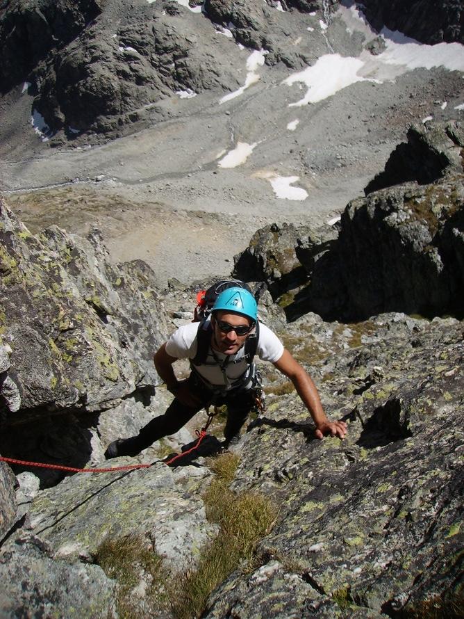
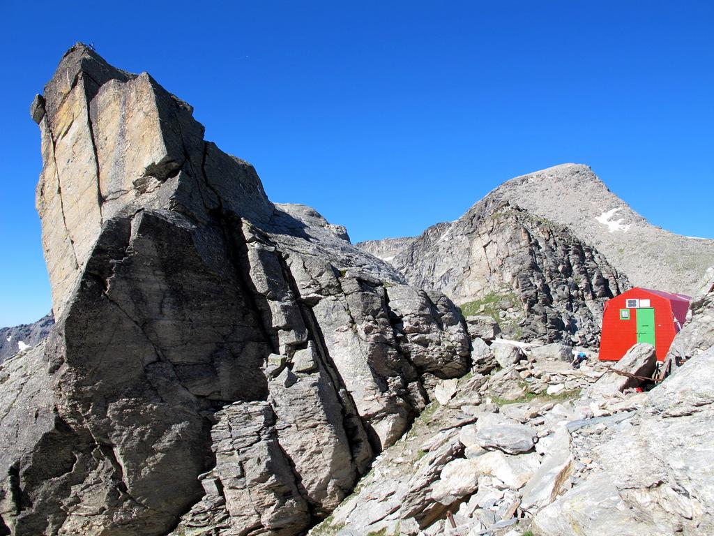
Risalire il Rio secco per circa 200 metri di dislivello e da qui imboccare il canale sulla destra orografica che porta alla miniere. Risalire il canale di neve che poi si trasforma in alcuni rigonfiamenti di ghiaccio fino all’altezza delle miniere di ferro (2200 m.). Qui il canale è sbarrato da una cascata di ghiaccio che si supera con due tiri di corda da 50 metri (3 grado). Superata la cascata il canale continua con pendenze sei 45° fino ad arrivare all’altare di ghiaccio. Proseguire verso sinistra dove si trova il passaggio che supera i caratteristici torrioni del Seguret. Superato lo stretto canale si sbuca in aperta parete e da qui si continua dritti verso la vetta.
DISCESA. La discesa si effettua per l’itinerario normale e seguendo la strada del Pramand si torna alla macchina.
- Cartografia:
- Fraternali 1:25.000 n.1 Alta Valle di Susa
Nelle vicinanze Mappa
Itinerari
12/09/2015 TO, Salbertrand D+ 1500 m F Tutte
Vallonetto (Cima del) per il Vallone del Rio Secco
 50m
50m
31/08/2025 TO, Salbertrand D+ 850 m F Sud-Ovest
Seguret (Monte) Via dei Torrioni
 2.6Km
2.6Km
31/05/2020 TO, Exilles D+ 1650 m F+ Sud-Est
Ferrand (Punta) Via Diretta Versante Sud-Est
 6Km
6Km
09/04/2025 TO, Exilles D+ 1300 m PD Sud-Est
Gros Beuri, canali sud-est da Grange della Valle
 6Km
6Km
20/09/2025 TO, Exilles D+ 1585 m F Varie
Niblè (Monte) Via Normale da Grange della Valle, anello per il Rifugio Vaccarone
 6Km
6Km
16/06/2025 TO, Exilles D+ 1700 m F Varie
Ferrand (Punta) da Grange della Valle per il Passo Clopaca
 6Km
6Km
25/05/2025 TO, Exilles D+ 1600 m AD- Nord-Est
Ambin (Monte) Parete Nord
 6Km
6Km
22/08/2016 TO, Exilles D+ 1650 m PD+ Sud-Est
Grand Cordonnier – Via Barale Cresta Sud e Parete Est da Grange della Valle
 6Km
6Km
09/08/2025 TO, Exilles D+ 1700 m F Tutte
Ferrand (Punta) da Grange della Valle per il Col d’Ambin
 6Km
6Km
16/06/2024 TO, Exilles D+ 1385 m AD Est
Ambin (Monte) Canali Versante Est
 6Km
6Km
Servizi
3Km
5.8Km
Levi Molinari Rifugio
Exilles
5.8Km
orto del frate Ristorante
Sauze d'Oulx
5.8Km
paddy mc ginty Ristorante
Sauze d'Oulx
6Km
L’Cantun B&B
Sauze D'oulx
6.1Km
Arlaud Rifugio
Salbertrand
7.7Km
La Moretta Ristorante
Oulx
8.1Km
La Quadriglia Ristorante
Exilles
8.1Km
L’ultima stisa Ristorante
Exilles
8.3Km