3.3Km
3.3Km

Note
 2Km
4.5Km
4.5Km
4.5Km
4.5Km
4.5Km
4.5Km
5.9Km
5.9Km
7.2Km
2Km
4.5Km
4.5Km
4.5Km
4.5Km
4.5Km
4.5Km
5.9Km
5.9Km
7.2Km
3.3Km
4.5Km
4.5Km
4.5Km
7.9Km
8.2Km
8.2Km
8.3Km
8.6Km
9Km
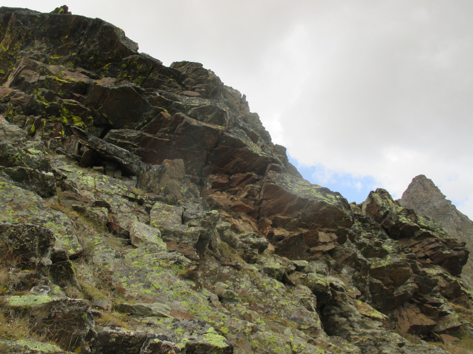
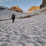
Percorso ben segnalato sino al Lago di Changier , poi tracce di animali e tratto delicato di cresta con roccia di qualità mediocre. Possibilità di arrivare al lago da due itinerari diversi, uno dall'alpe di felumaz , l'altro più a sud che sfrutta un traverso più basso e poi sale sulla direttiva del lago bruscamente e raggiungendo prima l'alpe Changier.
Vetta che può esser più ovvio raggiungere dalla Valgrisanche , ma senza poter evitare l'ultimo tratto di cresta impegnativo.
Avvicinamento
Vetta che può esser più ovvio raggiungere dalla Valgrisanche , ma senza poter evitare l'ultimo tratto di cresta impegnativo.
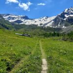
Risalire la valle di Rhemes fino oltre S. Georges, giunti alla frazione di Melignon sul lato sinistro orografico del torrente , posteggiare .
Descrizione
Dall’abitato di Melignon risalire i prati su sentiero ben segnalato con indicazioni per il Lago di Changier, attraversare dei tratti di bosco e pervenire all’alpeggio di Felumaz.
Girare a sinistra andando a prendere un colle erboso che è la parte terminale della cresta sud-est che scende dalla Pre d’Amont .
Con tratto in leggera discesa traversare a sinistra e raggiungere l’alpeggio di Changier addossato a una barra rocciosa.
Continuare su pascoli in salita diagonale a sinistra sino a pervenire al lago di Changier.
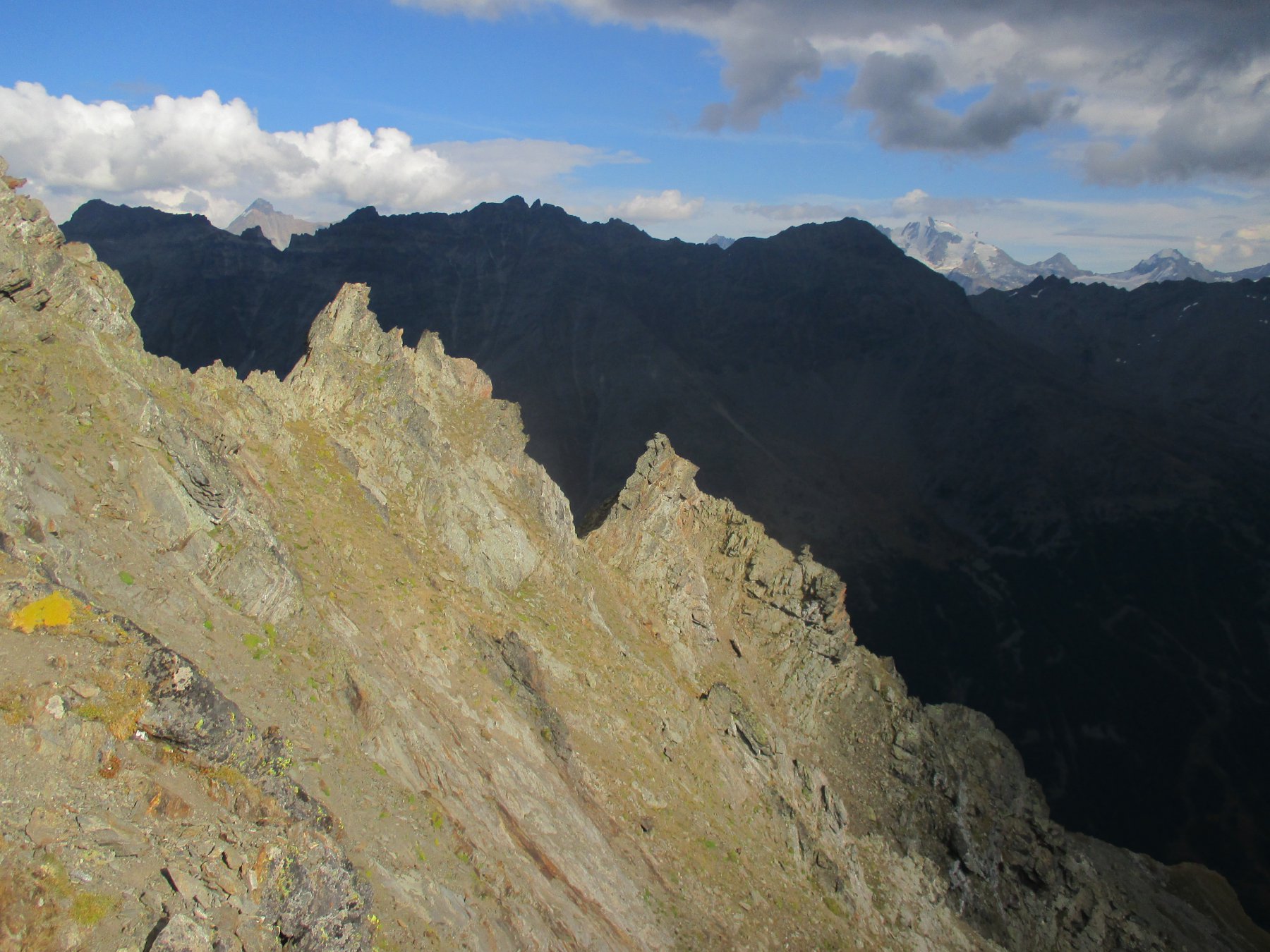
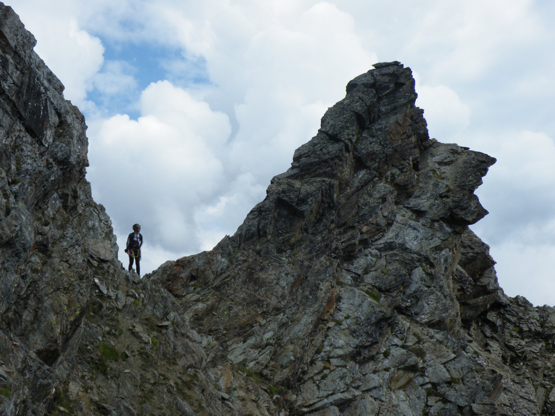
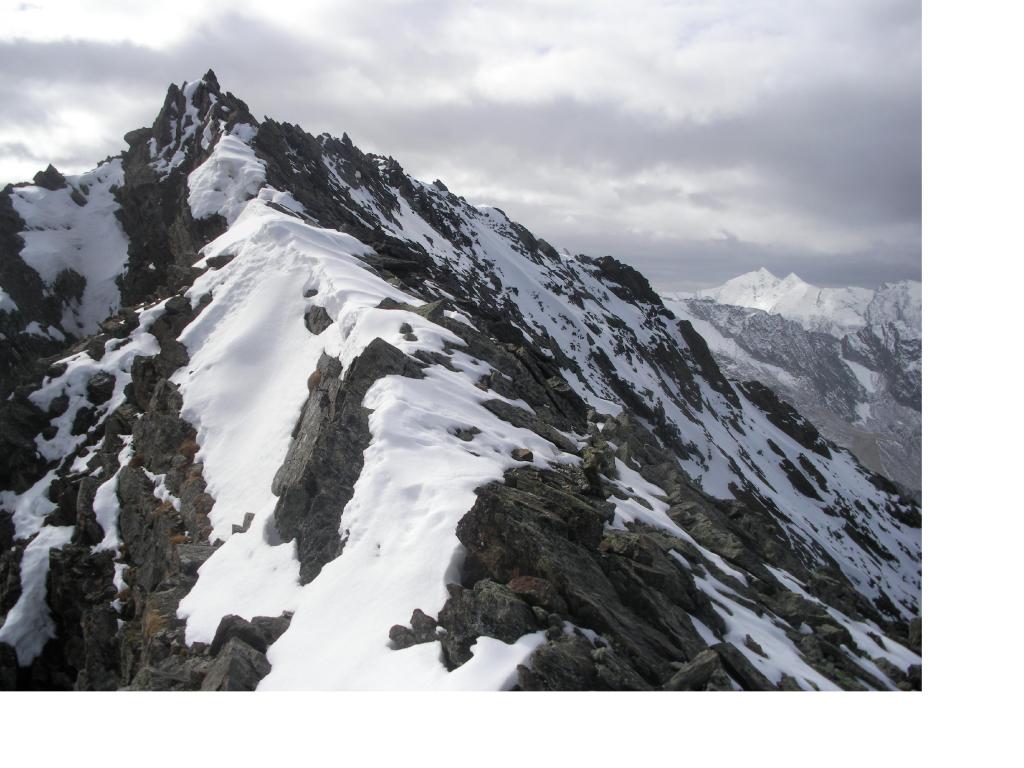
Dal lago salire per tratti erbosi alternati a tratti morenici e puntare alla punta soprastante che altro non è che la prima elevazione della cresta che scende dalla becca Laugier , attaccarla da destra da un canale di sfasciumi e per tracce di animali portarsi aiutandosi con le mani su un facile tratto di rocce rotte. Continuare in cresta senza difficoltà e raggiungere la prima elevazione, oltrepassare un’arco di roccia e passare sul versante est su tracce e raggiungere un ‘intaglio.
Passare sul versante sud e non farsi tentare da un sucessivo intaglio più in alto con cengia sempre a destra che porta ad una fascia rocciosa non difficile ma con pessima roccia.
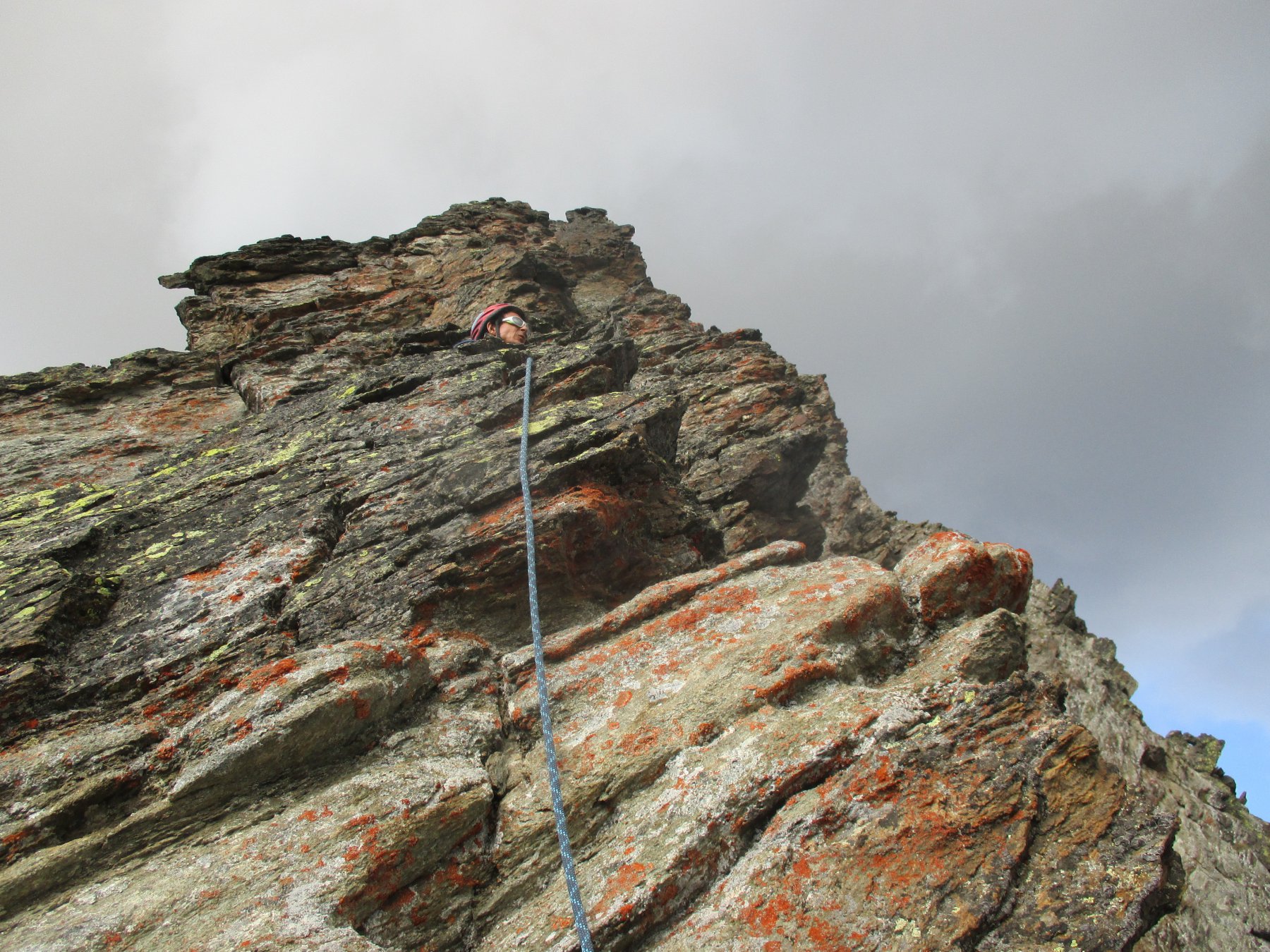
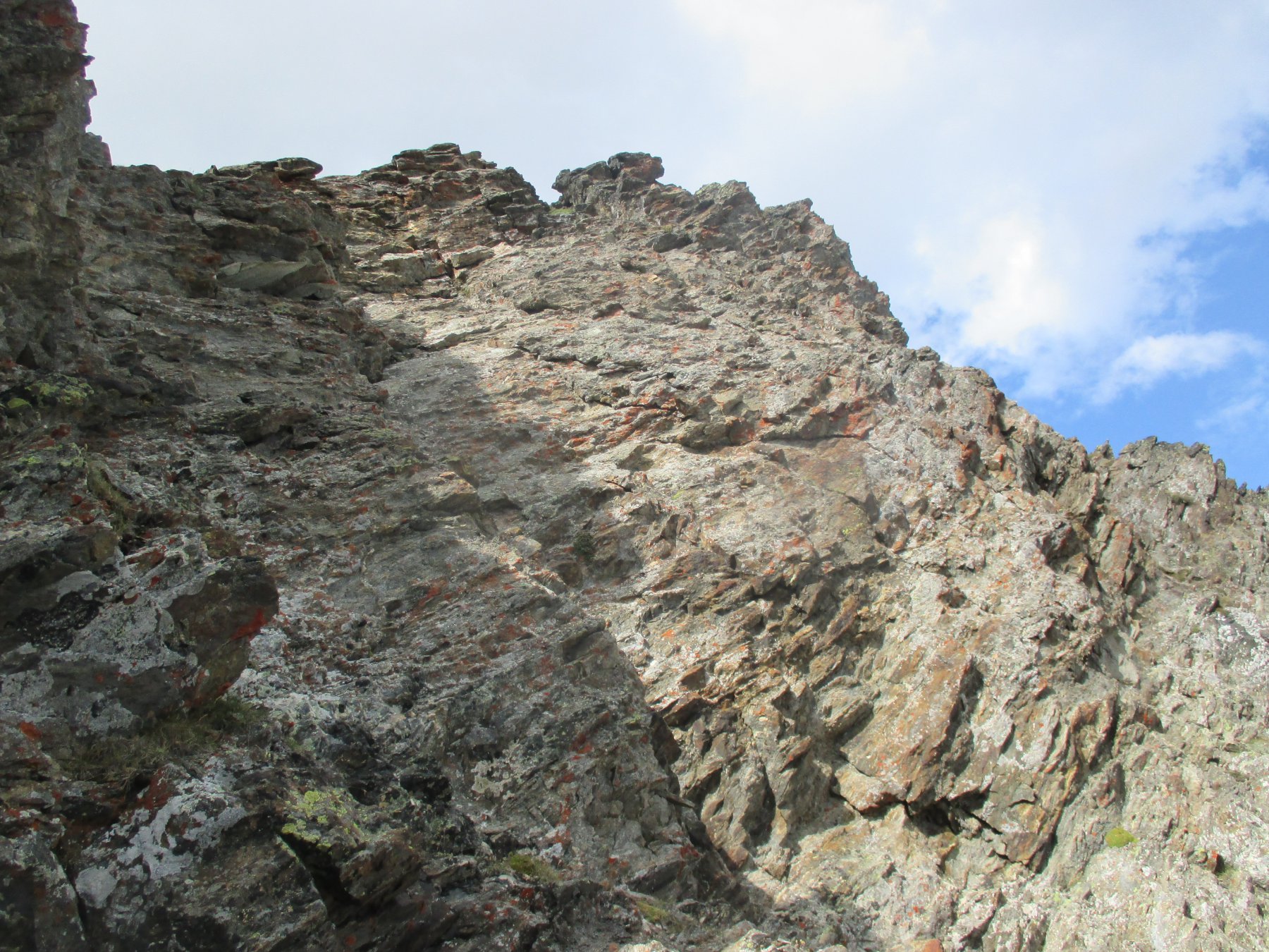
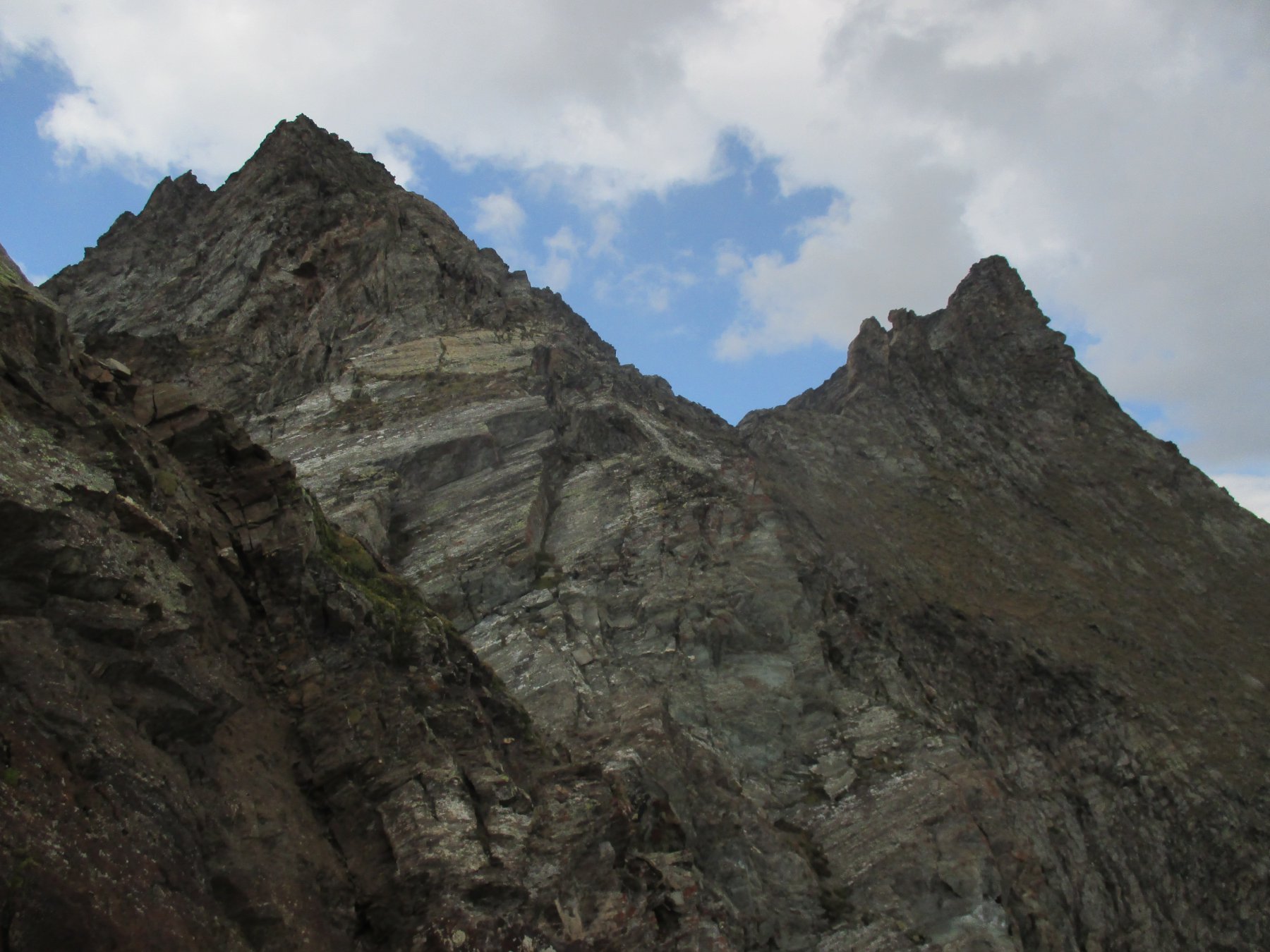
Tagliare i pendii orizzontalmente grazie a tracce di animali. Puntare ora alla cresta sud ovest già visibile e raggiungerla senza problemi. Da qui inizia il tratto più impegnativo che si supera prima con due tratti ripidi ed un traverso a destra sul versante sud poi sull’ovest con alcuni tratti delicati su roccia non sempre impeccabile e poco proteggibile infine sul filo di cresta un po’ più facile.
Da li in breve in vetta.
Discesa dal medesimo percorso.
- Cartografia:
- I.G :.C.
Nelle vicinanze Mappa
Itinerari
17/07/2021 AO, Rhêmes-Notre-Dame D+ 1850 m AD+ Ovest
Ran (Punta di) da Creton per il Passo di Nequedè e la cresta Sud
 2Km
2Km
04/09/2022 AO, Rhemes-Notre-Dame D+ 1253 m PD- Varie
Fort de Bard Cresta Nord-Est
 4.5Km
4.5Km
04/08/2019 AO, Rhêmes-Notre-Dame D+ 1600 m AD+ Sud-Ovest
Gollien (Cime di) da Bruil, traversata dal Colle di Entrelor al Colle di Sort
 4.5Km
4.5Km
11/08/2022 AO, 625600 D+ 300 m F Ovest
Chateau Quelet da Rhemes Notre Dame
 4.5Km
4.5Km
22/06/2008 AO, Rhêmes-Notre-Dame D+ 1250 m AD- Nord-Est
Grande Traversière – Via Bonacossa alla Parete NE
 4.5Km
4.5Km
22/06/2026 AO, Rhêmes-Notre-Dame D+ 1600 m F Nord
Calabre (Punta) Via Normale da Thumel per il Rifugio Benevolo
 4.5Km
4.5Km
28/06/2024 AO, Rhêmes-Notre-Dame D+ 1707 m F Nord
Entrelor (Cima di) da Bruil
 4.5Km
4.5Km
24/10/2021 AO, Rhemes-Saint-Georges D+ 1642 m PD- Tutte
Chamoussière (Punta) da Rhemes Saint Georges
 5.9Km
5.9Km
21/10/2012 AO, Rhemes-Saint-Georges D+ 1656 m PD Sud-Est
Pré d’Amont (Becca di) Cresta Est
 5.9Km
5.9Km
04/07/2015 AO, Valsavarenche D+ 1750 m PD Ovest
Favret (Mont) da Rovenaud per il versante ovest
 7.2Km
7.2Km
Servizi
3.3Km
4.5Km
Galisia Albergo
Rhemes-Notre-Dame
4.5Km
Tanini Ristorante
Rhemes-Notre-Dame
4.5Km
Lo Sabot Albergo
Rhemes-Notre-Dame
7.9Km
Benevolo Rifugio
Rhêmes-Notre-Dame
8.2Km
Lo Fourquin Bar
Valsavarenche
8.2Km
Chalet de L’Epée Rifugio
Valgrisenche
8.3Km
Abro de la Leunna Ristorante
Valsavarenche
8.6Km
La Tana delle Volpi Ristorante
Valgrisenche
9Km