 3.1Km
3.1Km
Note
 2.8Km
2.8Km
4.8Km
5Km
7.1Km
7.1Km
7.1Km
7.1Km
7.1Km
2.8Km
2.8Km
4.8Km
5Km
7.1Km
7.1Km
7.1Km
7.1Km
7.1Km
3.1Km
3.6Km
4Km
5.6Km
5.7Km
5.9Km
8Km
8.3Km
8.4Km
8.6Km
Lunga salita, in uno degli angoli meno battuti della Vallée.
Un modo originale per raggiungere l'Avic senza salire dal classico itinerario che parte da Veulla.
Percorso per gli amanti delle lunghe camminate e dei dislivelli importanti e molto più agevole del sentiero con segnavia n° 1 che parte da Fénis.
Avvicinamento
Un modo originale per raggiungere l'Avic senza salire dal classico itinerario che parte da Veulla.
Percorso per gli amanti delle lunghe camminate e dei dislivelli importanti e molto più agevole del sentiero con segnavia n° 1 che parte da Fénis.
Autostrada A5 Torino-Aosta, uscita Châtillon. Si prende la SS26 fino a raggiungere Chambave. Alla rotonda (indicazioni per Fénis), svoltare e subito dopo, alla successiva rotonda, non seguire per Fenis, ma per Pontey.
Al primo villaggio che si incontra, Arlier, entrare nel villaggio ed attraversarlo. La prima strada sulla destra all’uscita del villaggio conduce a Luxé. Dal bivio per Luxé, salire per 4,3 km fino ad incontrare poderale per Luxé. La poderale è lunga 2,3 km.
Dalla SS26 Luxé dista complessivamente ca 9 km. A Luxé la poderale termina e dietro l’alpeggio si stacca il sentiero con segnavia n° 4.
Descrizione
Al primo villaggio che si incontra, Arlier, entrare nel villaggio ed attraversarlo. La prima strada sulla destra all’uscita del villaggio conduce a Luxé. Dal bivio per Luxé, salire per 4,3 km fino ad incontrare poderale per Luxé. La poderale è lunga 2,3 km.
Dalla SS26 Luxé dista complessivamente ca 9 km. A Luxé la poderale termina e dietro l’alpeggio si stacca il sentiero con segnavia n° 4.
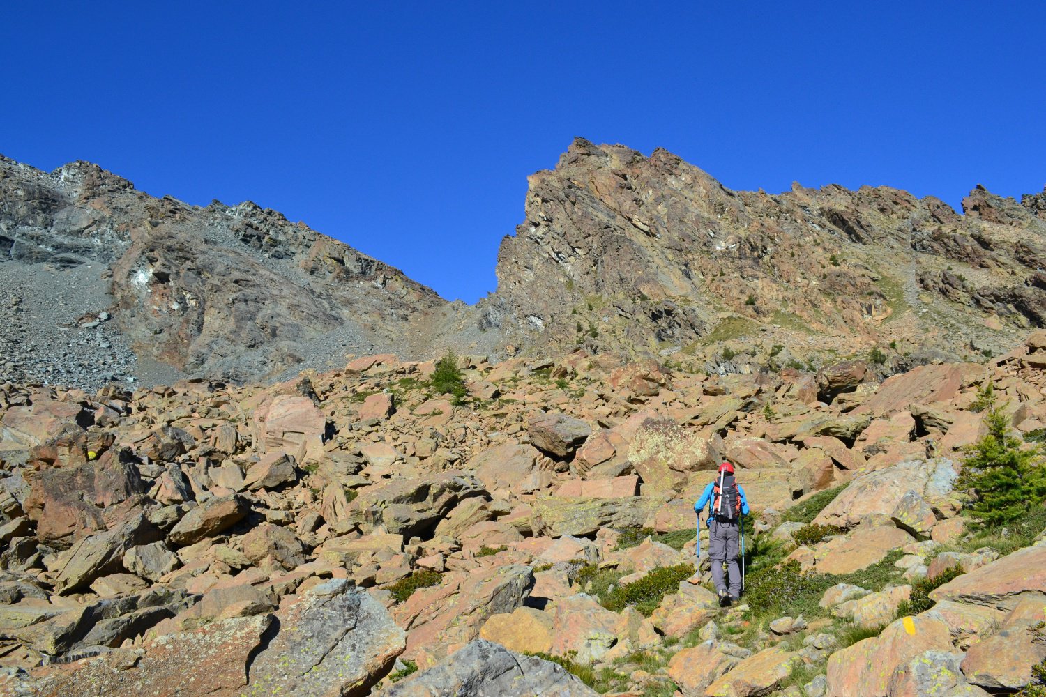
Si segue il segnavia n.4 fino a 1500 m di quota dove, tenendo la sinistra, ci si immette sul sentiero n° 7, tralasciando la diramazione di destra che porta al n° 1 proveniente da Fénis.
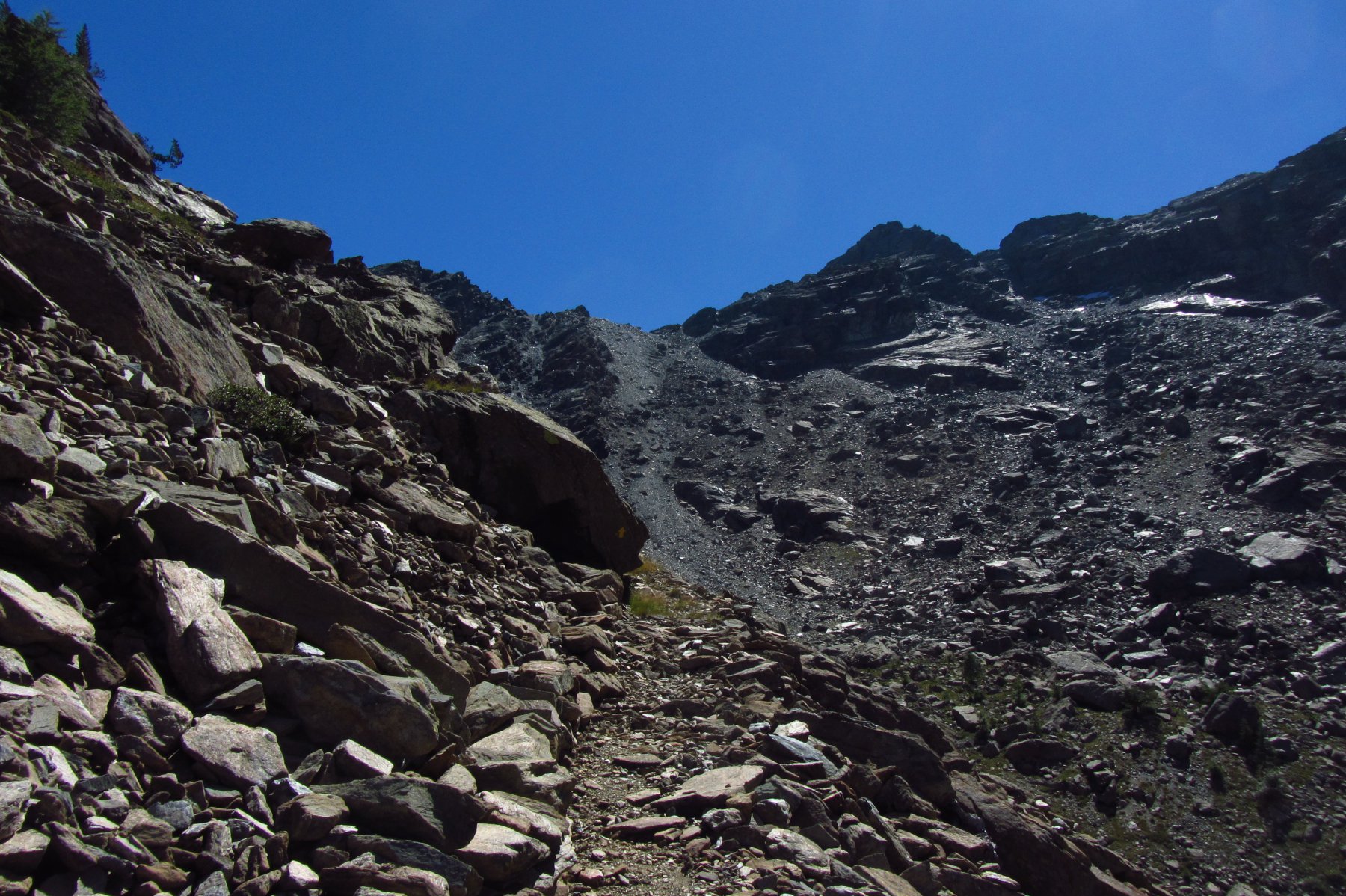
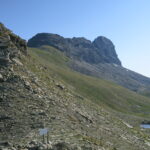
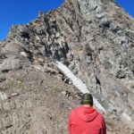
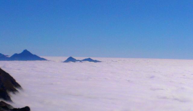
Si risale quindi l’intero vallone di Ponton sulla destra orografica fino a quota 2150 mt dove il segnavia (7) indica l’ultimo tratto di sentiero per il colle Varotta (2.589 mt). Giunti al colle deviare a destra superando una serie di piccoli denti rocciosi che si possono aggirare o superare con difficoltà di II. L’ultimo di questi denti si sale da sinistra per una piccola cengia ascendente facile, ma esposta.
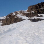
Si scende quindi brevemente ad un colletto, alla base del pendio finale di detriti che porta in vetta.
Su questo pendio, per tracce di sentiero, si sale verso la sommità che si raggiunge infine con qualche breve passo di I o II (corde fisse e cavi metallici sui passaggi più esposti).
- Cartografia:
- IGC Ivrea Biella Bassa Valle d'Aosta
- Bibliografia:
- Guida dei Monti d'Italia -Monte Emilus e Rosa dei Banchi- Parco del Mont Avic. G.Berrutto - L.Fornelli
Nelle vicinanze Mappa
Itinerari
27/07/2025 AO, Pontey D+ 1650 m D Sud
Noire (Cime) Cresta Sud dal Col Giron
 2.8Km
2.8Km
04/09/2021 AO, Chambave D+ 1900 m F Nord
Ruvic (Monte) da Verthuy per il vallone di Valmeriana e il Colletto Giron
 2.8Km
2.8Km
21/09/2008 AO, Champdepraz D+ 1700 m TD+ Sud
Ruvi (Monte), Parete sud – Minium
 4.8Km
4.8Km
05/09/2016 AO, Fenis D+ 2400 m F Varie
Avic (Mont) da Fenis per la cresta NO
 5Km
5Km
18/07/2026 AO, Fenis D+ 2000 m PD Sud-Est
Tersiva (Punta) Cresta Sud dalla Val Clavalité
 7.1Km
7.1Km
21/08/2017 AO, Fenis D+ 2200 m F Varie
Avic (Monte) dalla Val Clavalitè, anello creste ovest e est per i colli Raye Chevrere, Varotta,Bella Lanaz
7.1Km
03/07/2025 AO, Fenis D+ 1600 m F Nord
Avic (Monte) Via Normale dalla Val Clavalitè
 7.1Km
7.1Km
18/06/2022 AO, Fenis D+ 2000 m AD Nord-Est
Tersiva (Punta) Cresta Est da Val Clavalitè
 7.1Km
7.1Km
13/09/2020 AO, Fenis D+ 1700 m PD Varie
Pontonnet (Torre di) Cresta SE dalla Val Clavalitè
 7.1Km
7.1Km
06/06/2021 AO, Fenis D+ 2000 m AD+ Nord-Est
Tersiva (Punta) Parete NE
 7.1Km
7.1Km
Servizi
3.1Km
3.6Km
Mathamel Giorgio B&B
Verrayes
4Km
Maison Tersiva B&B
Nus
5.6Km
Blanche Neige Bar
Verrayes
5.7Km
Chez Gaillard B&B
Fenis
5.9Km
Lavesè Ristorante
Saint-denis
8Km
del Diavolo Ristorante
Saint-Marcel
8.3Km
Boule de neige B&B
Antey Saint Andrè
8.4Km
Maison Rosset Rifugio
Nus
8.6Km