 3.2Km
3.2Km
Note
Storico
 50m
100m
6.3Km
6.6Km
7.2Km
7.3Km
9.6Km
9.6Km
9.7Km
9.7Km
50m
100m
6.3Km
6.6Km
7.2Km
7.3Km
9.6Km
9.6Km
9.7Km
9.7Km
3.2Km
4.3Km
4.5Km
5.3Km
6.2Km
6.5Km
7.1Km
7.1Km
7.3Km
7.3Km
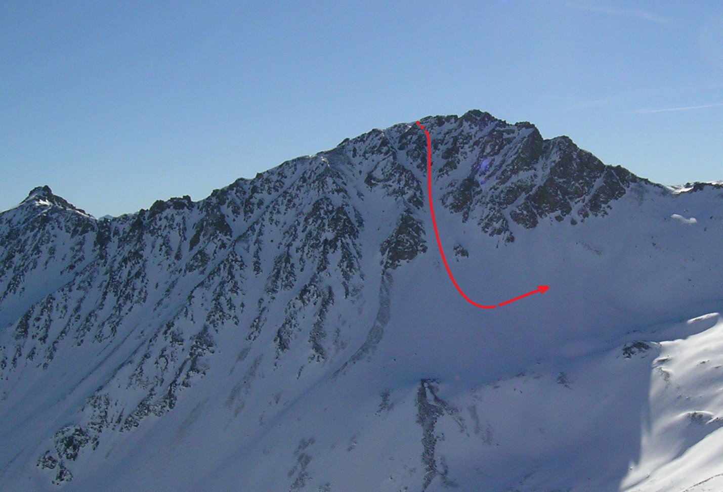
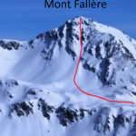
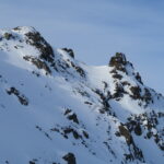
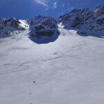
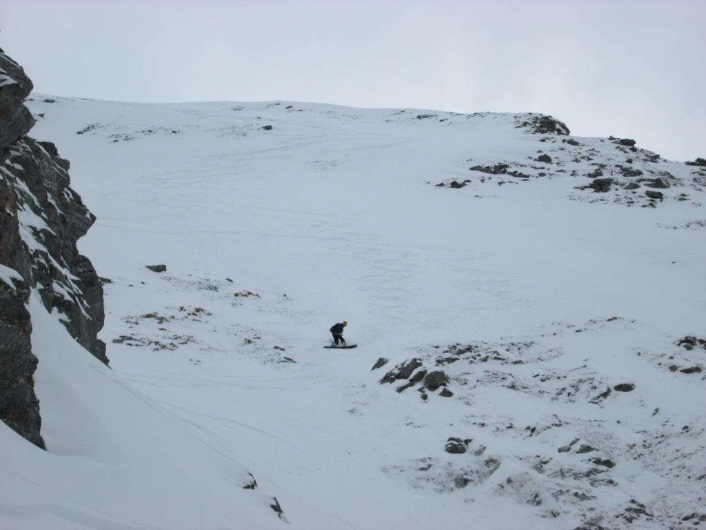
Breve canale di circa 250 m con esposizione in pieno N che conserva neve fredda a lungo. Dalla base del canale si risale in breve al colle q. 2670 tra il Fallere e il M. d'Ars.
L'idea è di Matteo G. che l'ha osservato nei giorni precedenti la nostra discesa e ci ha invitati a condividere con lui la gita.
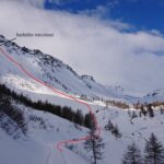
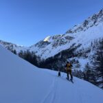
Avvicinamento
L'idea è di Matteo G. che l'ha osservato nei giorni precedenti la nostra discesa e ci ha invitati a condividere con lui la gita.
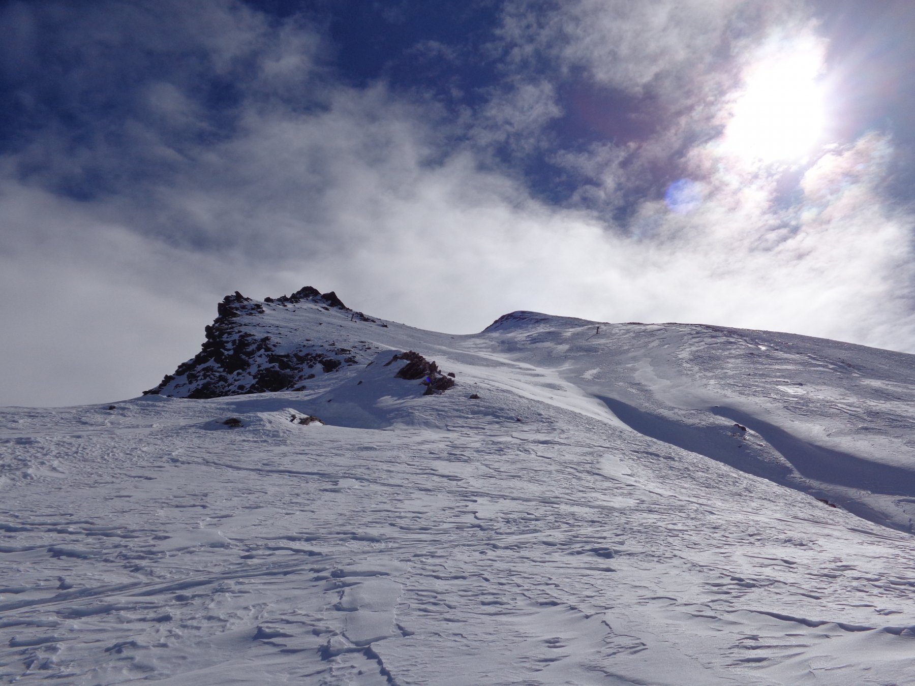
Da Thouraz seguire la poderale fino a q. 1900 circa, raggiungere l'alpe Morgnoz e proseguire lungo la dorsale che scende dalla cresta S del M. d'Ars fino a q. 2400 circa, quindi piegare gradualmente a dx ed entrare nel vallone compreso tra il M. d'Ars e il M. de la Tsa. Per pendii via via più sostenuti guadagnare la cresta E del M. d'Ars verso q. 2700 circa e da qui facilmente in vetta (ramponi utili).
Descrizione
Circa 50 m a Est della vetta si imbocca il canale per una rampetta obliqua a sx che permette di entrare agevolmente a piedi nel canale. Primi 50 m sui 40-45 un po’ stretti, poi il canale si allarga progressivamente e la pendenza diminuisce. Scendere a piacere in funzione di quanto si vuole risalire per ritornare al colle (minimo 100 m). Dal colle si segue a piacere l’ampio valloncello tra il Fallere e il M. d’Ars fino a ricongiungersi con l’itinerario di salita.
Non abbiamo notizie di precedenti discese, anche se la facilità di accesso rende probabile che sia già stato percorso.
- Cartografia:
- L'Escursionista - N° 4 - Conca di Aosta - Pila - M. Emilius
Nelle vicinanze Mappa
Itinerari
07/03/2024 AO, Sarre D+ 750 m I, 4.1, E1 Est
France (Becca de) Parete Est
 50m
50m
01/03/2026 AO, Sarre D+ 1253 m I, 3.2, E2 Varie
Tsa (Mont de la) Canale SO
 100m
100m
20/02/2024 AO, Gignod D+ 1201 m II, 4.3, E3 Nord
Tsa (Mont de la) Parete Nord da Buthier
 6.3Km
6.3Km
20/02/2021 AO, Saint-Pierre D+ 1281 m I, 4.1, E2 Ovest
Fallère (Monte) Canale Ovest
 6.6Km
6.6Km
15/12/2025 AO, Saint-Rhemy-En-Bosses D+ 1811 m I, 4.1, E1 Nord
Fallère (Monte) Parete Nord
 7.2Km
7.2Km
01/02/2026 AO, Etroubles D+ 1585 m II, 4.1, E2 Nord
Arsy o Ars (Mont d’) Canale Nord da Chez les Blanc
 7.3Km
7.3Km
01/02/2026 AO, Etroubles D+ 1237 m I, 3.2, E1 Sud
Noir (Bec) Canalino Sud
 9.6Km
9.6Km
06/04/2013 AO, Saint-Rhemy-En-Bosses D+ 1200 m II, 5.1, E3 Nord
Labiez (Monte), Parete Nord Canale Hotel Jorasses-Suite Real
 9.6Km
9.6Km
08/05/2021 AO, Gressan D+ 1290 m I, 4.3, E2 Nord-Ovest
Valletta (Punta della) Canale Ovest o della serpe
 9.7Km
9.7Km
13/04/2024 AO, Gressan D+ 1850 m IV, 5.2, E4 Nord-Ovest
Emilius (Monte) Couloir NO
 9.7Km
9.7Km
Servizi
3.2Km
4.3Km
Gran Paradiso B&B
Jovencan
4.5Km
La pineta Rifugio
Aymavilles
5.3Km
Le Vieux Noyer B&B
Saint-Pierre
6.2Km
Vetan Ristorante
Saint-Pierre
6.5Km
Notre Maison Albergo
Saint Pierre
7.1Km
Chez Duclos Ristorante
Gignod
7.1Km
Chez Edi Ristorante
Gignod
7.3Km
Carillon Bar
Aymavilles 7.3Km
7.3Km