200m
200m

Note
Storico
 50m
50m
50m
50m
1.2Km
3.8Km
3.8Km
3.8Km
3.8Km
50m
50m
50m
50m
1.2Km
3.8Km
3.8Km
3.8Km
3.8Km
200m
4.1Km
4.2Km
5.1Km
5.9Km
7Km
8.9Km
9.1Km
9.1Km
9.2Km
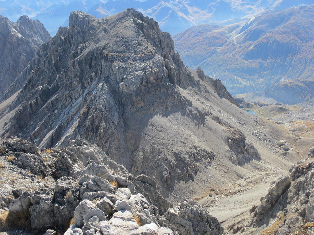
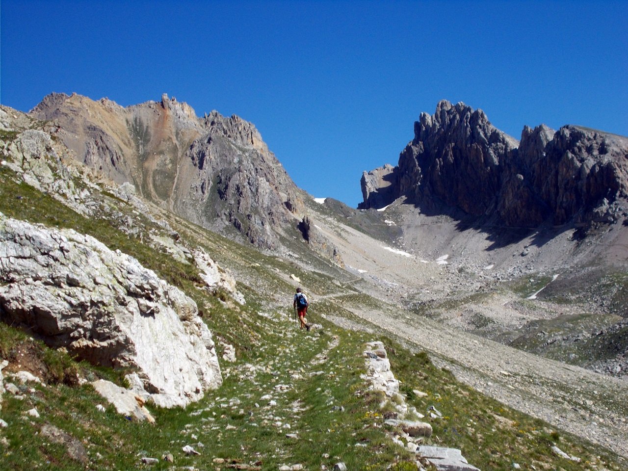
Dopo la casermetta breve canalino (di fianco sulla sx della verticale parete rocciosa) abbastanza ripido, come gli ultimi 100 metri prima della cima.
Avvicinamento
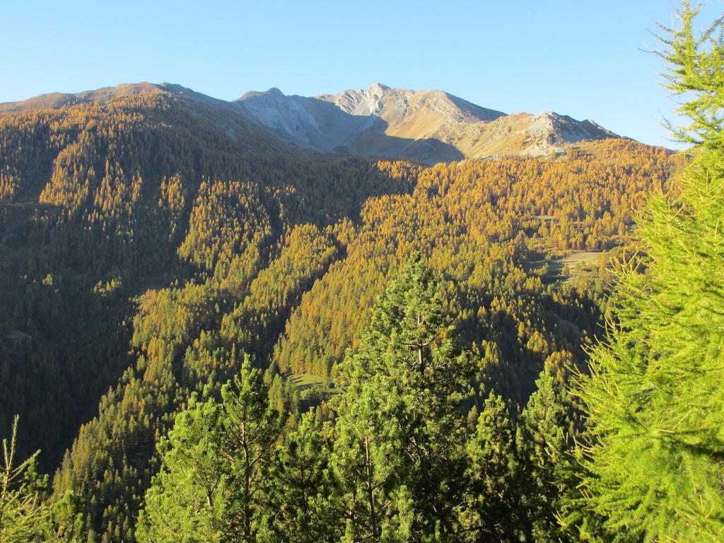
Si risale la valle Stura fino ad Argentera, superato il semaforo sulla dx accanto alla chiesa posteggio auto e palina indicatrice laghi Roburent sentiero P41.
Descrizione
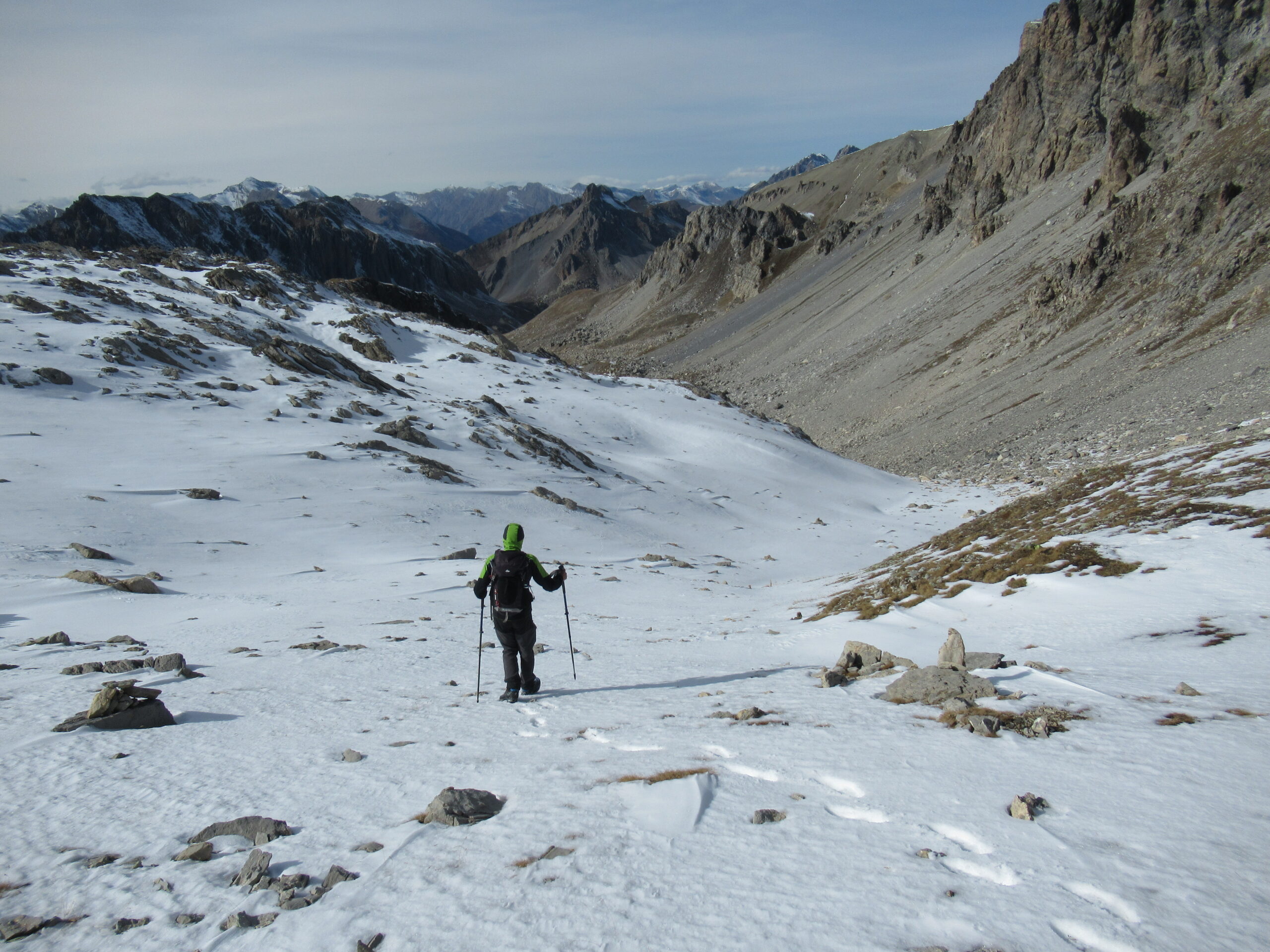
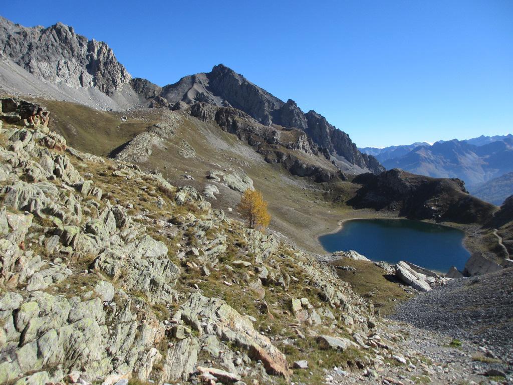
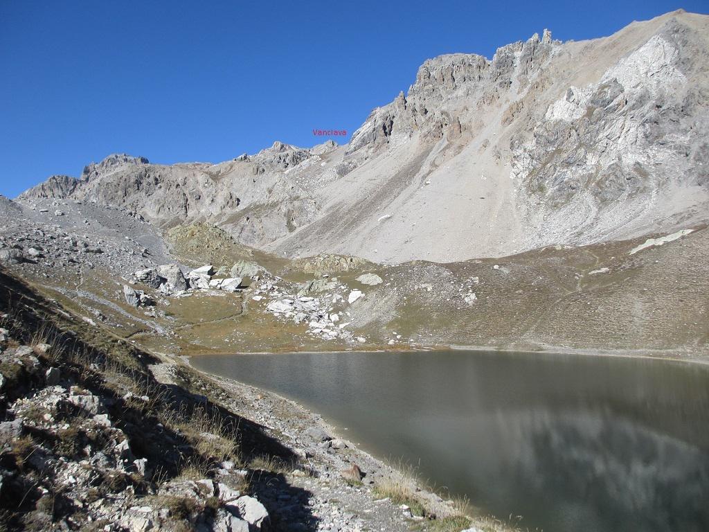
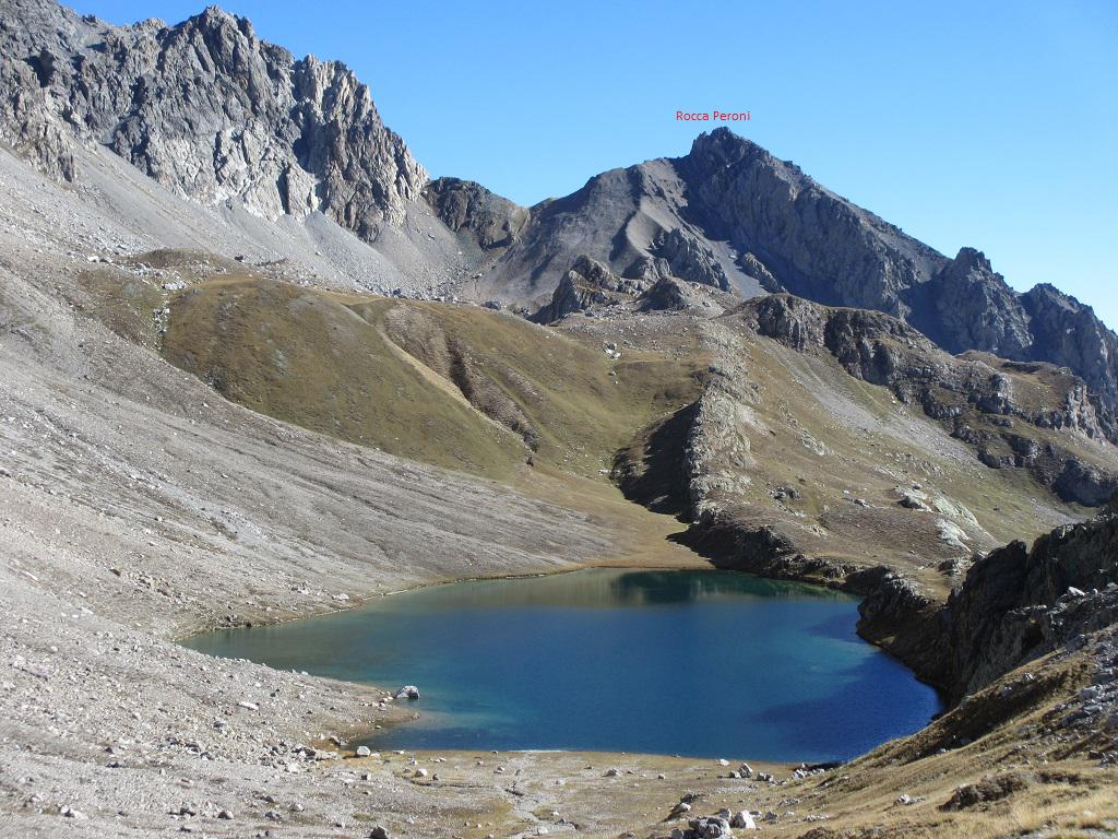
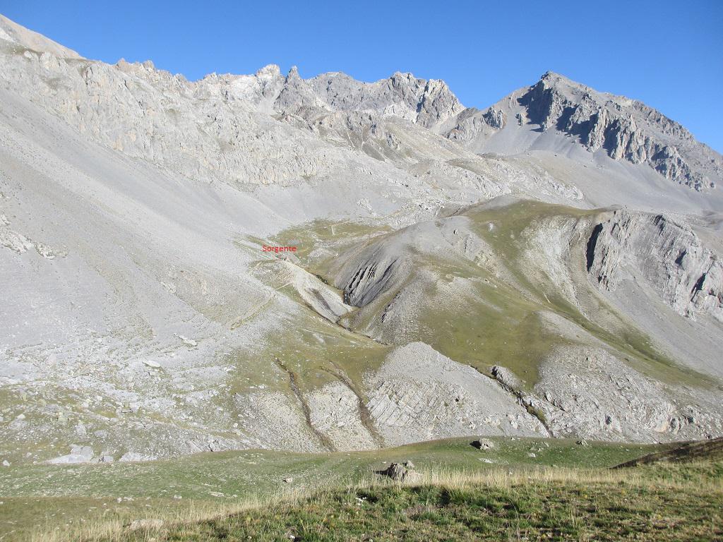
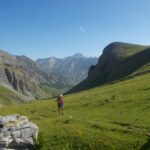
Dalla chiesetta prendere il sentiero per i laghi di Roburent,che sale ripido tra pini e larici fino alla prativa località Tinetta 2026 m.ottimo punto panoramico (da non confondere con la cima La Tinetta 2150 m. che vediamo alla nostra sx in alto),seguendo l’evidente sentiero dopo un tratto pianeggiante si riprende a salire arrivando ad una baita di recente costruzione, proseguendo si perdono alcuni metri di quota, si guada il rio Roburent (sorgente del rio) per riprendere la salita con pendenza regolare fino a superare i bei laghi inferiore e mediano di Roburent ed arrivare al bellissimo lago superiore,senza raggiungerlo si prende a dx una traccia che si va a congiungere con il sentiero proveniente dal colle di Roburent e che sale al passo Scaletta.
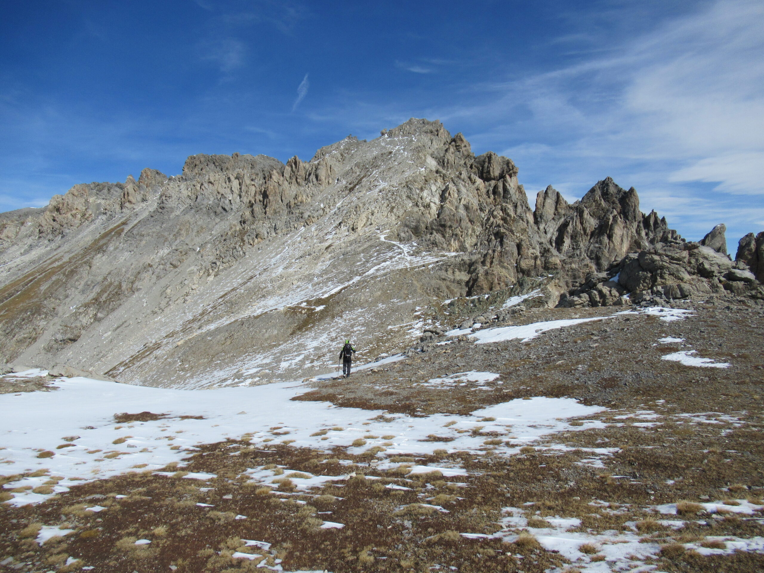
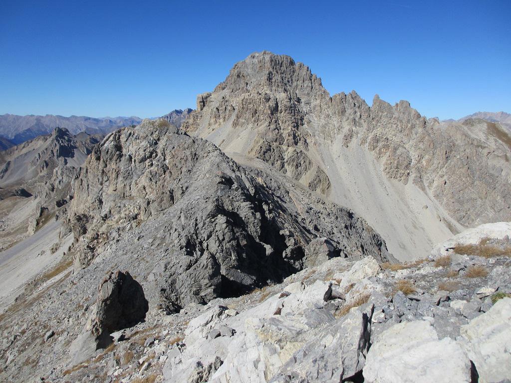
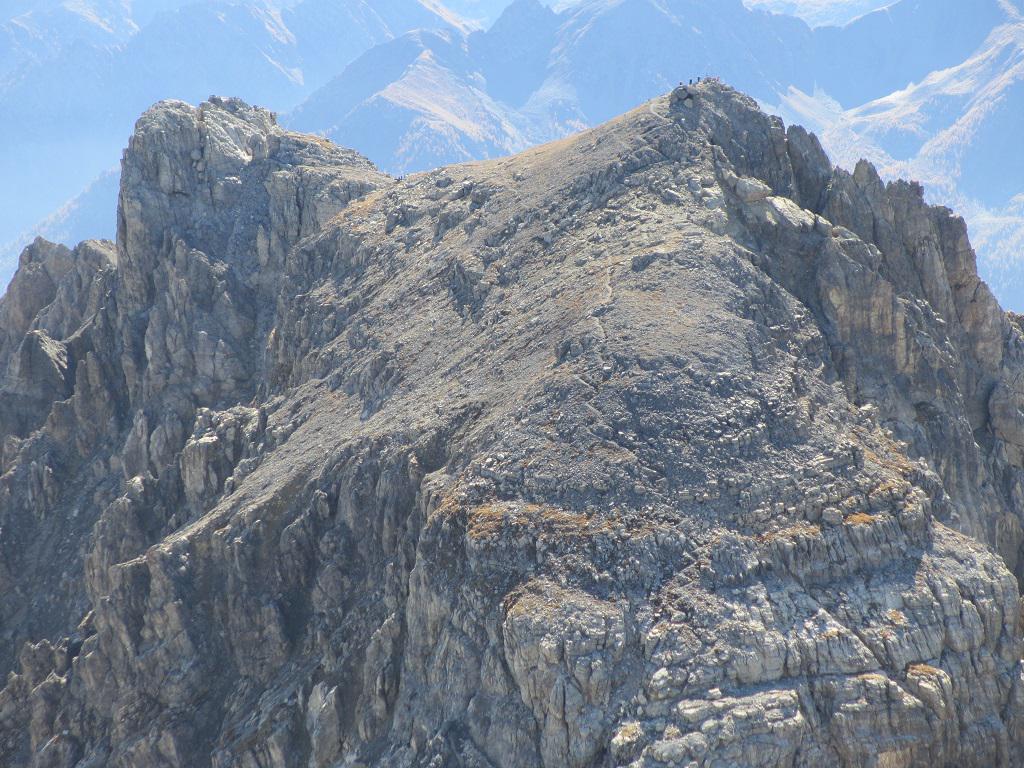
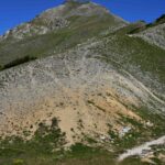
Poco prima del Passo troviamo delle frecce arancioni alla nostra sinistra che indicano il sentierino che porta alla visibile casermetta dalla quale possiamo intravvedere la via di salita(canalino) posta alla sx della parete verticale che sembra una rocca (foto).
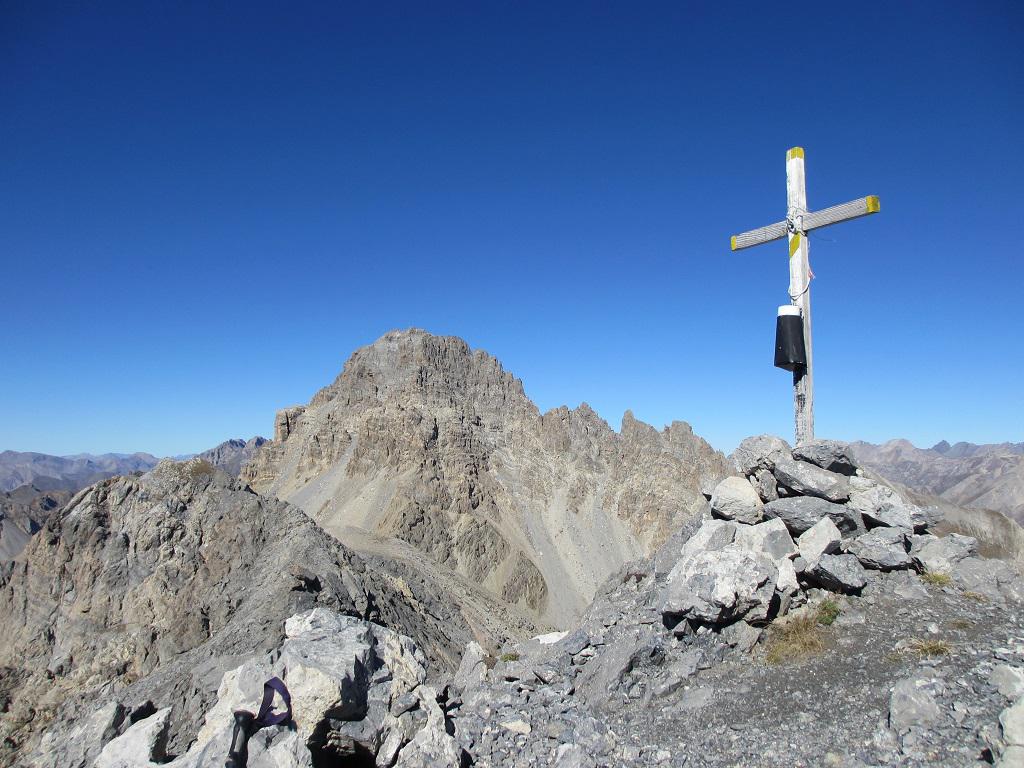
Superato il canalino si arriva ad un ripiano da dove si vede la cima sormontata da una croce di legno.
Per chi preferisce fare meno dislivello e godere di un altro panorama ambientale è anche possibile partire dopo un km circa dal colle della Maddalena a quota 1948 metri (superato il rio Oronaye) piccola piazzola e sentiero indicato per laghi Roburent, prima del lago superiore sentiero per colle Scaletta. Cima (a torto) meno frequentata del vicino monte Scaletta con una vista stupenda a 360°.
- Cartografia:
- I.G.C. Valli Maira Grana Stura N° 7
Nelle vicinanze Mappa
Itinerari
27/06/2021 CN, Bersezio/Argentera D+ 1200 m EE Tutte
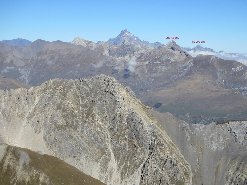
Pierassin (Monte) e Punta di Roburent da Argentera per i Laghi e Colle di Roburent
 50m
50m
23/06/2024 CN, Bersezio/Argentera D+ 812 m E Sud-Est
Roburent (Colle e Laghi di) da Argentera
 50m
50m
18/07/2025 CN, Bersezio/Argentera D+ 1300 m EE Varie
Scaletta (Monte) da Argentera, anello per Laghi Roburent, Passo Scaletta, Passo Peroni e Sentiero Cavallero
 50m
50m
02/07/2020 CN, Bersezio/Argentera D+ 980 m EE Nord
Bric (il) da Argentera per il Passo Peroni
 50m
50m
07/09/2025 CN, Bersezio/Argentera D+ 1350 m EE Varie
Enchastraye (Monte) e Rocca Tre Vescovi da Argentera per il vallone del Puriac
 1.2Km
1.2Km
19/10/2025 CN, Bersezio/Argentera D+ 1189 m EE Varie
Lose (Cima delle), Punta del Briccas e Punta Incianao da Bersezio, anello
 3.8Km
3.8Km
18/06/2023 CN, Bersezio/Argentera D+ 1157 m EE Sud
Oserot (Monte) quota 2781 m o falso Oserot da Bersezio
 3.8Km
3.8Km
02/11/2014 CN, Pietraporzio D+ 1189 m EE Varie
Lose (Cima delle) da Bersezio, anello valloni Puriac-Ferrere
 3.8Km
3.8Km
09/10/2014 CN, Bersezio/Argentera D+ 1357 m EE Varie
Servagno (Monte) da Bersezio per la Bassa di Terra Rossa e il Colle Bernoir
3.8Km
30/09/2025 CN, Bersezio/Argentera D+ 1237 m EE Varie
Oserot (Monte) da Bersezio
 3.8Km
3.8Km
Servizi
200m
4.1Km
da Mo Ristorante
Bersezio/Argentera
4.2Km
Bruno Ristorante
Bersezio/Argentera
5.1Km
Della Pace Rifugio
Bersezio/Argentera
5.9Km
B&b del Villaggio B&B
Bersezio/Argentera
7Km
Viviere Rifugio
Acceglio
8.9Km
Gardetta Rifugio
Canosio
9.1Km
La Tavernetta Ristorante
Acceglio
9.1Km
Chialvetta Rifugio
Acceglio
9.2Km