3.4Km
3.4Km

Note
 7.6Km
13.7Km
18.7Km
22.1Km
22.1Km
23.3Km
26Km
29.2Km
7.6Km
13.7Km
18.7Km
22.1Km
22.1Km
23.3Km
26Km
29.2Km
3.4Km
5.1Km
5.7Km
6.4Km
6.4Km
6.4Km
7.5Km
7.6Km
7.6Km
7.6Km
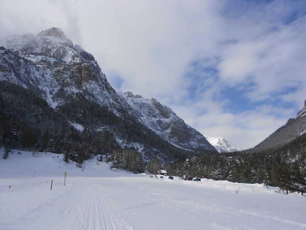
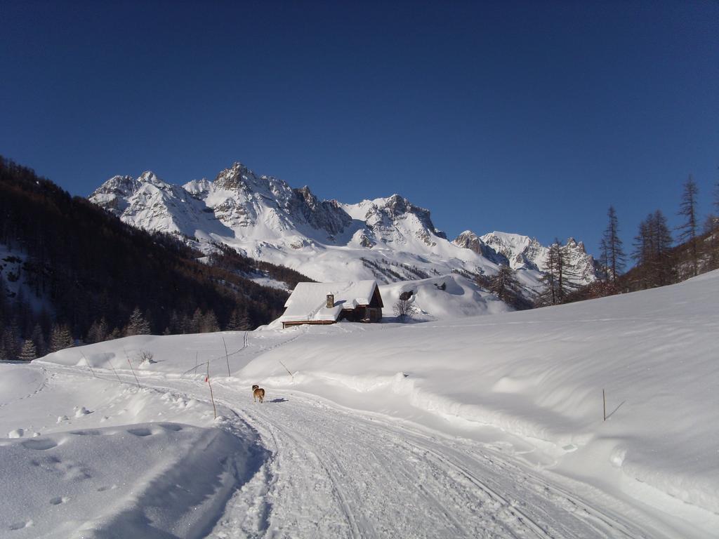
La pista per lo sci di fondo del Comune di Sestriere, inizia a 500m dalla sede dello "Sci Nordico" situato in via Monte Rotta n.24.
Tutte le informazioni relative ai pass (5€ il giornaliero), all'innevamento e alla sciolinatura si possono avere presso la sede dello sci nordico, tel 0122755016, dove troverete un attrezzatissimo negozio con noleggio materiale e un ottimo bar ristorante.
Descrizione
Tutte le informazioni relative ai pass (5€ il giornaliero), all'innevamento e alla sciolinatura si possono avere presso la sede dello sci nordico, tel 0122755016, dove troverete un attrezzatissimo negozio con noleggio materiale e un ottimo bar ristorante.
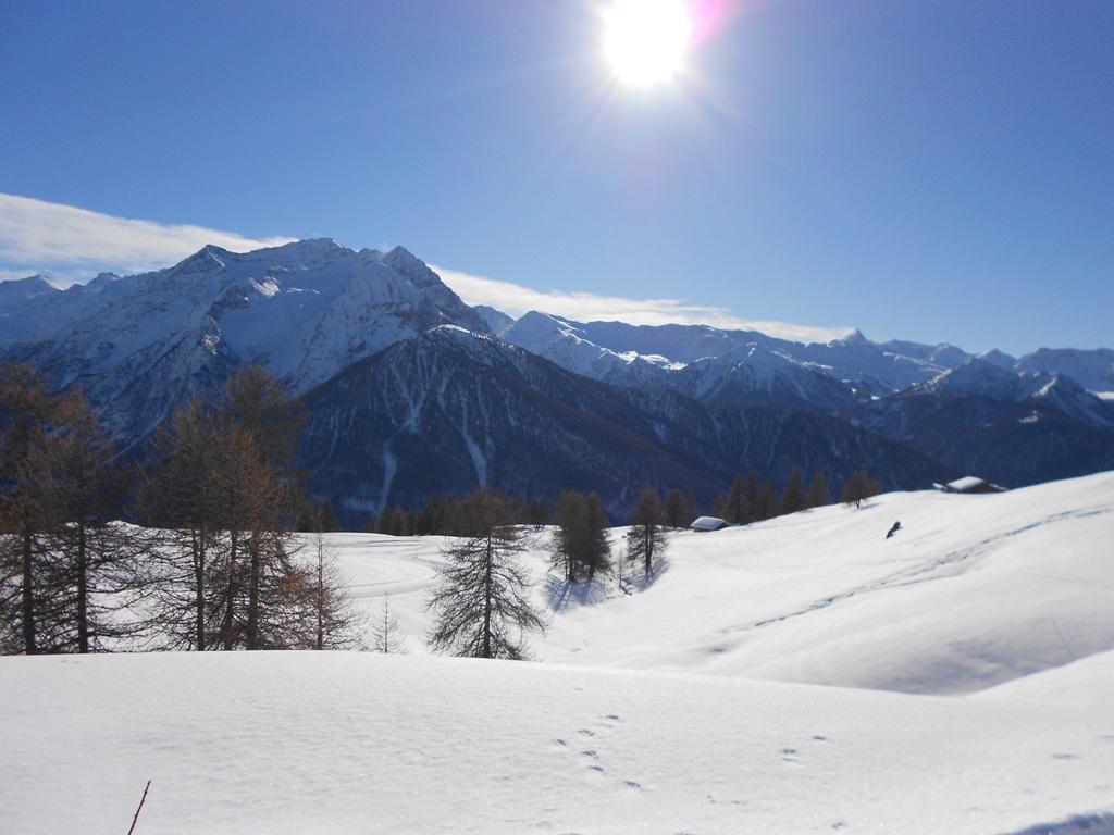
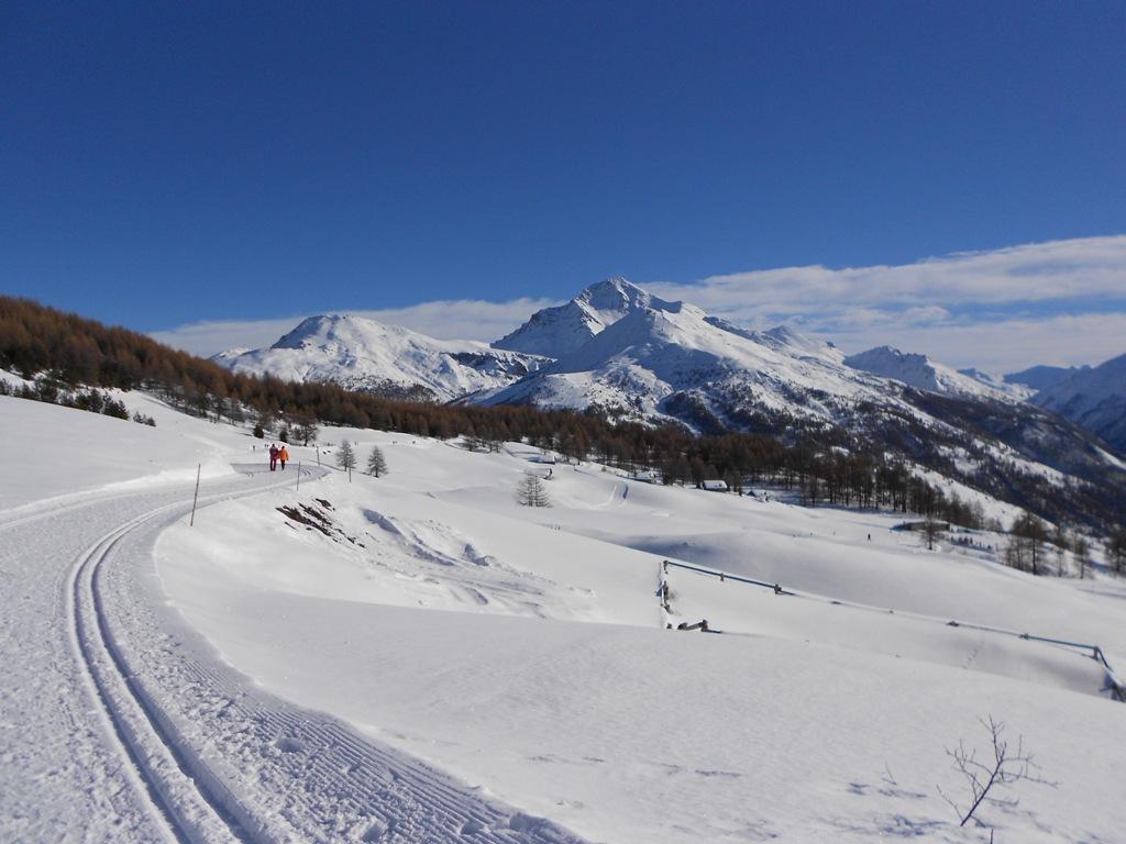
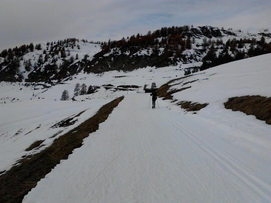
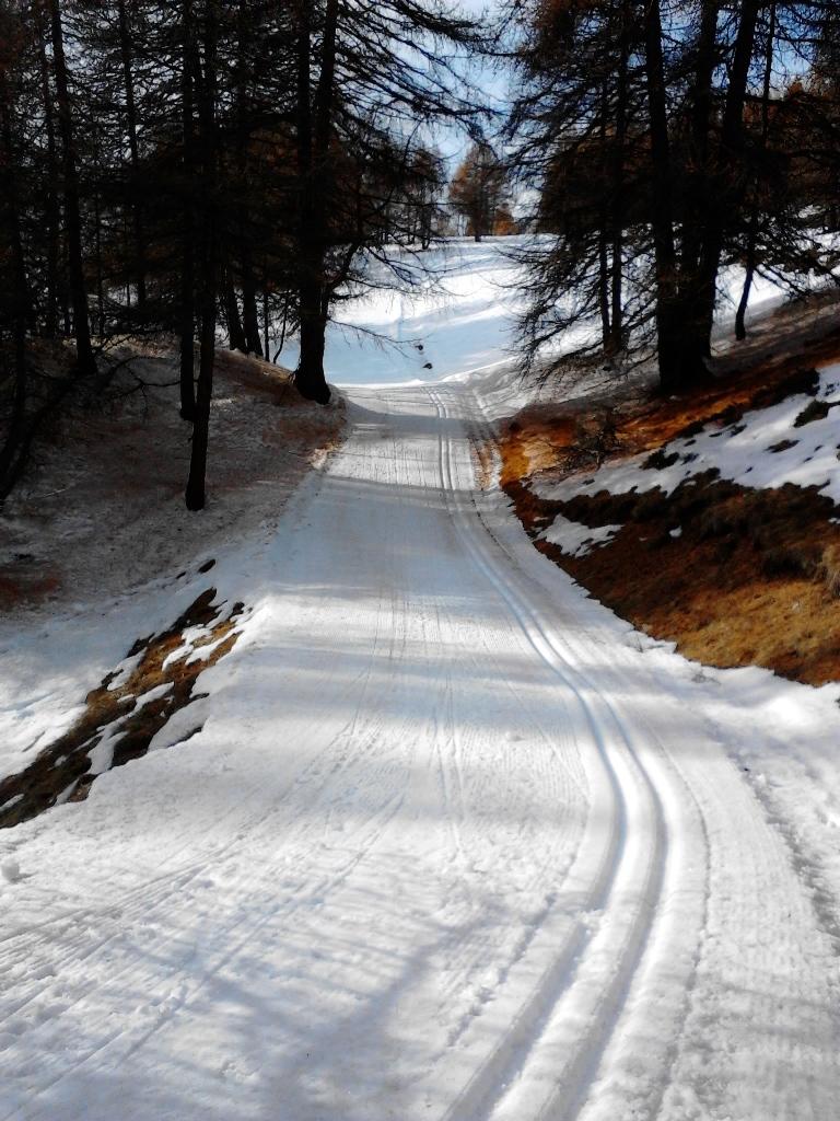
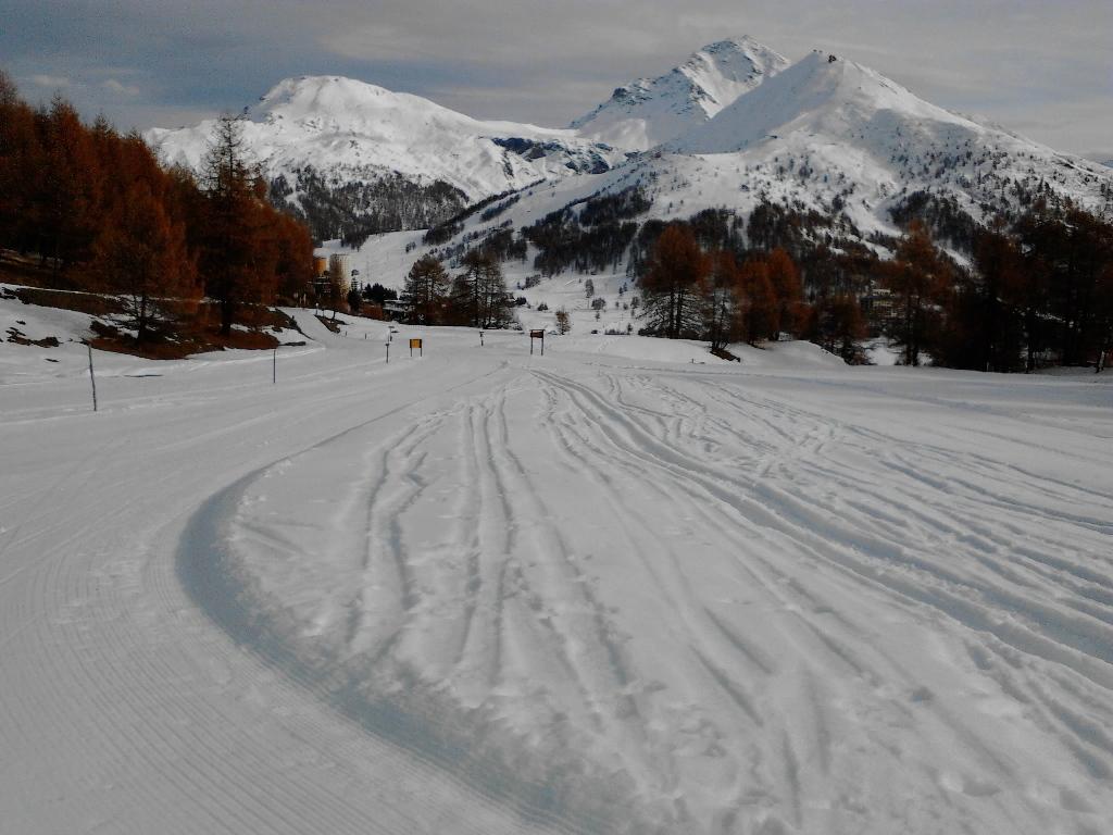
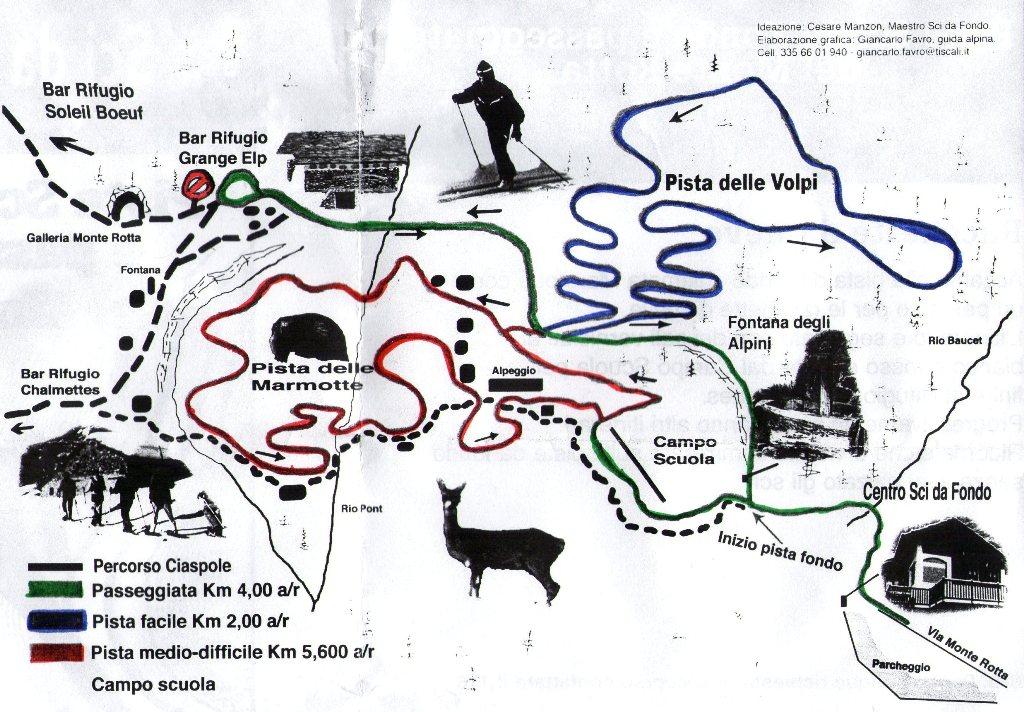
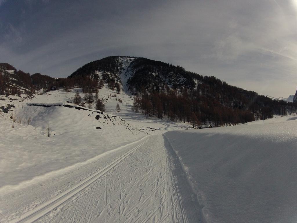
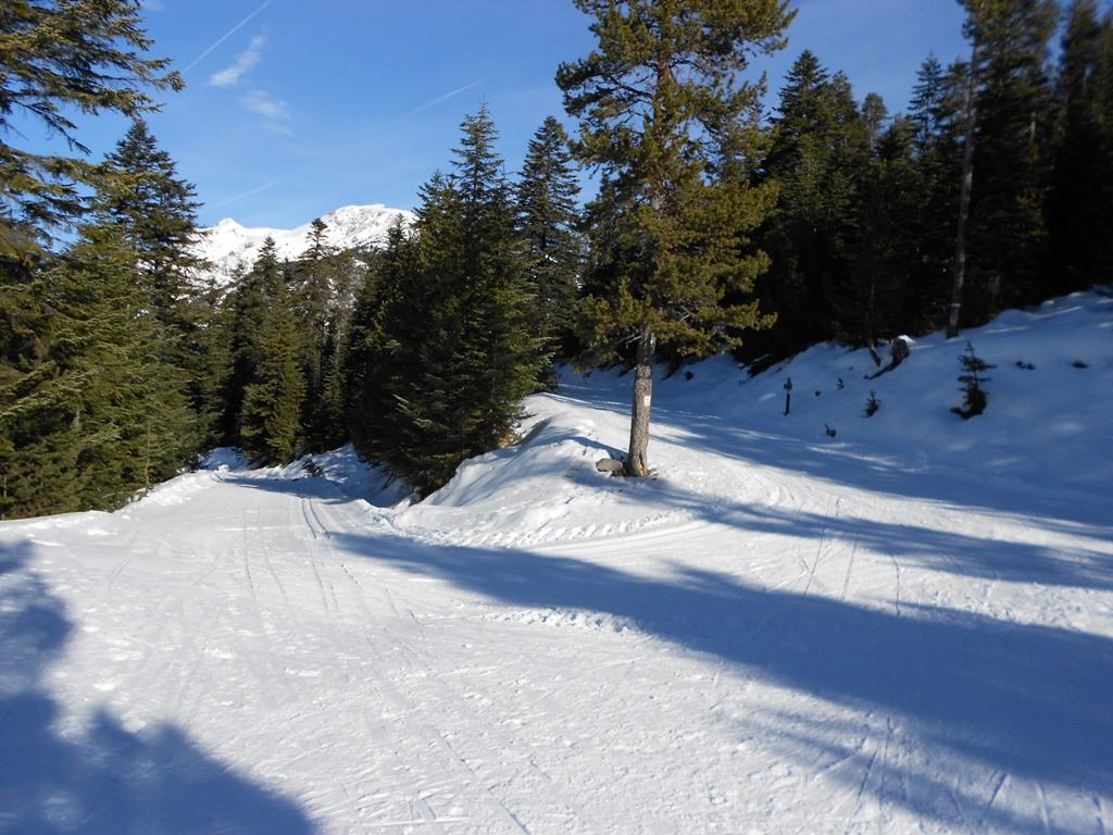
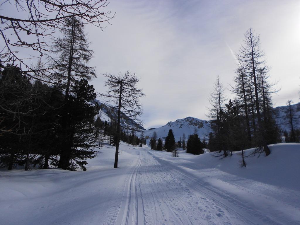
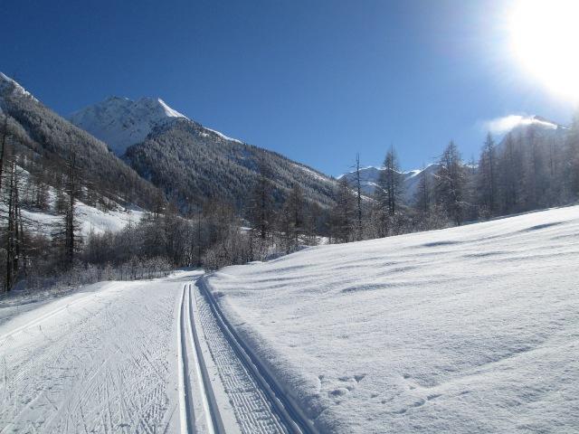
Monte Rotta, tra pinete e baite di un tempo. Il percorso di media difficoltà battuto per la tecnica classica e la tecnica libera è adatto per allenamenti in quota, 2060-2190m. La pista turistica si sviluppa lungo la passeggiata panoramica; è possibile percorrerla solo a passo alternato(doppio senso di marcia) ed è ideale per i principianti.
All’inizio delle piste si trova il campo scuola (riservato ai maestri di sci per le lezioni agli allievi). Dalla pista passeggiata (4km a/r) si dipartono altre due piste: la pista medio-difficile delle Marmotte (5.6 km a/r) e quella facile delle volpi (2 km a/r).
Nelle vicinanze Mappa
Itinerari
16/01/2011 TO, Cesana Torinese 20 Km Nera Varie
Chabaud (Grange) da Bousson
5.6Km
11/01/2026 TO, Pragelato 37 Km Tutte Varie
Pragelato Pista Olimpica del Fondo
 7.6Km
7.6Km
04/01/2015 Hautes-Alpes, Montgenèvre Rossa Nord
Bois de Sestrieres Claviere – Monginevro piste da Fondo
 13.7Km
26/02/2022 Hautes-Alpes, Cervières 42 Km Tutte Nord
Izoard (Col de l’) Piste di Fondo di Cervières
 18.7Km
30/01/2018 Hautes-Alpes, Montgenèvre Tutte Varie
La Vachette – Les Alberts – Le Rosier – Val des Prés. Site Nordique Val Clarée
20.1Km
07/01/2023 Hautes-Alpes, Château-Ville-Vieille 120 Km Tutte Tutte
Queyras piste di fondo di Ceillac, Molines, Saint Veran, Abries, Ristolas, Arvieux
 22.1Km
17/03/2024 TO, Prali 15 Km Rossa Nord
Prali pista fondo
 22.1Km
20/03/2016 TO, Bardonecchia Rossa Sud-Est
Grange di Valle Stretta e Piste di Pian del Colle Pian del Colle
 23.3Km
24/01/2012 Hautes-Alpes, Névache 10 Km Rossa Sud
Scala (Colle della) o Col de l’Echelle da Nevache
 26Km
26Km
06/01/2010 Hautes-Alpes, Névache 2012 Km Sud-Ovest
Laval (Chalets de) da Nevache
 29.2Km
Servizi
3.4Km
5.1Km
Centro Ristorante
Cesana Torinese
5.7Km
La Fontana del Thures Rifugio
Cesana Torinese
6.4Km
da Carlo Rifugio
Cesana Torinese
6.4Km
La Tana degli Orsi B&B
Cesana Torinese
6.4Km
La Crota B&B
Cesana Torinese
7.5Km
La Moretta Ristorante
Oulx
7.6Km
Piergiorgio Frassati B&B
Cesana Torinese
7.6Km
L’Ibarus Rifugio
Cesana Torinese
7.6Km