3.3Km
3.3Km
Note
 50m
50m
300m
950m
950m
950m
950m
950m
1Km
50m
50m
300m
950m
950m
950m
950m
950m
1Km
Parte del Tour du Mont Blanc (TMB) che prevede il rientro a Courmayeur con un mezzo di appoggio.
Avvicinamento
.
Descrizione
Courmayeur 1229 m – Rifugio Bertone 1991 m
dislivello salita 763 m
Dalla caserma Alpini (periferia sud) attraversare il centro di Courmayeur fino a piazza della Chiesa 1228 m; su strada asfaltata raggiungere Villair Inferiore 1282 m e Villair Superiore 1327 m;
proseguire su sterrata in val Sapin fino ad attraversare il ponte su torrente; dopo 1° tornante, imboccare a dx il sentiero 42; ripresa per breve tratto la sterrata, a quota 1470 imboccare a sx un sentiero che supera con larghe svolte un bosco di conifere; a q. 1800 si esce dal bosco, si incontrano una serie di terrazzi erbosi separati da modesti affioramenti rocciosi, i casolari di Le Pré, ed infine il rifugio Bertone 1991 m.
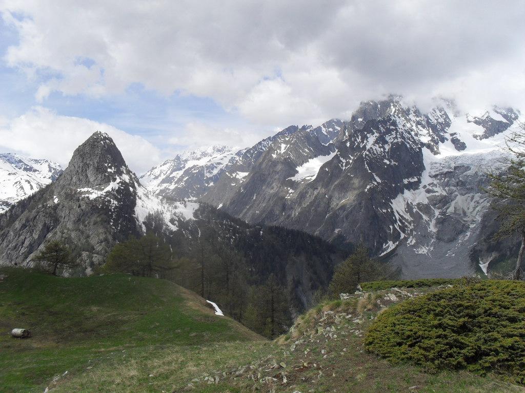
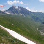
NB= salendo brevemente sul retro del rifugio fino al bivio di 2020 m, bella tavola panoramica e splendida veduta sul Ghiacciaio de La Brenva con il Pilier d’ Angle (pilastro di 900 mt. che chiude a SX la parete), il Dente del Gigante, la parete E delle Jorasses, e sul tormentato ghiacciaio di Fréboudze.
Rifugio Bertone 1991 – Rifugio Bonatti 2020 m
dislivello salita 874 m, discesa 760 m
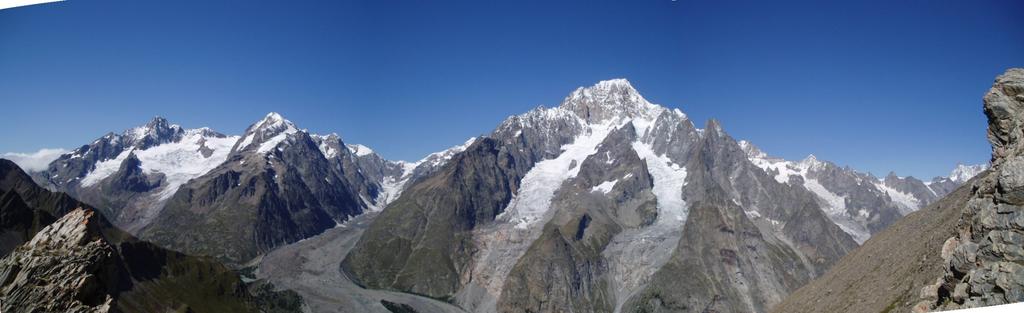
Poco oltre Plampiceux salire (sentiero) al bivio 2020 m; lasciato a sx il tratto pianeggiante per Leuche e val Ferret, risalire a dxX il crinale (faticoso) per raggiungere la sella poco distante dal Mont de la Saxe 2348 m: panorama completo della catena montuosa da Monte Bianco a Mont Dolent). Scendere ad una sella (2330), scavalcare vari dossi erbosi; dopo la traversata a mezza costa ai piedi della Testa Bernarda, salire sul crinale fino alla Testa della Tronche 2583 m che offre uno straordinario belvedere (partendo da SX: Aiguille Noire, crestine delle Dames Angleises, Monte Bianco con il sottostante ghiacciaio della Brenva, Anguille du Midi, Colle del Gigante, Rifugio Torino, Dente del Gigante, Grande Jorasses, Le Dolent, ed ancora molti altri monti, con relativi ghiacciai).
Breve discesa (faticosa) al Col Sapin 2436 m. Scendere a sx all’ampia conca sommitale del vallone di Séchéron, attraversare torrente, raggiungere l’ Alpe di Séchéron 2260 m. Salire verso DX, tralasciare a DX la vecchia mulattiera per Colle Battaglione Aosta, salire obliquamente all’ ampia sella erbosa del Pas d’ Entre Deux Sauts 2524 m.
Scendere su terreno sassoso all’ ampio Piano di Malatrà 2230 m, che si attraversa (panoramica su L’Aiguille de Talèfre ed il Mont Dolent). Trascurare a DX l’ Alta Via nr. 1 e scendere all’ Alpe Superiore di Malatrà 2213 m; scendere ancora fra pascoli all’ Alpe Inferiore di Malatrà 2056 m, quindi al rif. Bonatti 2020 m
Rifugio Bonatti 2020 m – Rifugio Elena 2062 m
dislivello salita 429 m, discesa 350 m
risalire brevemente all’Alpe Inferiore di Malatrà 2056 m; attraversare 3 valloncelli successivi (nel secondo scorre il Malatrà) ed i casolari Gioé 2007 m (in rovina). Trascurare un secondo sentiero che scende alla val Ferret, e seguire quello che sale: aggirare un crinale, proseguire in piano a mezza costa (bel panorama sul massiccio del Bianco). Attraversare grosso impluvio, leggera discesa, baita ristrutturata di Alpe Arnouva 2003 m.
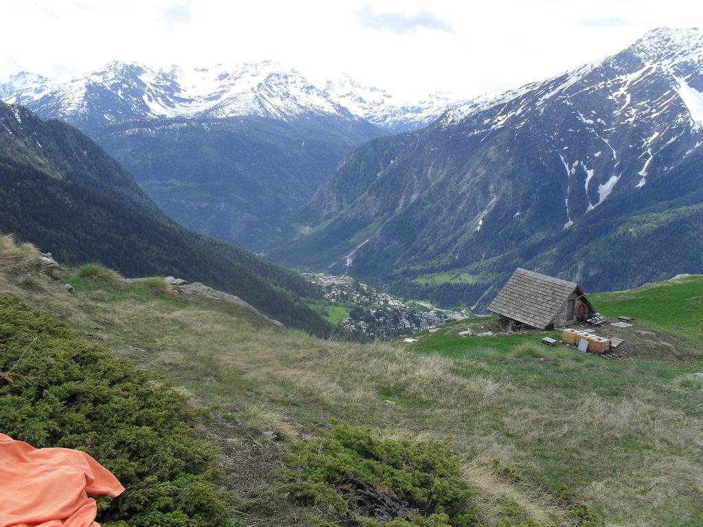
Tralasciare a dx sentiero per Belle Combe e piegare a sx, in diagonale, in direzione Courmayeur; ripida discesa a svolte; al primo bivio proseguire verso dx e continuare a scendere fino ad Arnouva 1759 m, nei pressi di un bar-ristorante; brevemente a dx su sterrata fino ad imboccare sentiero a dx: iniziale forte salita, poi leggeri saliscendi fino al rifugio Elena 2062 m, che si trova dietro una collina sulla cui sommità è installata una stazione meteo, con antenne sono ben visibili già in lontananza percorrendo il sentiero.
NB = da Arnouva si può anche raggiungere il rifugio percorrendo tutta la sterrata, o solo fino nei pressi della collina e dopo un ponte imboccare un sentiero che la risale direttamente fino alla stazione meteo.
Rifugio Elena 2062 m – Refuge le Dolent a La Fouly 1600 m
dislivello salita 495 m, in discesa 900 m
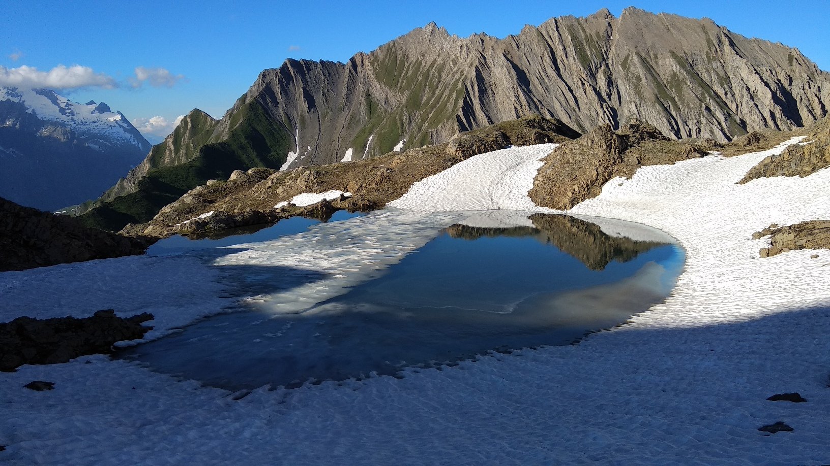
sentiero dietro il rifugio Elena: sale a tornanti (abbastanza faticoso) alle baite di Pré le Bar 2264 m, e si inoltra nel vallone delle Combette; tralasciare a dx sentiero per Col du Ban Darrey e spostarsi a sx; affacciatisi nuovamente sul ghiacciaio di Pré de Bar e sul Mont Dolent, salire a dx a mezza costa, poi percorrere il tratto pianeggiante che porta al Col du Grand Ferret, già ben visibile da tempo (2537 m, confine italo-svizzero ed ottimo belvedere sull’intera Val Ferret italiana e sul Cervino: bella tavola panoramica).
Un buon sentiero (molto frequentato) che scende sul lato svizzero aggira la parte alta del vallone di Peule, si affaccia su quello di Creuses, scende sul fianco dell’ Arète des Plansfins, prosegue per ripidi pendii erbosi e raggiunge le baite di La Peule 2071 m; ora strada sterrata con una serie di tornanti fino al ponte di legno 1775 m sulla Drance de Ferret; breve risalita al posteggio dell’ alpeggio di Les Ars Dessous 1795 m; strada asfaltata fino a La Fouly: Refuge Le Dolent 1600 m.
Refuge le Dolent a La Fouly 1600 – Praz le Fort 1151 m
dislivello salita 250 m, in discesa 450 m
dal campeggio dell’Alp Neuve (pochi metri a valle del Refuge Le Dolent) trascurare a sx sentiero per Cabane de l’Alp Neuve ed imboccare quello di dx (segnavia TMB): attraversa bosco, distesa di ghiaie, altro bosco che porta ai piedi della parete Dalle de l’Amone; non attraversare il ponte dell’Amone 1537 m ma proseguire in zona solitaria sulla riva sx del torrente Drance.
Il sentiero passa ai piedi della bella cascata di Trentse Bo, attraversa alcune fasce di bosco, lascia a dx altro ponte 1372 m; entra nella fitta Foret des Planereuses; breve tratto di canalone attrezzato con catena fissa (occorre pertanto portare al seguito alcuni metri di corda ed 1 moschettone); secondo canalone, tratto pianeggiante, bellissimo sentiero sul crinale morenico della Crete de Saleina.
Attraversare il ponte 1207 m strada asfaltata fino a Praz le Fort 1151 m.
Nelle vicinanze Mappa
Itinerari
13/08/2023 AO, Courmayeur D+ 1515 m EE/F Varie
Cormet (Mont) da Courmayeur, traversata a Morgex
 50m
50m
12/07/2025 AO, Courmayeur D+ 9300 m E Tutte
Monte Bianco (Giro del) da Courmayeur, giro antiorario (4 gg)
 50m
50m
17/01/2024 AO, Courmayeur D+ 3750 m EE Varie
Giro dei Giganti Tappa 1: Courmayeur – Valgrisenche
50m
10/07/2019 AO, Courmayeur D+ 1652 m E Nord-Ovest
Liconi (Testa di) da Courmayeur per la Val Sapin
 300m
300m
26/07/2024 AO, Courmayeur D+ 1616 m E Varie
Berrio Blanc (Colle del) da Dolonne, anello per Col de la Seigne, Col des Charmonts e Mont Fortin
 950m
950m
26/04/2012 AO, Courmayeur D+ 868 m E Sud
Courba Dzeleuna da Dolonne
 950m
950m
23/06/2009 AO, Courmayeur D+ 1450 m E Nord-Est
Youla (Colle di) da Dolonne
 950m
950m
12/09/2018 AO, Courmayeur D+ 1440 m E Tutte
Arp (Col d’) da Dolonne, anello per Colle di Youla e discesa per la Val Veny
 950m
950m
10/08/2013 AO, Courmayeur D+ 1536 m E Varie
Arp (Testa d’) da Dolonne
 950m
950m
30/08/2025 AO, Courmayeur D+ 1250 m EE Sud
Cormet (Mont) da Verrand
 1Km
1Km