 1.2Km
1.2Km
Note
 3.9Km
5.1Km
5.4Km
5.5Km
5.8Km
7.6Km
3.9Km
5.1Km
5.4Km
5.5Km
5.8Km
7.6Km
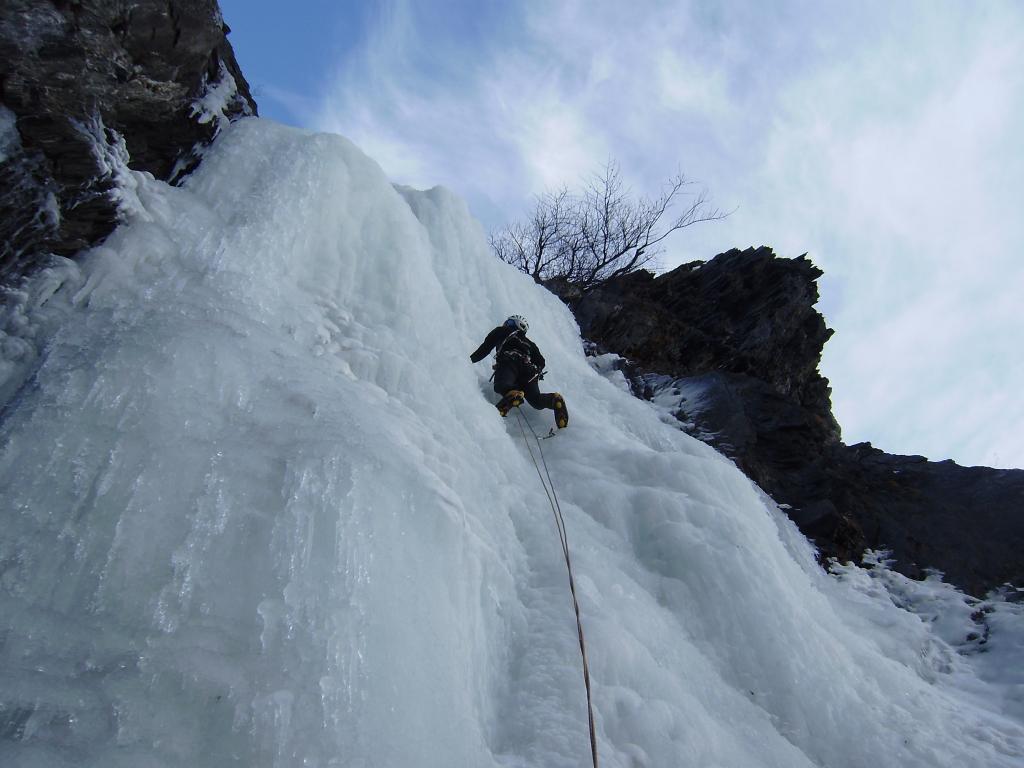
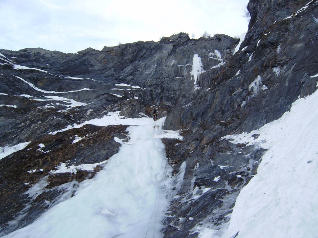
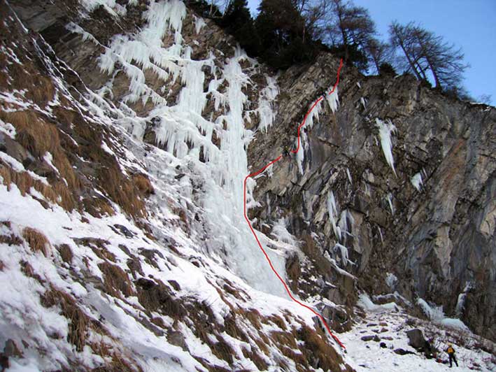
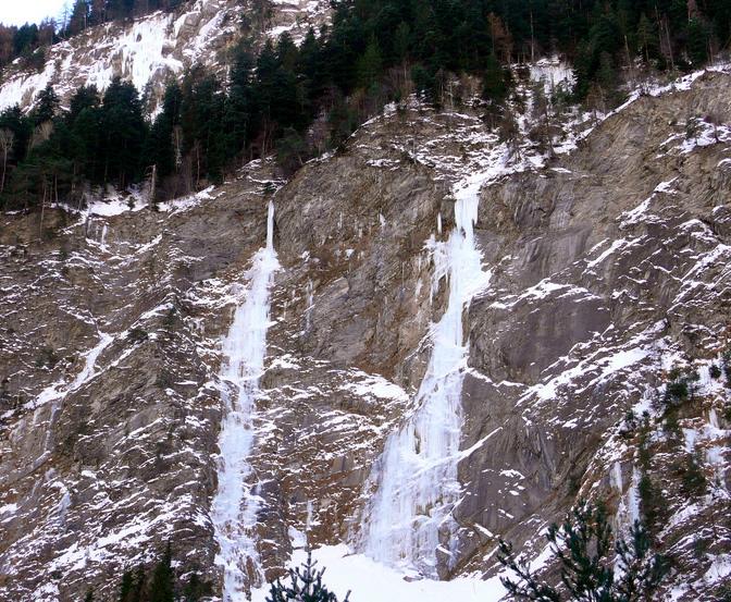
Bella cascata che si forma bene quasi ogni anno.
Essa si forma in un canalone, quindi da evitare dopo una nevicata. La cascata é ben visibile dalla ss26.
Per l'avvicinamento calcolare 40 minuti partendo dal Ponte delle Capre (il ponte che attraversa la dora per salire in Val Veny)
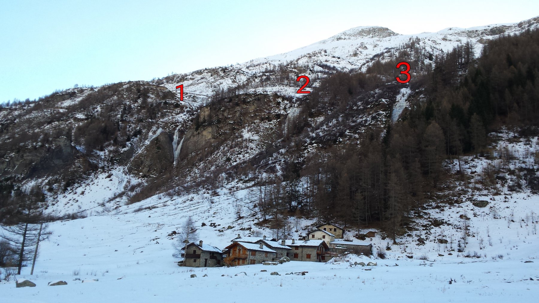
Avvicinamento
Essa si forma in un canalone, quindi da evitare dopo una nevicata. La cascata é ben visibile dalla ss26.
Per l'avvicinamento calcolare 40 minuti partendo dal Ponte delle Capre (il ponte che attraversa la dora per salire in Val Veny)
.
Descrizione
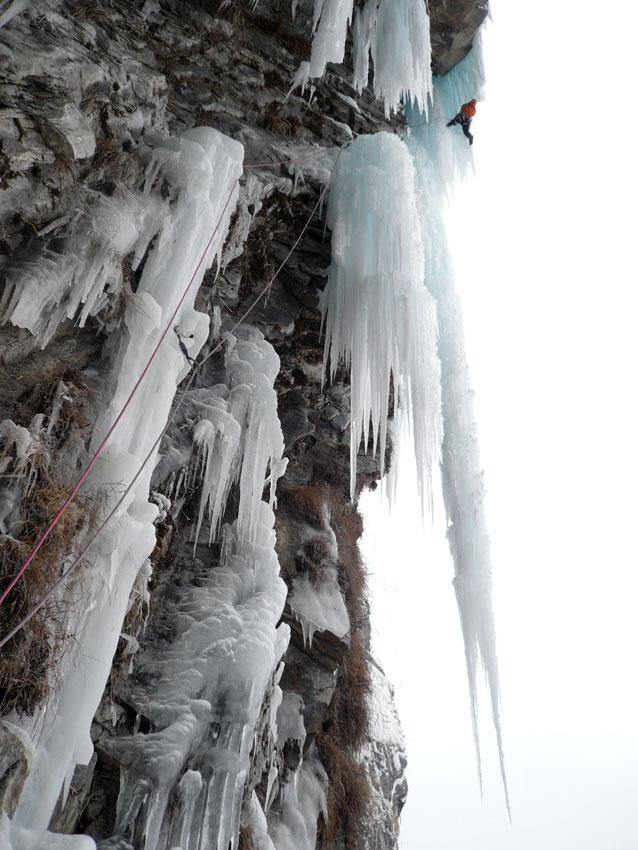
1A lung. 15 mt a 75° poi facile (50mt sosta su giaccio)
2A lung. tiro di raccordo ( 20 mt )
3A lung. Bel tiro sostenuto con alcuni metri a 90°, sosta su albero sulla destra ( 35 m)
- Bibliografia:
- Matteo Giglio - Effimeri Barbagli - 2014 Tipografia Valdostana
Nelle vicinanze Mappa
Itinerari
26/12/2005 AO, Pré-Saint-Didier 80 m II, 5 Nord-Est
Champex – Happy Birthday (Cascata)
 3.9Km
3.9Km
25/01/2003 AO, Pré-Saint-Didier 90 m II, 5 Nord-Est
Champex – Chougnagawa (Cascata)
4.4Km
26/12/2015 AO, Courmayeur 180 m III, 2 Nord-Ovest
Val Ferret – Tapa Ice (Cascata)
 5.1Km
5.1Km
07/01/2011 AO, Pré-Saint-Didier 160 m IV, 6+ Nord
Pre Saint Didier – Liaisons Dangereuses (Cascata)
 5.4Km
5.4Km
20/12/2015 AO, Courmayeur 100 m III, 3 Nord-Ovest
Val Ferret – Mayencet (Cascata di)
 5.5Km
5.5Km
01/02/2009 AO, Pré-Saint-Didier 160 m I, 5 Ovest
Pré Saint Didier – Au Bout des Thermes (Cascata)
5.6Km
31/12/2018 AO, Courmayeur 70 m II, 3 Nord-Ovest
Val Ferret – Y (Cascata)
 5.8Km
5.8Km
01/03/2003 AO, Pré-Saint-Didier 150 m II, 5 Varie
Pré Saint Didier – Alexandra (Cascata)
5.8Km
04/01/2009 AO, Courmayeur 1750 m III, 3 Nord
Val Ferret – Lèche (Cascata di)
6.3Km
08/01/2011 AO, Morgex 120 m I, 5+ Nord
Morgex – Grande Vacherie (Cascata)
 7.6Km
7.6Km