6.2Km
6.2Km

Note
 0m
50m
50m
50m
50m
50m
50m
50m
50m
0m
50m
50m
50m
50m
50m
50m
50m
50m
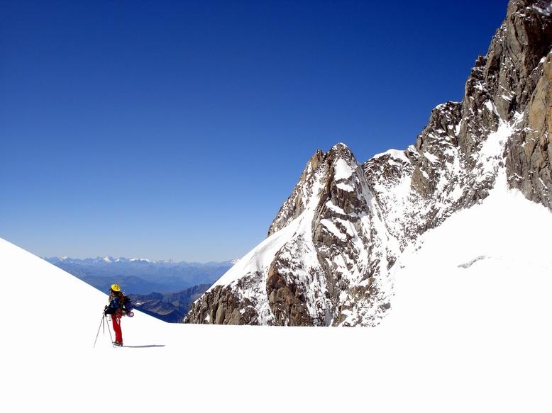
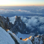
Risalendo le grandi vie ad est del monte Bianco o percorrendo la strada della Valle d’Aosta verso Courmayeur, ogni mattina la cresta di Peuterey brilla nel sole come una linea infuocata,dapprima rossa e poi con le sfumature del giallo, inondata di luce.
Cosi’ appare, su nel cielo, anche all’alba risalendo lo sperone della Brenva.
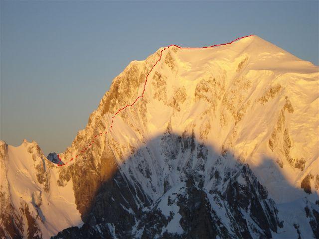
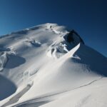
E’ considerata una della più belle vie di alta montagna delle Alpi e si conclude sulla vetta del Monte Bianco di Courmayeur 4765 m. dove, con un trasferimento di circa un’ora, conduce alla vetta del Bianco 4810 m.
Via di grande impegno per la quota, l’isolamento e la lunghezza. L’Itinerario qui descritto è una variante in provenienza dal col Eccles e bivacco sul col de Peuterey: se taglia via la Blanche, d’altra parte permette di spaziare tra i grandiosi ambienti Brouillard e Freney, passando sotto il pilone centrale del Freney e raggiungendo così il col de Peuterey e poi lungo la classica Arete de Peuterey, il Monte Bianco.
Avvicinamento
Cosi’ appare, su nel cielo, anche all’alba risalendo lo sperone della Brenva.
E’ considerata una della più belle vie di alta montagna delle Alpi e si conclude sulla vetta del Monte Bianco di Courmayeur 4765 m. dove, con un trasferimento di circa un’ora, conduce alla vetta del Bianco 4810 m.
Via di grande impegno per la quota, l’isolamento e la lunghezza. L’Itinerario qui descritto è una variante in provenienza dal col Eccles e bivacco sul col de Peuterey: se taglia via la Blanche, d’altra parte permette di spaziare tra i grandiosi ambienti Brouillard e Freney, passando sotto il pilone centrale del Freney e raggiungendo così il col de Peuterey e poi lungo la classica Arete de Peuterey, il Monte Bianco.
.
Descrizione
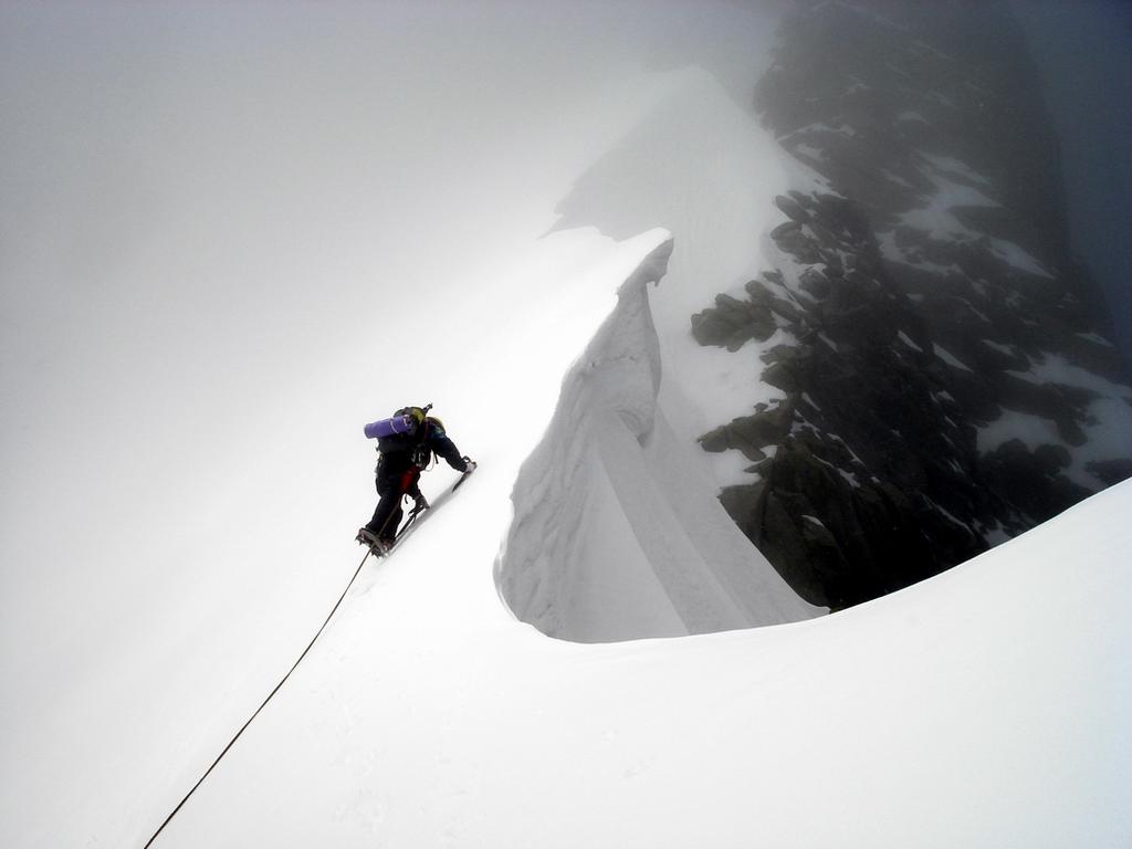
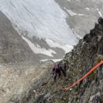
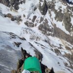
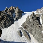
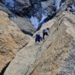
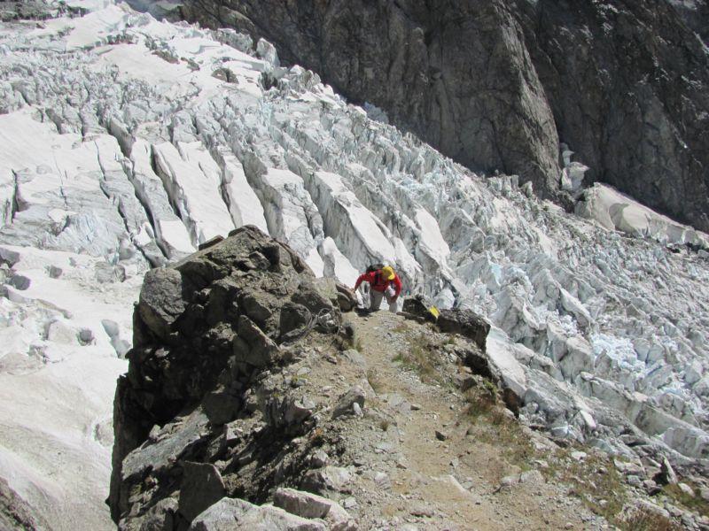
Dalla val Veny, per il rifugio Monzino risalire il ghiacciaio del Brouillard, passare ai bivacchi Eccles e traversare di nuovo nella parte alta del Brouillard, raggiungere il col Eccles 4021 m. dove parte anche la via dell’Innominata; calarsi con due doppie da 40-50 metri (verificare ancoraggi) sul bacino del Freney e con un traverso delicato ed esposto sulle seraccate, passare sotto i piloni del Freney (meglio al mattino presto con basse temperature), raggiungere il col de Peuterey 3934 m.
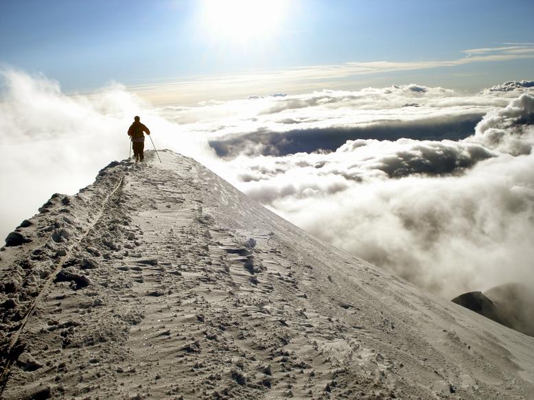
Da qui si può risalire la Blanche e ritornare per il bivacco. Risalire il couloir Eccles, se in buone condizioni, oppure per misto la parete del Grand Pilier d’Angle, raggiungere la cresta e percorrerla delle sue articolazioni sino a forzare la cornice, quasi sempre presente, del Mont Blanc de Courmayeur 4765 m.
Alla vetta del monte Bianco mancano circa 700 metri di facile trasferimento, aggirando le rocce della Tourette e passando per il col Mayor.
Dalla vetta scendere per una della vie normali.
- Cartografia:
- Monte Bianco - IGC
- Bibliografia:
- Monte Bianco I CAI-TCI G. Buscaini
Nelle vicinanze Mappa
Itinerari
24/08/2025 AO, Courmayeur D+ 1400 m PD- Sud
Estellette (Aiguille d’) da La Visaille
 0m
0m
02/04/2021 AO, Cormayeur D+ 950 m ED Sud-Est
Bianco (Monte) Hypercouloir du Brouillard
0m
26/07/1998 AO, Courmayeur D+ 1457 m F Varie
Lechaud (Punta) da La Visaille per il Colle di Chavannes ed il versante Est
 50m
50m
21/06/2026 AO, Courmayeur D+ 3110 m AD- Varie
Bianco (Monte) Via Normale Italiana o Via Ratti dal Rifugio Gonella
 50m
50m
14/06/2026 AO, Courmayeur D+ 2200 m AD- Varie
Trelatete (Aiguille de) traversata dal Bivacco Rainetto al Rifugio Elisabetta
 50m
50m
29/08/2021 AO, Courmayeur D+ 3237 m D+ Sud
Bianco (Monte) Cresta dell’Innominata
 50m
50m
14/07/2024 AO, Courmayeur D+ 3200 m D- Sud-Ovest
Bianco (Monte) Sperone della Tournette
 50m
50m
09/08/2024 AO, Courmayeur D+ 3400 m ED- Sud-Est
Bianco (Monte) Pilone Centrale Freney – Via classica
 50m
50m
02/07/2021 AO, Courmayeur D+ 400 m TD+ Sud-Est
Brouillard (Pilastro Rosso del) – Via Bonatti-Oggioni
 50m
50m
18/08/2021 AO, Courmayeur D+ 1300 m F+ Sud
Gonella Francesco (Rifugio) al Dome da La Visaille
 50m
50m