2Km
2Km
Note
Storico
 0m
0m
400m
900m
1.6Km
1.6Km
0m
0m
400m
900m
1.6Km
1.6Km
2Km
5.9Km
6.7Km
7.6Km
7.8Km
7.8Km
8Km
8Km
8Km
8Km
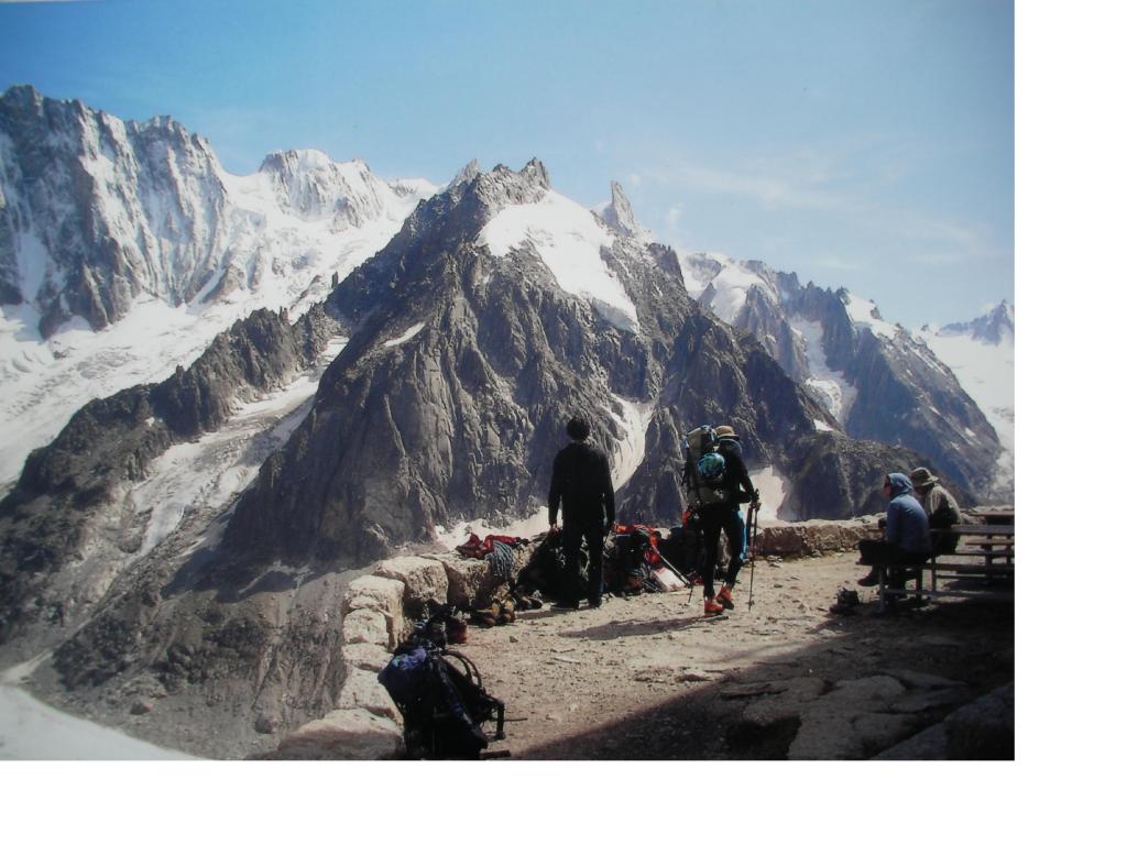
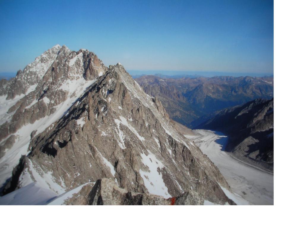
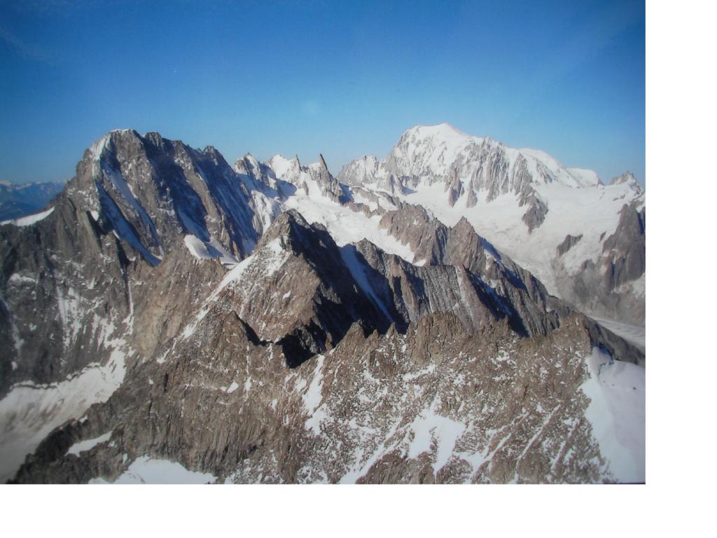
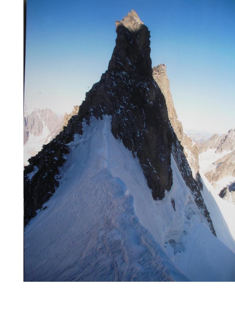
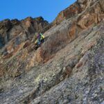
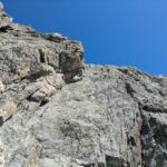
Salita con caratteristiche comuni al gruppo di appartenenza: ottimo granito e ambiente sugestivo tipico di alta montagna. Salendo si gode un ottimo colpo d'occhio sulla nord delle Jorasses, più in la Tour Ronde e sullo sfondo il tetto d'Europa.
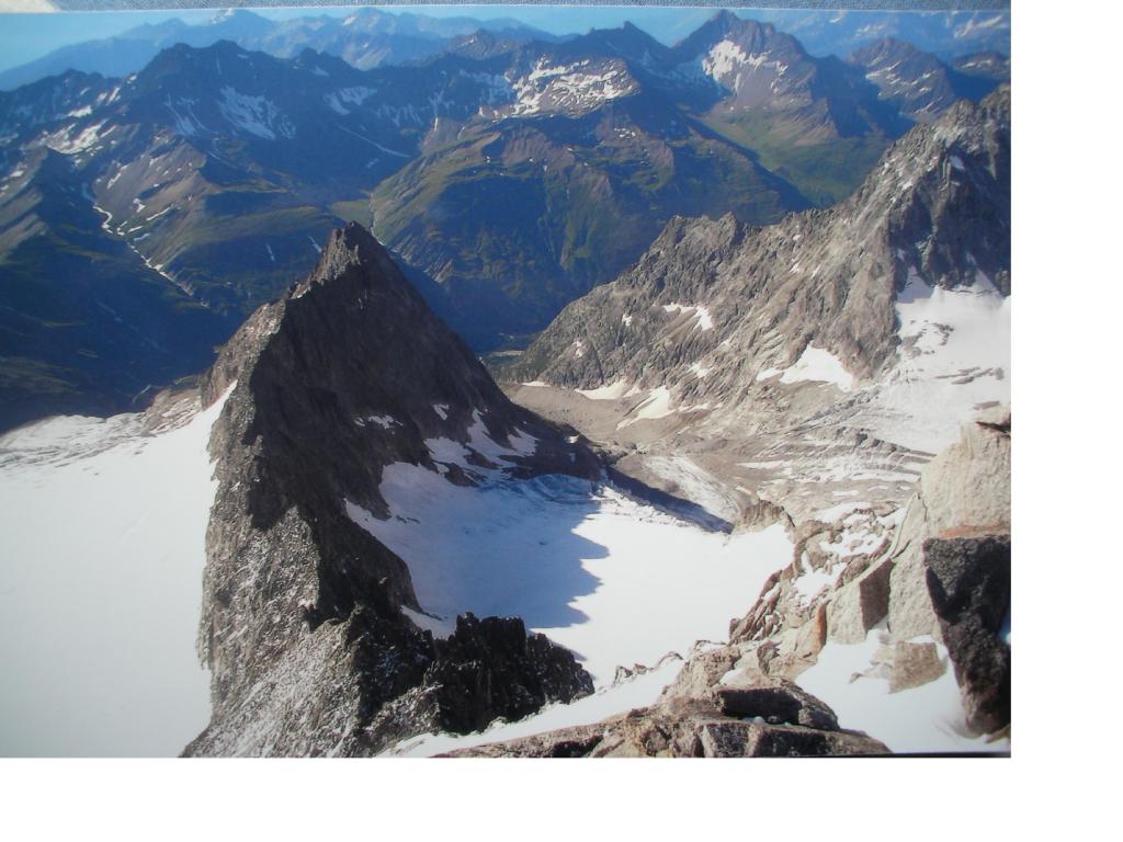
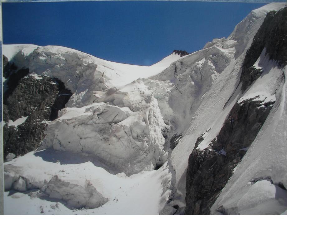
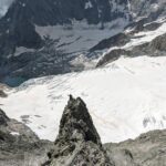
Il Triolet si trova in una delle quattro vallate trasversali della val Ferret (la penultima prima de confine svizzero) e fa parte di un bell'anfiteatro che comprende tra le altre l'aiguille del Leschaux e il Mont Grouvetta. Alla base di queste pareti si trova il ghiacciaio del Triolet sempre più ridotto all'osso ma che rende la salita tipica di alta montagna. L'ambiente è piuttosto desolato e solitario in quanto la maggior parte delle persone si ferma ad arrampicare sulle vie spittate vicino al rifugio: sulla via non abbiamo trovato nulla neanche un cordino a parte quelli delle soste attrezzate per la discesa: segno inconfutabile delle pochissime ripetizione della via.
Avvicinamento
Il Triolet si trova in una delle quattro vallate trasversali della val Ferret (la penultima prima de confine svizzero) e fa parte di un bell'anfiteatro che comprende tra le altre l'aiguille del Leschaux e il Mont Grouvetta. Alla base di queste pareti si trova il ghiacciaio del Triolet sempre più ridotto all'osso ma che rende la salita tipica di alta montagna. L'ambiente è piuttosto desolato e solitario in quanto la maggior parte delle persone si ferma ad arrampicare sulle vie spittate vicino al rifugio: sulla via non abbiamo trovato nulla neanche un cordino a parte quelli delle soste attrezzate per la discesa: segno inconfutabile delle pochissime ripetizione della via.
Dal rifugio Dalmazzi si raggiuge tramite comodo sentiero il ghiacciaio percorrendo la morena fino a quando in prossimità del limite inferiore del ghiacciaio si risale sulla destra orografica della valle per evitare la crepacciata e si raggiunge comodamente il bacino superiore dove senza fatica si raggiunge la base delle pareti (1:30 da rifugio)
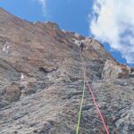
Descrizione
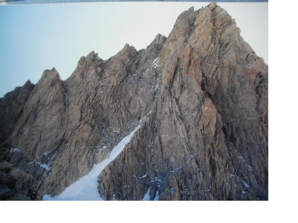
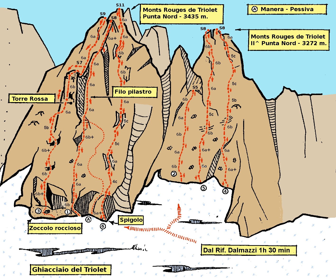
La via attacca all’estremità destra del pilastro che segna la parete O, a poca distanza dal canalino detritico che porta all’attacco di “Le fond de l’air” e a destra di un grande diedro ben segnato.
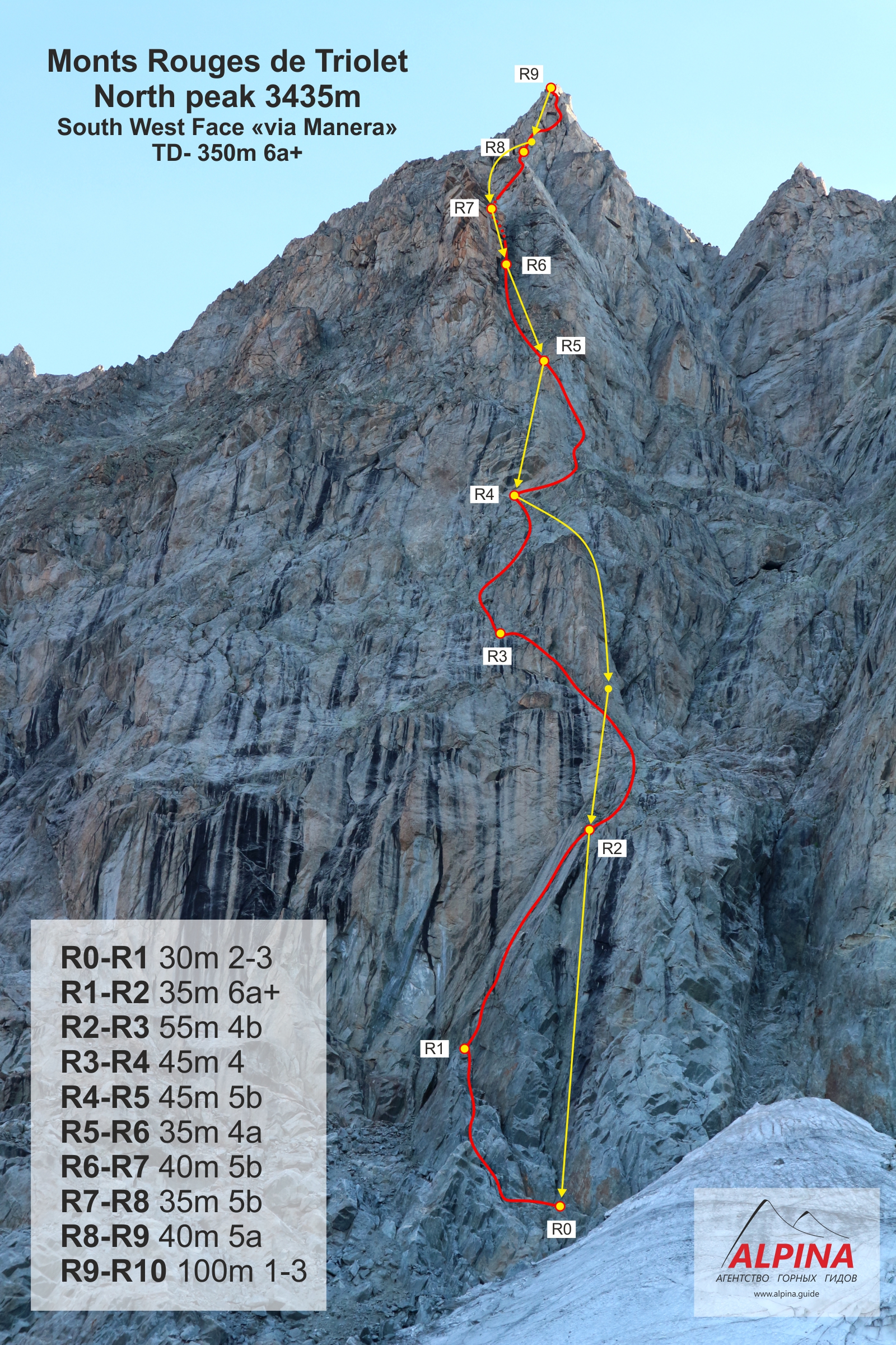
- Il primo tiro originale (5°) segue il filo dello sperone S-O e porta a delle evidenti terrazze su cui è attrezzata la prima sosta.
- Variante L1: bella Dulfer, costituita da un solo ma lungo tiro di corda (50 m) spezzabile in due sezioni con meno impiego di attrezzatura (serie di friends #0.3-3 misure Camalot, eventualmente doppi da #0.4 a #1).
- Dalle terrazze di S1 si sale verso l’evidente torre rossa di metà parete e con arrampicata molto divertente su roccia più che ottima si giunge alla seconda sosta (4° e p. di 5°).
- La linea prosegue all’interno del canalino che ben presto diventa un bel diedro, molto visibile dalla base della parete. Per percorrerlo tutto si impiegano due tiri di corda, il primo piuttosto semplice e poco continuo mentre il secondo decisamente più bello e sostenuto (5°). E’ importante seguire il diedrone all’interno fino alla cima evitando un’uscita anticipata in parete.
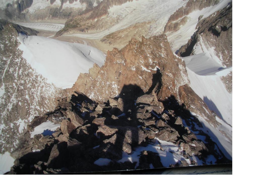
- Ora l’arrampicata diventa più semplice e davvero molto divertente: due tiri di corda di 3°/4° portano fino alla base della cima che si guadagna rigirandola verso Sud poco sotto la vetta.
Discesa:
lungo la linea di “Le fond de l’air” che deposita pochi metri a sinistra rispetto il diedro di attacco della variante L1.
lungo la linea di “Le fond de l’air” che deposita pochi metri a sinistra rispetto il diedro di attacco della variante L1.
Se si sceglie di calarsi lungo la via di salita è meglio avere una scelta di chiodi e martello per ribattere i chiodi delle vecchie soste e/o attrezzarne di nuove.
U. Manera, E. Pessiva 5/8/1979 (variante a L1: P. Gravante, M. Piola 5/1/1990)
Nelle vicinanze Mappa
Itinerari
04/07/2015 AO, Courmayeur 6b+, 6b obbl. Sud-Ovest
Triolet (Monts Rouges de), Punta Nord – Scacco alla Torre
0m
06/08/2022 AO, Courmayeur 6c, 6a+ obbl. Sud-Ovest
Triolet (Monts Rouges de), Punta Nord- Le Fond de l’Air
 0m
0m
19/08/2019 AO, Courmayeur 6b, 6a obbl. Nord-Ovest
Triolet (Monts Rouges de), Punta Nord – Reglette da Ballo
 0m
0m
16/07/2023 AO, Courmayeur 6b, 5c obbl., a0 Sud-Ovest
Triolet (Monts Rouges de), punta centrale – Sulle Tracce del Barba
 400m
400m
11/08/2025 AO, Courmayeur 5c, 5a obbl. Sud-Ovest
Triolet (Monts Rouges de), punta 3327 m – La beresina
 900m
900m
04/07/2026 AO, Courmayeur 5c, 5a obbl. Sud
Triolet (Monts Rouges de), 2a punta centrale – Les Chamois Volant
 1.6Km
1.6Km
24/06/2025 AO, Courmayeur 5c, 5b obbl. Sud-Ovest
Triolet (Monts Rouges de) – Kermesse folk
 1.6Km
1.6Km
23/08/2008 AO, Courmayeur 6c, 6a+ obbl. Sud-Est
Savoie (Aiguille de) – Rose Marie
1.7Km
02/08/2011 AO, Courmayeur 6c+, 6c+ obbl. Sud-Ovest
Triolet (Monts Rouges de), 2a punta centrale – Tout Fou
1.7Km
18/06/2017 AO, Courmayeur 6b+, 5c obbl. Sud-Est
Triolet (Monts Rouges de), 2a punta centrale – We Are the Champions
1.7Km
Servizi
2Km
5.9Km
Cabane de l’A Neuve Rifugio
La Fouly
6.7Km
Lavachey Albergo
Courmayeur 7.6Km
7.6Km
Chalet le Dolent B&B
La Fouly 7.8Km
7.8Km
Majya-Joie Ristorante
La Fouly 7.8Km
7.8Km
Auberge de Maya Joie Albergo
La Fouly 8Km
8Km
Zanskar Sport Servizi
La Fouly 8Km
8Km
Edelweiss Ristorante
La Fouly 8Km
8Km
Supermarché de La Fouly Servizi
La Fouly 8Km
8Km