7.8Km
7.8Km
Note
 50m
5.2Km
5.2Km
7.2Km
7.3Km
7.3Km
8.5Km
50m
5.2Km
5.2Km
7.2Km
7.3Km
7.3Km
8.5Km
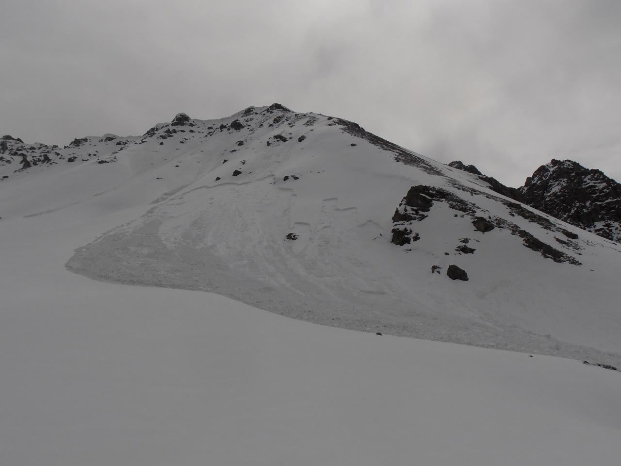
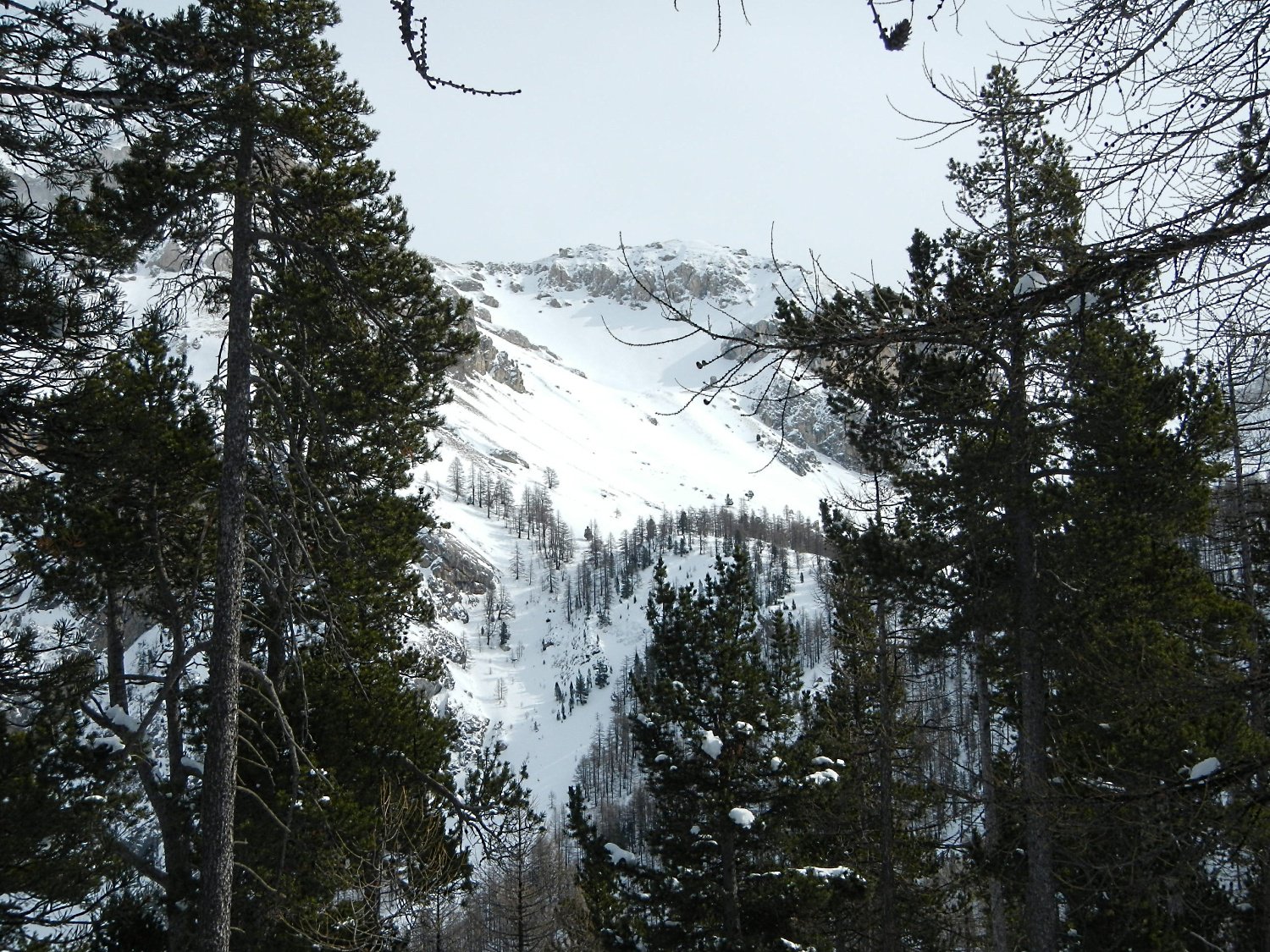
Itinerario vallivo; prestare attenzione ai numerosi colatoi e ripidi pendii delle montagne circostanti.
Scala volo 1.1 / E1 aggirando a sx il dosso sopra gli Chalets de l'Alp
Scala volo 1.2 / E1 aggirando a dx il dosso sopra gli Chalets de l'Alp
Avvicinamento
Scala volo 1.1 / E1 aggirando a sx il dosso sopra gli Chalets de l'Alp
Scala volo 1.2 / E1 aggirando a dx il dosso sopra gli Chalets de l'Alp
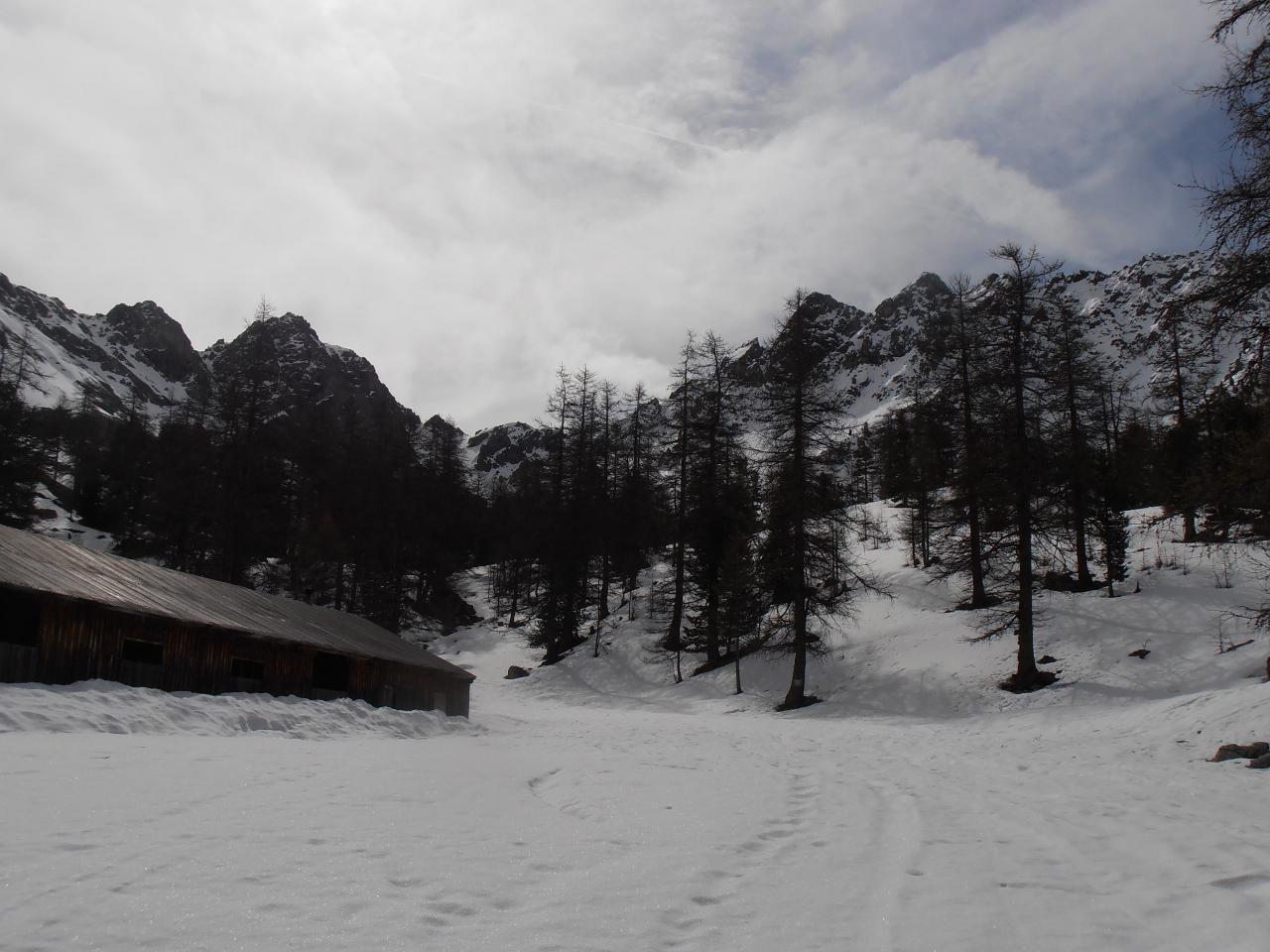
Da Villard Saint Pancrace risalire fino agli Chalet des Ayes (Strada chiusa in presenza di neve) su strada sterrata in buono stato. Dagli Chalet des Ayes continuare su strada sterrata (Qualche buca) verso il Lac de l'Orceriette. Oltre il lago la strada di solito risulta innevata a causa dell'esposizione N.
Descrizione
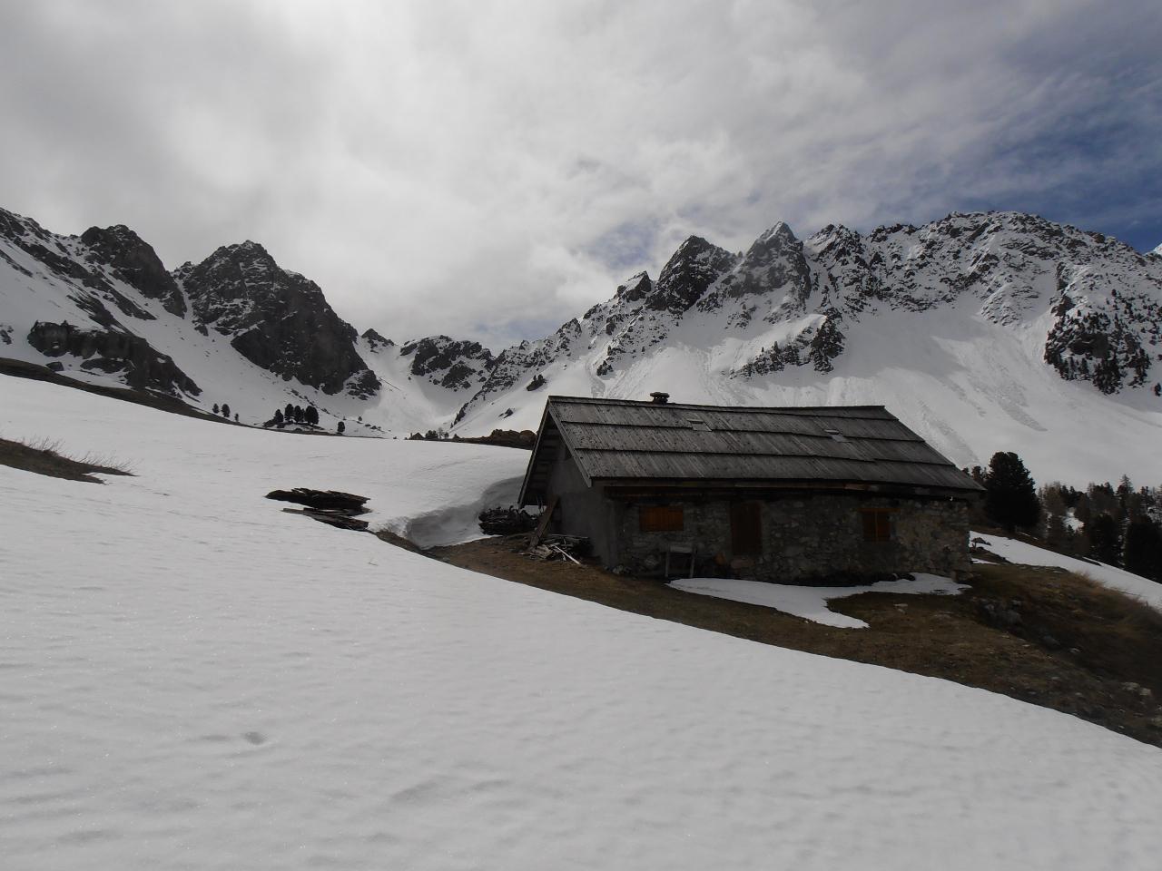
Dal Lac de l’Orcierette risalire lungo la strada, tagliandone i tornanti, fino agli Chalets de l’Alp. Fino a quì l’itinerario si svolge nel bosco rado.
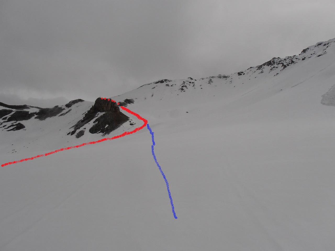
Dagli chalets mirare a sx di un grosso dosso, oltre il quale è ben visibile la croce sommitale del Rocher du Roux (roccione in mezzo al pendio).
Aggirare il dosso a sx e risalire alla meta lungo dolci pendii, lontano da rischi di slavine se non nella parte finale.
Eì anche possibile salire dalla dx del dosso, ma si passa vicino ad un pendio a forte rischio di slavine.
Discesa per l’itinerario di salita, abbastanza libero.
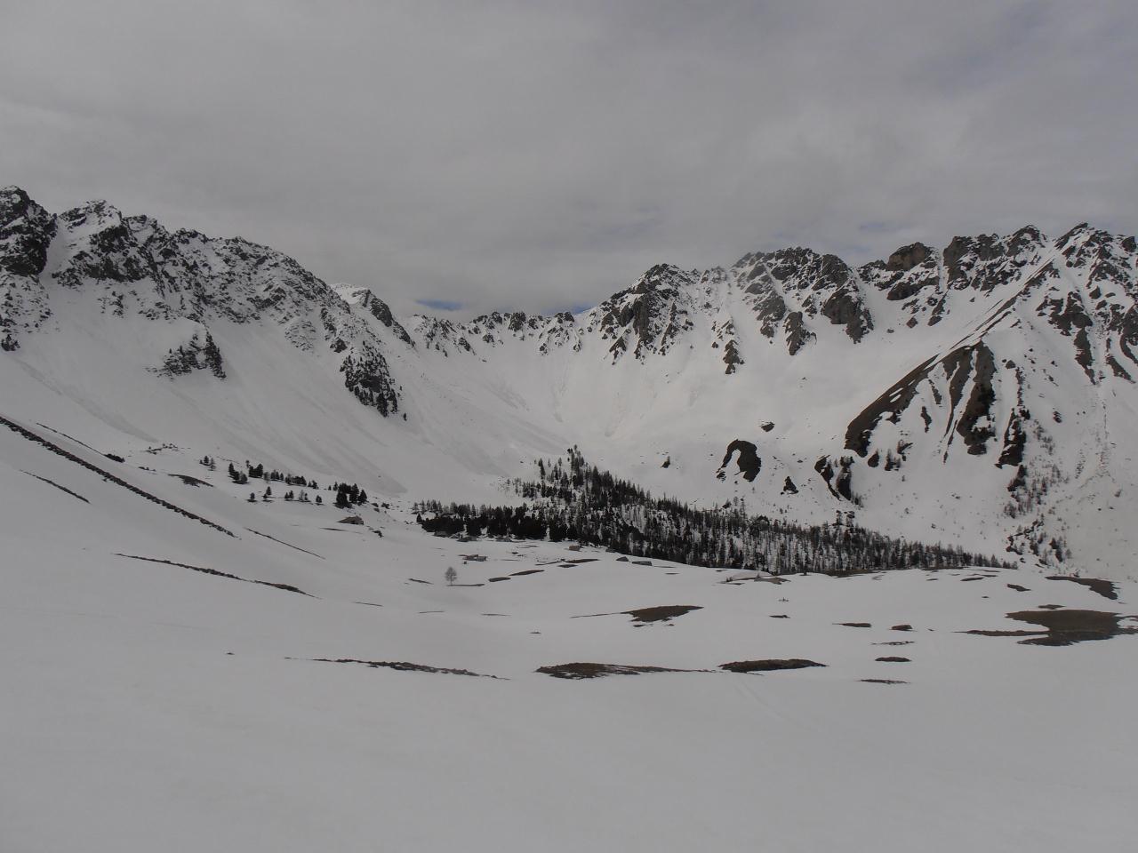
Fondovalle pittoresco.
- Cartografia:
- 1:25000 IGN Gullestre Vars Risoul
Nelle vicinanze Mappa
Itinerari
08/05/2016 Hautes-Alpes, Villar-Saint-Pancrace D+ 1300 m BS Tutte
Peyre Eyraute (Pic de) dal Lac de l’Orceyrette, traversata per Roc de Serre Chapelle
 50m
50m
13/01/2019 Hautes-Alpes, Villar-Saint-Pancrace D+ 1489 m OSA Nord-Ovest
Jean Rey (Pic) da Villar Saint Pancrace
 5.2Km
5.2Km
16/02/2013 Hautes-Alpes, Villar-Saint-Pancrace D+ 1372 m BS Nord
Barres (Crete des) da Villar Saint Pancrace
 5.2Km
5.2Km
21/02/2016 Hautes-Alpes, Villar-Saint-Pancrace D+ 1720 m BS Varie
Brusas (Crete des) da Villar Saint Pancrace, giro della Forete d’Ayes
5.2Km
13/02/2016 Hautes-Alpes, Villar-Saint-Pancrace D+ 1392 m BS Nord
Melezin (Cime du) da Villar-Saint-Pancrace
5.2Km
21/02/2016 Hautes-Alpes, Saint-Martin-de-Queyrières D+ 1000 m MS Nord
Bois de Testasson (Cime du) da le Villaret
 7.2Km
7.2Km
22/04/2002 Hautes-Alpes, Saint-Martin-de-Queyrières D+ 1134 m BS Nord
Moutiere (Roche de la) da le Villaret
7.2Km
10/05/2014 Hautes-Alpes, Saint-Martin-de-Queyrières D+ 1115 m MS Nord
Alpavin (Crete de l’) da Saint-Martin-de-Queyrières
 7.3Km
7.3Km
10/05/2014 Hautes-Alpes, Saint-Martin-de-Queyrières D+ 1293 m OSA Sud-Ovest
Peyre Eyraute (Pic de) da Rocher Baron per il Versante SO
 7.3Km
7.3Km
02/02/2020 Hautes-Alpes, Cervières D+ 987 m BS Varie
Cime (Clot de la) da le Laus, traversata a Brunissard
 8.5Km
8.5Km