1.1Km
1.1Km
Note
 0m
0m
0m
50m
50m
50m
50m
50m
50m
50m
0m
0m
0m
50m
50m
50m
50m
50m
50m
50m
1.1Km
4.5Km
4.5Km
4.5Km
5Km
5Km
5Km
5.4Km
5.7Km
5.8Km
Itinerario selvaggio e poco frequentato, soprattutto dopo la chiusura degli impianti del del Super Saint Bernard.
NB: Esposizione NW: i pendii non prendono il sole presto al mattino. Aspettare l'ora giusta per la discesa. Prevedere neve dura su pendenze più che sostenute.
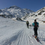
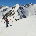
Avvicinamento
NB: Esposizione NW: i pendii non prendono il sole presto al mattino. Aspettare l'ora giusta per la discesa. Prevedere neve dura su pendenze più che sostenute.
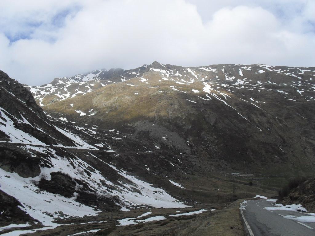
Da Aosta percorrere la strada del Gran San Bernardo. Passare il tunnel e girare subito a sx per parcheggiare a Bourg Saint Bernard (2017m) in territorio Svizzero (Valle di Entremont)
Descrizione
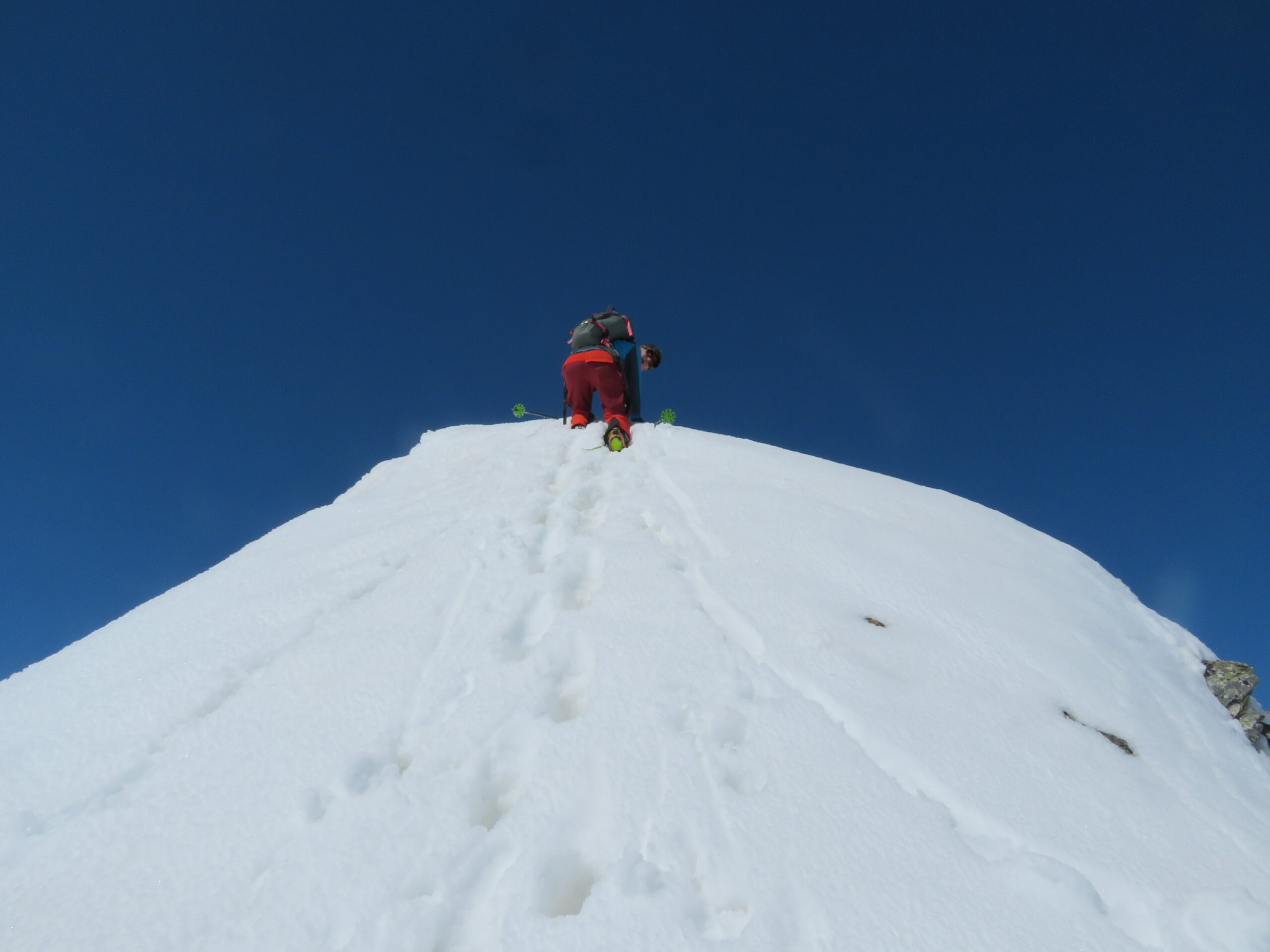
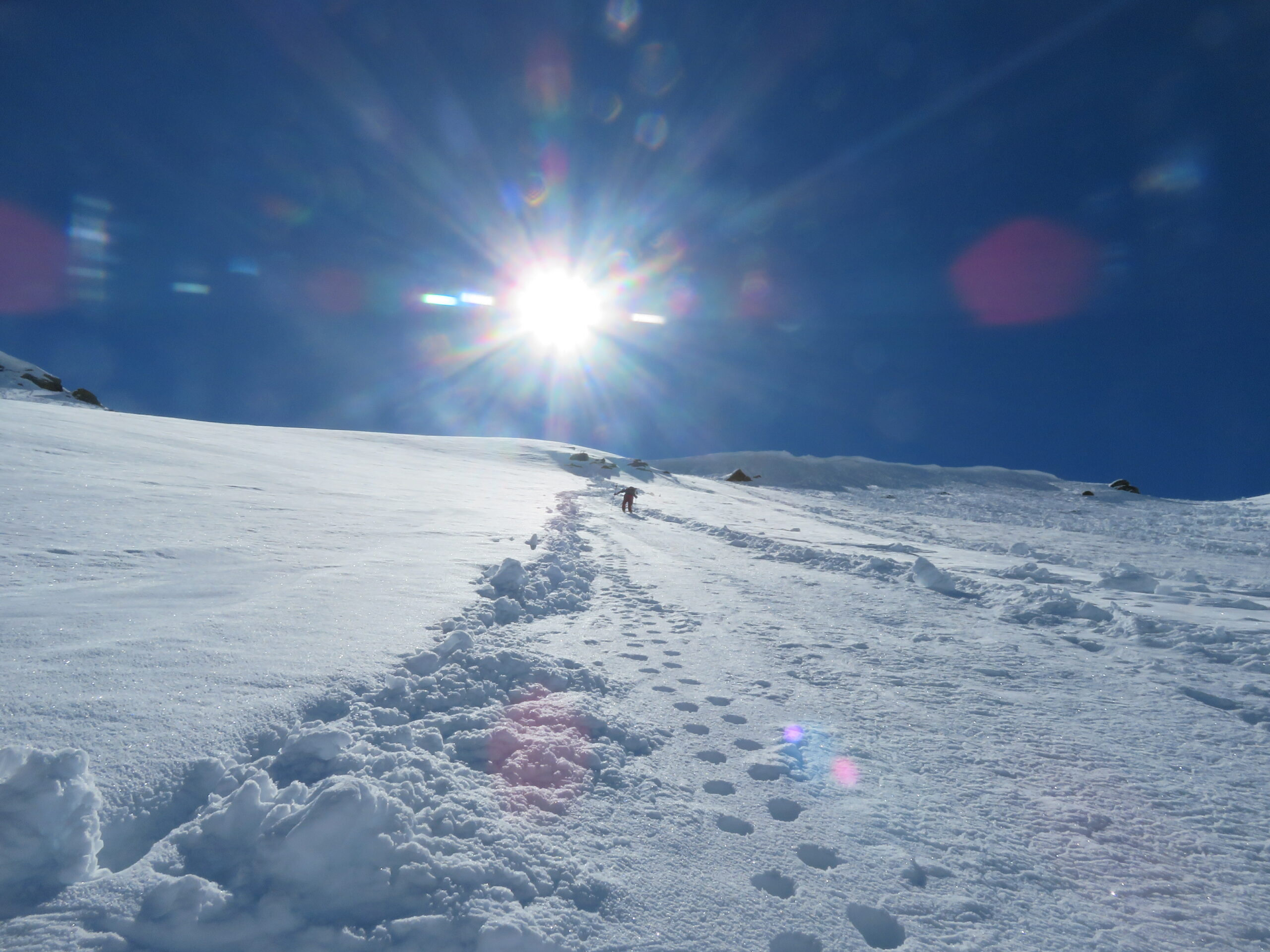
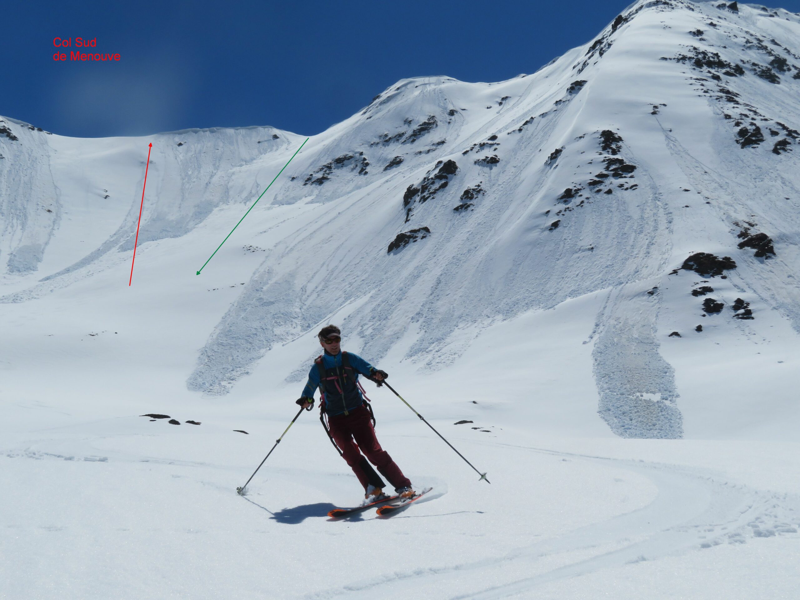
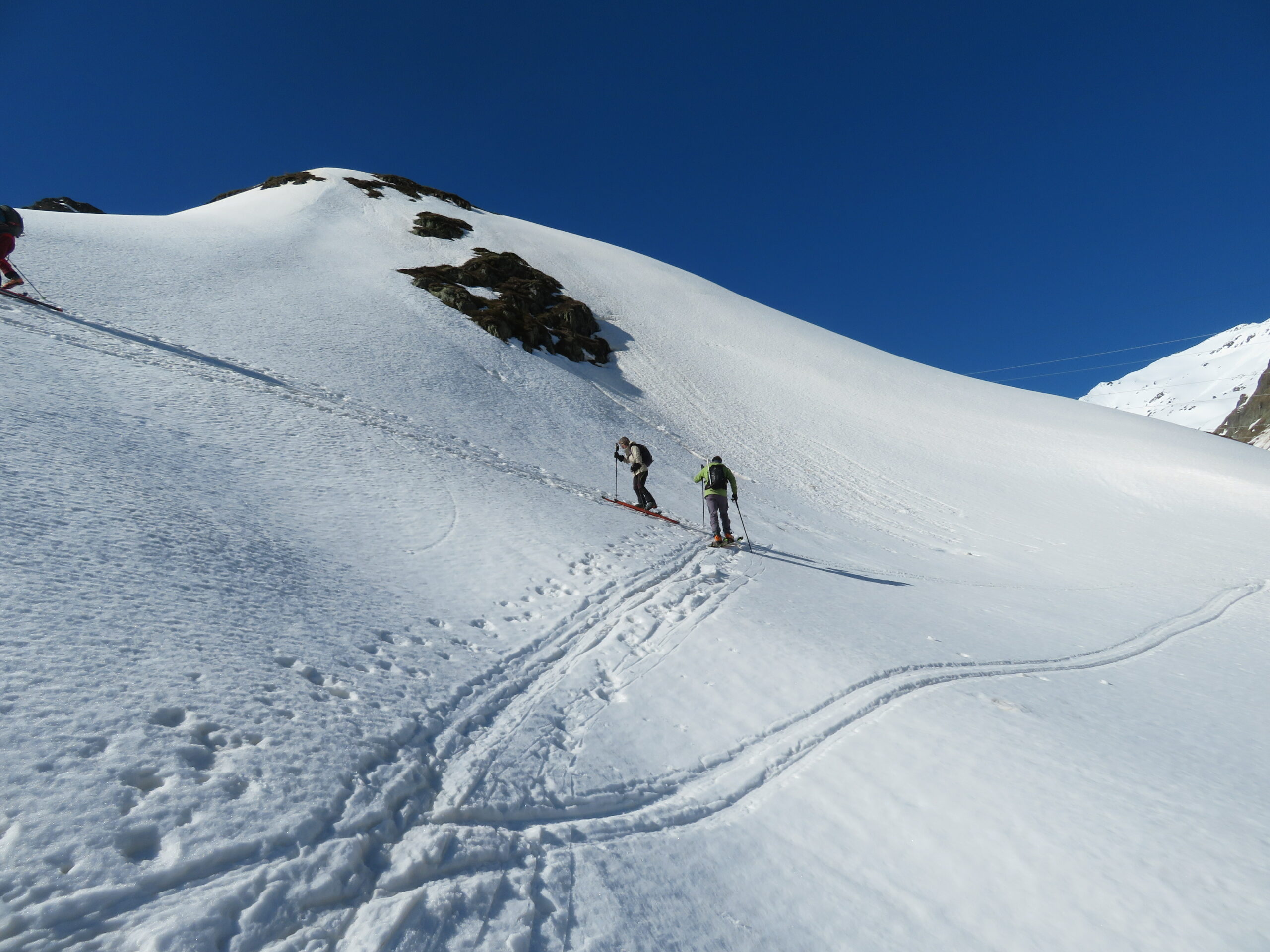
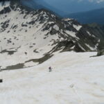
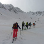
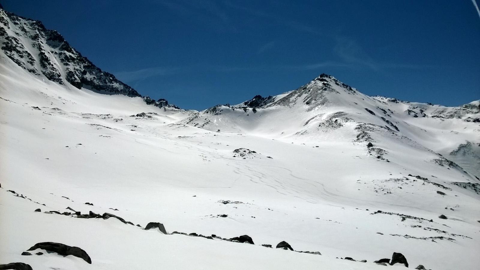
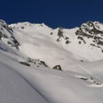
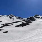
Dal parcheggio seguire la strada verso il colle del Gran San Bernardo fino all’Hospitalet 2085 m. Risalire a sx in direzione Sud-Est i ripidi pendii delle Places fino a raggiungere il Plan de Tcholeire (2469m). Continuare sempre in direzione sud-Est verso un Couloir con esposizione N/NO che risale al Col Sud de Menouve. Rimontare il Couloir (quasi sempre a piedi) fino al colle (40-45°) e prendere piede così sulla Arête de Tcholeire ,superando nel miglior modo possibile la cornice spesso presente. Seguire la cresta a dx ed in breve arrivare alla base della sommità finale, che si risale facilmente su neve e roccette (2805m).
In discesa, a seconda delle condizioni, percorrere il Couloir Nord del Col Sud de Menouve oppure in alternativa preferire un altro Couloir (sempre con Esposizione Nord) a metà strada tra il Col Sud de Menouve e quello che scende dalla vetta
- Bibliografia:
- x
Nelle vicinanze Mappa
Itinerari
28/06/2024 Entremont, Bourg-Saint-Pierre D+ 939 m OS Nord-Est
Mort (Mont) da Bourg Saint Bernard, parete Est
 0m
0m
28/01/2023 Entremont, Bourg-Saint-Pierre D+ 523 m MS Varie
Gran San Bernardo (Colle del) da Bourg Saint Bernard
 0m
0m
05/07/2013 Entremont, Bourg-Saint-Pierre D+ 1135 m BS Nord-Ovest
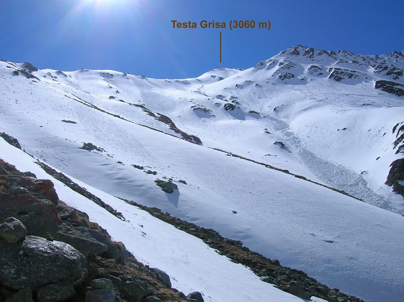
Grisa (Testa) da Bourg Saint Bernard
 0m
0m
16/03/2022 Entremont, Bourg-Saint-Pierre D+ 881 m BS Nord-Ovest
Menouve (Col Nord de) da Bourg Saint Bernard
 50m
50m
29/04/2007 Entremont, Bourg-Saint-Pierre D+ 1100 m MS Est
Fourchon (Mont) da Bourg Saint Bernard
 50m
50m
15/04/2015 Entremont, Bourg-Saint-Pierre D+ 1300 m OS Ovest
Petit Vélan Versante Ovest
 50m
50m
28/03/2022 Entremont, Bourg-Saint-Pierre D+ 810 m MS Nord-Ovest
Barasson (Tête de) da Bourg Saint Bernard
 50m
50m
27/12/2024 Entremont, Bourg-Saint-Pierre D+ 957 m OS Varie
Grand Lè (Dents du) da Bourg Saint Bernard
 50m
50m
07/04/2026 Entremont, Bourg-Saint-Pierre D+ 800 m BSA, PD- Sud
Godegotte (Pointe de) da Bourg Saint Bernard
 50m
50m
18/06/2024 Entremont, Bourg-Saint-Pierre D+ 763 m BS Nord-Ovest
Barasson (Pointe de) per la Comba di Barasson
 50m
50m
Servizi
1.1Km
4.5Km
De l’Hospice Rifugio
Bourg-Saint-Pierre 4.5Km
4.5Km
Auberge de l’Hospice Ristorante
Bourg-Saint-Pierre 4.5Km
4.5Km
Hospice du Grand-St-Bernard Albergo
Bourg-St-Pierre 5Km
5Km
Du Lac Ristorante
Saint-rhemy-en-bosses 5Km
5Km
Ristorante Italia Ristorante
Saint Rhemy 5Km
5Km
Albergo Italia Albergo
Saint-rhemy-en-bosses 5.4Km
5.4Km
La Linnaea B&B
Bourg-St-Pierre 5.7Km
5.7Km
Maison St-Pierre B&B
Bourg-St-Pierre 5.8Km
5.8Km