 6Km
6Km
Note
 50m
50m
100m
100m
100m
2.5Km
5.3Km
5.7Km
5.8Km
6Km
50m
50m
100m
100m
100m
2.5Km
5.3Km
5.7Km
5.8Km
6Km
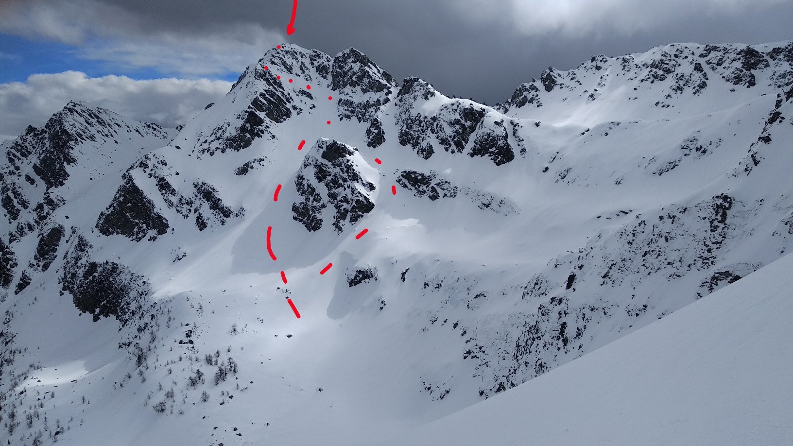
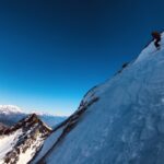
Evidente canale piuttosto frequentato, da percorrere con neve stabile. Può essere percorso anche in boucle come suggerito dalla guida citata in bibliografia, salendo dapprima al Col d'Ameran e seguendo poi la cresta S della Becca.
Avvicinamento
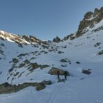
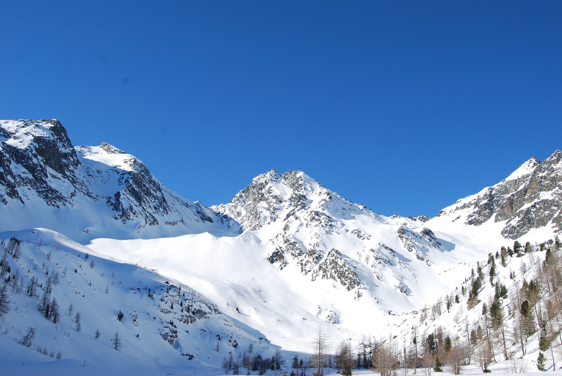
Da Arpy si sale fino al lago omonimo seguendo il fondo del vallone e in ultimo superando il breve ripido pendio boscoso che precede il lago dapprima verso destra, poi seguendo all'incirca il sentiero estivo.
Descrizione
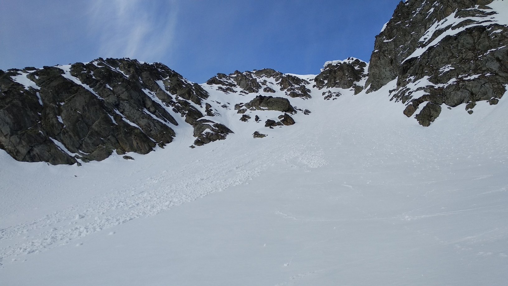
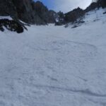
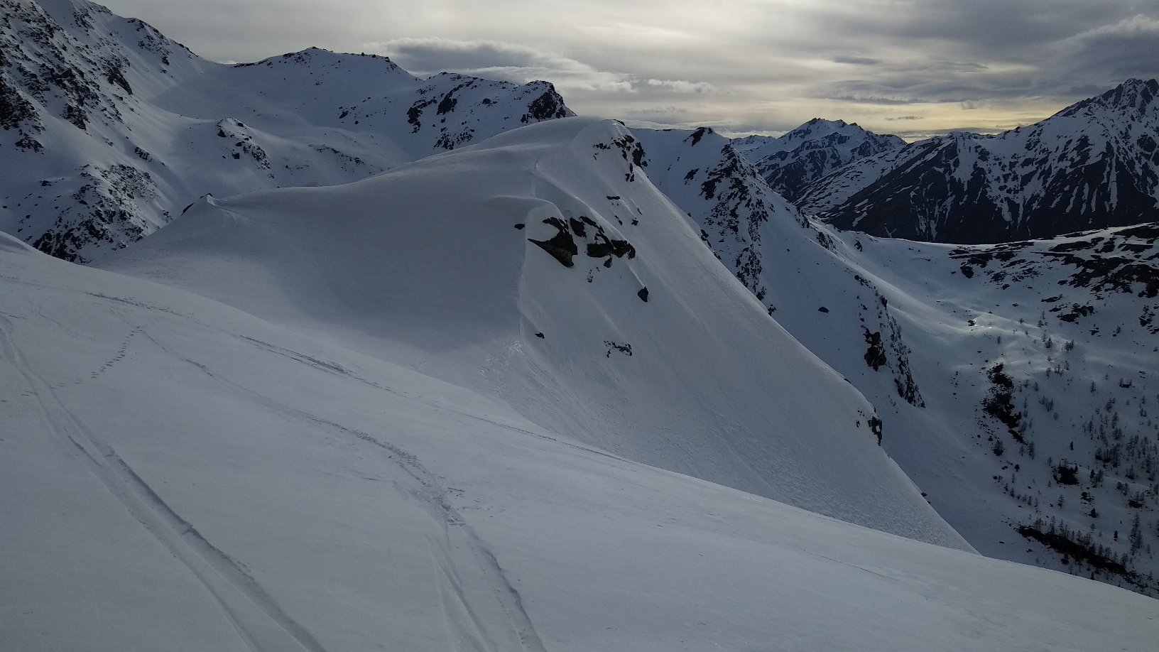
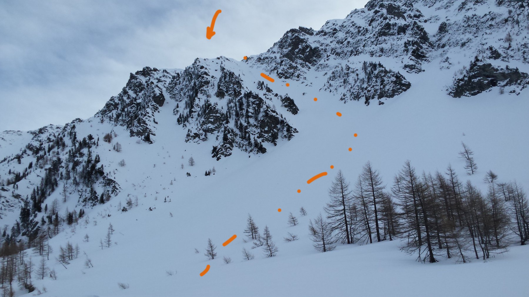
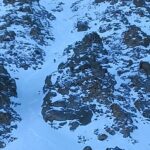
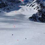
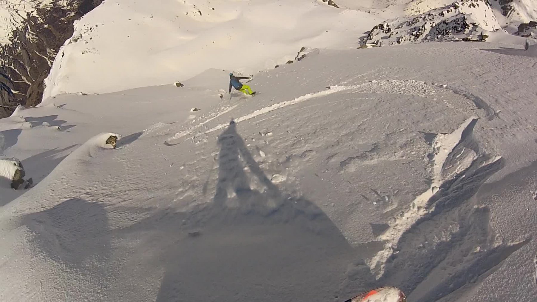
Proseguire lungo il classico itinerario del Mont Colmet fin verso q. 2350. Da qui dirigersi verso E e imboccare l’evidente canalone che sale verso la vetta della Becca Pouegnenta. Esso nella parte bassa è diviso in due da una costola rocciosa. Si può scegliere indifferentemente uno dei due rami, che successivamente confluiscono. Lo si percorre interamente uscendo direttamente a pochi passi dalla vetta q. 2826 (35-40°, qualche breve tratto più ripido in alto). Da qui volendo si può guadagnare in pochi minuti la vetta con la croce, di un metro più bassa.
- Cartografia:
- L'Escursionista - 02 - La Thuile, Piccolo San Bernardo
- Bibliografia:
- Grand Paradis - Jean-Baptiste Mang - Toponeige Val d'Aoste - Volopress 2018
Nelle vicinanze Mappa
Itinerari
21/03/2021 AO, Morgex D+ 800 m II, 4.2, E2 Ovest
Charvet (Mont) Canale della Lacrima
 50m
50m
07/05/2019 AO, Morgex D+ 1000 m III, 4.1, E2 Nord-Ovest
Pouegnenta o Pougnenta (Becca) Canale a gomito dell’anticima
 50m
50m
06/02/2023 AO, Morgex D+ 1000 m 4.1, E2 Ovest
Tereza (Passage de) da Arpy
 100m
100m
18/03/2018 AO, Morgex D+ 800 m 4.1, E1 Ovest
Charvet (Mont) Canale Ovest
 100m
100m
17/02/2024 AO, Morgex D+ 1130 m II, 4.2, E2 Nord
Colmet (Mont) spalla NE Couloirs du Lapin
 100m
100m
02/03/2025 AO, Morgex D+ 1370 m III, 4.1, E1 Nord-Est
Tereza (Passage de) dalla strada del Colle San Carlo
 2.5Km
2.5Km
16/04/2022 AO, La Thuile D+ 1000 m III, 4.3, E3 Nord
Colmet (Mont) Parete Nord
 5.3Km
5.3Km
23/03/2019 AO, La Salle D+ 1640 m 4.3, E2 Nord-Est
Paramont (Testa del) Canale Incisivo
 5.7Km
5.7Km
26/02/2023 AO, La Salle D+ 1580 m II, 4.3, E2 Nord-Est
Paramont (Testa del), anticima Ovest Canale NE
 5.8Km
5.8Km
22/01/2022 AO, La Thuile D+ 1538 m II, 4.3, E2 Nord-Est
Belleface (Mont, punta Sud) Canale NE
 6Km
6Km