Note
Storico
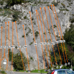
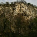
Bella falesia adatta ai principianti, vicina alla strada ma in contesto campestre comunque piacevole, quindi molto frequentata.
Il settore esposto a est, sulla strada principale, è stato abbandonato a causa del rischio di caduta massi.
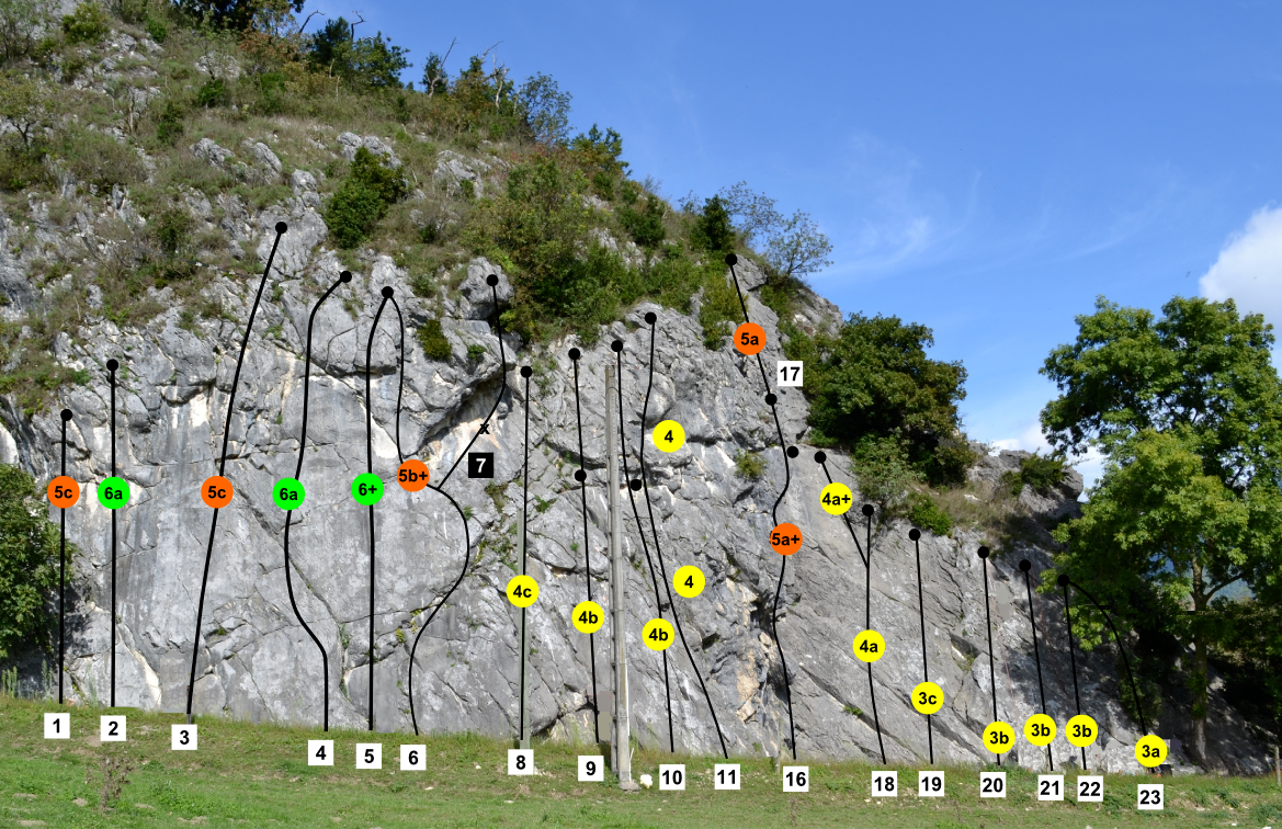
Arrampicata principalmente di placca, con un paio di diedri e una parte strapiombante, su un bel calcare grigio. Chiodatura corretta, soste con catena e anello di calata; sulla parte destra ci sono alcuni tiri di terzo grado super protetti, perfetti per bambini o debuttanti da primi.
Avvicinamento
Il settore esposto a est, sulla strada principale, è stato abbandonato a causa del rischio di caduta massi.
Arrampicata principalmente di placca, con un paio di diedri e una parte strapiombante, su un bel calcare grigio. Chiodatura corretta, soste con catena e anello di calata; sulla parte destra ci sono alcuni tiri di terzo grado super protetti, perfetti per bambini o debuttanti da primi.
Da Voiron o da Valence raggiungere il paese di L'Albenc tramite la provinciale D1092 o l'autostrada A49. Dall'abitato, superare la stazione ferroviaria e proseguire in direzione est, verso il fiume Isère; prendere la D48 in direzione Poliénas fino a passare accanto alla falesia, ben visibile dalla strada; 15 minuti circa da Voiron, 40 da Grenoble. Si parcheggia in uno spiazzo sulla strada principale, avvicinamento nullo.
Descrizione
Le vie da sinistra a destra:
- La fleche 5b+
- Les cheveux de Bérénice 6a
- Persée 5c
- Pegase 6a
- Andromede 6c
- Castor 5b+
- Pollux 5c+ (variante di uscita della precedente)
- Trot’heure 4b
- Régulus 4c
- Arcturus 4b
- Tree cycle L1: 4a L2: 4b (fattibile con corda da 60 m)
- Grande Ourse 6a
- Petite Ourse 6b
- La vierge 5b
- La licorne L1: 5a L2: 5b (fattibile con corda da 60 m)
- Poux set 4a
- Altair 3c
- Petit Renard 3b
- Alhéna 3b
- Admara 3a
- Gémeaux 3a
Chiodatura ad opera di: C. Bezier, P. Clerc e D. Papon
- Bibliografia:
- "Escalade en Isère - Tome 2" ed. ZE Topo 2021