 2.8Km
2.8Km
Note
 50m
50m
50m
50m
700m
1.4Km
3.1Km
50m
50m
50m
50m
700m
1.4Km
3.1Km
4.1 35°-40° per 250m (AD)
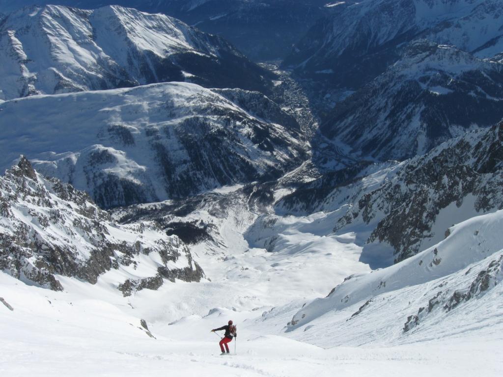
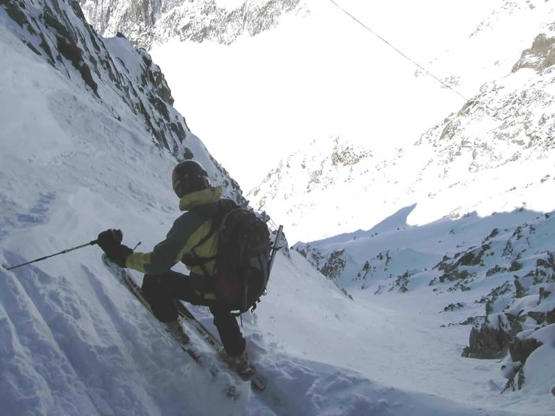
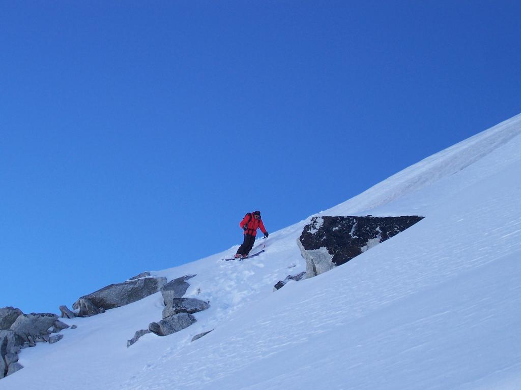
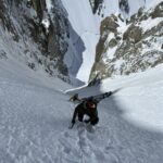
Splendido itinerario, spettacolare per ambiente e soddisfazione sciistica. Attenzione alla parte iniziale, ripida e difficile, con roccette, a volte una corda può essere utile. Avvicinamento poco impegnativo.
Eccezionale la discesa, quando possibile, fino al traforo con più di 2000m di dislivello!!
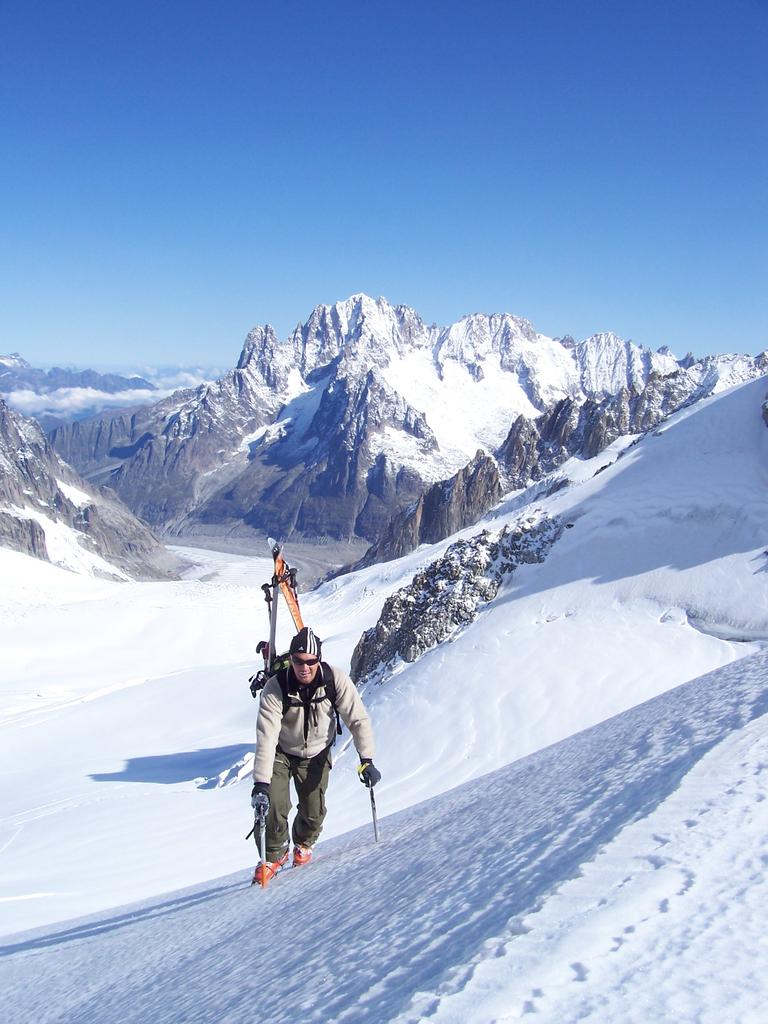
Avvicinamento
Splendido itinerario, spettacolare per ambiente e soddisfazione sciistica. Attenzione alla parte iniziale, ripida e difficile, con roccette, a volte una corda può essere utile. Avvicinamento poco impegnativo.
Eccezionale la discesa, quando possibile, fino al traforo con più di 2000m di dislivello!!
.
Descrizione
Da pointe Helbronner (3462m) si arriva al col Flambeux. Valicarlo e scendere nell’ampio bacino del glacier du Geant a contornare la base della Nord dell’Aiguille de Tuola. Puntare verso la Tour Rounde, passare all’attacco della via normale di salita e arrivare in breve al colle (3517m. 1h00′).
Dal colle scendere i primi duecento metri traversando dapprima verso destra (cornice, rocce affioranti, eventulale corda). Poi scendere il bel canalone alla base della Breche de la Brenva (ghiacciaio, crepacci) e della Aiguille della Brenva.
All’uscita tenersi a destra e traversare verso il Pavillon (2174m) o puntare ad uno dei canali che scendono verso il traforo (1345m)
- Cartografia:
- Carta dei sentieri L'Escursionista editore n.1, Monte Bianco
- Bibliografia:
- Anselme Baud, Mont Blanc et Aiguilles Roufes à ski, nevicata 2002
Ultima revisione 17/07/2026
Nelle vicinanze Mappa
Itinerari
15/01/2012 AO, Courmayeur D+ 600 m II, 5.1, E3 Sud-Est
Dente del Gigante (Gengiva) Pendio Sud Est
 50m
50m
27/02/2014 AO, Courmayeur D+ 450 m III, 4.3, E2 Sud-Ovest
Helbronner (Punta) Couloir della Passerella
 50m
50m
15/12/2024 AO, Courmayeur D+ 280 m I, 4.2, E3 Sud-Est
Entrèves (Aiguille d’) da Punta Helbronner
 50m
50m
10/01/2012 AO, Courmayeur D+ 220 m I, 3.1, E2 Sud-Ovest
Helbronner (Punta) Canale dell’Hangar
50m
17/02/2025 AO, Courmayeur D+ 2500 m III, 4.2, E2 Sud
Brenva (Ghiacciaio della)
 50m
50m
07/02/2012 AO, Courmayeur I, 4.2, E2 Sud
Helbronner (Punta) canali
50m
04/04/2022 Haute-Savoie, Chamonix-Mont-Blanc D+ 184 m III, 4.3, E2 Nord-Ovest
Toules (Aiguilles des) Scivolo Nord
 700m
700m
20/09/2008 Haute-Savoie, Chamonix-Mont-Blanc D+ 134 m 4.1, E2 Nord
Entreves (Aiguille d’) Scivolo N
 1.4Km
1.4Km
16/06/2024 Haute-Savoie, Chamonix-Mont-Blanc D+ 770 m II, 5.2, E2 Ovest
Tour Ronde – Couloir Gervasutti
 3.1Km
3.1Km
08/06/2006 Haute-Savoie, Chamonix-Mont-Blanc 5.3, E4 Nord-Est
Tacul (Col des Aiguilettes du) Parete NE
3.7Km