1.8Km
1.8Km
Note
 50m
50m
50m
50m
50m
50m
50m
50m
50m
50m
50m
50m
50m
50m
50m
50m
50m
50m
50m
50m
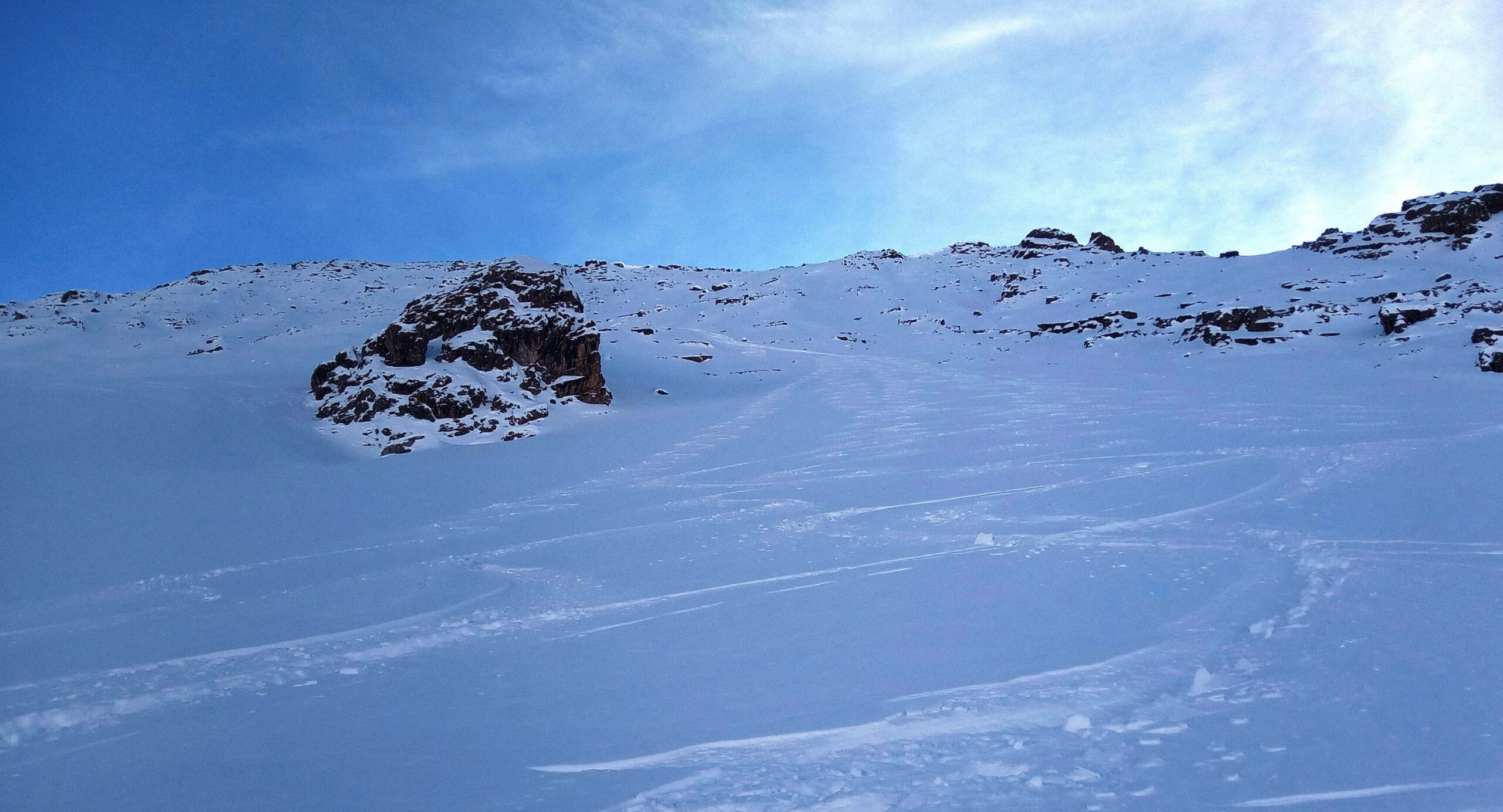
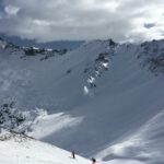
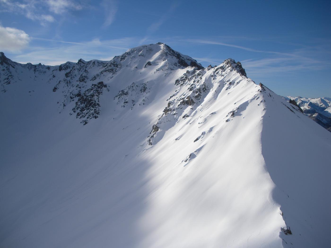
Itinerario che va affrontato con attenzione soprattutto per la metà superiore, dove la presenza di rocce ed eventuali cornici richiede un pò di studio. Essendo la parete molto ampia ci possono essere più soluzioni.
Avvicinamento
Da Briançon strada per il col d'Izoard. Parcheggio a Le Laus ai bordi della pista di fondo.
Descrizione
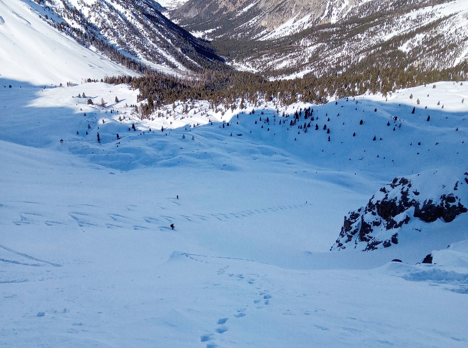
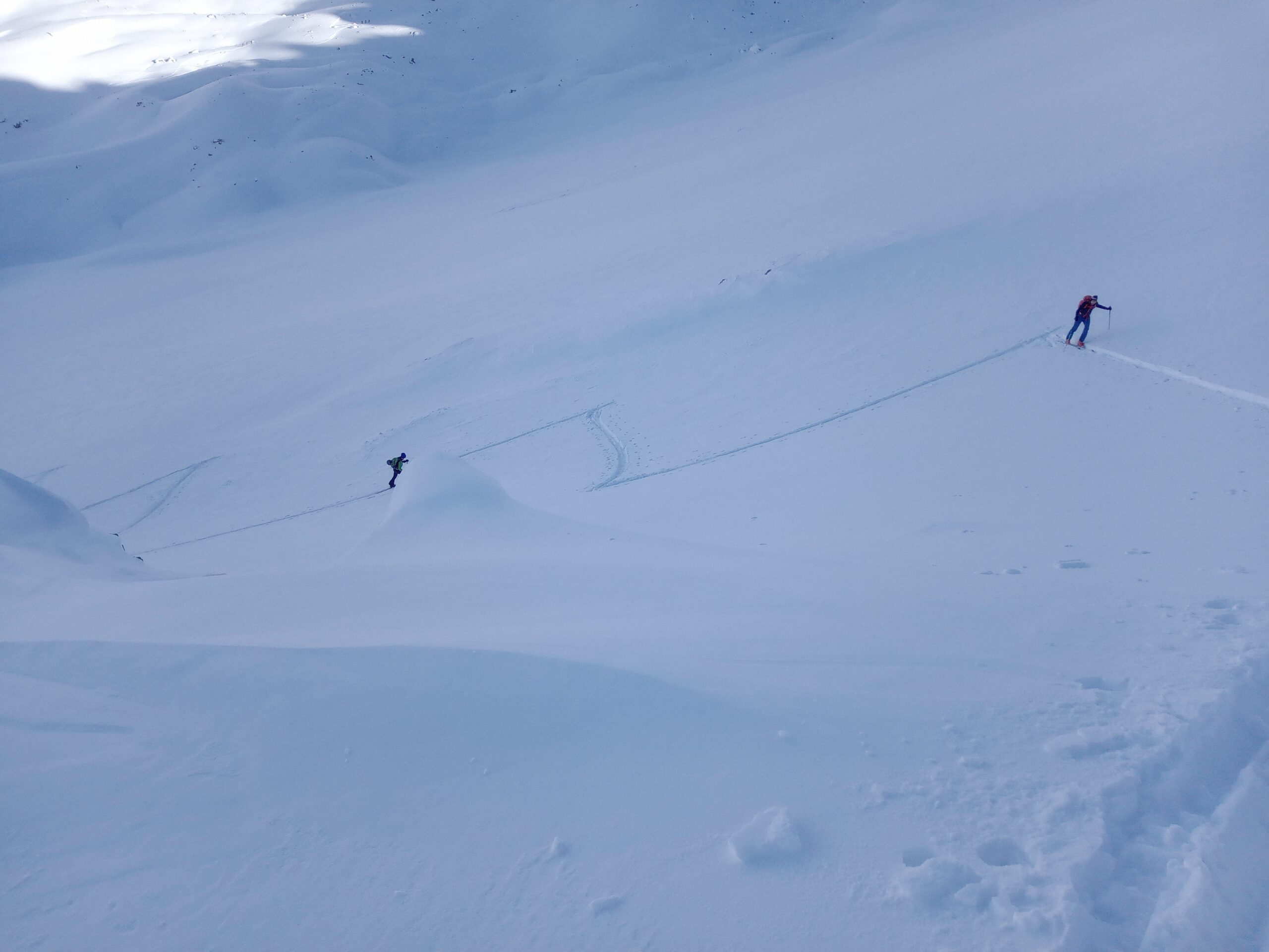
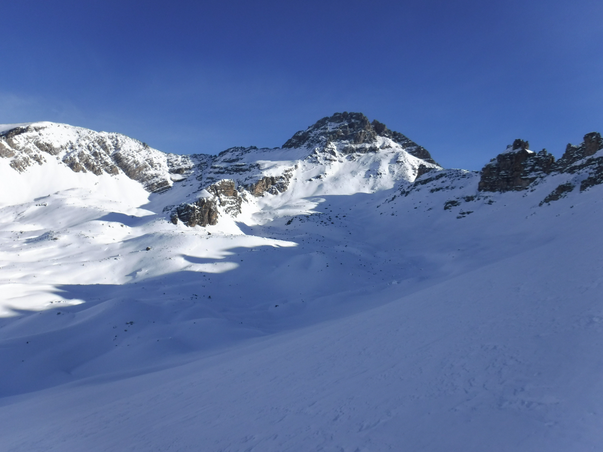
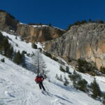
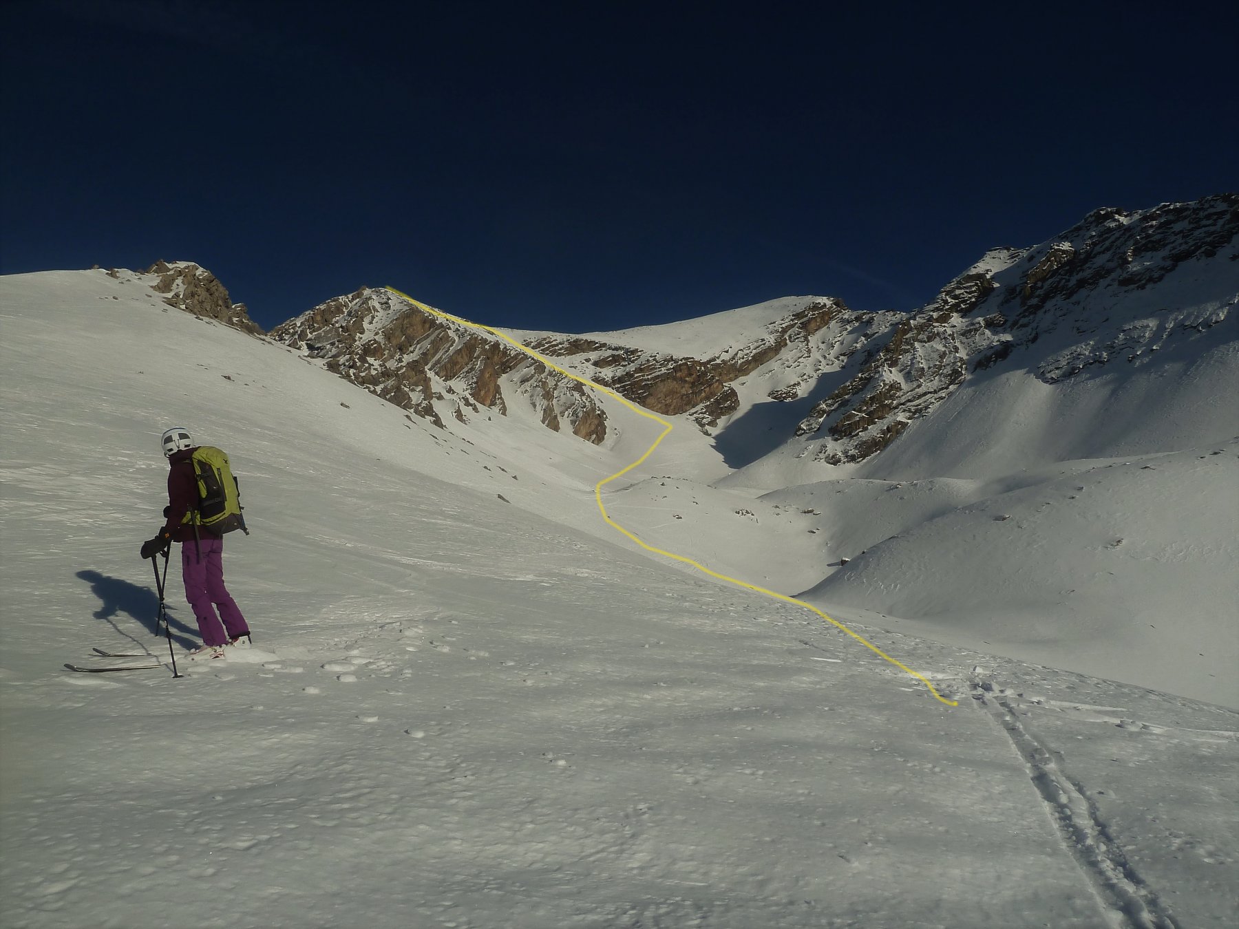
Da Le laus seguire l’itinerario per il Pic de Rochebrune, lungo la pista di fondo e il Bois des Oules. Usciti dal bosco portarsi verso destra in direzione di un caratteristico roccione posto al centro della larga parete tra il Cote Belle ovest e il Cote Belle est. Risalire la parete lasciando a destra il roccione, seguire una dorsale sopra il roccione per poi appena possibile spostarsi a destra per seguire un valloncello che porta sotto la vetta. In base all’innevamento e alle eventuali cornici raggiungere il Pic Central.
- Cartografia:
- IGN France 3536OT
- Bibliografia:
- La foto della parete su Toponege Queyras It A13
Nelle vicinanze Mappa
Itinerari
22/01/2023 Hautes-Alpes, Cervières D+ 1174 m OS Nord
Cote Belle (Pic Est de) da le Laus
 50m
50m
07/02/2026 Hautes-Alpes, Cervières D+ 650 m MS Nord-Ovest
Bois de Pemeant (Crete du) quota 2391 m da le Laus
 50m
50m
06/12/2025 Hautes-Alpes, Cervières D+ 1350 m BS Nord
Cote Belle (Pic ouest de) e Cime de l’Arpelin da le Laus
 50m
50m
03/01/2026 Hautes-Alpes, Cervières D+ 856 m BS Nord-Ovest
Arpelin (Cime de l’) da Le Laus per il Vallone dell’Izoard
 50m
50m
05/03/2025 Hautes-Alpes, Cervières D+ 701 m BS Nord-Est
Lausette (Crete de la) quota 2426 m da le Laus
 50m
50m
05/01/2019 Hautes-Alpes, Cervières D+ 1300 m OS Sud-Ovest
Turge de la Suffie da le Laus per il versante SO
 50m
50m
30/12/2025 Hautes-Alpes, Cervières D+ 1100 m BS Nord
Cote Belle (Pic ouest de) da le Laus
 50m
50m
09/03/2026 Hautes-Alpes, Cervières D+ 867 m MS Sud
Peygus (Col des) da le Laus
 50m
50m
31/12/2018 Hautes-Alpes, Cervières D+ 917 m BSA Nord
Petit Peygu (le) da le Laus
 50m
50m
02/03/2025 Hautes-Alpes, Cervières D+ 859 m BS Nord
Arpelin (Cime de l’) da le Laus per il Col Perdù
 50m
50m