 2.1Km
2.1Km

Note
 8.9Km
9.1Km
9.2Km
10Km
12.8Km
14.3Km
14.7Km
14.9Km
18.2Km
8.9Km
9.1Km
9.2Km
10Km
12.8Km
14.3Km
14.7Km
14.9Km
18.2Km
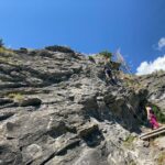
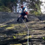
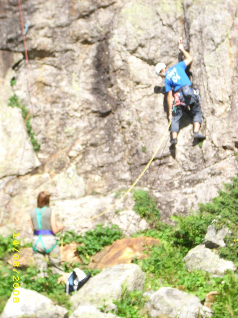
Questa falesia la definirei la perla dello Chetif, è una falesia storica che ti immerge nella antica cultura mineraria del villaggio di Dolonne. Scalando questa magnifica roccia gialla si riesce ad assaporare bene la filosofia valdostana.
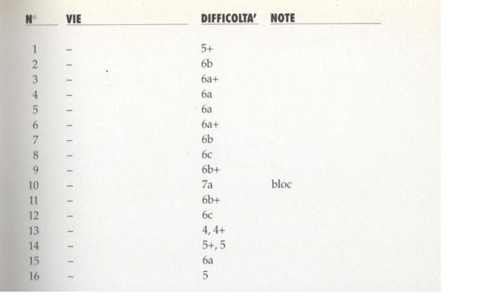
Gli spit sono mediamente buoni anche se a volte un po’ lontani, i gradi variano dal 5a fino all’8 e a parità di gradi li ho trovati più difficili rispetto a falesie di altre regioni. Le vie sono verticali o leggermente strapiombanti e l’esposizione è ottima. La falesia nelle sue 4 zone è sovente esposta e non è semplicissimo trovare un posto sicuro dove fare la sicura. Per raggiungere il settore terrazzo e la grotta bisogna utilizzare delle corde presenti e non tutte sono in ottimo stato, consiglio di salire con scarpe da approccio.
Avvicinamento
Gli spit sono mediamente buoni anche se a volte un po’ lontani, i gradi variano dal 5a fino all’8 e a parità di gradi li ho trovati più difficili rispetto a falesie di altre regioni. Le vie sono verticali o leggermente strapiombanti e l’esposizione è ottima. La falesia nelle sue 4 zone è sovente esposta e non è semplicissimo trovare un posto sicuro dove fare la sicura. Per raggiungere il settore terrazzo e la grotta bisogna utilizzare delle corde presenti e non tutte sono in ottimo stato, consiglio di salire con scarpe da approccio.
A poca distanza dalla partenza della funivia di Dolonne, proseguendo la strada che va verso La Villette si nota una strada che devia in direzione della montagna e sul muretto si vede un bollo giallo con su scritto "Pilastro Giallo). Proseguendo tale strada giunti al bivio si va a sinistra fino ad incontrare un piccolo ponte fatto di tronchi di legno con di fianco nuovamente il bollo giallo. Dopo aver passato il ponte proseguire il sentieri che è segnato da bolli gialli e talvolta rossi, da li il sentiero sale quasi verticalmente lungo la pietraia fino ad arrivare alla base della falesia nella sezione bassa.
- Bibliografia:
- Questa falesia si trova anche sul libro "Valle d'Aosta Sport Climbing" di Massimo Bal e Pratick Raspo
Nelle vicinanze Mappa
Itinerari
06/06/2026 AO, Courmayeur 6a, 8a+ Est
Courmayeur – Spartacus (Falesia)
800m
18/08/2023 AO, La Thuile 4, 6b Est
La Thuile – Palestra degli Alpini (Falesia)
 8.9Km
8.9Km
05/09/2020 AO, Morgex 3, 6b Nord-Est
Morgex – Valter Jordaney (Falesia)
 9.1Km
9.1Km
16/08/2023 AO, La Thuile 4, 6a Nord-Ovest
La Thuile – Buic (Falesia del)
 9.2Km
9.2Km
20/07/2024 AO, Morgex 3, 7c Est
Morgex – Hans Marguerettaz (Falesia)
 10Km
10Km
15/09/1995 AO, La Thuile 4, al 7a Sud-Ovest
Deffeyes (Rifugio, Falesia del)
 12.8Km
04/08/2016 AO, Courmayeur 4, al 6a Sud
Rouges de Triolet (Monts) Contrafforti Tommy monotiri
 14.3Km
17/08/2019 AO, Courmayeur 4, 6c Sud-Est
Val Ferret – Mochet (Falesia)
 14.7Km
18/08/2023 AO, Courmayeur 4, al 6c Sud
Pyramides Calcaries (Falesia)
 14.9Km
29/06/2018 Haute-Savoie, Chamonix-Mont-Blanc 3, 7a Sud
Chamonix – Les Gaillands (Falesia)
 18.2Km


