3.9Km
3.9Km
Note
 50m
1.6Km
1.7Km
1.7Km
2.1Km
2.5Km
2.5Km
2.7Km
2.8Km
50m
1.6Km
1.7Km
1.7Km
2.1Km
2.5Km
2.5Km
2.7Km
2.8Km
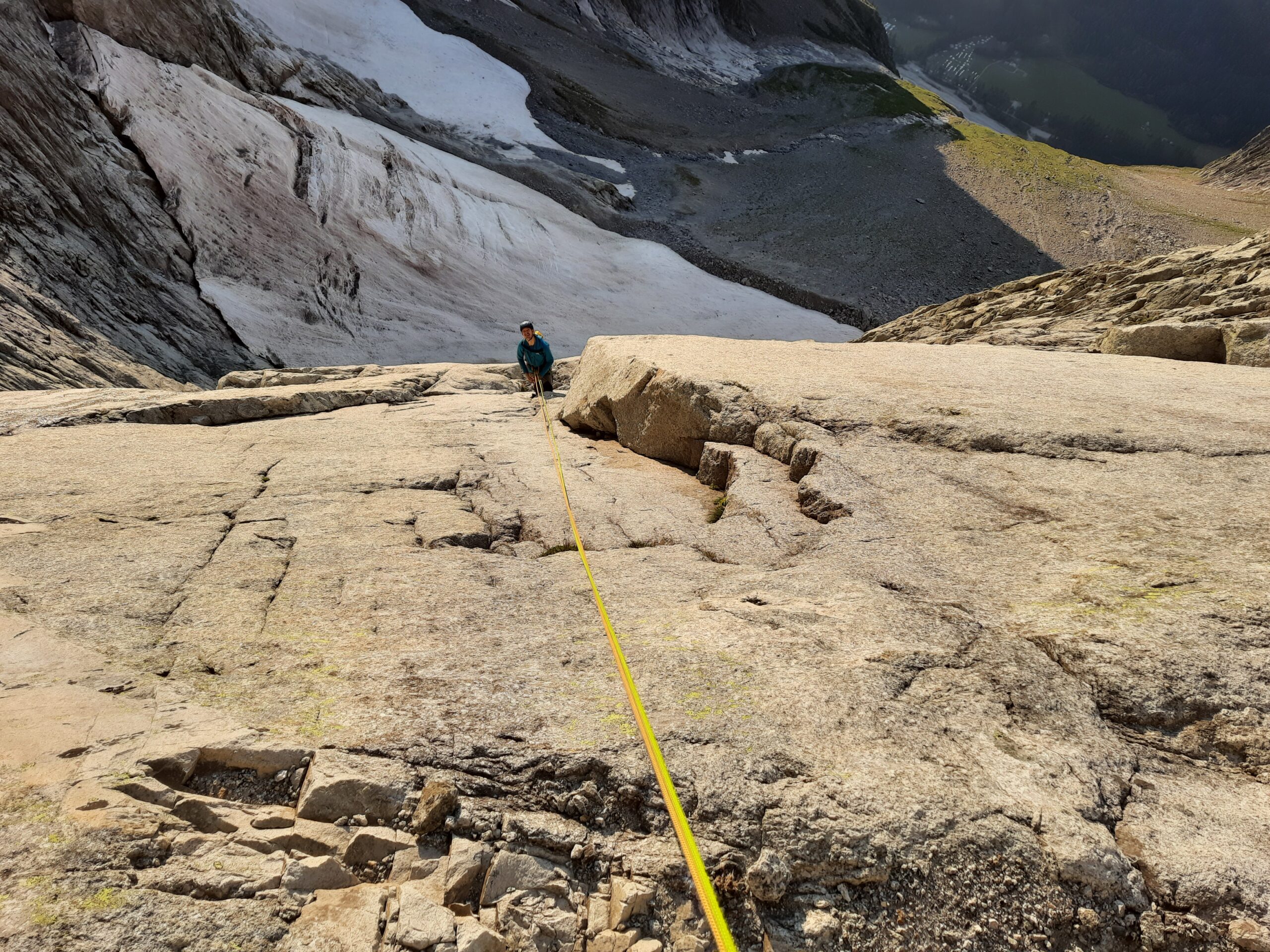
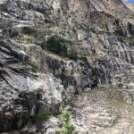
Bella via su roccia per lo più ottima. Le soste per presenti solo quelle che si usano per le calate(considerare che nella parte alta sono quasi tutte fuori via) e uno o due chiodi in tutta la via, noi abbiamo attrezzato tutte le soste con protezioni veloci.
Materiale da noi preso due serie di friend da 0,3 al 3, una di micro, una di nut, cordini d’abbandono per sostituirli nella discesa. Alcuni chiodi è meglio averli per rinforzare soste in discesa ed eventualmente anche in salita.
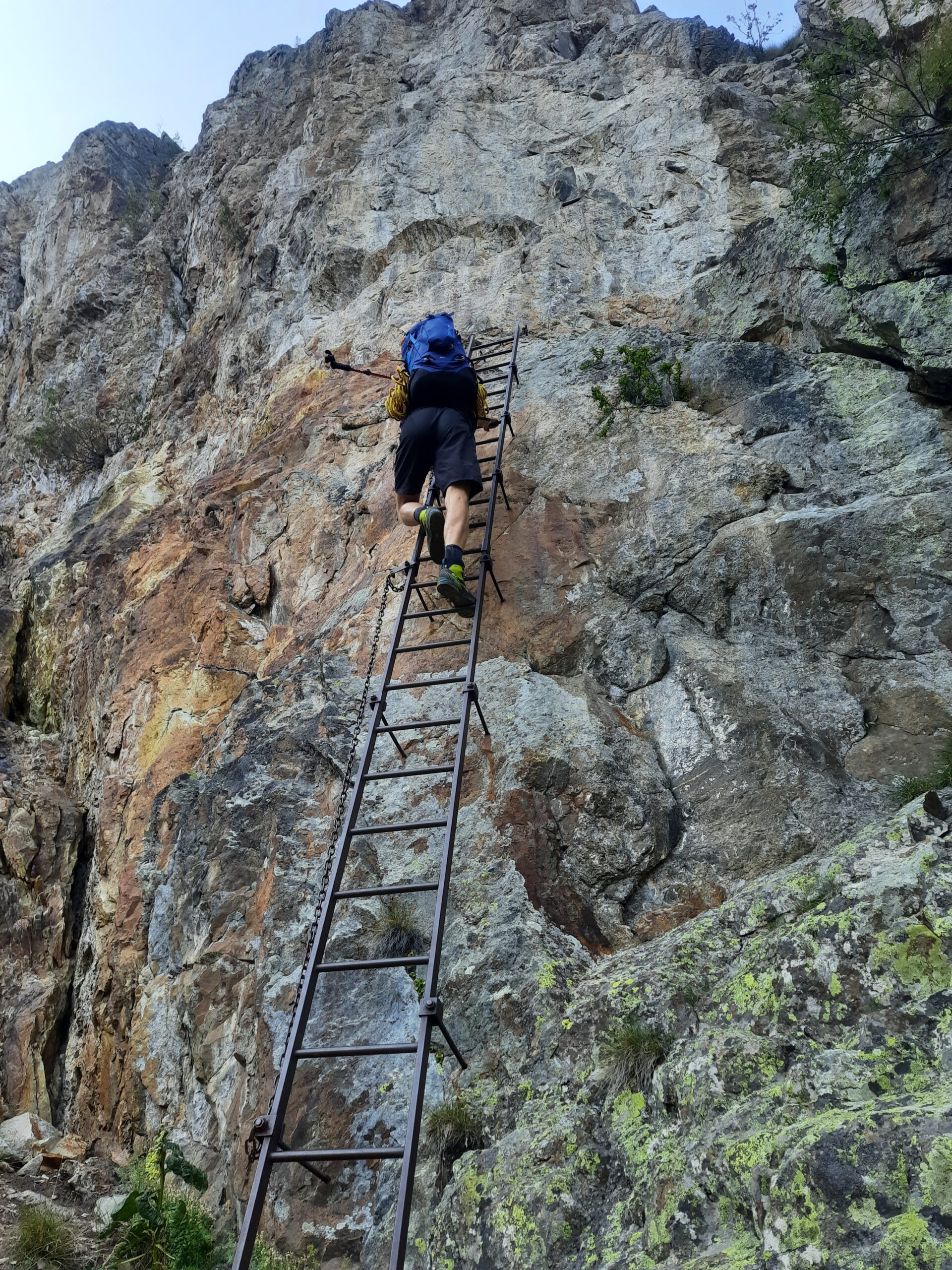
Avvicinamento
Materiale da noi preso due serie di friend da 0,3 al 3, una di micro, una di nut, cordini d’abbandono per sostituirli nella discesa. Alcuni chiodi è meglio averli per rinforzare soste in discesa ed eventualmente anche in salita.
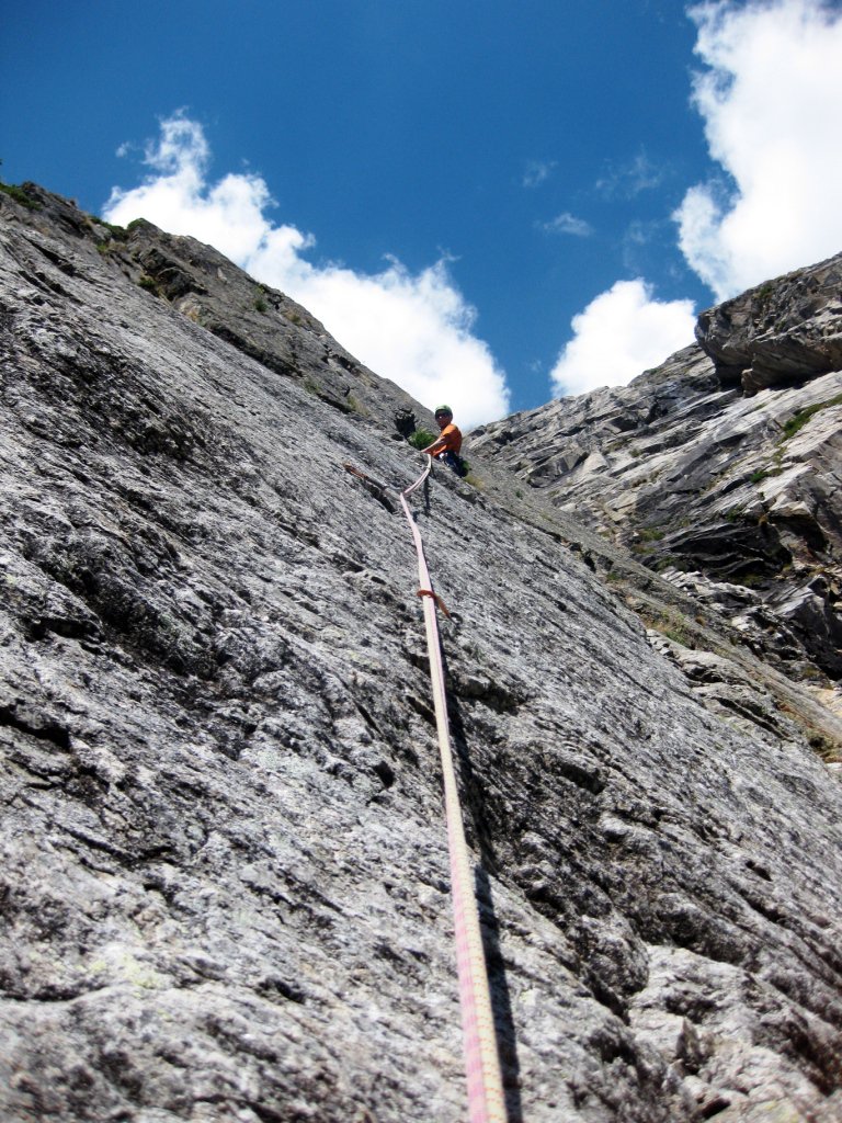
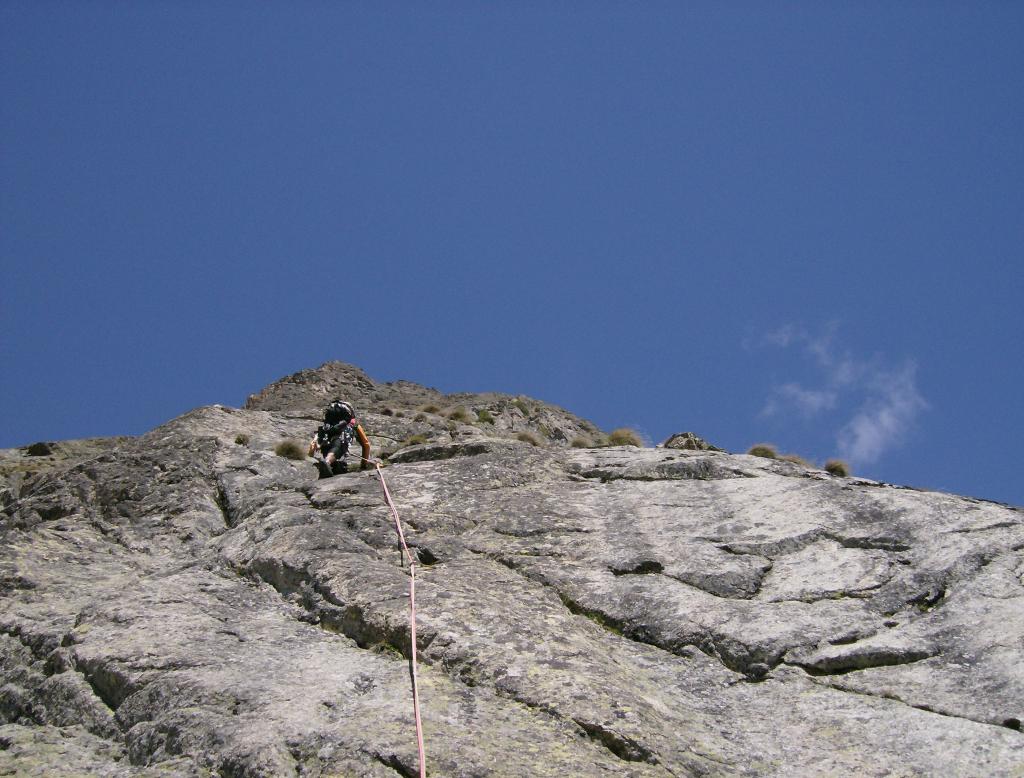
Dal Borelli in direzione della parete senza percorso obbligato sulla morena e l'ultimo tratto su nevaio più o meno grande in base al periodo e alla neve caduta durante inverno, utili i ramponi. 1,30h scarsa dal bivacco
Descrizione
Si attacca alla base di una fessura nera dove iniziano le placche appoggiate a dx di una zona verticale con roccia chiara, sosta zero con due chiodi e cordino azzurro.
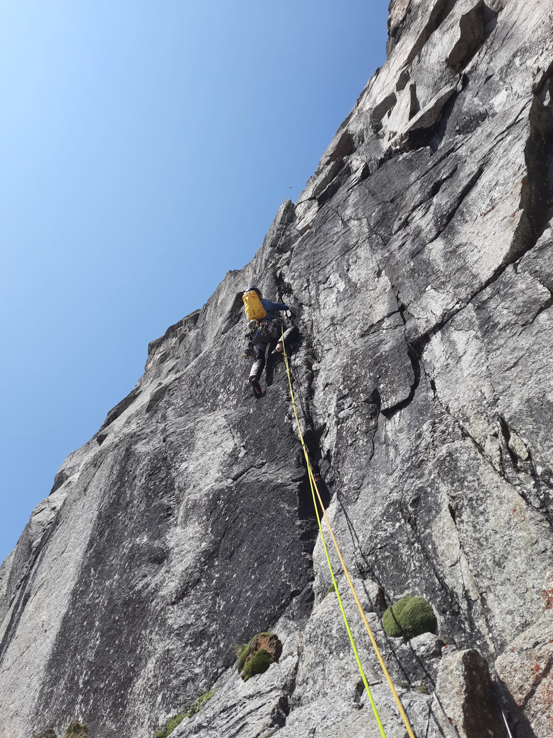
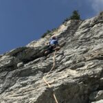
- I primi 5 tiri si svolgono sulle placche basali senza percorso obbligato si trovano le soste da usare in discesa seguendo il percorso più logico. Segue un tiro più verticale per arrivare alla base del primo 7a.
- Sul primo tiro di 7a abbiamo seguito le fessure sopra la sosta appena a sx, passando a dx del tetto nero salendo per una decina di metri oltre la sosta fino ad una lama/spuntone dalla quale abbiamo pendolato a dx perché sopra sembrava non si riuscisse a rientrare non abbiamo capito se eravamo giusti o se bisognava andare subito a dx dopo pochi metri dalla sosta. comunque sulla destra.
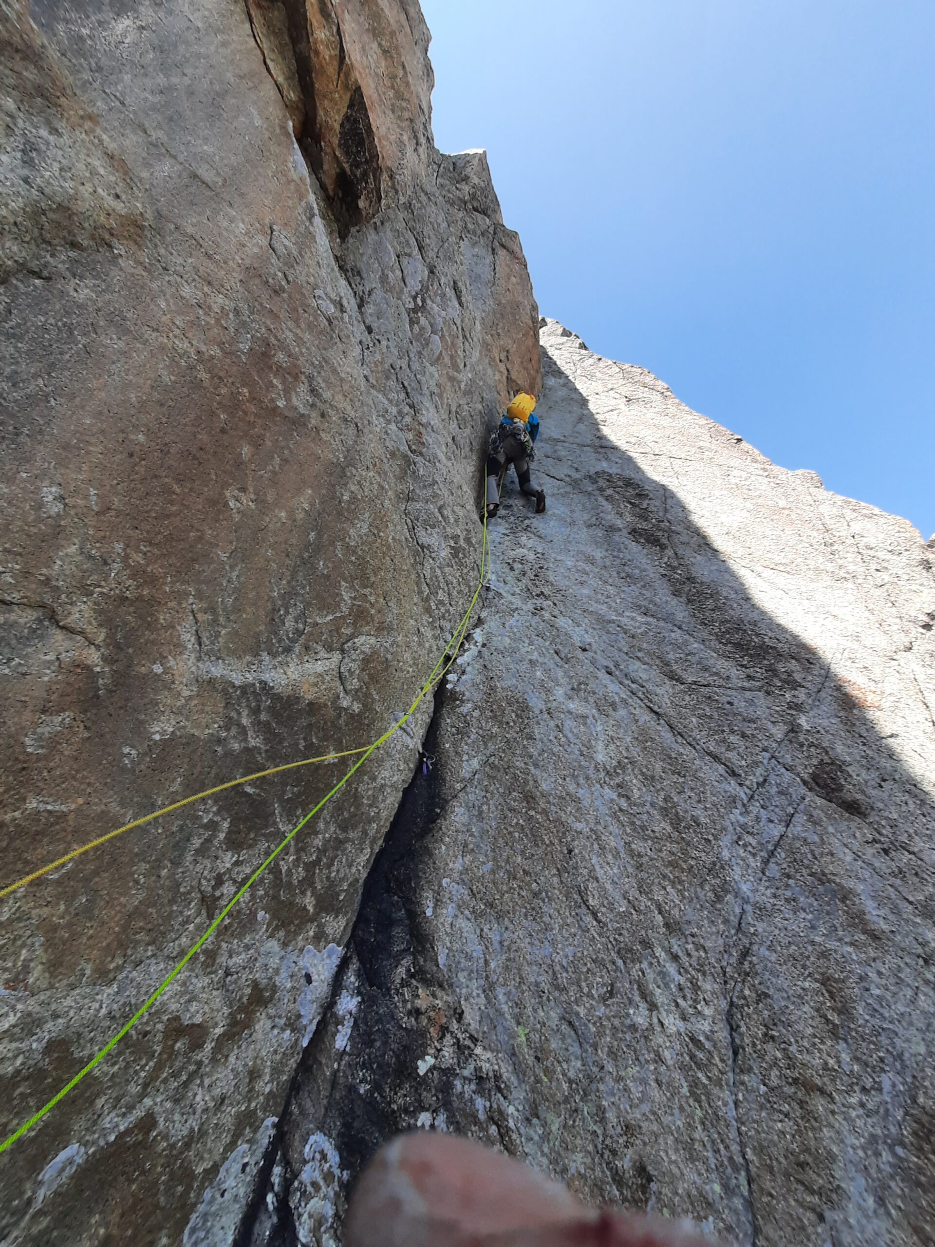
- Continuare verso sinistra sulle fessure oblique e quindi tendenzialmente a sx fino a superare un muro con poca possibilità di proteggersi e reperire la sosta su spuntone e chiodo collegati da cordini cordini, quindi dritti per circa 15 m e successivo traverso a destra fino alla base di un colatoio con sosta su due chiodi cordino e maglia rapida siamo alla base del 6a prima del 7b.
- Salire sulla verticale fino alla base della rampa ascendete a dx dove parte il tiro di 7b.
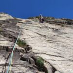
- Seguire la rampa a dx quindi aggirare il tettino a destra e salire per fessura corta ma strapiombante fino ad un chiodo dove noi abbiamo sostato alla base di una fessura nera tiro corto di 25 max 30m anche se era dato di 50 ci è sembrato giusto fare sosta li per fare sicura meglio sul tiro successivo (questo tiro ci è parso più facile di quanto dichiarato).
- Salire la fessura nera, con un chiodo alla base, si arriva in una nicchia si salta fuori arrivando poi ad una cengetta dove abbiamo sostato. (anche qui ci è sembrato più facile di quanto dichiarato)
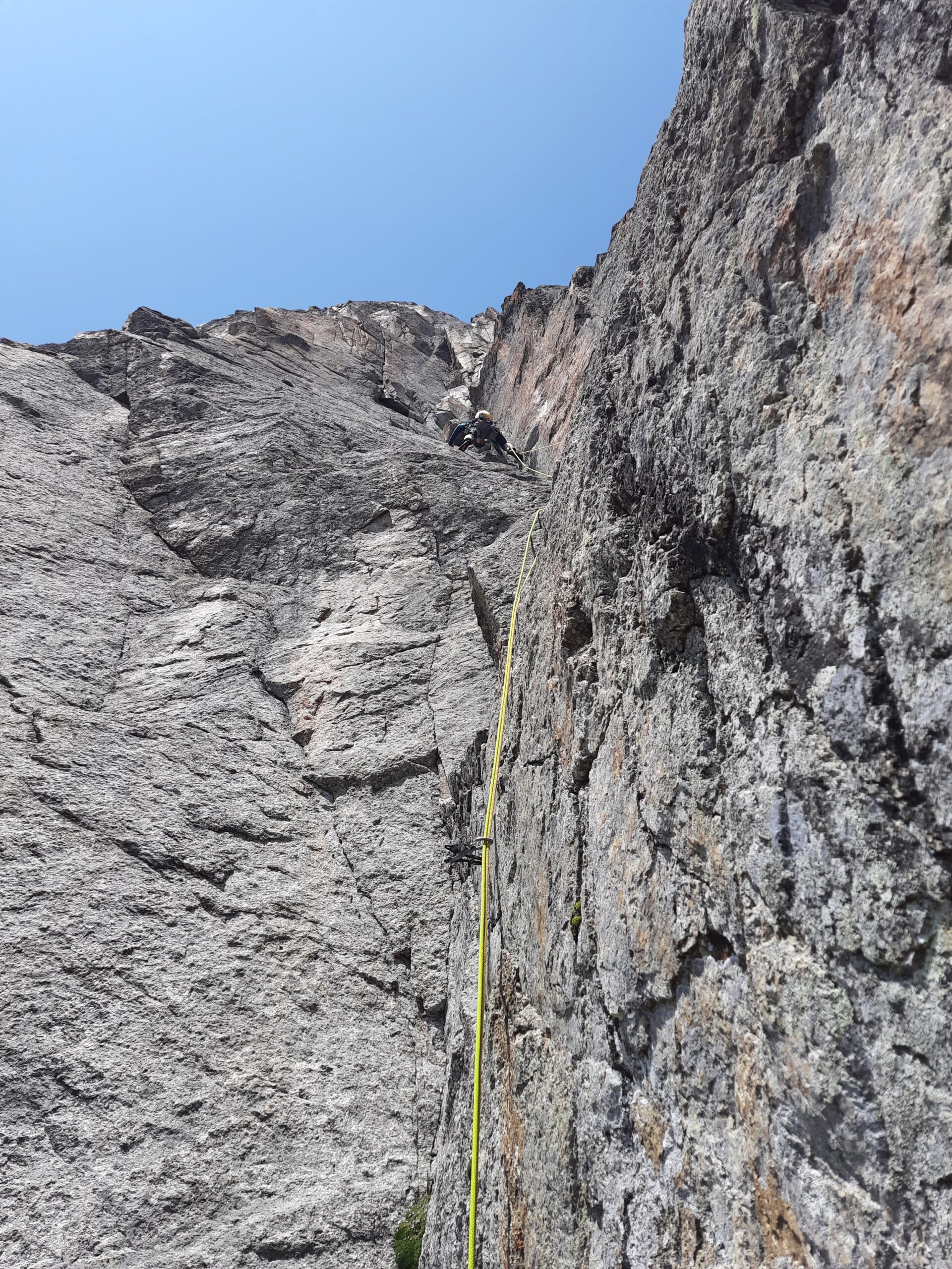
- Proseguire più o meno in verticale per circa 50m fino alla base del diedro non quello grande sulla sx ma quello alla sua dx.
- Salire tutto il diedro inizialmente si fatica a proteggersi poi meglio, fino a superare un blocco strapiombante alla sua… sosta sopra di esso.
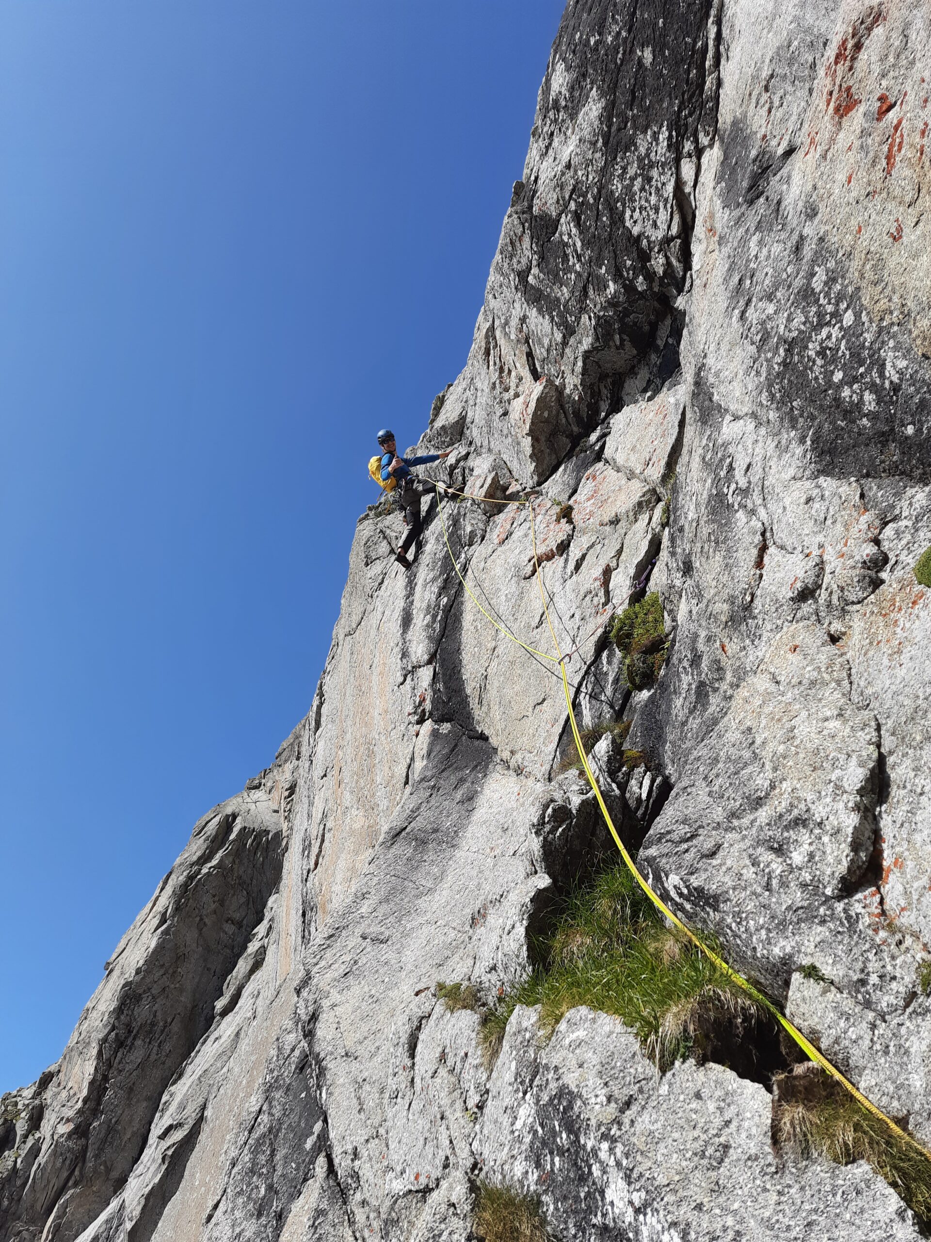
- Da qui noi abbiamo traversato a destra su cengetta inizialmente poi in leggera ascesa per circa 30 m fin oltre lo spigolo e quindi salito una decina di metri(dal disegno originale sembra si dovesse salire qualche metro in verticale e poi traversare con un tiro corto di 20m)
- Salire prima in obliquo a sx poi verticalmente fino alla base di un diedro composto da due risalti verticali(nel disegno sembra che la via passi più a sx con due tiri più facili)
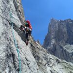
- Noi abbiamo proseguito per due tiri nel diedro (molto bello difficolta sul 6b/c) e quindi traversato decisamente a sx per arrivare alle terrazze con posti da bivacco di Punta Brendel!
Vista spaziale sul bacino del freney vari pilastri e piloni del bianco e tutto il resto!
Discesa da noi seguita:
Nella prima parte della discesa ci possibilità che le corde si incastrino ed essendo fuori via non risulterebbe simpatico, a noi è andata bene in un paio di punti abbiamo dovuto strattonarle per bene per farle scendere. Inoltre noi abbiamo risistemato varie soste ribattendo chiodi che uscivano a mano e sostituendo gran parte dei cordini.
Destra e Sinistra sempre inteso faccia alla parete
- 1- Da spuntone appena a sx dell’ intaglio di punta brendel la prima doppia nel canale (rischio incastro) fino a cordino su spuntone appena dopo che il canale finisce e diventa parete verticale. 40/50m
- 2- Corta circa 30m fino a terrazzino con chiodo e nut collegati da cordino rosso. (rischio incastro)
- 3- Giu dritti quando inizia a strapiombare si vede in basso a dx su terrazzino nel diedrone la sosta successiva, rinviarsi dentro con friend per beccarla due chiodi e cordino rosso (rischio incastro) .40/50m
- 4- Leggero obliquo a sx fino al bordo del cengione, oltre uno spigolo sulla sx cordini su spuntone. 50m
- 5- Dritti sosta successiva in piena parete due chiodi cordino e moschettone, pendolare avanti e indietro per non perdere contatto con la parete. 50m
- 6- Dritti fino a reperire, quella che per noi è stata, la sosta dopo il primo 6c spuntone e chiodo cordini rossi e fettuccia bianca. 50m
- 7- Dritti, sosta sulla sx in una nicchia nut e chiodo collegati da cordino rosso e bianco più maglia rapida. 50m
- 8- Scendere fino alla cengia che permette di salire a dx alla base del primo 7a, quindi ancora più a dx spuntone con cordini(recuperare le corde prima di andare a dx). 50m
- 9- Leggermente a sx qualche metro sotto una cengia più grossa sosta su due chiodi con cordino bianco doppio. 40m
Da questa sosta con cordino bianco si ribeccano le soste di salita sulle placche basali tendenzialmente in obliquo a sx, le elenco nell’ ordine di discesa (lunghezza e sosta alla quale si arriva): 25m due chiodi cordino rosso, 55m due chiodi cordino blu, 55m spuntone e chiodo fettuccia bianca, 55m 4 chiodi vari cordini e moschettone, 45m sosta zero (sopra la terminale) due chiodi cordino blu.
Finalmente piedi per terra, dritti al Borelli cibo a nastro e dolcetti per festeggiare si dorme e domani si scende
Nelle vicinanze Mappa
Itinerari
15/07/2023 AO, Courmayeur 6a+, 6a+ obbl. Sud-Est
Welzenbach (Punta) – Guido Rossa
 50m
50m
21/06/2026 AO, Courmayeur 6a+, 6a obbl. Sud-Est
Fauteuil des Allemands – Vento Solare
 1.6Km
1.6Km
16/07/2022 AO, Courmayeur 6a, 5b obbl. Sud-Est
Fauteuil des Allemands – Alexius
 1.7Km
1.7Km
15/08/2022 AO, Courmayeur 6c+, 6a+ obbl. Sud
Fauteuil des Allemands – Via Magan
 1.7Km
1.7Km
23/09/2018 AO, Courmayeur 6a, 5c obbl. Sud
Chatelet (Aiguille de) -Carpe Diem
 2.1Km
2.1Km
26/06/2010 AO, Courmayeur 6b, 6a obbl. Sud-Ovest
Peuterey (Mont Noir de) – Mondi sospesi
2.2Km
12/07/2026 AO, Courmayeur 6b, 6a obbl. Sud-Est
Croux (Aiguille), gendarme – Visite Guideé
 2.5Km
2.5Km
09/08/2022 AO, Courmayeur 6a+, 5c obbl. Sud-Est
Chatelet (Aiguille de) – Follow the Sun
 2.5Km
2.5Km
11/08/2022 AO, Courmayeur 6c, 6a+ obbl. Est
Chetif (Mont) – Punta Rovente
 2.7Km
2.7Km
20/08/2023 AO, Courmayeur 6a+, 6a obbl. Nord-Est
Chetif (Mont) – Madonna dell’Est o Madonnina
 2.8Km
2.8Km