1.8Km
1.8Km
Note
 2.4Km
3.2Km
3.2Km
3.2Km
3.2Km
3.2Km
3.2Km
3.2Km
3.3Km
2.4Km
3.2Km
3.2Km
3.2Km
3.2Km
3.2Km
3.2Km
3.2Km
3.3Km
1.8Km
1.8Km
1.8Km
1.8Km
3.6Km
5.1Km
6.1Km
7.6Km
7.7Km
7.7Km
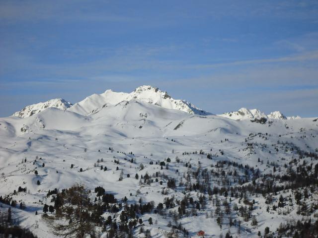
Itinerario che incrocia le piste e gli impianti del comprensorio sciistico dei Monti della Luna
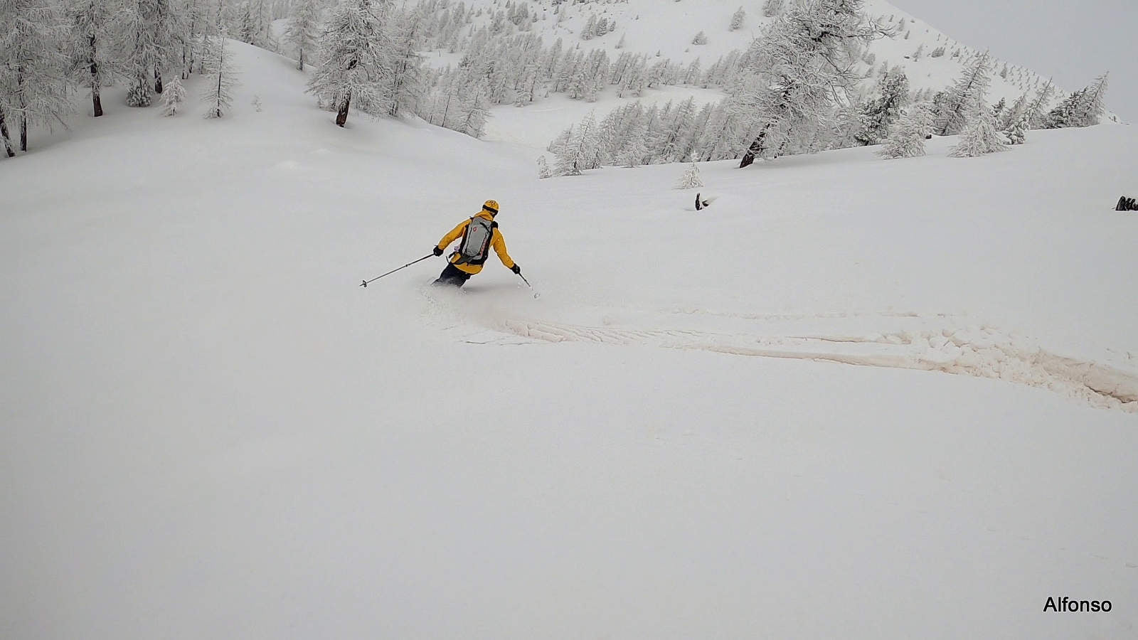
Descrizione
Superato l’abitato di Cesana Torinese, proseguire lungo la strada statale in direzione del Monginevro.
Dopo 1Km circa si trova un bivio sulla sx da dove inizia la strada che porta a Sagnalonga, parcheggiare quì (1450mt, 6-7 posti auto).
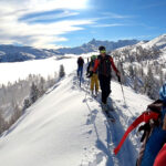
Si parte sci ai piedi lungo una stradina nel bosco che porta alla stazione d’arrivo della seggiovia Rafuyel (Quota 1538). Quì abbandonare la stradina (Pista di sci nella stagione invernale) e risalire una pista dismessa in direzione est.
Questa pista taglia diversi tornanti della stradina fino ad arrivare a Sagnalonga (Quota 2013).
Poco sotto al paesino si può tendere a sx-sud evitando così il grosso delle piste e degli impianti.
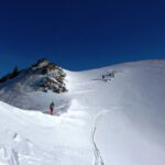
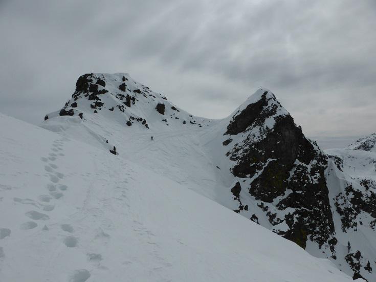
Giunti su una stradina (Pista da sci), seguirla in salita per 500mt fino alla Rocca Remolon; da quì raggiungere Colle Bercia (Visibile l’arrivo della seggiovia in cima) attraverso un bosco rado, evitando così le piste.
Gli ultimi 50 mt di dislivello sono ripidi, ma evitabili attraverso le piste da sci, dalla pendenza più dolce.
Discesa attraverso le piste da sci, lungo il tragitto di andata, oppure liberamente nel bosco rado (Meglio nella parte alta dell’itinerario).
- Cartografia:
- Fraternali 1:25000 n° 2
Nelle vicinanze Mappa
Itinerari
02/03/2019 TO, Cesana Torinese D+ 1100 m MS Nord
Fournier (Cima) da Sagnalonga per i Colli Begino, Saurel, Bercia
 2.4Km
2.4Km
21/02/2021 TO, Claviere D+ 652 m MS Nord-Ovest
Vert (Cima le), Roc La Luna da Claviere
 3.2Km
3.2Km
22/12/2021 TO, Claviere D+ 740 m OS Nord
Plane (Monte la) da Claviere per il versante nord
 3.2Km
3.2Km
30/03/2025 TO, Claviere D+ 700 m MS Nord
Saurel (Cima) da Claviere
 3.2Km
3.2Km
19/12/2020 TO, Claviere D+ 598 m BS Nord-Ovest
Rascià (Punta) da Claviere
 3.2Km
3.2Km
17/01/2025 TO, Claviere D+ 796 m BS Est
Plane (Monte la) da Claviere per il versante Est e Cresta NE
 3.2Km
3.2Km
29/03/2025 TO, Claviere D+ 525 m MS Nord-Ovest
Bercia (Colle) da Claviere
 3.2Km
3.2Km
10/02/2024 TO, Claviere D+ 600 m MS Varie
Saurel (Col) da Claviere per il Colle Bercia
 3.2Km
3.2Km
18/04/2025 TO, Cesana Torinese D+ 1000 m MS Nord-Ovest
Fraiteve (Monte) da San Sicario
 3.3Km
3.3Km
08/12/2003 TO, Cesana Torinese D+ 815 m MS Ovest
Platasse (Monte) da San Sicario
3.3Km
Servizi
1.8Km
1.8Km
L’Ibarus Rifugio
Cesana Torinese
1.8Km
Piergiorgio Frassati B&B
Cesana Torinese
1.8Km
Ottima Scelta Ristorante
Cesana Torinese
3.6Km
Baita Gimont Rifugio
Claviere
5.1Km
Centro Ristorante
Cesana Torinese
6.1Km
La Fontana del Thures Rifugio
Cesana Torinese
7.6Km
La Crota B&B
Cesana Torinese
7.7Km
da Carlo Rifugio
Cesana Torinese
7.7Km