 3.5Km
3.5Km
Note
 3Km
4.2Km
4.4Km
8.5Km
3Km
4.2Km
4.4Km
8.5Km
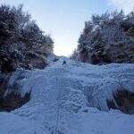
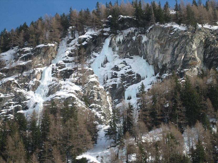
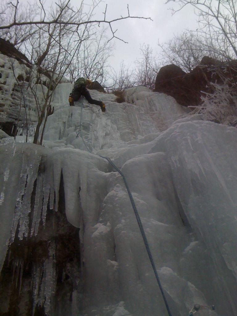
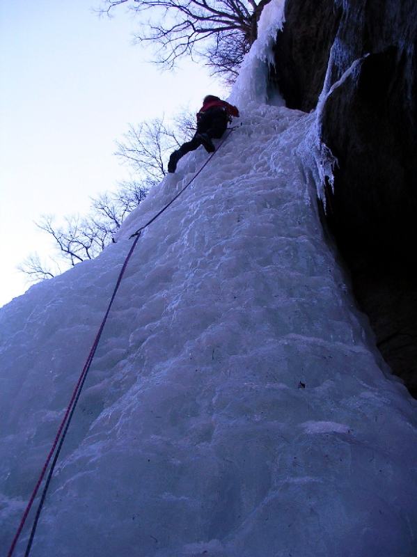
Bellissima linea moderna
Avvicinamento
.
Descrizione
1°. bel tiro di 40mt su ghiaccio , nella seconda parte leggermente ascendente. 4+ Protezioni veloci.friend 1/2/3 chiodi ghiaccio corti
2° .Misto M6 4 spit
3° ghiaccio 60mt , facile
4° misto M7 spit
5° ghiaccio 3+
- Bibliografia:
- Matteo Giglio - Effimeri Barbagli - 2014 Tipografia Valdostana
Nelle vicinanze Mappa
Itinerari
15/02/2023 AO, Arvier 80 m II, 3 Nord-Est
Valgrisenche – Grand-Haury (Cascata di)
 3Km
3Km
12/02/2015 AO, Valgrisenche 200 m II, 5 Ovest
Valgrisenche – Revers (Cascata di)
4Km
02/01/2004 AO, Valgrisenche 70 m I, 2 Nord-Ovest
Valgrisenche – The Year of Monkey (Cascata)
4Km
12/02/2015 AO, Valgrisenche 130 m II, 4+ Ovest
Valgrisenche – Le Professeur de la Glace (Cascata)
 4.2Km
4.2Km
06/01/2011 AO, Avise 60 m II, 3 Ovest
Avise – Baratro (Cascata)
 4.4Km
4.4Km
19/01/2002 AO, Rhêmes-Saint-Georges 220 m III, 4+ Nord
Rhemes Saint Georges (Cascata di)
5.7Km
01/02/2011 AO, Rhêmes-Saint-Georges 220 m III, 4 Nord
Rhemes Saint Georges – Lupo Alberto (Cascata)
5.7Km
22/01/2017 AO, La Salle 120 m II, 2 Nord-Est
La Salle – Lenteney (Cascata di)
7.1Km
11/01/2005 AO, Valgrisenche 70 m III, 3+ Sud-Est
Valgrisenche – A Volte Tornano (Cascata)
7.7Km
23/02/2006 AO, Introd 99 m I, 5+ Nord
Introd – Baratro (Cascata del)
 8.5Km
8.5Km