
 2.9Km
2.9Km

Note
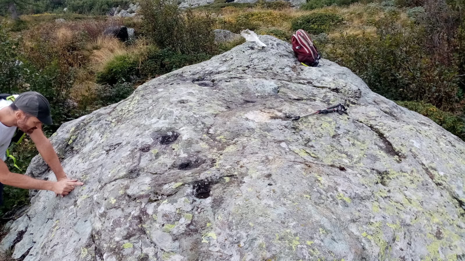
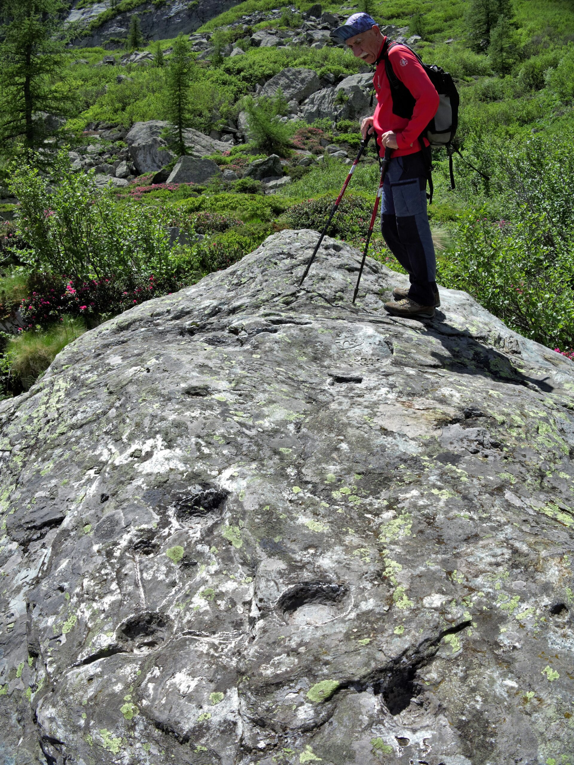
Trovato per puro caso, ravanando alla ricerca di un passaggio per la parete est. Non risultava catalogato. La zona sembrerebbe essere abbandonata dai pastori da più di 100 anni. E' stato datato tra il 400 e il 500 A.C. in seguito a sopralluogo del Soprintendente all'archeologia.
Sarà pubblicata una relazione su Quaderni della Soprintendenza archeologica del Piemonte 2022
Avvicinamento
Sarà pubblicata una relazione su Quaderni della Soprintendenza archeologica del Piemonte 2022
Da Pian della Mussa (ristorante Bricco) salire col sentiero 218 fino a Pian Saulera e poi 219 fino al colle del Tovo, scendere sull'altro versante fino a superare i ruderi dell'Alpe Losasset. Continuare sul sentiero in discesa superando un evidente grande larice isolato e raggiungere dopo un centinaio di m. un picchetto in legno b.co-rosso. Il masso altare si trova a 90° da questo picchetto a una distanza di circa 80-100 m. raggiungibile in modo un po' disagiato camminando sui rododendri.
Posizione 45°17'42.08" 7°11'27.25" Quota approssimativa m. 2101
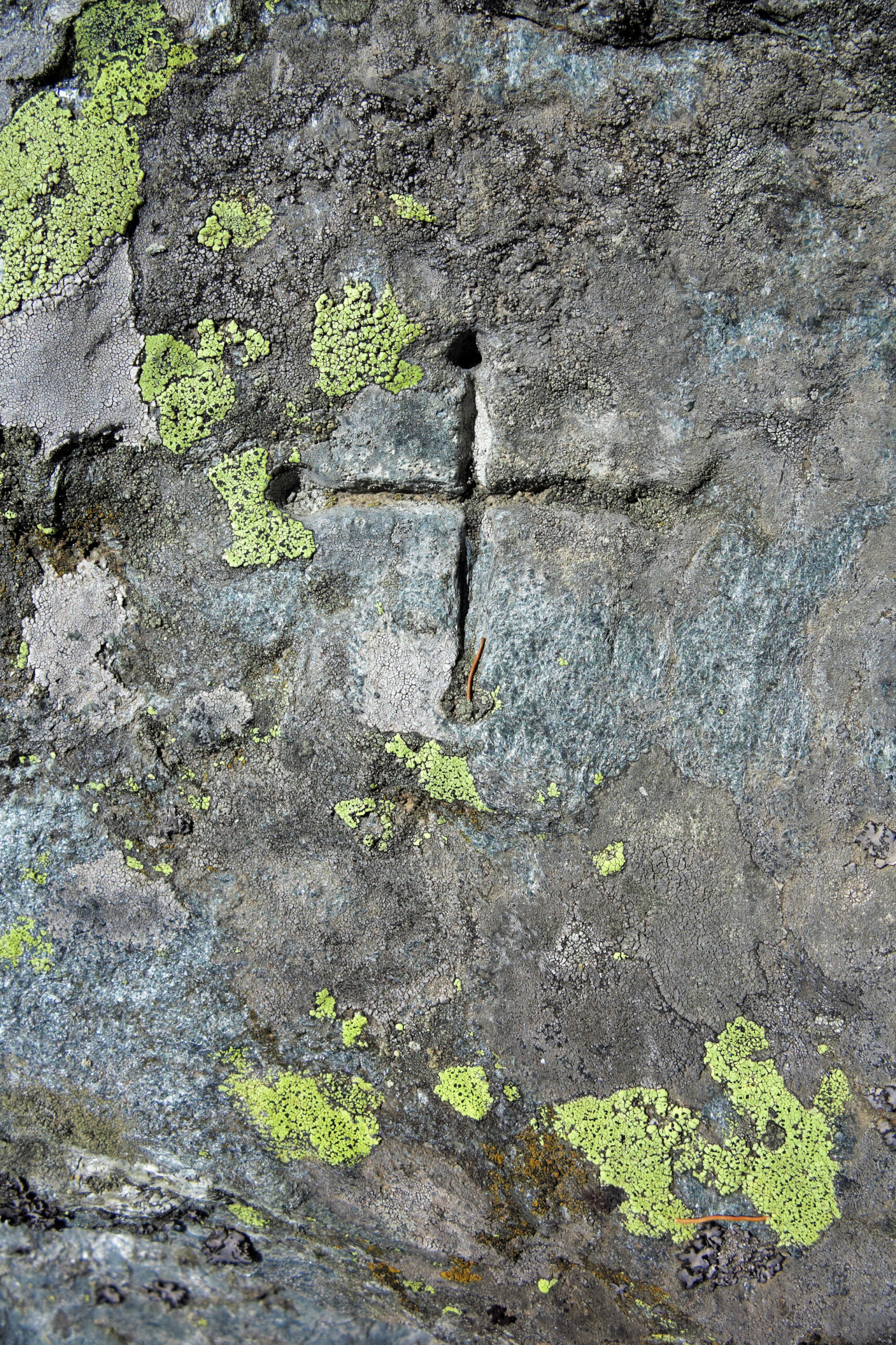
Descrizione
Posizione 45°17'42.08" 7°11'27.25" Quota approssimativa m. 2101
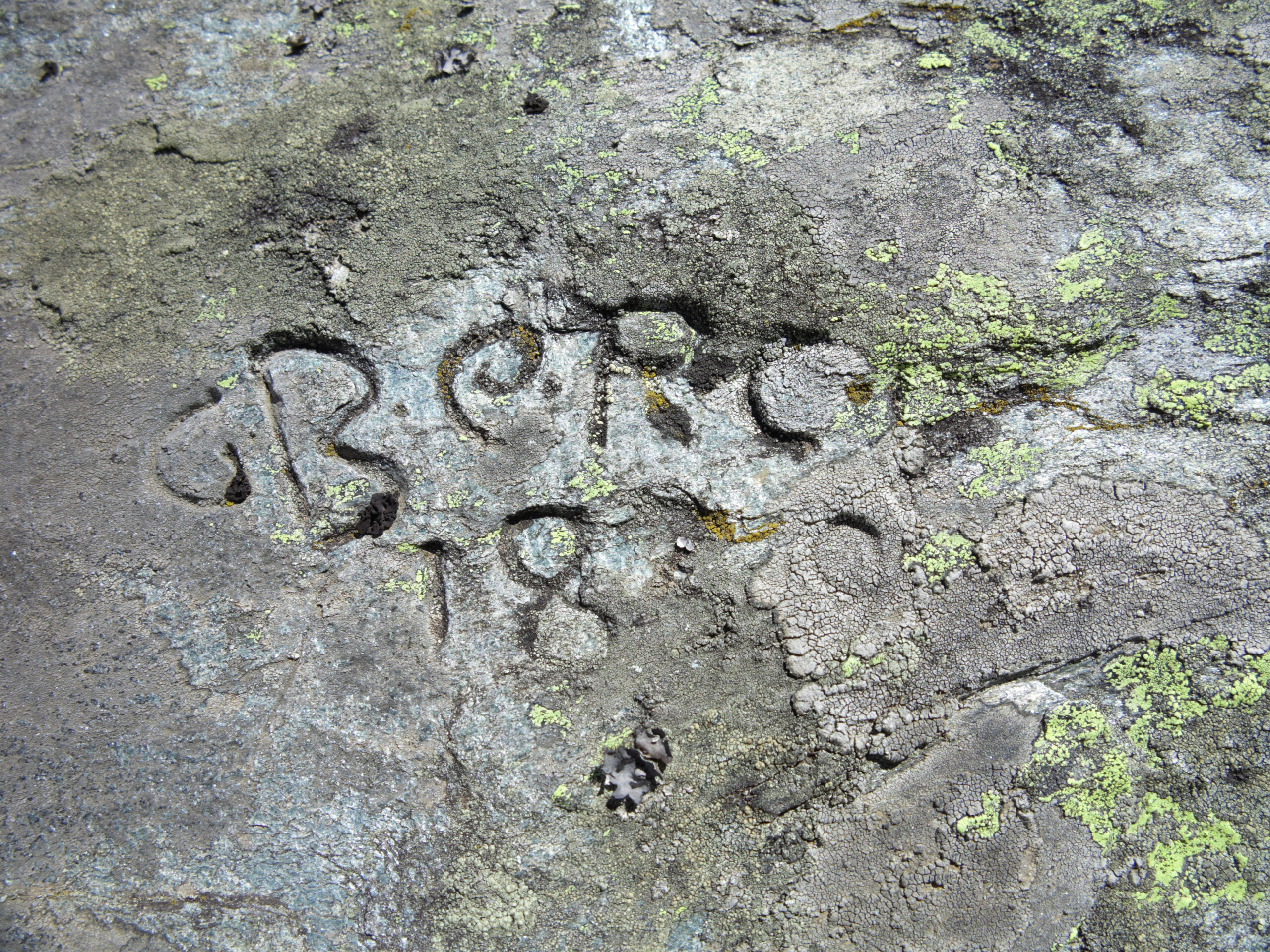
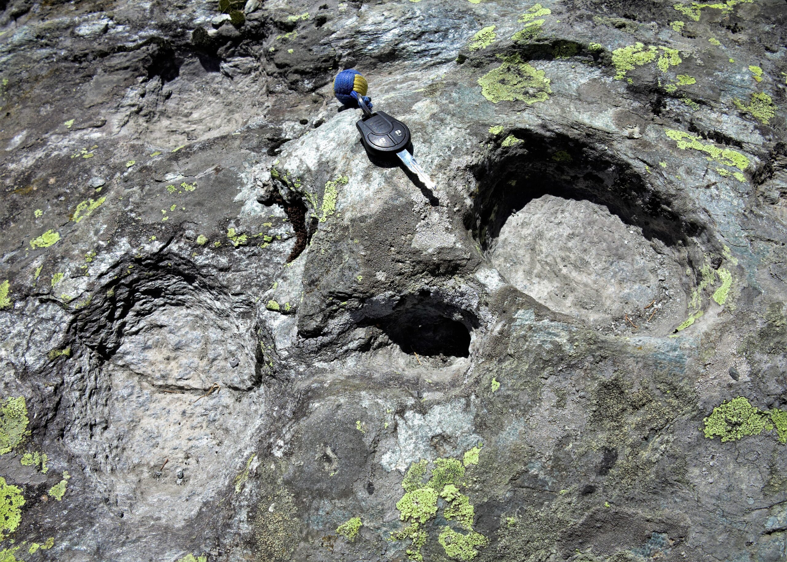
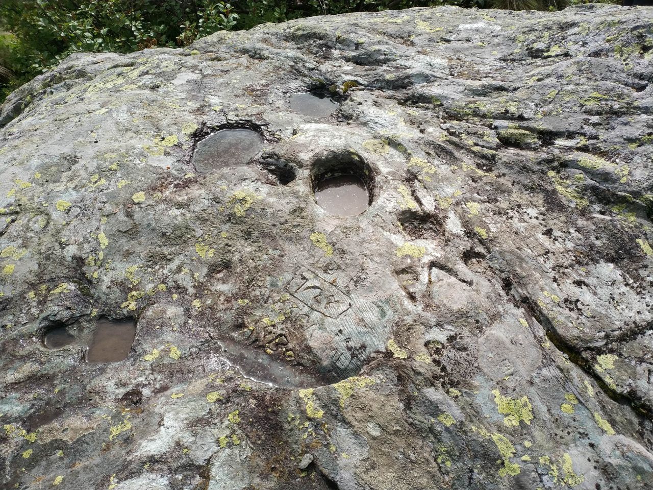
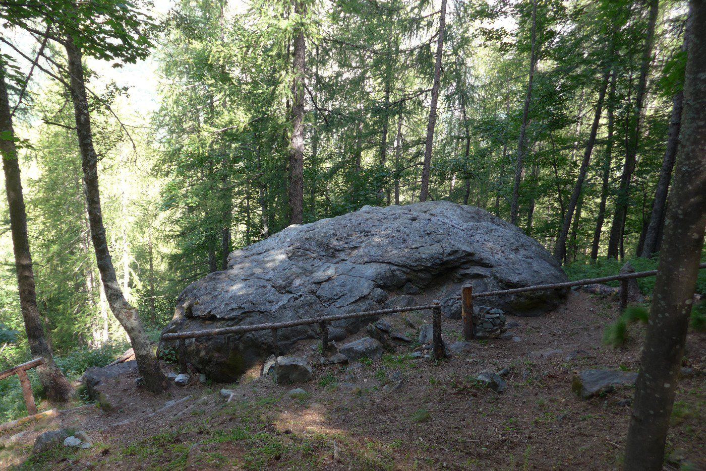
Si tratta di un grande masso alto circa 2m. e di un diametro di circa 5-6 m. E’ accoppiato ad un altro che però non presenta graffiti. Sono presenti numerose coppelle celtiche e successivi nel tempo petroglifi con date, nomi, animali e segni vari. Non è difficile da trovare basta un po’ di curiosità e voglia di ravanare 10 minuti. -:)
- Bibliografia:
- https://balmeclimb.blogspot.com/