 1.6Km
1.6Km
Avvicinamento
 5.9Km
8.3Km
8.3Km
8.3Km
8.3Km
8.3Km
8.3Km
5.9Km
8.3Km
8.3Km
8.3Km
8.3Km
8.3Km
8.3Km
1.6Km
2.2Km
2.8Km
5.1Km
5.1Km
5.1Km
5.2Km
5.8Km
5.9Km
7Km
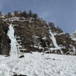
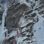
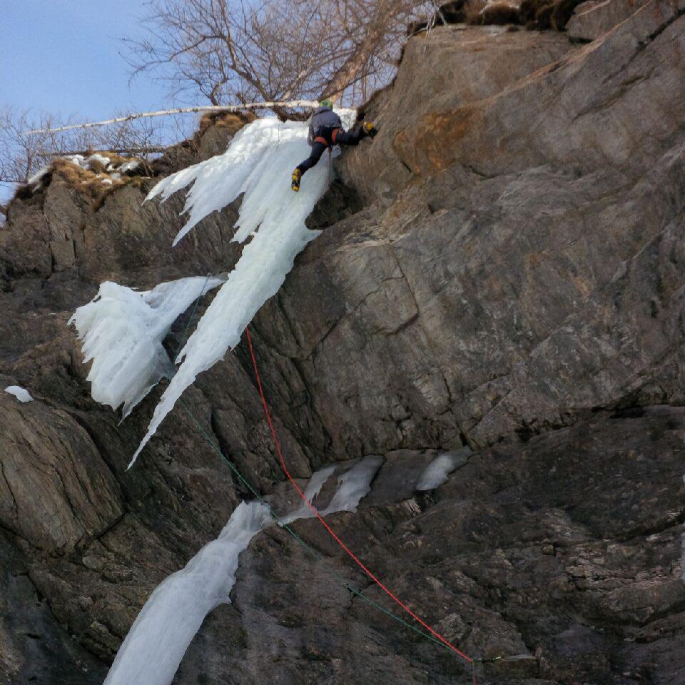
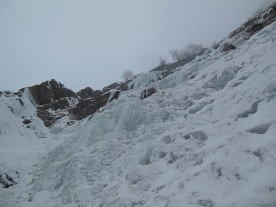
Da Oyace seguire il sentiero estivo per il Vallone di Vessona fino all'alpeggio di La Vieille. Puntare quindi all'evidente cascata che appare in alto a sinistra (versante destro idrografico). "Symbol of fantasy" è la più a destra delle colate che si vedono.
Descrizione
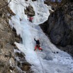
L1: muro vario non verticale (60 m, sosta su albero a sinistra).
Lungo canale di neve oppure ghiaccio a 30°.
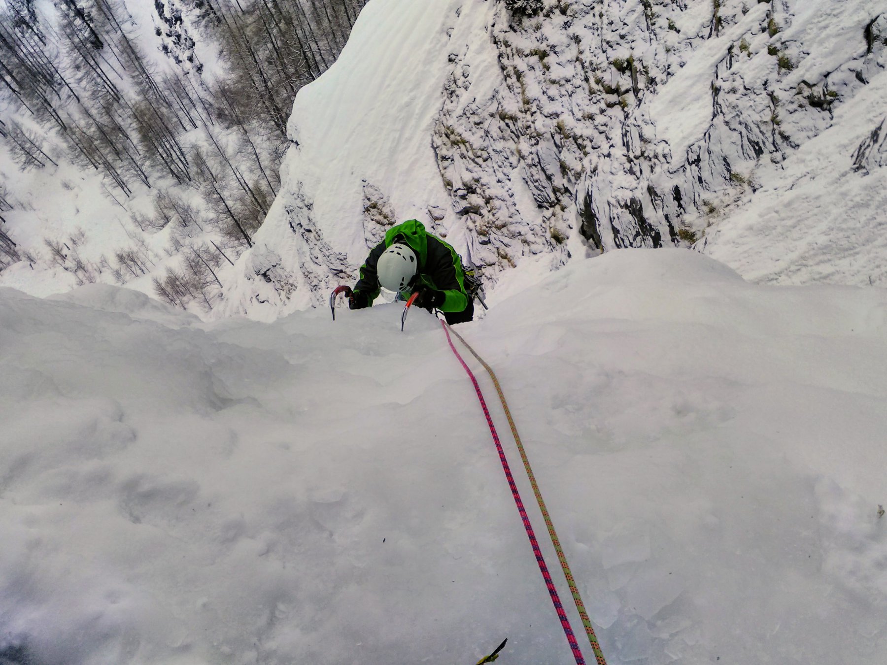
L2: muro appoggiato, poi progressivamente più ripido fino a diventare verticale (60 m, sosta su ghiaccio).
Discesa in doppia su abalakov dall’ultimo salto poi, in corrispondenza del primo tiro, a piedi sula riva destra idrografica della cascata.
- Bibliografia:
- Matteo Giglio - Effimeri Barbagli - 2014 Tipografia Valdostana
Nelle vicinanze Mappa
Itinerari
05/02/2002 AO, Bionaz 150 m II, 3 Nord-Est
Bionaz – Invergnao (Couloir de l’)
5.1Km
02/02/2010 AO, Valpelline 70 m II, 4 Sud
Valpelline – Breson (Cascata)
5.1Km
09/02/2026 AO, Oyace 120 m IV, 4 Ovest
Oyace – Melezé (Cascata di)
 5.9Km
5.9Km
15/02/2026 AO, Ollomont 120 m II, 3+ Ovest
Glacier – Oratorio (Cascata dell’)
 8.3Km
8.3Km
20/02/2026 AO, Ollomont 100 m III, 5 Ovest
Glacier – Sodoma (Cascata)
 8.3Km
8.3Km
03/02/2026 AO, Ollomont 120 m III, 5, M6 Ovest
Glacier – Medea (Cascata)
 8.3Km
8.3Km
08/02/2026 AO, Ollomont 180 m II, 3+ Ovest
Glacier – Gomorra (Cascata)
 8.3Km
8.3Km
16/02/2017 AO, Ollomont 40 m II, 4 Ovest
Glacier – Oratorio (Cascata dell’) diretta
8.3Km
13/02/2015 AO, Ollomont 160 m II, 4+, M6 Ovest
Glacier – Albice (Cascata)
 8.3Km
8.3Km
01/03/2014 AO, Ollomont 130 m II, 5 Nord-Ovest
Glacier – Pat & Gab (Cascata), variante diretta candela sx
 8.3Km
8.3Km
Servizi
1.6Km
2.2Km
Lac Lexert Campeggio
Bionaz
2.8Km
Crête Sèche Rifugio
Bionaz
5.1Km
Clé du Paradis B&B
Bionaz
5.1Km
Valentino Albergo
Bionaz
5.1Km
Betemps B&B
Bionaz
5.2Km
Vecchio Suisse Ristorante
Valpelline
5.8Km
Lievre Amoureux Albergo
Valpelline
5.9Km
Alpe Rebelle B&B
Bionaz 7Km
7Km